Updating search results...

Search Resources

288 Results

View
Selected filters:
  • cooperative-learning
Unit 6: Moving Forward: Evaluating Impacts of Modern-day Proposals Affecting the Carbon-cycle and Climate
Conditional Remix & Share Permitted
CC BY-NC-SA
Rating
0.0 stars

In this unit, students will review mock proposals that deal with some aspect of the role of carbon in the environment. Each proposal is based on actual actions proposed to mitigate some aspect of carbon consumption and/or climate change, and as such are considered "real world" scenarios (although somewhat generalized for this exercise). Students will review each proposal for the possible societal, economic, and moral implications if the proposal was pursued on a large scale -- for instance, by a single nation or collection of countries. Additionally, students will make recommendations to a fictitious governmental panel on the merits and pitfalls of each proposal and provide well-supported recommendations about whether that government panel should pursue or reject the proposal. Instructors can use this unit as a stand-alone activity, or as a summary activity to comprehensively review, discuss, and assess material presented in this module's earlier units.

(Note: this resource was added to OER Commons as part of a batch upload of over 2,200 records. If you notice an issue with the quality of the metadata, please let us know by using the 'report' button and we will flag it for consideration.)

Subject:
Applied Science
Biology
Career and Technical Education
Environmental Science
Environmental Studies
Geology
Life Science
Physical Science
Material Type:
Activity/Lab
Module
Provider:
Science Education Resource Center (SERC) at Carleton College
Provider Set:
Teach the Earth
Author:
Pete Berquist
Date Added:
09/04/2020
Unit 6: Ocean Sustainability and Geoengineering
Conditional Remix & Share Permitted
CC BY-NC-SA
Rating
0.0 stars

Students are introduced to the concept of geoengineering, "the deliberate large-scale intervention in the Earth's climate system, in order to moderate global warming" (The Royal Society). The goal is for them to leverage their acquired knowledge from previous units in physical oceanography, ocean chemistry, biodiversity, and ecosystem ecology to evaluate the validity and/or the risk of geoengineering (systems thinking). Current and future generations will be required to make informed decisions on whether they support strategies that result in irreversible changes in Earth's carbon cycle.

(Note: this resource was added to OER Commons as part of a batch upload of over 2,200 records. If you notice an issue with the quality of the metadata, please let us know by using the 'report' button and we will flag it for consideration.)

Subject:
Applied Science
Biology
Career and Technical Education
Chemistry
Engineering
Environmental Science
Environmental Studies
Geology
Life Science
Oceanography
Physical Science
Material Type:
Activity/Lab
Module
Provider:
Science Education Resource Center (SERC) at Carleton College
Provider Set:
Teach the Earth
Author:
Astrid Schnetzer
Cara Thompson
MICHELLE KINZEL
Date Added:
07/14/2020
Unit 6. Rainwater Harvesting
Conditional Remix & Share Permitted
CC BY-NC-SA
Rating
0.0 stars

Unit 6 covers the preliminary design of a rainwater harvesting unit. Pre-class assignments provide background on rainwater harvesting. An active learning exercise steps student teams through the process of sizing a rainwater harvesting cistern, using water demand estimates from Units 4 and 5. The activity leads into a revision of the water system mind map developed in previous units.

(Note: this resource was added to OER Commons as part of a batch upload of over 2,200 records. If you notice an issue with the quality of the metadata, please let us know by using the 'report' button and we will flag it for consideration.)

Subject:
Applied Science
Biology
Career and Technical Education
Engineering
Environmental Studies
Geology
Life Science
Mathematics
Measurement and Data
Physical Science
Statistics and Probability
Material Type:
Activity/Lab
Module
Provider:
Science Education Resource Center (SERC) at Carleton College
Provider Set:
Teach the Earth
Author:
Gigi Richard
Manoj Jha
Marshall Shepherd
Steven Burian
Date Added:
09/15/2020
Unit 7.1 - Model My Watershed
Conditional Remix & Share Permitted
CC BY-NC-SA
Rating
0.0 stars

Humans are agents of change in the Critical Zone. This unit focuses on the land/water connection and on how human-induced land use change affects local hydrology. Students will apply what they learned in the previous Hydrology Module about how hydrologists use data (land-cover type, soil texture, and slope) to predict the amount and destination of water as it moves through a built environment. Students will use the Generic Model from the Model My WatershedR application to evaluate the impact of human alterations to the landscape and will also investigate how best-management practices can lesson those impacts. While doing so, students will also be asked to consider impacts to society both from the increased runoff and from some mitigation measures.

(Note: this resource was added to OER Commons as part of a batch upload of over 2,200 records. If you notice an issue with the quality of the metadata, please let us know by using the 'report' button and we will flag it for consideration.)

Subject:
Biology
Business and Communication
Career and Technical Education
Communication
Environmental Studies
Life Science
Material Type:
Activity/Lab
Module
Provider:
Science Education Resource Center (SERC) at Carleton College
Provider Set:
Teach the Earth
Author:
Jim Washburne
Susan Gill
Date Added:
12/15/2020
Unit 7.2 - Agricultural Impacts
Conditional Remix & Share Permitted
CC BY-NC-SA
Rating
0.0 stars

Humans not only reside in the Critical Zone, they depend upon the land and water to provide sustenance. This unit will examine how humans affect soil resources and ecosystem services in the Critical Zone through food production. In addition, it will discuss farming practices that led to the Dust Bowl in the 1930s. Finally, it will examine emerging efforts to grow food locally such as Community Supported Agriculture (CSAs) and urban gardening programs.

(Note: this resource was added to OER Commons as part of a batch upload of over 2,200 records. If you notice an issue with the quality of the metadata, please let us know by using the 'report' button and we will flag it for consideration.)

Subject:
Agriculture
Biology
Career and Technical Education
Life Science
Mathematics
Measurement and Data
Material Type:
Activity/Lab
Module
Provider:
Science Education Resource Center (SERC) at Carleton College
Provider Set:
Teach the Earth
Author:
Ashlee Dere
Susan Gill
Date Added:
11/17/2021
Unit 8. Impacts of Extreme Hydroclimatic Events
Conditional Remix & Share Permitted
CC BY-NC-SA
Rating
0.0 stars

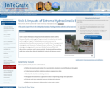
Picture of urban flooding

Provenance: Timothy Swinson https://commons.wikimedia.org/wiki/File:Trapped_woman_on_a_car_roof_during_flash_flooding_in_Toowoomba_2.jpg
Reuse: This item is offered under a Creative Commons Attribution-NonCommercial-ShareAlike license http://creativecommons.org/licenses/by-nc-sa/3.0/ You may reuse this item for non-commercial purposes as long as you provide attribution and offer any derivative works under a similar license.

Unit 8 covers the basics of hydroclimatic extreme events with a focus on floods and droughts. Topics include introduction to floods and droughts, impact of urbanization on extremes, how to understand and predict extremes, how to tackle them (management strategies), and elements of urban climate resilience. The teaching strategy is designed with short and divided lectures filled with discussion questions and a group activity. Students will be working with time series flow data for statistical analysis of extreme events.

(Note: this resource was added to OER Commons as part of a batch upload of over 2,200 records. If you notice an issue with the quality of the metadata, please let us know by using the 'report' button and we will flag it for consideration.)

Subject:
Biology
Career and Technical Education
Environmental Studies
Geology
Life Science
Mathematics
Measurement and Data
Physical Science
Statistics and Probability
Material Type:
Activity/Lab
Module
Provider:
Science Education Resource Center (SERC) at Carleton College
Provider Set:
Teach the Earth
Author:
Manoj Jha
Date Added:
09/20/2022
Using Cooperative Learning to Teach Mineralogy (and Other Courses Too!)
Conditional Remix & Share Permitted
CC BY-NC-SA
Rating
0.0 stars

This chapter is concerned primarily with how the content of a mineralogy course can be organized so that the students are more active and conscientious learners. This chapter is divided into three sections: Section I briefly describes the fundamentals of cooperative learning: why it's important and what is essential. Section II describes a variety of cooperative learning structures and their uses. Section III provides more detailed descriptions of cooperative learning activities specifically for a mineralogy class.

(Note: this resource was added to OER Commons as part of a batch upload of over 2,200 records. If you notice an issue with the quality of the metadata, please let us know by using the 'report' button and we will flag it for consideration.)

Subject:
Biology
Life Science
Material Type:
Activity/Lab
Reading
Provider:
Science Education Resource Center (SERC) at Carleton College
Provider Set:
Teach the Earth
Author:
LeeAnn Srogi
Date Added:
09/09/2020
Using Cooperative Peer Editing to Develop Effective Economic Research Questions
Conditional Remix & Share Permitted
CC BY-NC-SA
Rating
0.0 stars

Students engage in peer editing and cooperative discussion to enhance research questions based on criteria designed to generate effective economic research questions.

Subject:
Economics
Social Science
Material Type:
Activity/Lab
Provider:
Science Education Resource Center (SERC) at Carleton College
Provider Set:
Pedagogy in Action
Author:
KM McGoldrick
Date Added:
11/06/2014
Using "Dante's Peak" to Discuss Response to Risk
Conditional Remix & Share Permitted
CC BY-NC-SA
Rating
0.0 stars

In this classroom activity, students watch the movie "Dante's Peak" up to the point where Harry Dalton's supervisor arrives and talks to the town council. Students then compare and contrast Harry's assessment and advice to that of his supervisor, discuss the reaction of the town council members, and develop their own recommendations for how the scientists and town should proceed.

(Note: this resource was added to OER Commons as part of a batch upload of over 2,200 records. If you notice an issue with the quality of the metadata, please let us know by using the 'report' button and we will flag it for consideration.)

Subject:
Applied Science
Biology
Career and Technical Education
Environmental Studies
Geology
Health, Medicine and Nursing
Life Science
Physical Science
Material Type:
Activity/Lab
Provider:
Science Education Resource Center (SERC) at Carleton College
Provider Set:
Teach the Earth
Author:
Michael Phillips
Date Added:
09/10/2020
Using Dynamic Digital Maps to Teach Petrology
Conditional Remix & Share Permitted
CC BY-NC-SA
Rating
0.0 stars

In this session we will examine how to utilize Dynamic Digital Maps (DDMs) in undergraduate petrology courses to bring inaccessible and exciting volcanic field areas to the students in the classroom and to engage the students in authentic research experiences. A DDM is a stand-alone "presentation manager" computer program that contains interactive maps, analytical data, digital images and movies. They are essentially complete geologic maps in digital format, available on CD-ROM and on line. We have developed two different kinds of exercises that use DDMs to provide field-based context for undergraduate research projects in petrology. In one, the students use the DDM of the Tatara-San Pedro volcanic complex of the Andes Mountains of central Chile to develop a group research poster on part of the volcano's evolution, to present to the class, modeled after what would be presented at a national meeting. The second exercise focuses on the Springville Volcanic field, where the students try to understand the magma evolution using both field relations and quantitative modeling skills.
Â

Read a complete description of how dynamic digital maps work, with more ideas for the classroom. (from Teaching with Data, Simulations and Models)

(Note: this resource was added to OER Commons as part of a batch upload of over 2,200 records. If you notice an issue with the quality of the metadata, please let us know by using the 'report' button and we will flag it for consideration.)

Subject:
Geology
Physical Science
Material Type:
Activity/Lab
Data Set
Diagram/Illustration
Interactive
Lesson Plan
Provider:
Science Education Resource Center (SERC) at Carleton College
Provider Set:
Teach the Earth
Author:
Christopher D. Condit
Date Added:
09/24/2020
Using Google Earth to Analyze Structures in Southwest Utah
Conditional Remix & Share Permitted
CC BY-NC-SA
Rating
0.0 stars

Southwest Utah straddles the transition from the Colorado Plateau to the Basin and Range physiographic province. This transition also coincides with the leading edge of the Late Cretaceous to early Tertiary Sevier orogeny. A 3-D Geologic Map of the St. George 30x60 Quadrangle is used in Google to analyze overprinted compressional and extensional structures within an important geologic transition.

Outcomes:
Increase student ability to
1. describe the occurrence and geometric characteristics of structures.
2. gain experience reading geologic maps.
3. collect, analyze, and display quantitative structural data.
4. gather regional kinematic and dynamic information from structures.
5. Summarize findings in a scientific analysis
6. work with others to organize data, analyses, figures, and conclusions into a scientific report.

(Note: this resource was added to OER Commons as part of a batch upload of over 2,200 records. If you notice an issue with the quality of the metadata, please let us know by using the 'report' button and we will flag it for consideration.)

Subject:
Biology
Life Science
Mathematics
Measurement and Data
Material Type:
Activity/Lab
Homework/Assignment
Provider:
Science Education Resource Center (SERC) at Carleton College
Provider Set:
Teach the Earth
Author:
Julie Willis
Date Added:
08/12/2019
Using Inquiry to Group Minnesota Critters
Conditional Remix & Share Permitted
CC BY-NC-SA
Rating
0.0 stars

This activity is a teacher-guided inquiry activity of the sorting or grouping of Minnesota critters according to student driven criteria or purpose of their groupings. Teacher/student questions and discussion should be encouraged after this activity to emphasize that awareness of the criteria or purpose of certain groupings may be important before beginning an investigation.

Subject:
Biology
Life Science
Material Type:
Activity/Lab
Provider:
Science Education Resource Center (SERC) at Carleton College
Provider Set:
Pedagogy in Action
Author:
Ginger Baldwin
Date Added:
08/16/2012
Using Note-Taking Pairs to Enhance Understanding of Difficult Concepts (such as Income and Substitution Effects)
Conditional Remix & Share Permitted
CC BY-NC-SA
Rating
0.0 stars

A variation of the think-pair-share technique is used to reinforce understanding of the income and substitution effects associated with a price change.

Subject:
Economics
Social Science
Material Type:
Activity/Lab
Provider:
Science Education Resource Center (SERC) at Carleton College
Provider Set:
Pedagogy in Action
Author:
KM McGoldrick
Date Added:
11/06/2014
Using Oreo Cookies to Discover the Moon Phases
Conditional Remix & Share Permitted
CC BY-NC-SA
Rating
0.0 stars

This is a guided inquiry investigation where students record and gather visual information of what the moon phases look like.

Subject:
Astronomy
Physical Science
Material Type:
Activity/Lab
Lesson Plan
Provider:
Science Education Resource Center (SERC) at Carleton College
Provider Set:
Pedagogy in Action
Author:
Lisa Lind
Date Added:
10/04/2011
Using Range Through Charts: Constructing a Diversity Curve
Conditional Remix & Share Permitted
CC BY-NC-SA
Rating
0.0 stars

In advance of this assignment, students will hear a lecture discussing the major events throughout the history of life, including but not limited to: the Cambrian Explosion, the Ordovician Radiation, the "Big Five" mass extinctions and they will be shown the Sepkoski Curve. Additionally students will be introduced to major groups of organisms, mostly at the class and order level.

Students will be divided into groups of 4-5 students and each are assigned a major group of marine organisms with an extensive fossil record (e.g., Bivalves, Brachiopods, Arthropods, Cnidarians). Students will compile a list of 30-40 age ranges for genera within that group by conducting searches on the Paleobiology Database.

Using these ranges, students will construct a range-through chart by hand on paper scaled to a geologic time scale, generating a visual representation of the originations, persistence and extinction of these groups.

Upon construction of the range through chart, students will tally up the number of organisms present in each time period (either originating or persisting or going extinct during that time period). Using these counts, students will make a diversity curve in Microsoft Excel that should depict a rough approximation of the paleontological record of the group.

Students will answer a series of questions related to the interpretation of the range through chart and diversity curve, and devise hypotheses that explain the shape of the trajectory of the curve.

After generating the diversity curve in separate groups, the class will reassemble and combine data for the construction of a synoptic diversity curve.

Students will examine this curve and compare it to that of the Sepkoski curve for the purposes of analysis and hypothesis formation.

(Note: this resource was added to OER Commons as part of a batch upload of over 2,200 records. If you notice an issue with the quality of the metadata, please let us know by using the 'report' button and we will flag it for consideration.)

Subject:
Biology
Life Science
Material Type:
Activity/Lab
Provider:
Science Education Resource Center (SERC) at Carleton College
Provider Set:
Teach the Earth
Author:
Katherine Bulinski
Date Added:
09/04/2019
Using Satellite Data and Google Earth to Explore the Shape of Ocean Basins and Bathymetry of the Sea Floor
Conditional Remix & Share Permitted
CC BY-NC-SA
Rating
0.0 stars

This activity is for an introductory oceanography course. It is designed to allow students to use various tools (satellite images, Google Earth) to explore the shape of the sea floor and ocean basins in order to gain a better understanding of both the processes that form ocean basins, as well as how the shape of ocean basins influences physical and biological processes.

(Note: this resource was added to OER Commons as part of a batch upload of over 2,200 records. If you notice an issue with the quality of the metadata, please let us know by using the 'report' button and we will flag it for consideration.)

Subject:
Biology
Geology
Geoscience
Life Science
Mathematics
Measurement and Data
Physical Science
Material Type:
Activity/Lab
Data Set
Lesson Plan
Provider:
Science Education Resource Center (SERC) at Carleton College
Provider Set:
Teach the Earth
Author:
Molly Palmer
Date Added:
12/11/2019
Using cooperative peer editing to improve writing assignments in economics
Conditional Remix & Share Permitted
CC BY-NC-SA
Rating
0.0 stars

This peer review of writing tool helps students improve their writing by asking their peers in the class to provide feedback in a constructive manner.

Subject:
Economics
Social Science
Material Type:
Activity/Lab
Provider:
Science Education Resource Center (SERC) at Carleton College
Provider Set:
Pedagogy in Action
Author:
Julie Smith
Date Added:
11/06/2014
Using enthalpy to assess fuel sources
Conditional Remix & Share Permitted
CC BY-NC-SA
Rating
0.0 stars

A variety of fuels are evaluated for the amount of heat they liberate upon burning. This includes a discussion of how different criteria can influence the evaluation of what makes a "good" fuel.

Subject:
Chemistry
Physical Science
Material Type:
Activity/Lab
Provider:
Science Education Resource Center (SERC) at Carleton College
Provider Set:
Starting Point (SERC)
Author:
Jeffrey Bodwin
Date Added:
08/28/2012
VEPP: Volcanic activity and monitoring of Pu`u `O`o, Kilauea volcano, Hawaii
Conditional Remix & Share Permitted
CC BY-NC-SA
Rating
0.0 stars

Brief three-line description of the activity or assignment and its strengths:

This is a 10-week group project for a Volcanic Hazards elective course, for undergraduate geology students. Students will access and analyze data from the current eruption of Pu`u `O`o, Kilauea volcano, Hawaii, and make interpretations of the activity. They will use data (mostly near-real-time) from a number of monitoring techniques, including seismic, deformation, observational, gas, and thermal. The activity will culminate with a written report and an oral presentation.

(Note: this resource was added to OER Commons as part of a batch upload of over 2,200 records. If you notice an issue with the quality of the metadata, please let us know by using the 'report' button and we will flag it for consideration.)

Subject:
Biology
Business and Communication
Communication
Life Science
Mathematics
Measurement and Data
Material Type:
Activity/Lab
Provider:
Science Education Resource Center (SERC) at Carleton College
Provider Set:
Teach the Earth
Author:
Lizzette Rodriguez
Date Added:
09/12/2020
Viewpoint on Causes of Global Warming - An Assignment Using Anonymous Electronic Peer Review With a Dropbox
Conditional Remix & Share Permitted
CC BY-NC-SA
Rating
0.0 stars

This is an anonymous electronic peer review exercise that utilizes a dropbox, where students detail and support their viewpoint on nonhuman-induced global warming.

(Note: this resource was added to OER Commons as part of a batch upload of over 2,200 records. If you notice an issue with the quality of the metadata, please let us know by using the 'report' button and we will flag it for consideration.)

Subject:
Applied Science
Atmospheric Science
Biology
Environmental Science
Life Science
Physical Science
Material Type:
Assessment
Homework/Assignment
Provider:
Science Education Resource Center (SERC) at Carleton College
Provider Set:
Teach the Earth
Author:
Laura Guertin
Date Added:
09/22/2022