This Historical Geology lab exercise is an accompaniment to lab class instruction …
This Historical Geology lab exercise is an accompaniment to lab class instruction about geologic structures (folding and faulting) and geologic maps. It also serves as an excellent introduction to the Geology of the state of Texas. "Coloring" geologic maps, an important part of the exercise, may seem like a very elementary learning technique. But this lab engages students actively, and since the subject is often already somewhat familiar to them, emphasizing both the geology and geography of Texas, students receive it enthusiastically.
This activity could be adapted to other regions, since most states have color 8 1/2 by 11 geologic maps available. A color map could be scanned and modified in Photoshop to create a simplified black and white version as was done in the assignment handout.
(Note: this resource was added to OER Commons as part of a batch upload of over 2,200 records. If you notice an issue with the quality of the metadata, please let us know by using the 'report' button and we will flag it for consideration.)
Roger Steinberg, Department of Natural Sciences, Del Mar College 5000 Dots by …
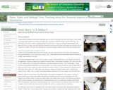
Roger Steinberg, Department of Natural Sciences, Del Mar College 5000 Dots by Computer (Click image to enlarge and download.)
(Note: this resource was added to OER Commons as part of a batch upload of over 2,200 records. If you notice an issue with the quality of the metadata, please let us know by using the 'report' button and we will flag it for consideration.)
When piecing together the geologic history of the Earth, geologists rely on …
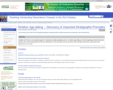
When piecing together the geologic history of the Earth, geologists rely on several key relative age-dating principles that allow us to determine the relative ages of rocks and the timing of significant geologic events. In a typical Historical Geology class or textbook, instructors/authors briefly discuss the important early researchers in the geological sciences, and then give the name of the stratigraphic principle, useful for relative age-dating of rocks and events, that these 17th and 18th century scientists are credited with discovering. After the instructor/author defines these principles, students are usually shown several examples so they can see how the principle can be applied.
But why not start with the examples and let students discover these principles for themselves?
Students are split into small groups which each work to discover a different relative age-dating principle. The groups are shown photos and given handouts with drawings of rock outcrops illustrating the various principles. These handouts include worksheets for which they must answer a series of prompts that help lead them to the discovery of their relative age-dating principle. Groups must also invent a name for their principle, and select a spokesperson who will present the group's results to the rest of the class.
(Note: this resource was added to OER Commons as part of a batch upload of over 2,200 records. If you notice an issue with the quality of the metadata, please let us know by using the 'report' button and we will flag it for consideration.)
I use single, euhedral, natural crystals of minerals extensively when teaching basic …
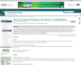
I use single, euhedral, natural crystals of minerals extensively when teaching basic concepts of crystallogtaphy. Wooden or paper models, showy museum-quality crystal clusters, colorful pictures in a book, or even computer images simply cannot compete with the beauty and awe-inspiring mystery and educational value of genuine, individual mineral crystals when held in your (or your students') hands. In my Mineralogy course, I use single, well-formed crystals in all aspects of basic crystallography inlcuding measurement of interfacial angles, determination of symmetry elements, recognition of crystal system and class, determination of forms, stereographic projections and stereograms, recognition of common twins and pseudomorphs, and even SHAPE plots - these are just some of the possibilities.
(Note: this resource was added to OER Commons as part of a batch upload of over 2,200 records. If you notice an issue with the quality of the metadata, please let us know by using the 'report' button and we will flag it for consideration.)
No restrictions on your remixing, redistributing, or making derivative works. Give credit to the author, as required.
Your remixing, redistributing, or making derivatives works comes with some restrictions, including how it is shared.
Your redistributing comes with some restrictions. Do not remix or make derivative works.
Most restrictive license type. Prohibits most uses, sharing, and any changes.
Copyrighted materials, available under Fair Use and the TEACH Act for US-based educators, or other custom arrangements. Go to the resource provider to see their individual restrictions.