Applications of geodetic imaging in geomorphology research often center on monitoring and …
Applications of geodetic imaging in geomorphology research often center on monitoring and detecting change within a system over time. Since most geomorphic systems evolve over longer time periods -- months, years, or more -- than available in a typical field course, this unit of the module may be entirely lab-based. Or you may have students collect data -- of a fluvial system, landslide, or other geomorphic feature -- if the feature they survey has a previously collected data set upon which to compare their new data set. The goal of this unit is to teach students to transform point clouds of a feature taken some time apart into DEMs. The DEMs are then subtracted to calculate the elevation change over time.
(Note: this resource was added to OER Commons as part of a batch upload of over 2,200 records. If you notice an issue with the quality of the metadata, please let us know by using the 'report' button and we will flag it for consideration.)
Kate Shervais (UNAVCO)
J. Ramon Arrowsmith (Arizona State University)
Nathan Niemi (University of Michigan)
Marin Clark (University of Michigan)
Chris Crosby (UNAVCO)
In this unit, students examine detailed hydrologic data from one river to …
In this unit, students examine detailed hydrologic data from one river to identify ways in which precipitation and stream discharge influence flooding which often impacts nearby human societies. They also research a local river and determine the hazard associated with flooding, describe historic flooding, and assess ways a local community mitigates the risks associated with flooding.
(Note: this resource was added to OER Commons as part of a batch upload of over 2,200 records. If you notice an issue with the quality of the metadata, please let us know by using the 'report' button and we will flag it for consideration.)
Is groundwater mining sustainable? In Unit 4 students compare and contrast long-term …
Is groundwater mining sustainable? In Unit 4 students compare and contrast long-term (decades) groundwater well levels in six states representing the East Coast, West Coast, and Midwest Plains states. Satellite imagery maps of the well locations will give students an idea of the land cover, specifically the presence of irrigated crops. Using groundwater well data from the USGS, students will recognize the depletion of aquifers in the western United States (e.g., the Ogallala/High Plains Aquifer), or groundwater mining, as an unsustainable practice.
(Note: this resource was added to OER Commons as part of a batch upload of over 2,200 records. If you notice an issue with the quality of the metadata, please let us know by using the 'report' button and we will flag it for consideration.)
This unit shows how GPS records of bedrock surface elevation may be …
This unit shows how GPS records of bedrock surface elevation may be used to monitor snow and ice loading/unloading on decadal and annual time scales. Students calculate secular trends in the GPS time series and then use the original and detrended records to identify sites that exhibit similar behavior. Students gain experience with the challenges and benefits of using bedrock geodetic data to study snow and ice mass changes. They also consider the magnitude and timing of the elastic component of vertical change compared to that associated with post-glacial rebound (viscoelastic response).
Show more information on GPS versus GNSS Hide Note: Although the term GPS (Global Positioning System) is more commonly used in everyday language, it officially refers only to the USA's constellation of satellites. GNSS (Global Navigation Satellite System) is a universal term that refers to all satellite navigation systems including those from the USA (GPS), Russia (GLONASS), European Union (Galileo), China (BeiDou), and others. In this module, we use the term GPS even though, technically, some of the data may be coming from satellites in other systems.
Show more about Online Teaching suggestions Hide Online-ready: The exercise is electronic and could be done individually or in small online groups. Lecture is best done synchronously due to the technical nature. Discussion would be better that way too.
(Note: this resource was added to OER Commons as part of a batch upload of over 2,200 records. If you notice an issue with the quality of the metadata, please let us know by using the 'report' button and we will flag it for consideration.)
The concepts of forward modeling and inverse modeling Provenance: Lee Slater, Rutgers …
The concepts of forward modeling and inverse modeling
Provenance: Lee Slater, Rutgers University-Newark Reuse: If you wish to use this item outside this site in ways that exceed fair use (see http://fairuse.stanford.edu/) you must seek permission from its creator. This unit introduces the student to the concept of geophysical inversion, which is the process of estimating the geophysical properties of the subsurface from the geophysical observations. The basic mechanics of the inversion process used to estimate spatial variations in electrical conductivity from electrical imaging (EI) datasets are introduced in a way that avoids the heavy mathematics. The challenges of inverting two dimensional geophysical datasets and the strategies for limiting the inversion to geologically reasonable solutions are described. The unfortunate characteristics of geophysical images (blurriness, imaging artifacts) are explained to highlight the limitations of inversion and to emphasize that the inverted images never match with geological reality. Students use the Excel-based Scenario Evaluator for Electrical Resistivity (SEER) tool introduced in Unit 3, Field Geophysical Measurements, to investigate key inversion concepts associated with measurement errors and the benefits of adding boreholes to surface data using synthetic datasets. Students are then led through an inversion of the two-dimensional EI dataset acquired in Harrier Meadow using ResIPy, a Python-based graphical user interface developed for instructional use. Following the instructional video, students then perform the inversion in ResIPy themselves and explore how variations in inversion settings related to the errors in the measurements result in distinctly different images.
(Note: this resource was added to OER Commons as part of a batch upload of over 2,200 records. If you notice an issue with the quality of the metadata, please let us know by using the 'report' button and we will flag it for consideration.)
Students are introduced to evapotranspiration (ET) and how ET varies with meteorological …
Students are introduced to evapotranspiration (ET) and how ET varies with meteorological factors and plant factors. A pre-class video and worksheet introduce students to estimating landscape water needs from ET and precipitation data. In class, students design low water-use landscaping and calculate the water savings of water-efficient landscaping compared with turf grass.
(Note: this resource was added to OER Commons as part of a batch upload of over 2,200 records. If you notice an issue with the quality of the metadata, please let us know by using the 'report' button and we will flag it for consideration.)
The assignment is to calculate an annual water balance for a tree …
The assignment is to calculate an annual water balance for a tree using data gathered at the Southern Sierra Critical Zone Observatory. In the framework of experimental design, students will organize around a research question "Is there enough water in the soil to account for transpiration?" After gathering and organizing data, students will calculate the annual water fluxes and reservoirs using a mass balance approach. Later these lessons can be expanded to catchment-scale calculations.
(Note: this resource was added to OER Commons as part of a batch upload of over 2,200 records. If you notice an issue with the quality of the metadata, please let us know by using the 'report' button and we will flag it for consideration.)
The 2014 South Napa earthquake was the first large earthquake (Mag 6) …
The 2014 South Napa earthquake was the first large earthquake (Mag 6) to occur within the Plate Boundary Observatory GPS network since installation. It provides an excellent example for studying crustal strain associated with the earthquake cycle of a strike-slip fault with clear societal relevance. The largest earthquake in the California Bay Area in twenty-five years, the South Napa earthquake caused hundreds of injuries and more than $400 million in damages. This activity uses a single triangle of GPS stations (P198, P200, SVIN), located to the west of the earthquake epicenter, to estimate both the interseismic strain rate and coseismic strain. By the end of the exercise, the students also have direct evidence that considering the recurrence interval on a single fault, which is part of a larger system, is not reasonable. An extension option gives the opportunity to discuss earthquake early warning systems.
Show more information on GPS versus GNSS Hide Note: Although the term GPS (Global Positioning System) is more commonly used in everyday language, it officially refers only to the USA's constellation of satellites. GNSS (Global Navigation Satellite System) is a universal term that refers to all satellite navigation systems including those from the USA (GPS), Russia (GLONASS), European Union (Galileo), China (BeiDou), and others. In this module, we use the term GPS even though, technically, some of the data may be coming from satellites in other systems.
Show more about Online Teaching suggestions Hide Online-ready: The exercise is electronic (including accessing an online data portal) and could be done individually or in small online groups. Lecture can be done in synchronous or asynchronous online format.
(Note: this resource was added to OER Commons as part of a batch upload of over 2,200 records. If you notice an issue with the quality of the metadata, please let us know by using the 'report' button and we will flag it for consideration.)
This is the second module of a two week-long unit on hydrology …
This is the second module of a two week-long unit on hydrology in an upper-level undergraduate course on the Critical Zone. After Unit 5.1, students should have a basic understanding of the fluxes and reservoirs in the context of a tree and basin water balance. In Unit 5.2, students will learn how to apply environmental sensor data to larger catchment or regional scales (Part 1) and will connect hydrologic processes in the Critical Zone to societal needs through a quantitative resource availability and decision-making exercise (Part 2).
(Note: this resource was added to OER Commons as part of a batch upload of over 2,200 records. If you notice an issue with the quality of the metadata, please let us know by using the 'report' button and we will flag it for consideration.)
This unit has students build on a system diagram, to include new …
This unit has students build on a system diagram, to include new knowledge about quantitative values and relationships. They will also write about and discuss what they know about their systems, the questions that still remain, and how to find answers to their questions.
(Note: this resource was added to OER Commons as part of a batch upload of over 2,200 records. If you notice an issue with the quality of the metadata, please let us know by using the 'report' button and we will flag it for consideration.)
In this two-day activity, students monitor an evolving volcanic crisis at a …
In this two-day activity, students monitor an evolving volcanic crisis at a convergent plate boundary (Cascadia). Using monitoring data and geologic hazard maps, students make a series of forecasts for the impending eruption and associated risks. By the end of the activity, students will have learned the outcome of the eruption and assess the impacts of the eruption of Mount Rainier on specific locations around the volcano. This unit begins by having students examine past volcanic eruptions at Mount St. Helens, associated with the Cascadia convergent plate boundary, through firsthand accounts by United States Geological Survey (USGS) personnel who describe their work monitoring the geologic activity and some associated impacts. During class on the first day (Unit 5), students will begin working in small groups to interpret one of three data sets used to monitor volcanic activity (seismic, gas and ash emissions, and tilt). During prework and in-class activities for day 2 (Unit 6), students will update their predictions by combining information from all three data sets in mixed groups in which students act as "experts" for a particular data set. The exercise culminates with students assessing the impacts of a simulated volcanic eruption at their assigned locations.
(Note: this resource was added to OER Commons as part of a batch upload of over 2,200 records. If you notice an issue with the quality of the metadata, please let us know by using the 'report' button and we will flag it for consideration.)
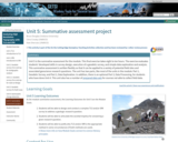
Unit 5 is a final exercise that can start during a lab …
Unit 5 is a final exercise that can start during a lab period and carry over into work outside of the lab time. The project report will test students' abilities to synthesize and apply knowledge related to LiDAR, InSAR, and infrastructure analysis learned in earlier units of the module. Data are provided for two potential case study sites for the final report -- El Major Cucapah Earthquake (Mexico 2010) and South Napa Earthquake (California 2014). Alternatively, the instructor or students can choose other sites to analyze. Unit 5, along with an exam question, is the summative assessment for the module. Students will be able to use the experience as a means of preparing for a final exam question on a related topic.
Show more about Online Teaching suggestions Hide Online-ready: The exercise is a final project that can be done remotely, individually or in small online groups.
(Note: this resource was added to OER Commons as part of a batch upload of over 2,200 records. If you notice an issue with the quality of the metadata, please let us know by using the 'report' button and we will flag it for consideration.)
This unit addresses changes in hurricane risks due to coastal development. Students …
This unit addresses changes in hurricane risks due to coastal development. Students will calculate the risks from hurricanes and how the hazards have changed (or not) from 1901 to 2010. Students will determine how changes in coastal development have altered the risks presented by hurricanes by analyzing data in Activity 5.1 and historic maps and aerial photographs in Activity 5.2.
(Note: this resource was added to OER Commons as part of a batch upload of over 2,200 records. If you notice an issue with the quality of the metadata, please let us know by using the 'report' button and we will flag it for consideration.)
Screenshot of the slider tool used to relate geophysical images to vegetation …
Screenshot of the slider tool used to relate geophysical images to vegetation pattern
Provenance: Lee Slater, Rutgers University-Newark Reuse: This item is in the public domain and maybe reused freely without restriction. In this unit, students explore spatial associations between the three-dimensional electromagnetic (EM) conductivity inversions and the visible patterns of Salicornia (Pickleweed) introduced in Unit 1, Exploring Harrier Meadow. The Arcview Storymap started in Unit 1 allows students to overlay inverted electrical conductivity patterns for different depths on aerial photographs of Harrier Meadow that highlight the patches of Pickleweed. Students analyze how conductivity patterns vary with depth and explore for evidence for a relationship between electrical conductivity and Pickleweed patches based on the hypothesis introduced in Unit 1. Students then perform an integrated interpretation of both the EM and electrical imaging inversions along with the results of direct sampling (coring, pore water sampling, soil characterization) conducted at locations selected using the electrical conductivity patterns observed in the EM dataset. Students perform basic qualitative assessments of the correlation between physical and chemical properties of the sampled soils and soil electrical conductivity from the EM inversions. Students finish the module by evaluating the extent to which the geophysical dataset and supporting direct measurements support the hypothesis pertaining to the cause of the Salicornia clusters introduced in Unit 1.
(Note: this resource was added to OER Commons as part of a batch upload of over 2,200 records. If you notice an issue with the quality of the metadata, please let us know by using the 'report' button and we will flag it for consideration.)
empty (Note: this resource was added to OER Commons as part of …
empty
(Note: this resource was added to OER Commons as part of a batch upload of over 2,200 records. If you notice an issue with the quality of the metadata, please let us know by using the 'report' button and we will flag it for consideration.)
Students will examine data that record the modern increase in carbon dioxide …
Students will examine data that record the modern increase in carbon dioxide concentrations and the associated increase in average temperatures, and they will investigate the effects of carbon dioxide on various components of the Earth system (atmosphere, cryosphere, hydrosphere -- oceans). Students also learn how the burning of fossil fuels contributes to increases in atmospheric carbon dioxide.
(Note: this resource was added to OER Commons as part of a batch upload of over 2,200 records. If you notice an issue with the quality of the metadata, please let us know by using the 'report' button and we will flag it for consideration.)
Unit 5 addresses the concept of Net Zero Water of buildings. Net …
Unit 5 addresses the concept of Net Zero Water of buildings. Net Zero Water can be defined in different ways. For this module it means a building's water needs are supplied 100% from harvested rainwater or water that is recycled on site. Reducing indoor and outdoor water use is a key element. Reading and videos are assigned to aid students grasping the concept of Net Zero Water as applied to buildings. A spreadsheet tool from the U.S. Green Building Council is introduced and used to estimate indoor water demand for baseline and design (water conservation) scenarios. In addition, this unit links to Unit 4 by including an estimate for outdoor water demand. The central activity for the unit is an active learning team exercise to analyze indoor water use reduction for a case study building and evaluate Net Zero Water.
(Note: this resource was added to OER Commons as part of a batch upload of over 2,200 records. If you notice an issue with the quality of the metadata, please let us know by using the 'report' button and we will flag it for consideration.)
Students will review current ocean pressures related to overfishing and human impacts …
Students will review current ocean pressures related to overfishing and human impacts on ocean ecosystems. By examining data collected in relation to the presence of marine reserves, students will explore long-term strategies for protecting ocean resources. Students will review scientific data to assess biomass, biodiversity, and reproductive success of fishery stocks in a marine protected area (MPA) and propose a location for the establishment of a marine reserve in the Channel Islands, California.
(Note: this resource was added to OER Commons as part of a batch upload of over 2,200 records. If you notice an issue with the quality of the metadata, please let us know by using the 'report' button and we will flag it for consideration.)
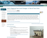
Is sea level change globally uniform? How do sea level changes have …
Is sea level change globally uniform? How do sea level changes have the potential to influence major metropolitan areas during the next century? How should these changes be addressed, and who should be responsible for taking action? In this unit, the conclusion to the Ice Mass and Sea Level Change module, students explore the potential impacts of sea level change on the economy, infrastructure, and residents of Southern California and New York City. Students also consider how changes in these two regions will have a widespread influence on other US cities, even for landlocked communities.
Show more about Online Teaching suggestions Hide Online-adaptable: This sea level impact analysis is designed to be done in small groups and possibly with a class gallery walk. These would need to be converted to small online groups and online discussion. The Part 4 wall walk could potentially be adapted to class discussion that uses polling feature to see people's opinions. Arguments could be made verbally or with the chat box.
(Note: this resource was added to OER Commons as part of a batch upload of over 2,200 records. If you notice an issue with the quality of the metadata, please let us know by using the 'report' button and we will flag it for consideration.)
Unit 5 is the summative assessment for the module. This final exercise …
Unit 5 is the summative assessment for the module. This final exercise takes eight to ten hours. The exercise evaluates students' developed skills in survey design, execution of a geodetic survey, and simple data exploration and analysis. This summative assessment is written flexibly so that it can be applied to a variety of potential field sites and associated geoscience research questions. The unit has two parts, like most of the units in the module: Part 1, Geodetic Survey; and Part 2, Data Exploration. In addition, there is an optional Part 3, Data Processing, for students who have done Unit 4. This unit also has a number of prepared data sets for courses not able to collect field data.
(Note: this resource was added to OER Commons as part of a batch upload of over 2,200 records. If you notice an issue with the quality of the metadata, please let us know by using the 'report' button and we will flag it for consideration.)
No restrictions on your remixing, redistributing, or making derivative works. Give credit to the author, as required.
Your remixing, redistributing, or making derivatives works comes with some restrictions, including how it is shared.
Your redistributing comes with some restrictions. Do not remix or make derivative works.
Most restrictive license type. Prohibits most uses, sharing, and any changes.
Copyrighted materials, available under Fair Use and the TEACH Act for US-based educators, or other custom arrangements. Go to the resource provider to see their individual restrictions.