Updating search results...

Search Resources

77 Results

View
Selected filters:
  • volcanology
Petrology and Geochemistry of the Ongoing Pu'u 'Ō'ō Eruption of Kīlauea Volcano, Hawai'i (1983-2009)
Conditional Remix & Share Permitted
CC BY-NC-SA
Rating
0.0 stars

Pre-lab material provides background on the Hawaiian hotspot and the current eruption utilizing maps, diagrams, information, photographs, and video footage of the Pu'u 'Ō'ō eruption with written questions that test understanding of this material.
Examination of hand samples (available on request) and photomicrographs of lavas from a distinct interval of the Pu'u 'Ō'ō eruption with group partners in lab.
Working within groups assigned to particular intervals of the eruption to make time-series analyses of lava geochemistry from the Pu'u 'Ō'ō eruption to evaluate crustal processes of magmatic evolution.
Interpretation and synthesis of background information, petrography, and geochemistry, and presentation of results and interpretation with group partners at the beginning of the next lab period.

(Note: this resource was added to OER Commons as part of a batch upload of over 2,200 records. If you notice an issue with the quality of the metadata, please let us know by using the 'report' button and we will flag it for consideration.)

Subject:
Biology
Chemistry
Geology
Life Science
Physical Science
Material Type:
Activity/Lab
Provider:
Science Education Resource Center (SERC) at Carleton College
Provider Set:
Teach the Earth
Author:
Andrew Greene
Michael Garcia
Date Added:
08/21/2020
Phase Diagrams from Kitchen Chemistry
Conditional Remix & Share Permitted
CC BY-NC-SA
Rating
0.0 stars

An ability to read and use simple igneous phase diagrams is a major goal of most undergraduate courses in petrology. Many students have difficulty attaining this goal because phase diagrams are an unfamiliar kind of graph and they are described in most textbooks with an unfamiliar language

Subject:
Geology
Physical Science
Physics
Material Type:
Activity/Lab
Provider:
Science Education Resource Center (SERC) at Carleton College
Provider Set:
Teach the Earth
Author:
John Brady
Date Added:
01/20/2023
Physical and Chemical Variations Along the Central American Volcanic Arc
Conditional Remix & Share Permitted
CC BY-NC-SA
Rating
0.0 stars

The Central American volcanic arc displays large arc-parallel variations in chemical composition that yield important clues concerning the complex origin of magmas in subduction zones. In this exercise, students use data compiled for the NSF MARGINS program to compare heights, volumes, and whole-rock compositions of 39 Quaternary volcanic centers along the Central American arc, together with crustal thicknesses, to assess the possible sources of the magmas and the petrologic processes that have modified them prior to eruption.

(Note: this resource was added to OER Commons as part of a batch upload of over 2,200 records. If you notice an issue with the quality of the metadata, please let us know by using the 'report' button and we will flag it for consideration.)

Subject:
Biology
Chemistry
Geoscience
Life Science
Physical Science
Material Type:
Activity/Lab
Data Set
Lesson Plan
Provider:
Science Education Resource Center (SERC) at Carleton College
Provider Set:
Teach the Earth
Author:
Kent Ratajeski
Date Added:
11/15/2016
Porosity and Permeability of Magmas
Conditional Remix & Share Permitted
CC BY-NC-SA
Rating
0.0 stars

SSAC Physical Volcanology module. Students build a spreadsheet for an iterative calculation to find volume of bubbles and hence porosity, permeability and gas escape as a function of depth.

(Note: this resource was added to OER Commons as part of a batch upload of over 2,200 records. If you notice an issue with the quality of the metadata, please let us know by using the 'report' button and we will flag it for consideration.)

Subject:
Biology
Life Science
Mathematics
Measurement and Data
Physical Science
Physics
Statistics and Probability
Material Type:
Activity/Lab
Provider:
Science Education Resource Center (SERC) at Carleton College
Provider Set:
Teach the Earth
Author:
chuck connor
Date Added:
09/01/2020
Porosity and Permeability of Magmas
Conditional Remix & Share Permitted
CC BY-NC-SA
Rating
0.0 stars

SSAC Physical Volcanology module. Students build a spreadsheet for an iterative calculation to find volume of bubbles and hence porosity, permeability and gas escape as a function of depth.

Subject:
Geoscience
Mathematics
Physical Science
Physics
Material Type:
Activity/Lab
Provider:
Science Education Resource Center (SERC) at Carleton College
Provider Set:
Pedagogy in Action
Author:
Chuck Connor
Date Added:
11/06/2014
Properties of Rhyolite Magma
Conditional Remix & Share Permitted
CC BY-NC-SA
Rating
0.0 stars

Students have to determine the dimensions of a Quaternary rhyolite flow from a topographic map, employ a mineral thermometer to establish magma temperature, calculate density of the magma from its chemical composition, and use the Jeffreys equation relating flow velocity and viscosity.

(Note: this resource was added to OER Commons as part of a batch upload of over 2,200 records. If you notice an issue with the quality of the metadata, please let us know by using the 'report' button and we will flag it for consideration.)

Subject:
Biology
Life Science
Mathematics
Measurement and Data
Statistics and Probability
Material Type:
Activity/Lab
Data Set
Lesson Plan
Provider:
Science Education Resource Center (SERC) at Carleton College
Provider Set:
Teach the Earth
Author:
Barbara Nash
Date Added:
09/05/2019
Using Dynamic Digital Maps to Teach Petrology
Conditional Remix & Share Permitted
CC BY-NC-SA
Rating
0.0 stars

In this session we will examine how to utilize Dynamic Digital Maps (DDMs) in undergraduate petrology courses to bring inaccessible and exciting volcanic field areas to the students in the classroom and to engage the students in authentic research experiences. A DDM is a stand-alone "presentation manager" computer program that contains interactive maps, analytical data, digital images and movies. They are essentially complete geologic maps in digital format, available on CD-ROM and on line. We have developed two different kinds of exercises that use DDMs to provide field-based context for undergraduate research projects in petrology. In one, the students use the DDM of the Tatara-San Pedro volcanic complex of the Andes Mountains of central Chile to develop a group research poster on part of the volcano's evolution, to present to the class, modeled after what would be presented at a national meeting. The second exercise focuses on the Springville Volcanic field, where the students try to understand the magma evolution using both field relations and quantitative modeling skills.
Â

Read a complete description of how dynamic digital maps work, with more ideas for the classroom. (from Teaching with Data, Simulations and Models)

(Note: this resource was added to OER Commons as part of a batch upload of over 2,200 records. If you notice an issue with the quality of the metadata, please let us know by using the 'report' button and we will flag it for consideration.)

Subject:
Geology
Physical Science
Material Type:
Activity/Lab
Data Set
Diagram/Illustration
Interactive
Lesson Plan
Provider:
Science Education Resource Center (SERC) at Carleton College
Provider Set:
Teach the Earth
Author:
Christopher D. Condit
Date Added:
09/24/2020
VEPP: Determining the relationship between the summit and Pu'u 'O'o on Kilauea
Conditional Remix & Share Permitted
CC BY-NC-SA
Rating
0.0 stars

This is an exercise that is in development and will not be fully tested until Fall 2010. Please check back regularly for updates and changes.
Brief three-line description of the activity or assignment and its strengths:
Students first learn about several volcanic monitoring techniques. Given three hypotheses on the movement of magma in the plumbing between the summit and Pu'u 'Ō'ō on Kilauea, students make predictions about what they would expect to see for each hypothesis in the data. They then analyze the data and test each hypothesis.

Full length description:

In this activity, students learn, using a balloon experiment and sketches, how the monitoring techniques of ground tilt and ground motion (using GPS) illustrate magma chamber inflation and deflation. Students also are briefly introduced to the varying composition of basalt lava.
Three hypotheses about the movement of magma between the Kilauea summit and Pu'u 'Ō'ō are given to the students. For each hypothesis, students make predictions about what they would expect to see with each monitoring technique. After making predictions, students are given handouts with the data from each technique, they analyze the data to evaluate each hypothesis, and they make a conclusion about the movement of magma beneath Kilauea.

(Note: this resource was added to OER Commons as part of a batch upload of over 2,200 records. If you notice an issue with the quality of the metadata, please let us know by using the 'report' button and we will flag it for consideration.)

Subject:
Biology
Life Science
Material Type:
Activity/Lab
Provider:
Science Education Resource Center (SERC) at Carleton College
Provider Set:
Teach the Earth
Author:
Karen Kortz
Date Added:
09/12/2020
VEPP: Hawaii Volcanoes National Park - A Restless Paradise
Conditional Remix & Share Permitted
CC BY-NC-SA
Rating
0.0 stars

This is an exercise that is in development and has not yet been fully tested in the classroom. Please check back regularly for updates and changes.

This activity is encompassed in a PowerPoint module (PowerPoint 6.1MB Oct1 10) with embedded Excel spreadsheets that will incorporate data and increase students' quantitative skills.

Brief three-line description of the activity or assignment and its strengths (you will have an opportunity to expand on this description later in the form):

This PowerPoint module is embedded with Excel spreadsheets and provides information about the geology of Hawai'i Volcanoes National Park. The core quantitative aspect of this module is graph interpretation. The module also requires students to convert units and solve the Pythagorean Theorem.

Full length description:This PowerPoint module introduces students to the geology and current volcanic activity at Hawai'i Volcanoes National Park in conjunction with the Volcanoes Exploration Program:Puu Oo (VEPP) project. The module briefly covers the geologic setting and evolution of a hot spot island chain, monitoring techniques, historical eruptions, and hazards. Along the way, students complete short, ad hoc spreadsheets to answer questions regarding visual observations of an earthquake map and determining latitude and longitude, finding the highest and lowest concentrations of SO2 gas from graphed data, interpreting tiltmeter graphs, solving the Pythagorean Theorem to determine distance between GPS stations, making visual observations from webcam images, and converting units for eruption volumes.

(Note: this resource was added to OER Commons as part of a batch upload of over 2,200 records. If you notice an issue with the quality of the metadata, please let us know by using the 'report' button and we will flag it for consideration.)

Subject:
Biology
Life Science
Material Type:
Activity/Lab
Provider:
Science Education Resource Center (SERC) at Carleton College
Provider Set:
Teach the Earth
Author:
Judy McIlrath
Judy McIlrath McIlrth
Date Added:
09/29/2022
VEPP: Monitoring the Pu'u 'Ō'ō Eruption of Kīlauea Volcano Using Geochemical, Deformation and Seismicity Timeseries Data
Conditional Remix & Share Permitted
CC BY-NC-SA
Rating
0.0 stars

Show credits
HidePu'u 'O'o at the end of episode 32 (USGS photograph by J.D. Griggs, 4/22/85, JG5363).
This is an exercise that is in development and has not yet been fully tested in the classroom. Please check back regularly for updates and changes.

Goals of this lab are to: (1) gain background on volcano monitoring using maps, photographs, and geochemical, deformation (tiltmeter) and seismic data from eruptive activity of the Pu'u 'Ō'ō eruption; (2) make and interpret geochemical, deformation and seismic data plots as part of a time-series analysis for particular intervals of eruptive activity; and (3) answer questions and discuss information about magmatic and structural processes associated with volcanism at Kīlauea Volcano.

Brief description of the activity

The current eruption of Kīlauea Volcano on the island of Hawai'i has been closely monitored and studied since its inception in 1983. This laboratory exercise utilizes the excitement of an ongoing eruption to demonstrate volcano monitoring, deformation, and magmatic processes to better understand an active hotspot volcano.

(Note: this resource was added to OER Commons as part of a batch upload of over 2,200 records. If you notice an issue with the quality of the metadata, please let us know by using the 'report' button and we will flag it for consideration.)

Subject:
Biology
Chemistry
Life Science
Physical Science
Material Type:
Activity/Lab
Provider:
Science Education Resource Center (SERC) at Carleton College
Provider Set:
Teach the Earth
Author:
Andrew R. Greene and Michael O. Garcia, University of Hawai'i at Mānoa
Date Added:
03/28/2018
VEPP: Part 1: Volcanic Hazards and Risk; Part 2: Monitoring an Active Volcano
Conditional Remix & Share Permitted
CC BY-NC-SA
Rating
0.0 stars

Please contact the author if you have questions, concerns or suggestions.

This is an applied in-class exercise designed to have students evaluate monitoring data. The students, broken into groups of 4, will describe, evaluate, and synthesize several monitoring datasets. They will come up with hypothesis for the data, which will be the basis for a class discussion.

(Note: this resource was added to OER Commons as part of a batch upload of over 2,200 records. If you notice an issue with the quality of the metadata, please let us know by using the 'report' button and we will flag it for consideration.)

Subject:
Biology
Life Science
Material Type:
Activity/Lab
Provider:
Science Education Resource Center (SERC) at Carleton College
Provider Set:
Teach the Earth
Author:
Brittany Brand
Date Added:
11/13/2019
VEPP: Using the VEPP website in an introductory geology course: an investigation of the July 21, 2007 eruption of Pu'u O'o
Conditional Remix & Share Permitted
CC BY-NC-SA
Rating
0.0 stars

Introductory geology students will use geologic data obtained from the VEPP website (tilt and seismic) to identify and interpret changes during the July 21st, 2007 eruption of Pu'u 'O'o.

(Note: this resource was added to OER Commons as part of a batch upload of over 2,200 records. If you notice an issue with the quality of the metadata, please let us know by using the 'report' button and we will flag it for consideration.)

Subject:
Biology
Life Science
Material Type:
Activity/Lab
Provider:
Science Education Resource Center (SERC) at Carleton College
Provider Set:
Teach the Earth
Author:
Geoffrey Cook
Date Added:
11/15/2016
VEPP: Volcanic activity and monitoring of Pu`u `O`o, Kilauea volcano, Hawaii
Conditional Remix & Share Permitted
CC BY-NC-SA
Rating
0.0 stars

Brief three-line description of the activity or assignment and its strengths:

This is a 10-week group project for a Volcanic Hazards elective course, for undergraduate geology students. Students will access and analyze data from the current eruption of Pu`u `O`o, Kilauea volcano, Hawaii, and make interpretations of the activity. They will use data (mostly near-real-time) from a number of monitoring techniques, including seismic, deformation, observational, gas, and thermal. The activity will culminate with a written report and an oral presentation.

(Note: this resource was added to OER Commons as part of a batch upload of over 2,200 records. If you notice an issue with the quality of the metadata, please let us know by using the 'report' button and we will flag it for consideration.)

Subject:
Biology
Business and Communication
Communication
Life Science
Mathematics
Measurement and Data
Material Type:
Activity/Lab
Provider:
Science Education Resource Center (SERC) at Carleton College
Provider Set:
Teach the Earth
Author:
Lizzette Rodriguez
Date Added:
09/12/2020
Variation Diagrams and the Evolution of Thingmuli Lavas, Iceland
Conditional Remix & Share Permitted
CC BY-NC-SA
Rating
0.0 stars

In this problem set students are provided with an EXCEL spreadsheet containing major element analyses of lavas frm Thingmuli Volcano in Iceland. They are asked to construct variation diagrams (Harker plots) and then explain the trends they see for various elements. I use this problem set to introduce the use of EXCEL and to help students to think about the connections between mineral assemblage and rock chemistry.

(Note: this resource was added to OER Commons as part of a batch upload of over 2,200 records. If you notice an issue with the quality of the metadata, please let us know by using the 'report' button and we will flag it for consideration.)

Subject:
Biology
Chemistry
Life Science
Mathematics
Measurement and Data
Physical Science
Statistics and Probability
Material Type:
Activity/Lab
Data Set
Interactive
Lesson Plan
Provider:
Science Education Resource Center (SERC) at Carleton College
Provider Set:
Teach the Earth
Author:
Jeff Tepper
Date Added:
08/11/2019
Virtual Field Trip to Laki Fissure
Conditional Remix & Share Permitted
CC BY-NC-SA
Rating
0.0 stars

This is a virtual field trip to Iceland's Laki Fissure, which explores the 1783 eruption as a type example of a large historical lava flow eruption that had a significant impact on the local human population and the global environment. Students explore the climate impacts of the eruption, as well as the different types of volcanic deposits it produced. Students use their observations to develop hypotheses about past and future volcanic hazards associated with the volcano.

(Note: this resource was added to OER Commons as part of a batch upload of over 2,200 records. If you notice an issue with the quality of the metadata, please let us know by using the 'report' button and we will flag it for consideration.)

Subject:
Biology
Life Science
Material Type:
Simulation
Provider:
Science Education Resource Center (SERC) at Carleton College
Provider Set:
Teach the Earth
Author:
Katherine Kelley
Date Added:
08/15/2022
Virtual Field Trip to Mt. Vesuvius
Conditional Remix & Share Permitted
CC BY-NC-SA
Rating
0.0 stars

This is a virtual field trip to Italy's Mt. Vesuvius, which explores the 79AD eruption of the volcano. Students explore the excavated cities of Pompeii and Herculaneum, as well as the different types of volcanic deposits found to have buried those cities. Students use their observations to develop hypotheses about past and future volcanic hazards associated with the volcano.

(Note: this resource was added to OER Commons as part of a batch upload of over 2,200 records. If you notice an issue with the quality of the metadata, please let us know by using the 'report' button and we will flag it for consideration.)

Subject:
Biology
Life Science
Material Type:
Simulation
Provider:
Science Education Resource Center (SERC) at Carleton College
Provider Set:
Teach the Earth
Author:
Katherine Kelley
Date Added:
08/15/2022
Viscosity experiments: physical controls and implications for volcanic hazards
Conditional Remix & Share Permitted
CC BY-NC-SA
Rating
0.0 stars

Teaching students about viscosity is easy, effective and fun. It is a topic that is conducive to a range of teaching and learning styles, and allows for the integration of theory, experiments, and calculations. During the course of this exercise, students are required to make predictions about the outcomes of experiments, quantitatively document the results of their experiments, calculate viscosities using the Jeffreys equation (Jeffreys 1925; Nichols 1939; Cas and Wright 1987), and extrapolate the concepts learned from their laboratory results to natural conditions appropriate for silicate magmas and lavas. Students are also introduced to Ken Wohletz's freeware program MAGMA (no longer available), which allows them to determine viscosities for magma and lava compositions, and are required to do some simple graphical analysis of the effects of composition, dissolved H2O, and % solids on magma and lava viscosity using the MAGMA calculations. Viscosity is important for students at all levels of earth science to understand because it is a critical control on morphologies of volcanoes, velocities of lava flows, eruptive styles (effusive versus explosive), and ascent velocities of magmas within the earth.

The objectives of the lab are for students to:

learn about the rheological property called viscosity and some of the factors that affect it;
think about and discuss ways in which viscosity controls styles of eruptions and relates to volcanic hazards; and
practice quantitative skills.

I have used the viscosity experiments as a classroom demonstration in introductory geology courses, as one part of a more extensive lab on volcanoes in introductory geology courses, and as a more intensive viscosity lab for introductory petrology courses. Generally the students do this exercise after they have had at least one introductory lecture on volcanoes, so that they are familiar with several basic terms, including viscosity, lava, magma, as well as some basic igneous rock terms (basalt, andesite, rhyolite). Over the fives years that I have been using the experiments, students at all levels have commented that the experiments are some of the most memorable, interesting and fun parts of my courses. I would welcome any direct student or instructor feedback for improvements or additions to the exercises (edwardsb AT dickinson.edu).

(Note: this resource was added to OER Commons as part of a batch upload of over 2,200 records. If you notice an issue with the quality of the metadata, please let us know by using the 'report' button and we will flag it for consideration.)

Subject:
Biology
Life Science
Material Type:
Activity/Lab
Provider:
Science Education Resource Center (SERC) at Carleton College
Provider Set:
Teach the Earth
Author:
Ben Edwards
Date Added:
09/15/2020
Volcanic Ejecta from Sunset Crater
Conditional Remix & Share Permitted
CC BY-NC-SA
Rating
0.0 stars

Students are provided with equations and geological data to estimate the velocities and impact effects of volcanic bombs that were ejected during the last eruption of Sunset Crater, a young cinder cone volcano in northern Arizona.

Click here to view the full activity on the KÃyah Math Project website.

(Note: this resource was added to OER Commons as part of a batch upload of over 2,200 records. If you notice an issue with the quality of the metadata, please let us know by using the 'report' button and we will flag it for consideration.)

Subject:
Biology
Geoscience
Life Science
Mathematics
Measurement and Data
Physical Science
Statistics and Probability
Material Type:
Activity/Lab
Provider:
Science Education Resource Center (SERC) at Carleton College
Provider Set:
Teach the Earth
Author:
KÃyah Math Project development team: Nancy Zumoff, Christopher Schaufele, Steven Semken, Tracy Perkins, Lynn Onken, Philippe Laval, David Gonzales, and Andrew Becenti (deceased). KÃyah Math Project directed by Steven Semken , Arizona State University; and Christopher Schaufele and Nancy Zumoff, Professors of Mathematics, Emeritus. Archived at Arizona State University School of Earth and Space Exploration.
Date Added:
09/25/2022
Volcanic Histories
Conditional Remix & Share Permitted
CC BY-NC-SA
Rating
0.0 stars

To prepare for this in-class problem, students should have read about volcanism in their introductory text. Specifically they will need to know the types of volcanoes, the characteristics of volcanic products, such as lava flows of different silica compositions, tephra, lahars, and pyroclastic flows. Students should be able to connect the types of activity of a volcano to its type, such as composite volcanoes having abundant tephra, with some lava flows, while a shield volcano may have less tephra and more low viscosity lava flows.
This activity is similar to the process used by geoscientists to evaluate the history and hazards of a volcano.

(Note: this resource was added to OER Commons as part of a batch upload of over 2,200 records. If you notice an issue with the quality of the metadata, please let us know by using the 'report' button and we will flag it for consideration.)

Subject:
Biology
Life Science
Material Type:
Activity/Lab
Provider:
Science Education Resource Center (SERC) at Carleton College
Provider Set:
Teach the Earth
Author:
Robert Filson
Date Added:
08/29/2019
Volcanic Landforms and Magma Composition
Conditional Remix & Share Permitted
CC BY-NC-SA
Rating
0.0 stars

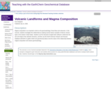
Magma composition is an important control on the geomorphology of lava flows and volcanoes. In this exercise, students investigate this relationship by studying several classic examples of diverse volcano types in the western United States. Students use the interactive Google Earth software to determine the size and shape of the selected volcanoes, and then use the North American Volcanic and Intrusive Database (NAVDAT) to gather whole-rock geochemical data to test the nature of the relationship between magma composition and volcano geomorphology.

(Note: this resource was added to OER Commons as part of a batch upload of over 2,200 records. If you notice an issue with the quality of the metadata, please let us know by using the 'report' button and we will flag it for consideration.)

Subject:
Biology
Life Science
Material Type:
Activity/Lab
Data Set
Lesson Plan
Provider:
Science Education Resource Center (SERC) at Carleton College
Provider Set:
Teach the Earth
Author:
Kent Ratajeski
Date Added:
12/10/2020