The purpose of this 3 ACT task is to provide students with …
The purpose of this 3 ACT task is to provide students with an opportunity to problem solve based on a real-world situation. In the task, students are presented with a map of a Bull Kelp bed near Squaxin Island and asked to generate their own questions that could be answered using the map. Students then decide on necessary resources for finding the solution and are given time as a group to complete their work. The task concludes by having students examine the information provided in Act three to see if it answers their question. Includes slides to support the implementation of "Keeping An Eye On Kelp (Algebra)" Math Performance Task with charts, images, etc.
Most students understand that water quality is an important issue, however many …
Most students understand that water quality is an important issue, however many do not understand the complexity associated with the processes involved, the complex nature of estuarine systems, or the fact that management decisions are made based on available data sets that can be difficult at best to interpret. Students will be provided nutrient data in Excel for two Texas estuaries which they will supplement with additional information that they have compiled on these two estuaries during the duration of the course through a GIS database available to the entire class. Furthermore, students will retrieve information from the WWW to learn more about the specific estuaries and the nutrients of interest and their impacts on the environment.
(Note: this resource was added to OER Commons as part of a batch upload of over 2,200 records. If you notice an issue with the quality of the metadata, please let us know by using the 'report' button and we will flag it for consideration.)
Introduction to dynamics and vibration of lumped-parameter models of mechanical systems. Three-dimensional …
Introduction to dynamics and vibration of lumped-parameter models of mechanical systems. Three-dimensional particle kinematics. Force-momentum formulation for systems of particles and for rigid bodies (direct method). Newton-Euler equations. Work-energy (variational) formulation for systems particles and for rigid bodies (indirect method). Virtual displacements and work. Lagrange’s equations for systems of particles and for rigid bodies. Linearization of equations of motion. Linear stability analysis of mechanical systems. Free and forced vibration of linear damped lumped parameter multi-degree of freedom models of mechanical systems. Application to the design of ocean and civil engineering structures such as tension leg platforms. This subject was originally offered in Course 13 (Department of Ocean Engineering) as 13.013J. In 2005, ocean engineering became part of Course 2 (Department of Mechanical Engineering), and this subject merged with 2.003.
This course begins with the foundations of 3D elasticity, fluid and elastic …
This course begins with the foundations of 3D elasticity, fluid and elastic wave equations, elastic and plastic waves in rods and beams, waves in plates, and dynamics and acoustics of cylindrical shells. The course considers acoustic fluids effects such as radiation and scattering by submerged plates and shells, and interaction between structural elements. Finally, it covers the response of plates and shells to high-intensity loads, dynamic plasticity and fracture, and structural damage caused by implosive and impact loads. This course was originally offered in Course 13 (Department of Ocean Engineering) as 13.811. In 2005, ocean engineering subjects became part of Course 2 (Department of Mechanical Engineering), and this course was renumbered 2.067.
Students consider the history and development of the United Nations Law of …
Students consider the history and development of the United Nations Law of the Sea Treaty, with a focus on extraction of natural resources from the ocean. Sustainability of a single resource is investigated in detail.
The Tour Stops are arranged in a teaching sequence, starting with continental …
The Tour Stops are arranged in a teaching sequence, starting with continental rifting and incipient ocean basin formation in East Africa and the Red Sea and ending with the oldest surviving fragments of oceanic crust. Transforms and fracture zones are introduced, also abandoned basins, convergent boundaries, and marginal basins. Instructors can easily change the sequence of stops to suit their courses using the Google Earth desktop app or by editing the KML file.
The ORSEA program connects math and science educators with scientists to create …
The ORSEA program connects math and science educators with scientists to create and pilot lessons centered around marine-focused anchoring phenomena. ORSEA supports data science education and ocean literacy, while also exposing students to a variety of marine-related careers. This project is funded by Oregon Sea Grant and the National Science Foundation through OSU's Regional Class Research Vessel Project.
Currently there are 23 lessons/units integrate math and marine science in units and lessons for students in grades 6 - 12.
Human-induced nutrient loading of the world's oceans has been linked to increased …
Human-induced nutrient loading of the world's oceans has been linked to increased and prolonged algae blooms, sometimes with potentially deadly consequences. In this investigation, students will create their own algal blooms, analyze satellite images of chlorophyll concentrations in the Sea of CortÃs, and learn about two alarming consequences of excessive algae growth-—dead zones and harmful algae blooms (HABs).
(Note: this resource was added to OER Commons as part of a batch upload of over 2,200 records. If you notice an issue with the quality of the metadata, please let us know by using the 'report' button and we will flag it for consideration.)
2.26 is a 6-unit Honors-level subject serving as the Mechanical Engineering department’s …
2.26 is a 6-unit Honors-level subject serving as the Mechanical Engineering department’s sole course in compressible fluid dynamics. The prerequisites for this course are undergraduate courses in thermodynamics, fluid dynamics, and heat transfer. The goal of this course is to lay out the fundamental concepts and results for the compressible flow of gases. Topics to be covered include: appropriate conservation laws; propagation of disturbances; isentropic flows; normal shock wave relations, oblique shock waves, weak and strong shocks, and shock wave structure; compressible flows in ducts with area changes, friction, or heat addition; heat transfer to high speed flows; unsteady compressible flows, Riemann invariants, and piston and shock tube problems; steady 2D supersonic flow, Prandtl-Meyer function; and self-similar compressible flows. The emphasis will be on physical understanding of the phenomena and basic analytical techniques.
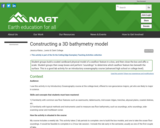
To prepare for this lab, students read a section of the textbook …
To prepare for this lab, students read a section of the textbook about observational techniques to measure the seafloor bathymetry as well as the occurrence of common sea floor features, such as seamounts, coastal shelves, mid-ocean ridges, and trenches. In the first lab, groups of students are provided with a bathymetric map, cutting board, sharp edges, and plenty of cardboard. They trace some contours from the map onto tracing paper, and then cut those out of the cardboard to construct a scale model of their given sea floor feature. They attach the sheets of cardboard with double-sided tape, and affix it to the bottom of a rigid box. The box lid has a grid of holes drilled into it. They determine the scale of the map (cm of the model to km in the ocean, for example), and affix the scale to the outside of the box. This concludes the first lab session.
In the second lab session, each team of students is provided with a box from an unknown team. The box is closed, and they do not know what ocean feature lay inside. They use bamboo skewers to take "soundings" at each of the drilled holes in the box lid, and mark their measurements on a piece of graph paper. Then they construct a contour map from the soundings, and try to identify the sea floor feature in the box from a global seafloor topography map that is hanging on a wall.
Students complete guided questions about the process of constructing their 3D scaled model and exploring the unknown ocean.
This course is an introduction to numerical methods and MATLAB®: Errors, condition …
This course is an introduction to numerical methods and MATLAB®: Errors, condition numbers and roots of equations. Topics covered include Navier-Stokes; direct and iterative methods for linear systems; finite differences for elliptic, parabolic and hyperbolic equations; Fourier decomposition, error analysis and stability; high-order and compact finite-differences; finite volume methods; time marching methods; Navier-Stokes solvers; grid generation; finite volumes on complex geometries; finite element methods; spectral methods; boundary element and panel methods; turbulent flows; boundary layers; and Lagrangian coherent structures (LCSs). Prof. Pierre Lermusiaux is very grateful to the teaching assistants Dr. Matt Ueckermann, Dr. Tapovan Lolla, Mr. Jing Lin, and Mr. Arpit Agarwal for their contributions to the course over the years.
In this activity, students will practice the steps involved in a scientific …
In this activity, students will practice the steps involved in a scientific investigation as they learn why ice formations on land (and not those on water) will cause a rise in sea level upon melting. This is a discovery lesson on ice and water density and displacement of water.
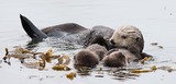
This video segment features subsistence fishing and harvesting in the Northwestern US. …
This video segment features subsistence fishing and harvesting in the Northwestern US. The segment was adapted from a student video produced at Northwest Indian College in Bellingham, Washington.
In this activity, students estimate the drop in sea level during glacial …
In this activity, students estimate the drop in sea level during glacial maxima, when ice and snow in high latitudes and altitudes resulted in lower sea levels. Students estimate the surface area of the world's oceans, use ice volume data to approximate how much sea levels dropped, and determine the sea-level rise that would occur if the remaining ice melted.
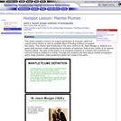
This lesson introduces the theory of mantle plumes and possible ways of …
This lesson introduces the theory of mantle plumes and possible ways of finding evidence to support the theory.
(Note: this resource was added to OER Commons as part of a batch upload of over 2,200 records. If you notice an issue with the quality of the metadata, please let us know by using the 'report' button and we will flag it for consideration.)
Jamie A. Russell, Scripps Institution of Oceanography
Related Links
Relative Dating
Hotspot Theory and Plate Velocities
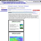
Samoan Hotspot
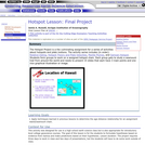
Final Hotspot Project
View Lesson Plan at ERESE ...
This lesson discusses the similarities and difference between Samoa and Hawaii. Both …
This lesson discusses the similarities and difference between Samoa and Hawaii. Both Samoa and Hawaii are island chains in the Pacific and thought to be the result of hotspots.
(Note: this resource was added to OER Commons as part of a batch upload of over 2,200 records. If you notice an issue with the quality of the metadata, please let us know by using the 'report' button and we will flag it for consideration.)
Jamie A. Russell, Scripps Institution of Oceanography
Related Links
Relative Dating
Hotspot Theory and Plate Velocities
Mantle Plumes
Final Hotspot Project
View Lesson Plan at ERESE ...
In this kinesthetic activity, the concept of energy budget is strengthened as …
In this kinesthetic activity, the concept of energy budget is strengthened as students conduct three simulations using play money as units of energy, and students serve as parts of a planetary radiation balance model. Students will determine the energy budget of a planet by manipulating gas concentrations, energy inputs and outputs in the system in this lesson that supports the study of climate on Mars, Mercury, Venus and Earth. The lesson supports understanding of the real-world problem of contemporary climate change. The resource includes a teacher's guide and several student worksheets. This is the second of four activities in the lesson, How do Atmospheres affect planetary temperatures?, within Earth Climate Course: What Determines a Planet's Climate? The resource aims to help students to develop an understanding of our environment as a system of human and natural processes that result in changes that occur over various space and time scales.
Students form groups to work on a assigned hotspot chain. Each group …
Students form groups to work on a assigned hotspot chain. Each group gets to study a seamount trail from around the world and needs to present 15 slides that each have 3 main points and one nice graphical illustration or image.
(Note: this resource was added to OER Commons as part of a batch upload of over 2,200 records. If you notice an issue with the quality of the metadata, please let us know by using the 'report' button and we will flag it for consideration.)
Jamie A. Russell, Scripps Institution of Oceanography
Related Links
Relative Dating
Hotspot Theory and Plate Velocities
Mantle Plumes
Samoan Hotspot
View Lesson Plan at ERESE ...
This course covers the complete cycle of designing an ocean system using …
This course covers the complete cycle of designing an ocean system using computational design tools for the conceptual and preliminary design stages. Students complete the projects in teams with each student responsible for a specific subsystem. Lectures cover such topics as hydrodynamics; structures; power and thermal aspects of ocean vehicles; environment, materials, and construction for ocean use; and generation and evaluation of design alternatives. The course focuses on innovative design concepts chosen from high-speed ships, submersibles, autonomous vehicles, and floating and submerged deep-water offshore platforms. Lectures on ethics in engineering practice are included, and instruction and practice in oral and written communication is provided.
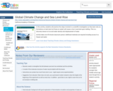
This interactive map allows the user to explore projected alterations of land …
This interactive map allows the user to explore projected alterations of land surfaces in coastal communities, based on different scenarios of sea level changes over time.
No restrictions on your remixing, redistributing, or making derivative works. Give credit to the author, as required.
Your remixing, redistributing, or making derivatives works comes with some restrictions, including how it is shared.
Your redistributing comes with some restrictions. Do not remix or make derivative works.
Most restrictive license type. Prohibits most uses, sharing, and any changes.
Copyrighted materials, available under Fair Use and the TEACH Act for US-based educators, or other custom arrangements. Go to the resource provider to see their individual restrictions.