Updating search results...

Search Resources

2403 Results

View
Selected filters:
  • Water
The Great Flood of 1993
Read the Fine Print
Educational Use
Rating
0.0 stars

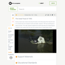
In this video segment adapted from NOVA, a meteorologist explains how an unusual weather pattern led to one of the most devastating floods of this century.

Subject:
Hydrology
Physical Science
Material Type:
Activity/Lab
Diagram/Illustration
Provider:
PBS LearningMedia
Provider Set:
PBS Learning Media: Multimedia Resources for the Classroom and Professional Development
Author:
National Science Foundation
WGBH Educational Foundation
Date Added:
12/17/2005
The Great Gravity Escape
Read the Fine Print
Educational Use
Rating
0.0 stars

Students use water balloons and a length of string to understand how the force of gravity between two objects and the velocity of a spacecraft can balance to form an orbit. They see that when the velocity becomes too great for gravity to hold the spacecraft in orbit, the object escapes the orbit and travels further away from the planet.

Subject:
Applied Science
Engineering
Physical Science
Physics
Material Type:
Activity/Lab
Provider:
TeachEngineering
Provider Set:
TeachEngineering
Author:
Chris Yakacki
Daria Kotys-Schwartz
Geoffrey Hill
Janet Yowell
Malinda Schaefer Zarske
Timothy M. Dittrich
Date Added:
10/14/2015
The Great Pacific Garbage Patch
Read the Fine Print
Educational Use
Rating
0.0 stars

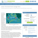
The Great Pacific Garbage Patch (GPGP) is an intriguing and publicized environmental problem. This swirling soup of trash up to 10 meters deep and just below the water surface is composed mainly of non-degradable plastics. These plastic materials trap aquatic life and poison them by physical blockage or as carriers of toxic pollutants. The problem relates to materials science and the advent of plastics in modern life, an example of the unintended consequences of technology. Through exploring this complex issue, students gain insight into aspects of chemistry, oceanography, fluids, environmental science, life science and even international policy. As part of the GIS unit, the topic is a source of content for students to create interesting maps communicating something that they will likely begin to care about as they learn more.

Subject:
Applied Science
Engineering
Environmental Science
Material Type:
Lesson Plan
Provider:
TeachEngineering
Provider Set:
TeachEngineering
Author:
Andrey Koptelov
Nathan Howell
Date Added:
09/18/2014
Green Infrastructure/Green Roofs
Conditional Remix & Share Permitted
CC BY-NC-SA
Rating
0.0 stars

Runoff in urban areas is an increasingly important issue when it comes to water quality. It is a major hydrologic issue in New York City, as urban infrastructure creates excess runoff and impervious surfaces decrease the infiltration rate of land surfaces. This excess runoff, which often times carries with it pollutants and contaminants, has proven to create water quality issues. It has become ever more critical to try to mitigate the influx of runoff into our waterways. Urbanization increases runoff, and in NYC 64% of the area is impervious.
In this module students will explore green roofs as a potential solution to the environmental impacts of increased precipitation brought on by climate change. They will evaluate data collected from studies on 15 green roofs from different areas of the US and other countries, as well as historical precipitation data from Central Park in NY to illustrate how precipitation patterns are changing and if we need to use green infrastructure, such as green roofs, to combat the symptoms of climate change. Students will also use Model My Watershed , a watershed-modeling web app, to analyze real land use data, model storm-water runoff and water-quality impacts using professional-grade models, and compare how different conservation or development scenarios could modify runoff and water quality.

(Note: this resource was added to OER Commons as part of a batch upload of over 2,200 records. If you notice an issue with the quality of the metadata, please let us know by using the 'report' button and we will flag it for consideration.)
Subject:
Biology
Career and Technical Education
Environmental Studies
Geology
Life Science
Mathematics
Measurement and Data
Physical Science
Statistics and Probability
Material Type:
Activity/Lab
Provider:
Science Education Resource Center (SERC) at Carleton College
Provider Set:
Teach the Earth
Author:
Elizabeth Farrell, CUNY Queens College; SUNY Nassau Community College
Date Added:
09/19/2022
Green Infrastructure and Low-Impact Development Technologies
Read the Fine Print
Educational Use
Rating
0.0 stars

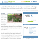
Students are introduced to innovative stormwater management strategies that are being used to restore the hydrology and water quality of urbanized areas to pre-development conditions. Collectively called green infrastructure (GI) and low-impact development (LID) technologies, they include green roofs and vegetative walls, bioretention or rain gardens, bioswales, planter boxes, permeable pavement, urban tree canopy, rainwater harvesting, downspout disconnection, green streets and alleys, and green parking. These approaches differ from the traditional centralized stormwater collection system with the idea of handling stormwater at its sources, resulting in many environmental, economic and societal benefits. A PowerPoint® presentation provides photographic examples, and a companion file gives students the opportunity to sketch in their ideas for using the technologies to make improvements to 10 real-world design scenarios.

Subject:
Applied Science
Engineering
Hydrology
Physical Science
Material Type:
Lesson Plan
Provider:
TeachEngineering
Provider Set:
TeachEngineering
Author:
Brigith Soto
Jennifer Butler
Krysta Porteus
Maya Trotz
Ryan Locicero
William Zeman
Date Added:
09/18/2014
Green Landscape and Environmental Policy
Conditional Remix & Share Permitted
CC BY-NC-SA
Rating
0.0 stars

This course introduces students to basic rain garden design, water cistern development, and bioretention principles. Students will also explore the uses of landform, plants, and structure to shape space. Classes will include slide-illustrated lectures, class discussions, and project critiques. Through a combination of short practicum that includes rain garden design for residential, commercial, and government locations, students will be able to analyze and create a design that applies modern theories to questions of spatial organization, order, and selection of building materials. Students will translate research and case studies by applying building, drawing, and design critiques specific for the site design and present their findings to the community.

(Note: this resource was added to OER Commons as part of a batch upload of over 2,200 records. If you notice an issue with the quality of the metadata, please let us know by using the 'report' button and we will flag it for consideration.)
Subject:
Biology
Hydrology
Life Science
Physical Science
Material Type:
Activity/Lab
Homework/Assignment
Provider:
Science Education Resource Center (SERC) at Carleton College
Provider Set:
Teach the Earth
Author:
Stephanie Freeman
Date Added:
08/16/2019
Greenhouse Gases: A Closer Look
Read the Fine Print
Rating
0.0 stars

This lesson covers different aspects of the major greenhouse gases - water vapor, carbon dioxide, methane, nitrous oxides and CFCs - including some of the ways in which human activities are affecting the atmospheric concentrations of these key greenhouse gases. This is lesson six in a nine-lesson module about climate change.

Subject:
Atmospheric Science
Physical Science
Material Type:
Activity/Lab
Provider:
CLEAN: Climate Literacy and Energy Awareness Network
Provider Set:
CLEAN: Climate Literacy and Energy Awareness Network
Author:
King's Centre for Visualization in Science
Date Added:
10/27/2014
Greenland Sharks
Read the Fine Print
Rating
0.0 stars

In this video, Jonathan travels to Canada in search of the Greenland shark, a huge, lethargic shark that lives in arctic waters. It takes days of effort, but finally, in dark, cold, murky water, Jonathan finally meets this elusive animal, and it's nothing like he expected. Please see the accompanying study guide for educational objectives and discussion points.

Subject:
Geoscience
Life Science
Oceanography
Physical Science
Material Type:
Diagram/Illustration
Lesson Plan
Provider:
Jonathan Bird's Blue World
Provider Set:
Jonathan Bird's Blue World
Author:
Jonathan Bird Productions
Oceanic Research Group
Date Added:
09/10/2010
Green or Gray? Choosing to Preserve Water Quality
Read the Fine Print
Rating
0.0 stars

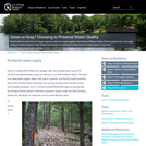
Faced with the potential of a large expense related to water quality, the Portland (Maine) Water District performed a thorough analysis of their options. Their choice came down to making an investment in conservation or concrete.

Subject:
Hydrology
Physical Science
Material Type:
Case Study
Provider:
National Oceanic and Atmospheric Administration
Provider Set:
U.S. Climate Resilience Toolkit
Date Added:
08/30/2016
Groundwater Depth and Fracture Pattern Determination
Conditional Remix & Share Permitted
CC BY-NC-SA
Rating
0.0 stars

Working in teams, the students begin by conducting a vertical resistivty sounding to determine the depth to the water table. This can be checked because the survey is done in the middle of an existing well field. Using the depth determined, the students then conduct the equivalent of horizontal resistivity survey using a fixed "a" spacing. Instead of making a map they collect data at 10-degree intervals rotating the array around a central point. This provides them with information about how the resistivity varies with magnetic bearing and they then have to relate that to an interpretation of the local structure (fracture patterns). Each student has to submit an individual report which includes an interpretation of the data.
Uses geophysics to solve problems in other fields

(Note: this resource was added to OER Commons as part of a batch upload of over 2,200 records. If you notice an issue with the quality of the metadata, please let us know by using the 'report' button and we will flag it for consideration.)

Subject:
Biology
Life Science
Material Type:
Activity/Lab
Homework/Assignment
Provider:
Science Education Resource Center (SERC) at Carleton College
Provider Set:
Teach the Earth
Author:
Lawrence L. Malinconico
Date Added:
09/05/2019
Groundwater Detectives
Read the Fine Print
Educational Use
Rating
0.0 stars

Student teams locate a contaminant spill in a hypothetical site by measuring the pH of soil samples. Then they predict the direction of groundwater flow using mathematical modeling. They also use the engineering design process to come up with alternative treatments for the contaminated water.

Subject:
Applied Science
Engineering
Environmental Science
Material Type:
Activity/Lab
Provider:
TeachEngineering
Provider Set:
TeachEngineering
Author:
Ben Heavner
Janet Yowell
Malinda Schaefer Zarske
Melissa Straten
Date Added:
10/14/2015
Groundwater Discharge and Flow Rate
Conditional Remix & Share Permitted
CC BY-NC-SA
Rating
0.0 stars

This activity allows students to understand the groundwater flow. Using a groundwater map, they will draw flow lines and determine the discharge and rate of flow.

(Note: this resource was added to OER Commons as part of a batch upload of over 2,200 records. If you notice an issue with the quality of the metadata, please let us know by using the 'report' button and we will flag it for consideration.)
Subject:
Biology
Hydrology
Life Science
Physical Science
Material Type:
Activity/Lab
Provider:
Science Education Resource Center (SERC) at Carleton College
Provider Set:
Teach the Earth
Author:
Tej Gautam
Date Added:
08/06/2019
Groundwater Flow Model
Conditional Remix & Share Permitted
CC BY-NC-SA
Rating
0.0 stars

Students will work in groups to make observations, identify aquifers, describe aquifer properties and measure hydraulic head in a physical groundwater flow model. The information collected will be used to answer questions pertaining to the groundwater flow system. The activity serves to consolidate the key concepts covered in lecture materials. These concepts include the water cycle, hydraulic head, types of aquifers, hydraulic conductivity, permeability, Darcy's Law, hydraulic gradient, porosity and groundwater contamination.

(Note: this resource was added to OER Commons as part of a batch upload of over 2,200 records. If you notice an issue with the quality of the metadata, please let us know by using the 'report' button and we will flag it for consideration.)

Subject:
Biology
Hydrology
Life Science
Physical Science
Material Type:
Activity/Lab
Provider:
Science Education Resource Center (SERC) at Carleton College
Provider Set:
Teach the Earth
Author:
Alex Manda
Date Added:
08/11/2019
Groundwater-Surface Water Interactions
Conditional Remix & Share Permitted
CC BY-NC-SA
Rating
0.0 stars

In class, instructor provides background on groundwater-surface water interactions, defines the hyporheic zone, and describes why knowledge of the HZ is important for both hydrology and ecology.

(Note: this resource was added to OER Commons as part of a batch upload of over 2,200 records. If you notice an issue with the quality of the metadata, please let us know by using the 'report' button and we will flag it for consideration.)

Subject:
Biology
Hydrology
Life Science
Physical Science
Material Type:
Activity/Lab
Homework/Assignment
Provider:
Science Education Resource Center (SERC) at Carleton College
Provider Set:
Teach the Earth
Author:
Madeline Schreiber
Date Added:
08/27/2019
Groundwater - Why it's important, how it flows & what's in your water?
Conditional Remix & Share Permitted
CC BY-NC-SA
Rating
0.0 stars

Average inquiry level: Guided inquiry
This activity introduces students to the basic concepts of Groundwater and its movement. The lab format includes hands-on activities that allow students to construct their own aquifers, manipulate these physical models, and evaluate the behavior of the system. Students move through a series of steps to develop a basic groundwater system, assess the behavior of water and contaminants within that system, and then consider the implications of those behaviors in a natural setting including in their own water sources.

(Note: this resource was added to OER Commons as part of a batch upload of over 2,200 records. If you notice an issue with the quality of the metadata, please let us know by using the 'report' button and we will flag it for consideration.)

Subject:
Biology
Life Science
Material Type:
Activity/Lab
Provider:
Science Education Resource Center (SERC) at Carleton College
Provider Set:
Teach the Earth
Author:
Annette Veilleux
Kyle Fredrick
Date Added:
09/27/2022
Groundwater in Tampa FL on the Sulphur Springs Quadrangle
Conditional Remix & Share Permitted
CC BY-NC-SA
Rating
0.0 stars

Groundwater accounts for only 0.75% of all water on Earth, yet it is a precious resource for the biosphere. In the United States, about one-fifth of the population taps into the groundwater reservoir of the hydrologic cycle as their main source of drinking water. However, worldwide, about 40% of all irrigation water comes from groundwater, and up to 80% of groundwater withdrawals are used for agriculture. Groundwater is also at risk and vulnerable to pollution, especially in areas with karst topography such as Tampa FL. Thus, the more people who understand the potential and the problems associated with groundwater, the better are the prospects for this resource.

Student materials for this exercise include a Microsoft Excel spreadsheet with with data for dye tests and elevations, a .zip archive with two versions of the topographic map (PDF and JPG), as well as the instruction sheet. The exercise is divided into three parts.

In Part I, students study the Sulphur Springs topographic quadrangle and identify features of karst topography on the map. This part of the exercise also reviews basic groundwater terminology.

Part II involves transferring hydraulic head information from Microsoft Excel to a simplified sketch map of the quadrange and drawing contour lines on the potentiometric surface. Next, students use the contour lines to add arrows indicating the direction of groundwater flow. Finally, students apply their knowledge to determine which lakes could be affected by a toxic spill within the quadrangle.

In Part III, students study the results of dye tests in the Sulphur Springs quadrangle to analyze the flow of groundwater. They also use elevation data to construct a vertical cross section that illustrates the ground surface, the water table, and the potentiometric surface for the Floridan aquifer, and they relate the cross section to features on the topographic map.

(Note: this resource was added to OER Commons as part of a batch upload of over 2,200 records. If you notice an issue with the quality of the metadata, please let us know by using the 'report' button and we will flag it for consideration.)
Subject:
Biology
Hydrology
Life Science
Mathematics
Measurement and Data
Physical Science
Statistics and Probability
Material Type:
Activity/Lab
Provider:
Science Education Resource Center (SERC) at Carleton College
Provider Set:
Teach the Earth
Author:
Eileen Herrstrom
Date Added:
03/30/2022
Grow Your Own Algae!
Read the Fine Print
Educational Use
Rating
0.0 stars

Students discover how tiny microscopic plants can remove nutrients from polluted water. They also learn how to engineer a system to remove pollutants faster and faster by changing the environment for the algae.

Subject:
Applied Science
Engineering
Environmental Science
Material Type:
Activity/Lab
Provider:
TeachEngineering
Provider Set:
TeachEngineering
Author:
Dayna Lee Martinez
Tapas K. Das
Date Added:
09/18/2014
Growing Floaters and Shrinking Sinkers
Conditional Remix & Share Permitted
CC BY-SA
Rating
0.0 stars

This expository article, written for students in grades 4-5, explains why ice floats and how this is essential to life on earth. Modified versions are available for younger students.

Subject:
Applied Science
Environmental Science
Material Type:
Lesson Plan
Provider:
Ohio State University College of Education and Human Ecology
Provider Set:
Beyond Penguins and Polar Bears: An Online Magazine for K-5 Teachers
Author:
Stephen Whitt
Date Added:
10/17/2014
Growing Floaters and Shrinking Sinkers: Grades 4-5: Illustrated Book
Conditional Remix & Share Permitted
CC BY-SA
Rating
0.0 stars

This informational text discusses the unique property of ice - that it floats in liquid water. Students learn why this occurs and how ice is necessary for life in the polar regions. The text is written at a grade four through grade five reading level. This version is a full-color PDF that can be printed, cut and folded to form a book. Each book contains color photographs and illustrations.

Subject:
Geoscience
Life Science
Physical Science
Material Type:
Diagram/Illustration
Provider:
Ohio State University College of Education and Human Ecology
Provider Set:
Beyond Penguins and Polar Bears: An Online Magazine for K-5 Teachers
Author:
Stephen Whitt
Date Added:
08/17/2010
Growing Floaters and Shrinking Sinkers: Grades 4-5: Text Only Version
Conditional Remix & Share Permitted
CC BY-SA
Rating
0.0 stars

This informational text discusses the unique property of ice - that it floats in liquid water. Students learn why this occurs. They also focus on real-world examples and how ice is necessary for life in the polar regions. The text is written at a grade four through grade five level. This is a PDF containing the informational text and a glossary.

Subject:
Applied Science
Education
Engineering
Mathematics
Physical Science
Physics
Material Type:
Reading
Provider:
Ohio State University College of Education and Human Ecology
Provider Set:
Beyond Penguins and Polar Bears: An Online Magazine for K-5 Teachers
Author:
Stephen Whitt
Date Added:
08/17/2010