Using planetary maps, students will be able to read cartographic information and …
Using planetary maps, students will be able to read cartographic information and compare the environmental conditions of Io to those Earth. They will understand the conditions needed for life to exist, and be able to explain why it cannot exist on Io.
Using planetary maps, students will be able to read cartographic information and …
Using planetary maps, students will be able to read cartographic information and compare the environmental conditions of Mars to those Earth. They will understand the conditions needed for life to exist, and be able to explain why it cannot exist on Mars.
Using planetary maps, students will be able to read cartographic information and …
Using planetary maps, students will be able to read cartographic information and compare the environmental conditions of Pluto/Charon to those Earth. They will understand the conditions needed for life to exist, and be able to explain why it cannot exist on Pluto or Charon.
Using planetary maps, students will be able to read cartographic information and …
Using planetary maps, students will be able to read cartographic information and compare the environmental conditions of The Moon to those Earth. They will understand the conditions needed for life to exist, and be able to explain why it cannot exist on The Moon.
Using planetary maps, students will be able to read cartographic information and …
Using planetary maps, students will be able to read cartographic information and compare the environmental conditions of Titan to those Earth. They will understand the conditions needed for life to exist, and be able to explain why it cannot exist on Titan.
Using planetary maps, students will be able to read cartographic information and …
Using planetary maps, students will be able to read cartographic information and compare the environmental conditions of Venus to those Earth. They will understand the conditions needed for life to exist, and be able to explain why it cannot exist on Venus.
Click to watch Alain Plattner discuss his activity or watch the full webinar.We use MATLAB functions available from https://github.com/NSGeophysics/Seism-O to simulate the superimposition of different seismic waves recorded in a simple near-surface geophysics setting. The choice of the geophone layout influences how easy it is to discern the different wave types, which is crucial for the success of a near-surface seismics survey. Students learn which parameters they should try to estimate before the survey, why these parameters are crucial, and how they influence the setup of the survey.
(Note: this resource was added to OER Commons as part of a batch upload of over 2,200 records. If you notice an issue with the quality of the metadata, please let us know by using the 'report' button and we will flag it for consideration.)
Average inquiry level: Guided inquiry In this laboratory exercise for introductory geology …
Average inquiry level: Guided inquiry In this laboratory exercise for introductory geology or environmental science courses, students use data to examine climate change in their local environment. They compare local changes to global data over different time scales. As an assessment, students create an infographic to demonstrate their understanding of how local climate change may affect their region and what people can do to be better prepared. This lab was originally designed for online instruction, but may be used in face-to-face instruction as well.
(Note: this resource was added to OER Commons as part of a batch upload of over 2,200 records. If you notice an issue with the quality of the metadata, please let us know by using the 'report' button and we will flag it for consideration.)
This unit introduces high school students to climate change, the carbon cycle, …
This unit introduces high school students to climate change, the carbon cycle, and the effects of increasing atmospheric carbon dioxide on Earth's climate. Students create a model from string, toss bean bags, and sort chemical cards to review key processes in the carbon cycle. Then they quantitatively model the carbon cycle by playing a board game.
This lesson covers the definitions of differences between weather and climate. Students …
This lesson covers the definitions of differences between weather and climate. Students will discuss local climates in Washinton state, then they will dicsuss climates around the world and collaborate to determine distinct attributes of different climates. For this lesson, the focus will be on the ice block activity to demonstrate how a changing climate affects the local ecosystem.
In this 3rd grade integrated STEM Storyline focused around the topics of …
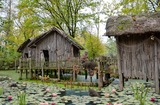
In this 3rd grade integrated STEM Storyline focused around the topics of climate and weather, we present students with the challenge of designing and building prototype temporary shelters for people in need. The unit launches with a discussion about the importance of shelter for humans. Then, students explore the significance of local weather conditions, the local climate, and how these may affect us. Students continue by exploring climate conditions around the world and how people have designed housing that shelters them from daily weather and climate. This unit culminates with students engaging in a design thinking process (similar to engineering design) where they design and test a shelter for people to use.
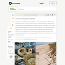
Earth Systems and Changes from Educational Service District 123, provides professional learning …
Earth Systems and Changes from Educational Service District 123, provides professional learning resources for K-5 teachers around elementary Earth Science and Climate Science related standards content.
It also provides learning to assist in the development of classroom tasks: Claims, Evidence Reasoning, and Models and Explanations, that can be used formatively to elicit student ideas and to support changes in student thinking over time.
License: License: Commons Attribution 4.0 (CC BY) Except where otherwise noted, this template by Educational Service District 123 is licensed under a Creative Commons Attribution License. All logos and trademarks are property of their respective owners. Content within template is the copyright of the creator.
This interactive resource adapted from the National Park Service describes the different …
This interactive resource adapted from the National Park Service describes the different kinds of sediments that make up coastlines, with a focus on the variety in color, size, and sorting.
This interactive resource adapted from the National Park Service describes the many …
This interactive resource adapted from the National Park Service describes the many forces that affect shorelines, including tides, weathering, erosion, and deposition.
In this Earth Science activity, students will investigate rocks in an outdoor …
In this Earth Science activity, students will investigate rocks in an outdoor field trip. Students will be divided into groups and given a Ziploc bag to collect rocks. We will then return to the classroom, and the students will put their rocks into different groups. The different groups could be the size, shape, color, and texture of the rocks. We will then talk about the Rock Cycle and the three main types of rocks. Students will record their observations in their science journals.
Explore geological wonders, firsthand. Visit an EarthCache and learn from the rocks under …
Explore geological wonders, firsthand. Visit an EarthCache and learn from the rocks under your feet. An EarthCache is a special type of geocache you can visit to learn a geology lesson developed by the community. This EarthCache is located on the Columbia College campus, in Columbia, CA. After completing this EarthCache, you will learn more about the geology under your feet here.
Spreadsheets Across the Curriculum module/Geology of National Parks course. Students study how …
Spreadsheets Across the Curriculum module/Geology of National Parks course. Students study how discharge per unit area varies with elevation in the high country of Glacier National Park from USGS hydrograph data from Swiftcurrent Creek and its tributary Grinnell Creek..
In this activity students synthesize ideas from lecture, reading, and viewing two …
In this activity students synthesize ideas from lecture, reading, and viewing two PBS NOVA videos on hurricanes.
(Note: this resource was added to OER Commons as part of a batch upload of over 2,200 records. If you notice an issue with the quality of the metadata, please let us know by using the 'report' button and we will flag it for consideration.)
No restrictions on your remixing, redistributing, or making derivative works. Give credit to the author, as required.
Your remixing, redistributing, or making derivatives works comes with some restrictions, including how it is shared.
Your redistributing comes with some restrictions. Do not remix or make derivative works.
Most restrictive license type. Prohibits most uses, sharing, and any changes.
Copyrighted materials, available under Fair Use and the TEACH Act for US-based educators, or other custom arrangements. Go to the resource provider to see their individual restrictions.