This site describes how and when 100-year floods occur. It states that …
This site describes how and when 100-year floods occur. It states that flood designations are based on statistical averages, not on the number of years between big floods. It also suggests that it would make more sense to refer to 100-year floods as 1-in-100 chance floods. This resource is a United States Geological Survey (USGS) Fact Sheet. It can be used in teaching quantitative skills.
This website contains a geologic map of the Island Park, Idaho area. …
This website contains a geologic map of the Island Park, Idaho area. The map shows rocks, deposits, faults, calderas, flows, and other geologic features of interest.
The primary objective of this U.S. Geological Survey Open-file Report is to …
The primary objective of this U.S. Geological Survey Open-file Report is to improve seismic-hazard assessments in regions of Wyoming with low to moderate levels of historic seismicity. A map and pamphlet are available for download in PDF format. The map shows faults and folds with evidence of Quaternary movement including data on timing of the most recent movement, sense of movement, slip rate, and continuity of surface expression.
Cretaceous and Tertiary strata exposed in northern Alaska record clastic sediment deposition …
Cretaceous and Tertiary strata exposed in northern Alaska record clastic sediment deposition within a foreland basin adjacent to the ancestral Brooks Range, and form part of an important petroleum play. The goal of this U.S. Geological Survey report is to synthesize the complex stratigraphy of this area into a more simplified scheme. It discusses the regional geology of northern Alaska and the stratigraphy of the Colville Basin in detail. Maps, cross sections, correlation charts, and numerous outcrop photos with detailed captions accompany the text.
This is an interactive map that illustrates the scale of potential flooding …
This is an interactive map that illustrates the scale of potential flooding in Alabama, Mississippi, and Florida due to projected sea level rise. It is a collaborative project of NOAA Sea Grant Consortium and the US Geological Survey. It is a pilot project, so there is some possibility that the resource may not be maintained over time.
This geologic map shows Tertiary and Quaternary rock formations, volcanic and surficial …
This geologic map shows Tertiary and Quaternary rock formations, volcanic and surficial deposits, faults, contacts, and other geologic features in Yellowstone National Park. The map is freely downloadable as a PDF file.
This U.S. Geological Survey clearinghouse provides a diverse array of over 40 …
This U.S. Geological Survey clearinghouse provides a diverse array of over 40 links to information on the Yellowstone volcanic system. The links are organized by category, including background and information; special items of interest; maps, graphics, and images; items of interest; useful links; educational outreach; and other menus of interest.
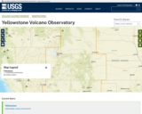
This is the homepage of the United States Geological Survey's (USGS) Yellowstone …
This is the homepage of the United States Geological Survey's (USGS) Yellowstone Volcano Observatory. It features news articles, monitoring information, status reports and information releases, and information on the volcanic history of the Yellowstone Plateau Volcanic Field. Users can access monthly updates with alert levels and aviation warning codes and real-time data on ground deformation, earthquakes, and hydrology. There is also a list of online products and publications, and an image gallery
No restrictions on your remixing, redistributing, or making derivative works. Give credit to the author, as required.
Your remixing, redistributing, or making derivatives works comes with some restrictions, including how it is shared.
Your redistributing comes with some restrictions. Do not remix or make derivative works.
Most restrictive license type. Prohibits most uses, sharing, and any changes.
Copyrighted materials, available under Fair Use and the TEACH Act for US-based educators, or other custom arrangements. Go to the resource provider to see their individual restrictions.