Students learn about the structure of the earth and how an earthquake …
Students learn about the structure of the earth and how an earthquake happens. In one activity, students make a model of the earth including all of its layers. In a teacher-led demonstration, students learn about continental drift. In another activity, students create models demonstrating the different types of faults.
Students learn about factors that engineers take into consideration when designing buildings …
Students learn about factors that engineers take into consideration when designing buildings for earthquake-prone regions. Using online resources and simulations available through the Earthquakes Living Lab, students explore the consequences of subsurface ground type and building height on seismic destruction. Working in pairs, students think like engineers to apply what they have learned to sketches of their own building designs intended to withstand strong-magnitude earthquakes. A worksheet serves as a student guide for the activity.
Students learn what causes earthquakes, how we measure and locate them, and …
Students learn what causes earthquakes, how we measure and locate them, and their effects and consequences. Through the online Earthquakes Living Lab, student pairs explore various types of seismic waves and the differences between shear waves and compressional waves. They conduct research using the portion of the living lab that focuses primarily on the instruments, methods and data used to measure and locate earthquakes. Using real-time U.S. Geological Survey (USGS) data accessed through the living lab interface, students locate where earthquakes are occurring and how frequently. Students propose questions and analyze the real-world seismic data to find answers and form conclusions. They are asked to think critically about why earthquakes occur and how knowledge about earthquakes can be helpful to engineers. A worksheet serves as a student guide for the activity.
Students study how geology relates to the frequency of large-magnitude earthquakes in …
Students study how geology relates to the frequency of large-magnitude earthquakes in Japan. Using the online resources provided through the Earthquakes Living Lab, students investigate reasons why large earthquakes occur in this region, drawing conclusions from tectonic plate structures and the locations of fault lines. Working in pairs, students explore the 1995 Kobe earthquake, why it happened and the destruction it caused. Students also think like engineers to predict where other earthquakes are likely to occur and what precautions might be taken. A worksheet serves as a student guide for the activity.
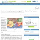
Students gather evidence to explain the theory of plate tectonics. Using the …
Students gather evidence to explain the theory of plate tectonics. Using the online resources at the Earthquakes Living Lab, students examine information and gather evidence supporting the theory. They also look at how volcanoes and earthquakes are explained by tectonic plate movement, and how engineers use this information. Working in pairs, students think like engineers and connect what they understand about the theory of plate tectonics to the design of structures for earthquake-resistance. A worksheet serves as a student guide for the activity.
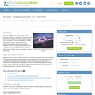
Students investigate how mountains are formed. Concepts include the composition and structure …
Students investigate how mountains are formed. Concepts include the composition and structure of the Earth's tectonic plates and tectonic plate boundaries, with an emphasis on plate convergence as it relates to mountain formation. Students learn that geotechnical engineers design technologies to measure movement of tectonic plates and mountain formation, as well as design to alter the mountain environment to create safe and dependable roadways and tunnels.
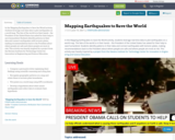
In the Mapping Earthquakes to Save the World activity, students leverage real-time …
In the Mapping Earthquakes to Save the World activity, students leverage real-time data to plot earthquakes on a world map. The fate of the world is in their hands – the President of the United States has asked for their help to save humankind. Students identify patterns in their data and connect earthquakes with tectonic plates, making recommendations back to the President about where people are safe and where people are most at risk. This activity was heavily inspired by a project from the Stevens Institute for Technology Center for Innovation in Engineering and Science Education.
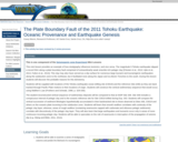
This is one component of the Seismogenic zone Experiment Mini Lessons This …
This is one component of the Seismogenic zone Experiment Mini Lessons This mini lesson provides an example of how stratigraphy influences tectonics, and vice versa. The magnitude 9 Tohoku earthquake slipped a record 50m along a plate boundary fault comprised of extraordinarily weak smectite-rich pelagic clay [Chester et al., 2013; Ujiie et al., 2013, Fulton et al., 2013]. This clay may also have served as a slip surface for numerous large tsunami and tsunamigenic earthquakes along the subduction zone to the northeast, but it facilitated none along the Japan and Izu-Bonin Trenches to the south. During this lesson students will discover the probable reasons for this dichotomy. Students will be supplied with locations of the Tohoku earthquake ocean drilling site (C0019) and the reference Site (436) as they are back tracked through Pacific Plate motions to their locations of origin. Students will construct the vertical sedimentary sequence that would occur, using Walther's Law (Prothero and Schwab, 1996, p. 329-330).
The student-reconstructed vertical sequence of sedimentary deposits will be compared to that at IODP Site 436. Site 436 includes a conspicuous interval of pelagic clay and is the oceanic reference site for Site C0019 drilled during Exp. 343. Students will compare the vertical succession of sediment lithologies hypothetically accumulated in their backtracked site to those observed at Sites 436, C0019 and others on the oceanic plate incoming to the subduction zone. Students will learn that smooth seafloor correlates with continuity of the pelagic clay layer, whereas, areas of rough seafloor (containing seamounts capped with carbonate and siliceous pelagic sediments) correlate with discontinuity of the pelagic clay layer. They will also learn that large earthquakes and tsunamis occur only in areas of more continuous incoming pelagic clay. Students will be able to speculate on the role of seamounts in interruption of the propagation of seismic slip (e.g. Wang and Bilek, 2011, 2014).
Using actual earthquake data from the circum-Pacific region, students make predictions about …
Using actual earthquake data from the circum-Pacific region, students make predictions about where earthquakes should occur in the immediate future. Data are provided in the form of global earthquake locations over 30 year time spans from 1900â2015. Students form groups and use one map to predict where earthquakes should occur during the subsequent 30 year interval. Students then compare their predictions to actual earthquake locations.
The high school earth and physical science unit moves through an exploration …
The high school earth and physical science unit moves through an exploration of tectonic plates, why and how they move, and the earthquakes that they cause. As the final project, teams learn about Early Warning Systems for earthquakes and how they have saved millions of lives in other countries. Teams take on a population in Oregon and design a ShakeAlert system to give them the seconds required to prepare for a mega earthquake.
No restrictions on your remixing, redistributing, or making derivative works. Give credit to the author, as required.
Your remixing, redistributing, or making derivatives works comes with some restrictions, including how it is shared.
Your redistributing comes with some restrictions. Do not remix or make derivative works.
Most restrictive license type. Prohibits most uses, sharing, and any changes.
Copyrighted materials, available under Fair Use and the TEACH Act for US-based educators, or other custom arrangements. Go to the resource provider to see their individual restrictions.