Updating search results...

Search Resources

148 Results

View
Selected filters:
  • extreme-weather
Climate as Constraint
Conditional Remix & Share Permitted
CC BY-NC-SA
Rating
0.0 stars

Introduction:
Groundwater is key to Texas future and economy. The resource has long been a focus of legislative and economic interest. In the earliest days, the resource was viewed as 'occult and hidden.' That sense of mystery remains even as groundwater becomes more critical to the water resource picture for the state.
Since 1951, the state conducts regional water planning with the involvement of citizen stakeholders. Let's use your science-based knowledge of groundwater flow to see if you can find the right balance for both protecting and planning for groundwater use.
Our Case:
This week we will evaluate a historic court case from June 13, 1904. The case of East versus Texas Central Railroad Company is the Texas Supreme Ruling that provides the foundation for Texas groundwater law -- Rule of Capture.
In the appendix, you will find the following figures to help you determine whether or not Mr. East's well was impacted by the railroad company's pumping:

Platt map showing well locations and possible distances
Schematics of the well dimensions, along with simplified subsurface geology in the area.

In addition, you will be interested in knowing that the Geologic Atlas of Texas shows that the wells were likely completed in the Pawpaw Formation, which is a thick calcareous clay unit in the lower sections and cemented sand in the upper part. Lithologies in the area are reported to yield limited to moderate amounts of water in shallow wells. You can expect that the formation was an unconfined unit and assume that the East well is down-gradient from the Railroad well.
Assignment Part One:

1. Using the information from our last lecture, what do you think a reasonable transmissivity rate might be for the Pawpaw formation?

a. Estimate a transmissvity for a cemented sand unit.
b. Use this value as your first estimate in calculations to calculate the potential drawdown with Jacob's equation. This calculates the drawdown in an nonleaky artesian aquifer, sa, given the observed water table drawdowns.

sa = swt -- (s2st/2m)

c. Calculate swt using a correction equation.

Swt = m-(m2-2msa)1/2

Where m is the initial saturated thickness, which you may estimate at 30 ft.

2. How much water do you estimate that the railroad can extract before the well is impacted? Complete a diagram showing estimated drawdown (ft) on the y-axis and distances from the Railroad well (ft) using different transmissivity values and different distances. What do you discover about the case?
3. With your hydrogeologic analysis, do you believe that the East well was impacted by the railroad well? Can you explain how significant the impact may or may not have been?

Climate Considerations:
Is it possible that climate conditions could have impacted conditions in the well? Visit the Greenleaf website ([greenleaf.unl.edu/downloads/scPDSI.zip]) and access data for Palmer Drought Severity Indices. Looking at this data, complete the next questions.
Assignment Part 2:

4. Looking at the drought severity index maps of Texas from October 1900 to September 1902. What kind of implications might climate conditions have had on the groundwater conditions?
5. If climate conditions worsened, what do you think would happen to the wells?

Reference:
Mace, R.E., Ridgeway, C., and Sharp, J.M., 2004, Groundwater is no longer secret and occult - A historical and hydrogeologic analysis of the East case, 100 Years of Rule of Capture: From East to Groundwater Management, ed. Mullican, W.F. and Schwarz, S., Report 361, Texas Water Development Board, 63-86 pp.
Appendix -- support documents:
Figure 1 shows that Mr. East lived in Denison County, TX. The inset is a plan view map showing the potential locations of the wells in the town.
(in supporting documents)
Figure 2: Schematic of well dimensions and simplified geology.
(In supporting documents)

(Note: this resource was added to OER Commons as part of a batch upload of over 2,200 records. If you notice an issue with the quality of the metadata, please let us know by using the 'report' button and we will flag it for consideration.)

Subject:
Biology
Hydrology
Life Science
Mathematics
Measurement and Data
Physical Science
Statistics and Probability
Material Type:
Activity/Lab
Provider:
Science Education Resource Center (SERC) at Carleton College
Provider Set:
Teach the Earth
Author:
Suzanne Pierce
Date Added:
08/29/2019
Confirmation of the IPCC Prediction re: Increased Storminess
Conditional Remix & Share Permitted
CC BY-NC-SA
Rating
0.0 stars

This activity represents a culmination project for this unit by means of which students can assess whether the IPCC prediction of increased storminess as an outcome of global warming survives testing. For the previous three weeks students will have conducted several inquiry-based group activities designed to introduce and reinforce fundamental meteorology/climatology concepts. In this 2-day project, students access online AVHRR SST imagery, as well as tabulated numeric data regarding historical North American tropical cyclones, import data into Excel for interpretation and analysis, and submit two group reports.

(Note: this resource was added to OER Commons as part of a batch upload of over 2,200 records. If you notice an issue with the quality of the metadata, please let us know by using the 'report' button and we will flag it for consideration.)

Subject:
Applied Science
Biology
Environmental Science
Life Science
Mathematics
Measurement and Data
Oceanography
Physical Science
Statistics and Probability
Material Type:
Activity/Lab
Provider:
Science Education Resource Center (SERC) at Carleton College
Provider Set:
Teach the Earth
Author:
Robert Kuhlman
Date Added:
08/21/2020
Consequences of Climate Change: Lessons about Water Availability and Extreme Weather
Conditional Remix & Share Permitted
CC BY-SA
Rating
0.0 stars

This article from the free online magazine Beyond Weather and the Water Cycle provides appropriate science lessons for Grades K-5. The focus is on acquainting young learners with climate-change concepts that are not too complex for their grade level and will not frighten them. In each issue, the magazine develops articles around one of the seven essential principles of climate science. The author believes early lessons about water availability and extreme weather events will prepare students for complex climate concepts they will encounter in later grades.

Subject:
Ecology
Education
Forestry and Agriculture
Geoscience
Life Science
Mathematics
Physical Science
Physics
Space Science
Material Type:
Lesson Plan
Teaching/Learning Strategy
Provider:
Ohio State University College of Education and Human Ecology
Provider Set:
Beyond Weather and the Water Cycle
Author:
Jessica Fries-Gaither
National Science Foundation
Date Added:
05/30/2012
Does Climate Change Cause Extreme Weather?
Read the Fine Print
Rating
0.0 stars

This video provides a good introduction to the field of attribution science. Beginning with an introduction to weather and climate, it describes how severe weather might be linked to climate change and the science behind attribution studies. It gives a good explanation behind how scientists use climate models to study whether severe weather events were influenced by climate change. It also discusses the question, "does climate change cause extreme weather?" and provides an introduction to the concepts of probability, causation, and correlation in regards to attribution science (how much climate change influenced an event verses normal variations in weather).

Subject:
Applied Science
Atmospheric Science
Career and Technical Education
Environmental Science
Environmental Studies
Physical Science
Provider:
CLEAN: Climate Literacy and Energy Awareness Network
Provider Set:
CLEAN: Climate Literacy and Energy Awareness Network
Author:
Above the Noise
KQED
Date Added:
09/24/2018
Dress for Success
Read the Fine Print
Educational Use
Rating
0.0 stars

In this design activity, students investigate materials engineering as it applies to weather and clothing. Teams design and analyze different combinations of materials for effectiveness in specific weather conditions. Analysis includes simulation of temperature, wind and wetness elements, as well as the functionality and durability of final prototypes.

Subject:
Applied Science
Engineering
Material Type:
Activity/Lab
Provider:
TeachEngineering
Provider Set:
TeachEngineering
Author:
Glen Sirakavit
Janet Yowell
Malinda Schaefer Zarske
Marissa Forbes
Date Added:
10/14/2015
Drought Affects California's Water Availability
Read the Fine Print
Educational Use
Rating
0.0 stars

In this resource, students learn about changes in water availability due to drought in California from 2013 to 2017. This resource provides opportunities for students to interpret data and analyze imagery for observational evidence of drought conditions through maps, satellite images, and photographs.

Subject:
Applied Science
Atmospheric Science
Career and Technical Education
Environmental Science
Environmental Studies
Physical Science
Material Type:
Reading
Provider:
CLEAN: Climate Literacy and Energy Awareness Network
Provider Set:
CLEAN: Climate Literacy and Energy Awareness Network
Author:
LearningMedia
Public Broadcasting Service
Date Added:
07/27/2022
Drought Basics
Read the Fine Print
Educational Use
Rating
0.0 stars

This PBS Learning Media activity addresses drought basics, including its causes and impacts and ways to assess it, by using media from NOAA and NASA. It defines the types of drought, the impacts, monitoring, and responses to drought. Use this resource to stimulate thinking and questions on the complexity of drought and to identify some variables used in defining drought.

Subject:
Applied Science
Atmospheric Science
Career and Technical Education
Economics
Environmental Science
Environmental Studies
Physical Science
Social Science
Material Type:
Reading
Simulation
Provider:
CLEAN: Climate Literacy and Energy Awareness Network
Provider Set:
CLEAN: Climate Literacy and Energy Awareness Network
Author:
PBS
WGBH Educational Foundation
Date Added:
03/02/2020
Drought: Identifying Impacts and Evaluating Solutions
Read the Fine Print
Educational Use
Rating
0.0 stars

In this set of activities, students learn about impacts of drought through news videos of communities facing serious water shortages, analyze drought data and models, and research and evaluate potential solutions. This lesson works well as a component within a larger unit on climate change, its impacts, and ways to address the resulting issues.

Subject:
Applied Science
Atmospheric Science
Career and Technical Education
Environmental Science
Environmental Studies
Physical Science
Material Type:
Activity/Lab
Provider:
CLEAN: Climate Literacy and Energy Awareness Network
Provider Set:
CLEAN: Climate Literacy and Energy Awareness Network
Author:
PBS
WGBH Educational Foundation
Date Added:
03/06/2020
Drought: Identifying Impacts and Evaluating Solutions Lesson Plan
Read the Fine Print
Educational Use
Rating
0.0 stars

Through this set of lessons, students learn about the impacts of water shortages due to drought, make connections to climate patterns, and explore community resiliency solutions. The lessons engage students in evaluating solutions for a particular case study community. Students will need to do additional research on solutions, but by the end of the lesson, students will be able to articulate how drought, although a localized problem, has far-reaching impacts, and to suggest solutions to a problem that is projected to intensify as the climate continues to change.

Subject:
Applied Science
Atmospheric Science
Career and Technical Education
Environmental Science
Environmental Studies
Physical Science
Material Type:
Activity/Lab
Provider:
CLEAN: Climate Literacy and Energy Awareness Network
Provider Set:
CLEAN: Climate Literacy and Energy Awareness Network
Author:
PBS Learning Media
Date Added:
06/25/2019
Drought in the Colorado Basin
Read the Fine Print
Rating
0.0 stars

This series of visualizations is part of a rich multi-agency effort to showcase the usefulness of open data (i.e., data provided in a discoverable, sharable, and machine-readable format) by exploring the 16-year drought as of 2016 and its effects on the Colorado River Basin.

Subject:
Applied Science
Atmospheric Science
Career and Technical Education
Environmental Science
Environmental Studies
Physical Science
Material Type:
Simulation
Provider:
CLEAN: Climate Literacy and Energy Awareness Network
Provider Set:
CLEAN: Climate Literacy and Energy Awareness Network
Author:
U.S. Department of the Interior
Date Added:
09/24/2018
ESRI Drought Tracker
Read the Fine Print
Rating
0.0 stars

Using US Drought Monitor data and its classification system, this interactive tool tracks drought in the continental US by county, from 2000 to the present.

Subject:
Applied Science
Atmospheric Science
Career and Technical Education
Environmental Science
Environmental Studies
Physical Science
Material Type:
Simulation
Provider:
CLEAN: Climate Literacy and Energy Awareness Network
Provider Set:
CLEAN: Climate Literacy and Energy Awareness Network
Author:
ESRI
National Drought Mitigation Center
Date Added:
09/24/2018
Earth Exploration Toolbook Chapter: Exploring and Animating GOES Images
Conditional Remix & Share Permitted
CC BY-NC-SA
Rating
0.0 stars

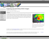
DATA: GOES Weather Images. TOOL: ImageJ. SUMMARY: Transform a time series of GOES images into an animation. Plot a storm track and determine storm speed.

(Note: this resource was added to OER Commons as part of a batch upload of over 2,200 records. If you notice an issue with the quality of the metadata, please let us know by using the 'report' button and we will flag it for consideration.)

Subject:
Atmospheric Science
Biology
Life Science
Physical Science
Material Type:
Activity/Lab
Data Set
Diagram/Illustration
Interactive
Lesson Plan
Provider:
Science Education Resource Center (SERC) at Carleton College
Provider Set:
Teach the Earth
Author:
Nick Haddad
Date Added:
04/13/2021
EarthNow Climate Digest
Read the Fine Print
Rating
0.0 stars

This visualization provides an informative summary of the quarterly seasonal global weather and climate using the 3-D Science on a Sphere format. These video summaries use animations of recent NOAA data and an engaging commentary to review the climate highlights of the past 4 seasons. Topics include, El Nino/La Nina, temperature trends, extreme weather, and emerging climate research.

Subject:
Applied Science
Atmospheric Science
Career and Technical Education
Environmental Science
Environmental Studies
Physical Science
Provider:
CLEAN: Climate Literacy and Energy Awareness Network
Provider Set:
CLEAN: Climate Literacy and Energy Awareness Network
Author:
Earth Now
NOAA/CIMMS
Date Added:
09/24/2018
Eco-Health Relationship Browser
Read the Fine Print
Educational Use
Rating
0.0 stars

This highly informative site explores five different ecosystems and the public health issues that have arisen in each. Students can explore the different ways that ecosystem services that address air quality, heat hazard mitigation, recreation and physical activity, water hazard mitigation, and water quality impact many health conditions.

Subject:
Applied Science
Atmospheric Science
Career and Technical Education
Ecology
Environmental Science
Environmental Studies
Life Science
Physical Science
Material Type:
Reading
Simulation
Provider:
CLEAN: Climate Literacy and Energy Awareness Network
Provider Set:
CLEAN: Climate Literacy and Energy Awareness Network
Author:
United States Environmental Protection Agency
Date Added:
06/29/2022
El NiÃo 101
Read the Fine Print
Educational Use
Rating
0.0 stars

This video explains what El NiÃo is and provides the definition of El NiÃo. It goes into detail about the devastating terrestrial and aquatic effects an El NiÃo can have on living organisms and the climate (disease, storms, floods, tornadoes, drought, wildfire, increased air temperatures, decreased water temperatures, etc).

Subject:
Applied Science
Atmospheric Science
Career and Technical Education
Environmental Science
Environmental Studies
Oceanography
Physical Science
Material Type:
Diagram/Illustration
Reading
Provider:
CLEAN: Climate Literacy and Energy Awareness Network
Provider Set:
CLEAN: Climate Literacy and Energy Awareness Network
Author:
National Geographic
Date Added:
07/28/2022
Exploring NCAR Climate Change Data Using GIS
Unrestricted Use
CC BY
Rating
0.0 stars

This Earth Exploration Toolbook chapter uses ArcGIS and climate data from the National Center for Atmospheric Research (NCAR) Climate Change Scenarios GIS Data Portal to help users learn the basics of GIS-based climate modeling. The five-part exercise involves calculating summer average temperatures for the present day and future climate modeled output, visually comparing the temperature differences for the two model runs, and creating a temperature anomaly map to highlight air temperature increases or decreases around the world.

Subject:
Applied Science
Atmospheric Science
Environmental Science
Physical Science
Material Type:
Activity/Lab
Provider:
CLEAN: Climate Literacy and Energy Awareness Network
Provider Set:
CLEAN: Climate Literacy and Energy Awareness Network
Author:
Cathy Reznicek
Constantin Cranganu
David Smith
Earth Exploration Toolbook
Jennifer Boehnert
Lawrence Buja
Michele Thornton
Olga Wilhelmi
Date Added:
06/19/2012
Exploring the Link Between Hurricanes and Climate Using GCM Results
Unrestricted Use
CC BY
Rating
0.0 stars

In this activity, students examine global climate model output and consider the potential impact of global warming on tropical cyclone initiation and evolution. As a follow-up, students read two short articles on the connection between hurricanes and global warming and discuss these articles in context of what they have learned from model output.

Subject:
Applied Science
Atmospheric Science
Environmental Science
Oceanography
Physical Science
Material Type:
Activity/Lab
Provider:
CLEAN: Climate Literacy and Energy Awareness Network
Provider Set:
CLEAN: Climate Literacy and Energy Awareness Network
Author:
Cindy Shellito
SERC - On the Cutting Edge Collection
Date Added:
06/19/2012
Extreme Event Game
Read the Fine Print
Educational Use
Rating
0.0 stars

The Extreme Events Game is an in-person role-playing game that allows participants the experience of building community resilience in the face of disaster. Players work together to make decisions and solve problems during a fast-paced disaster simulation.

Subject:
Applied Science
Atmospheric Science
Career and Technical Education
Environmental Science
Environmental Studies
Physical Science
Material Type:
Activity/Lab
Provider:
CLEAN: Climate Literacy and Energy Awareness Network
Provider Set:
CLEAN: Climate Literacy and Energy Awareness Network
Author:
LabX
The National Academy of Sciences
Date Added:
04/08/2022
Extreme Heat and Community Health
Read the Fine Print
Educational Use
Rating
0.0 stars

This short video clip is part of a longer video series titled How Climate Effects Community Health. This clip focuses on human health risks from extreme heat events caused by increasing global temperatures.

Subject:
Applied Science
Atmospheric Science
Career and Technical Education
Environmental Science
Environmental Studies
Physical Science
Material Type:
Diagram/Illustration
Reading
Provider:
CLEAN: Climate Literacy and Energy Awareness Network
Provider Set:
CLEAN: Climate Literacy and Energy Awareness Network
Author:
Centers for Disease Control and Prevention
Date Added:
03/04/2020
Extreme Weather and Climate Change
Read the Fine Print
Rating
0.0 stars

This video explores what scientists know about how changes in global climate and increasing temperatures affect different extreme weather events.

Subject:
Applied Science
Atmospheric Science
Career and Technical Education
Environmental Science
Environmental Studies
Physical Science
Provider:
CLEAN: Climate Literacy and Energy Awareness Network
Provider Set:
CLEAN: Climate Literacy and Energy Awareness Network
Author:
Earth Now
Date Added:
09/24/2018