In this activity, students experiment with the effects of Reynolds numbers (viscosity), …
In this activity, students experiment with the effects of Reynolds numbers (viscosity), particle shape, and particle concentration (flocculation) on settling velocity.
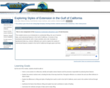
An introduction to processes associated with continental rifting, and resulting fault geometries …
An introduction to processes associated with continental rifting, and resulting fault geometries and distributions, and lithospheric responses, using seismic data examples from the Gulf of California.
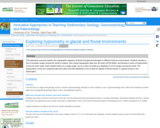
This laboratory exercise explores the topographic signature of fluvial and glacial landscapes …
This laboratory exercise explores the topographic signature of fluvial and glacial landscapes in different tectonic environments. Students develop a list of mountain ranges around the world to explore, then extract topographic data from 90-meter SRTM DEMs, and develop a series of hypsometric curves for each range. Each student works on a single range, but as a class we build up a database of 10-15 ranges around the world. The hypsometric curves are compared with each other and with published curves to look for signals of fluvial incision vs. glacial erosion in the landscapes.
This exercise consisted of a five-hour field exercise and subsequent data analysis. …
This exercise consisted of a five-hour field exercise and subsequent data analysis. In the field, students made individual observation, participated in discussions of evidence, and collected group field data. Data analysis consisted of calculations of sediment yields, channel slopes, and erosive power. Designed for a geomorphology course Addresses student fear of quantitative aspect and/or inadequate quantitative skills
(Note: this resource was added to OER Commons as part of a batch upload of over 2,200 records. If you notice an issue with the quality of the metadata, please let us know by using the 'report' button and we will flag it for consideration.)
An example set of tasks and questions for the first field trip …
An example set of tasks and questions for the first field trip of a 300-level Sedimentology and Stratigraphy course.
(Note: this resource was added to OER Commons as part of a batch upload of over 2,200 records. If you notice an issue with the quality of the metadata, please let us know by using the 'report' button and we will flag it for consideration.)
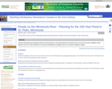
Students explore the USGS water website to identify the location of stream …
Students explore the USGS water website to identify the location of stream gauges on the Minnesota River and the types of data that can be retrieved from the website. They determine which data to download based on the area of interest in the exercise (St. Peter, MN) and import historical flood data into MS Excel. The students use a spreadsheet to rank each flood and calculate a recurrence interval for a given flood, then estimate the discharge and stage of the 100-year flood in St. Peter, MN. The final task is to establish a flood hazard zone on a topographic map of the city of St. Peter. Note: this exercise can be applied to almost any non-dammed river with two or more USGS gaging stations on it. Go to http://water.usgs.gov and select your state from the pull-down menu to view an interactive map of your state's rivers and gaging station locations.
(Note: this resource was added to OER Commons as part of a batch upload of over 2,200 records. If you notice an issue with the quality of the metadata, please let us know by using the 'report' button and we will flag it for consideration.)
Before this exercise, student should be briefly introduced to the concept that …
Before this exercise, student should be briefly introduced to the concept that rocks can be deformed. I will usually show relevant images from the textbook regarding strike, dip, and basic fold geometry. In addition, I spend some time reviewing compass directions, and how to describe the orientation of a line. After the introduction, each student (or pair of students) is given a flexible piece of foam which is treated as an analog for a sedimentary bed. Students are asked to place their foam into the proper orientation, given the strike and dip measurements. Students are encouraged to help one another as the tasks become more complex.
Students will look up an address (either of their choosing or instructor-provided) …
Students will look up an address (either of their choosing or instructor-provided) and assess the geologic characteristics and vulnerability of that location. Students will utilize datasets about geologic issues/hazards to learn more about how different geologic processes affect the location.
This activity is an inquiry-based field investigation of the geologic history of …
This activity is an inquiry-based field investigation of the geologic history of the Minnehaha Falls and St. Anthony Falls areas of Minneapolis. Students will be introduced to rocks and the stories rocks tell in a genuine geologic context, rather than as samples in the classroom.
This exercise is designed to simulate how a basic geological investigation of …
This exercise is designed to simulate how a basic geological investigation of a site takes place. A basic geological investigation includes familiarizing yourself with the unconsolidated sediments, rocks, structural geology, and groundwater present at your site. As part of this exercise you will have to properly identify a variety of rock types and sediments, create maps that represent data you collected at each location, and complete a basic report of your findings (optional). Once completed, this exercise should give students a basic understanding of how the various concepts used throughout the semester are applied in the real world in the form of a geological investigation.
(Note: this resource was added to OER Commons as part of a batch upload of over 2,200 records. If you notice an issue with the quality of the metadata, please let us know by using the 'report' button and we will flag it for consideration.)
This activity is a field investigation where students gather data on fossiliferous …
This activity is a field investigation where students gather data on fossiliferous limestone, develop an experimental question, and develop a mental model of local geologic history.
Each student in the Geological Oceanography class writes a series of one-page …
Each student in the Geological Oceanography class writes a series of one-page papers for topics throughout the semester, presents one topic as a 3 to 5 minute oral presentation, and revises all papers as a portfolio for submission at the end of the semester. The eight topics are objects in the solar system, minerals, rocks, hydrothermal vents, volcanoes & earthquakes, marine sediments, hurricanes & typhoons, and tides.
Students work in groups to develop content for am online hiking tour …
Students work in groups to develop content for am online hiking tour which is matched to the geologic time scale. This project has been used as a semester group work project in an introductory geologic history course, but could be adapted for high school or upper level and graduate courses focused on outreach.
Short Description: This is an inquiry based field investigation where students gather …
Short Description: This is an inquiry based field investigation where students gather data on the Credit River from the rocks in the river bed, water speed, and maps. Students interpret their findings and develop new questions.
In this culminating activity, students will be assessed on what they have …
In this culminating activity, students will be assessed on what they have learned during the Geology unit of their Earth Science class. After conducting classroom and field studies on geology students will utilize this knowledge to interpret the rock layers and formation of the Grand Canyon. Outside of class students will read/review a website and complete a study guide to be reviewed by the teacher to assess students' learning. Following teacher review of study guides, the next class period(s) will be a discussion and questioning session(s) on the formation of the Grand Canyon.
This course presents a topical approach to landform analysis and process. Map …
This course presents a topical approach to landform analysis and process. Map interpretations are used to demonstrate relationships to constructive and destructive processes during landform development. Planning economic and social considerations are examined.
This was an assignment for students in two parts: (1) for a …
This was an assignment for students in two parts:
(1) for a given week, students sign up for a landform that pertains to the processes we’ll be studying (e.g. landslides, streams, volcanoes, etc…). The student will use wikipedia, govt. agency websites, or primary sources to present a “show and tell” of the landform including 4 things: a) describe the process by which that feature is formed, b) give an example of where it can be found, c) find 3 pictures of the landform, & d) sketch (or find a depiction) of what the feature would look like on a topographic contour map.
(2) Students will take their presentations and use them to create pages on a Google Sites webpage that will become an online textbook. Students will be able to use the book to study for quizzes on the landforms.
(3) Students will read and leave comments on 2 other students’ pages to provide constructive feedback to help improve the textbook’s content and readability.
Learning Objectives: Students gain oral and written communication skills by presenting and documenting/sharing their research. Students will describe the shape of landforms and connect landforms with the processes responsible for their formation by learning from each other and from doing their own research.
Students choose a place that is named based on its relationship to …
Students choose a place that is named based on its relationship to geomorphology. They research and describe the geologic template, geologic processes and time involved in the formation of their chosen place and use Google Earth to report their results.
This two-week long laboratory exercise examines the linkages between the endogenic (tectonic …
This two-week long laboratory exercise examines the linkages between the endogenic (tectonic and isostatic) and exogenic processes that created the Eastern Snake River Plain (ESRP) landscape. The landform analysis portion of the exercise focuses upon recent basaltic volcanism and the Menan Buttes, the St. Anthony dunes and the fluvial drainage patterns that developed in the region.
No restrictions on your remixing, redistributing, or making derivative works. Give credit to the author, as required.
Your remixing, redistributing, or making derivatives works comes with some restrictions, including how it is shared.
Your redistributing comes with some restrictions. Do not remix or make derivative works.
Most restrictive license type. Prohibits most uses, sharing, and any changes.
Copyrighted materials, available under Fair Use and the TEACH Act for US-based educators, or other custom arrangements. Go to the resource provider to see their individual restrictions.