This video highlights students taking scientific measurements to support investigations in atmospheric …
This video highlights students taking scientific measurements to support investigations in atmospheric science, hydrology, soils, and land cover. It shows students reporting data through the Web, creating scientific visualizations for analysis, and collaborating with students and scientists around the world. This is one two introductory videos in the 24-part GLOBE video series. GLOBE (Global Learning and Observation to Benefit the Environment) is a worldwide, hands-on, K-12 school-based science education program.
This video highlights students taking scientific measurements to support investigations in atmospheric …
This video highlights students taking scientific measurements to support investigations in atmospheric science, hydrology, soils, and land cover. It shows students reporting data through the Web, creating scientific visualizations for analysis, and collaborating with students and scientists around the world. This is one of two introductory videos in the 24-part GLOBE video series. GLOBE (Global Learning and Observation to Benefit the Environment) is a worldwide, hands-on, K-12 school-based science education program.
This video demonstrates students locating and preparing a study site where they …
This video demonstrates students locating and preparing a study site where they can conduct field observations. The procedure used when describing a soil profile is outlined. The properties of soil are described, including the structure, color, consistence, and texture, as well as the presence of roots, rocks and free carbonates. Safety precautions are stressed. The resource includes a video and a written transcript, and is supported by the Soil Characterization, Field Measurement Protocol in the GLOBE Teacher Guide. This is one of five videos about soils in the 24-part instructional video series describing scientific protocols used by GLOBE (Global Learning and Observation to Benefit the Environment) a worldwide, hands-on, K-12 school-based science education program.
This video describes how to select a soil infiltration study site, and …
This video describes how to select a soil infiltration study site, and demonstrates procedures used when taking soil infiltration in the field. Instructions for fabricating a necessary piece of field equipment, a dual-ring soil infiltrometer, are provided. The resource includes a video and a written transcript, and is supported by the Soil Infiltration Protocol in the GLOBE Teacher's Guide. This is one of five videos about soils in the 24-part instructional video series describing scientific protocols used by GLOBE (Global Learning and Observation to Benefit the Environment) a worldwide, hands-on, K-12 school-based science education program.
This video describes how to select a soil moisture study site and …
This video describes how to select a soil moisture study site and sampling strategy, and identifies what laboratory instruments will be needed to complete a soil moisture analysis. Students are shown collecting soil moisture data and asking questions about what soil moisture data might tell them about the environment. The resource includes a video and a written transcript, and is supported by the Soil Moisture Protocol in the GLOBE Teacher's Guide. This is one of five videos about soils in the 24-part instructional video series describing scientific protocols used by GLOBE (Global Learning and Observation to Benefit the Environment), a worldwide, hands-on, K-12 school-based science education program.
This video describes how to select a soil temperature study site, and …
This video describes how to select a soil temperature study site, and demonstrates the procedure students use when taking soil temperature measurements in the field. The resource includes a video and a written transcript, and is supported by the Soil Temperature Protocol in the GLOBE Teacher Guide. This is one of five videos about soils in the 24-part instructional video series describing scientific protocols used by GLOBE (Global Learning and Observation to Benefit the Environment) a worldwide, hands-on, K-12 school-based science education program.
This video demonstrates students measuring the transparency of water, a measure of …
This video demonstrates students measuring the transparency of water, a measure of water quality, using a Secchi disk or turbidity tube. Field measurements of water temperature are also shown. The resource includes a video and a written transcript, and is supported by the Water Transparency and Temperature Protocols in the GLOBE Teacher's Guide. This is one of seven videos on hydrology in the 24-part instructional video series describing scientific protocols used by GLOBE (Global Learning and Observation to Benefit the Environment), a worldwide, hands-on, K-12 school-based science education program.
When New England was hit by Tropical Storm Irene in 2011, there …
When New England was hit by Tropical Storm Irene in 2011, there was not a satellite monitoring tropical storms that far north; the Tropical Rainfall Measuring Mission (TRMM) was operating in a band between the 35-degree latitudes. The Global Precipitation Measurement (GPM) mission will change that. GPM will build upon TRMM's capacity by examining a larger swath of Earth with instruments that are more advanced and more sensitive. This video introduces the GPM satellite, its instruments and their capabilities.
In this brief video, NASA scientists discuss the Global Precipitation Measurement (GPM) …
In this brief video, NASA scientists discuss the Global Precipitation Measurement (GPM) mission and its role in studying and tracking Earth's freshwater resources. The GPM mission will advance our understanding of Earth's water and energy cycles, improve the forecasting of extreme events that cause natural disasters, and extend current capabilities of using satellite precipitation information to directly benefit society.
The Gamma-ray Burst Skymap website automatically updates for each gamma-ray burst as …
The Gamma-ray Burst Skymap website automatically updates for each gamma-ray burst as it occurs, whether detected by Swift or other orbiting satellites. For each burst, the location on the sky, star map, constellation and detecting mission are generated automatically. It is then quickly updated by hand to include a written description of the burst properties and scientific significance, as observations continue. Note: In order to view the content of the website, users need to download and install Silverlight on their computers.
In this investigation, students discover the spatial relationship between recent earthquakes, volcanoes, …
In this investigation, students discover the spatial relationship between recent earthquakes, volcanoes, and the Earth's plates through visual inspection of tectonic activity plots on world maps, and by comparing the position of recent tectonic events with the position of the Earth's plates. Summary background information, data and images supporting the activity are available on the Earth Update data site. To complete the activity, students will need to access the Space Update multimedia collection, which is available for download and purchase for use in the classroom.
Mathematicians often argue that anything which can be represented numerically or algebraically …
Mathematicians often argue that anything which can be represented numerically or algebraically can also be represented geometrically. This is perhaps true even to the extent that simple numeric calculations can be demonstrated geometrically. This example illustrates one such geometric process of addition. This resource is from PUMAS - Practical Uses of Math and Science - a collection of brief examples created by scientists and engineers showing how math and science topics taught in K-12 classes have real world applications.
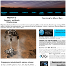
This is a set of four, one-page problems about the distance craft …
This is a set of four, one-page problems about the distance craft travel on Mars. Learners will use the Pythagorean Theorem to determine distance between a series of hypothetical exploration sites within Gale Crater on Mars. Options are presented so that students may learn about the Mars Science Laboratory (MSL) mission through a NASA press release or by viewing a NASA eClips video [6 min.]. This activity is part of the Space Math multi-media modules that integrate NASA press releases, NASA archival video, and mathematics problems targeted at specific math standards commonly encountered in middle school.
Problem: How do you measure an angle with a protector, when that …
Problem: How do you measure an angle with a protector, when that angle is between two solid walls? This resource is from PUMAS - Practical Uses of Math and Science - a collection of brief examples created by scientists and engineers showing how math and science topics taught in K-12 classes have real world applications.
This resources identifies best practices for giving presentations or talks in elementary …
This resources identifies best practices for giving presentations or talks in elementary classrooms and was developed to help scientists and engineers who have been asked to visit an elementary classroom. It provides helpful suggestions before, during, and after the presentation, as well questions for the teacher (e.g., what content do you want me to cover, what have students already learned about this content?).
This resources identifies best practices for giving presentations or talks in middle …
This resources identifies best practices for giving presentations or talks in middle school classrooms and was developed to help scientists and engineers who have been asked to visit a middle school classroom. It provides helpful suggestions before, during, and after the presentation, as well questions for the teacher (e.g., what content do you want me to cover, what have students already learned about this content?).
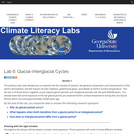
This online lab exercise focuses on the causes, characteristics and effects of …
This online lab exercise focuses on the causes, characteristics and effects of the glacial-interglacial cycle. The sixth in a 10-part lab series on weather and climate, this lab exercise is designed for first and second year college geoscience students (majors and non-majors) as well as pre-service STEM teachers.
This manual provides simple demonstrations to show how lenses and mirrors are …
This manual provides simple demonstrations to show how lenses and mirrors are used to create telescopes. It was created for use by the Night Sky Network of astronomy clubs.
No restrictions on your remixing, redistributing, or making derivative works. Give credit to the author, as required.
Your remixing, redistributing, or making derivatives works comes with some restrictions, including how it is shared.
Your redistributing comes with some restrictions. Do not remix or make derivative works.
Most restrictive license type. Prohibits most uses, sharing, and any changes.
Copyrighted materials, available under Fair Use and the TEACH Act for US-based educators, or other custom arrangements. Go to the resource provider to see their individual restrictions.