This activity provides students with an in-class practice of landscape interpretation using …
This activity provides students with an in-class practice of landscape interpretation using slides of beaches shown by the instructor. Students view a select number of slides and are asked to classify each beach shown using the Wright and Short Beach Classification: dissipative, reflexive, and intermediate by visually identifying landforms and processes of each beach type. The outcome of this activity is that students have practice identifying landforms and processes and applying their observations and interpretations of geomorphic features and processes for an applied purpose. Designed for a geomorphology course Has minimal/no quantitative component
(Note: this resource was added to OER Commons as part of a batch upload of over 2,200 records. If you notice an issue with the quality of the metadata, please let us know by using the 'report' button and we will flag it for consideration.)
This OLogy activity shows kids that there are simple, but very helpful …
This OLogy activity shows kids that there are simple, but very helpful things they can do to protect the ocean, even if they live nowhere near the water. It has a checklist of 14 ways kids can be ocean helpers that includes asking for tap water instead of bottled water and leaving plants and animals where they find them. For each of the checklist items, kids can check either "I am doing this" or "I could do this."
This Nature video segment focuses on the four foods most important to …
This Nature video segment focuses on the four foods most important to the grizzly bears' survival, and it describes the threats to the supply of each of them.
This Nature video segment explores how the relationship between humans and grizzly …
This Nature video segment explores how the relationship between humans and grizzly bears has changed over the course of American History, and it describes the closing of the Yellowstone National Park garbage dumps in the 1970s.
During the course of the day, students examine the high-grade metasupracrustal rocks, …
During the course of the day, students examine the high-grade metasupracrustal rocks, related gneisses, and the late Archean granitoids and mafic dikes. We have prepared a number of exercises that might be done with classes at different levels. Depending on the background and preparation of your class you might want to emphasize different learning skills specific to the class level: observation, interpretation, integration (i.e. multiple lines of evidence focused on a given problem), and synthesis (i.e. relationship to the "big picture", drawing from the corpus of geologic knowledge). We have also prepared a compilation of our key scientific results, but these are under seal and we'd like you to do the exercises first as if you were students before taking a look at the supporting evidence.
(Note: this resource was added to OER Commons as part of a batch upload of over 2,200 records. If you notice an issue with the quality of the metadata, please let us know by using the 'report' button and we will flag it for consideration.)
This learning activity explores the concept of resiliency. It allows students to …
This learning activity explores the concept of resiliency. It allows students to make city planning decisions and then employs a game to test their resilience decisions against potential impacts from severe weather, climate change, and natural hazards.
This video segment explores the world of the beaver, including the biology …
This video segment explores the world of the beaver, including the biology of the species and, more importantly, its ability to transform an ecosystem for its own benefit.
This video segment describes how the Australopithecus afarensis skeleton known as Lucy …
This video segment describes how the Australopithecus afarensis skeleton known as Lucy could have been fossilized. Footage courtesy of NOVA: "In Search of Human Origins."
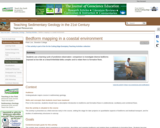
To prepare for this activity, students receive background on bedforms and flow …
To prepare for this activity, students receive background on bedforms and flow regimes in class and practice identifying and classifying bedforms from field photographs. Students are then given a map of a barrier beach/inlet/tidal delta complex in mid-coast Maine and asked to predict what bedforms they expect to find in specific sub-environments. During a subsequent field trip to the area, students observe, classify and map bedforms and relate them qualitatively to formative flows. Qualitative description and classification are supplemented by quantitative measurements of bedform morphology and orientation, and by GPS-located digital photographs. After the trip, students compare their predictions and observations of bedforms in the sub-environments, reflecting on the reasons for the differences and the evolution of their thinking. The exercise also serves to set the stage for subsequent quantitative studies of bedforms and bedload transport, as well as interpretation of sedimentary structures and clastic depositional environments in the geological record.
(Note: this resource was added to OER Commons as part of a batch upload of over 2,200 records. If you notice an issue with the quality of the metadata, please let us know by using the 'report' button and we will flag it for consideration.)
Students are given the task of predicting where parasequence boundaries would exist …
Students are given the task of predicting where parasequence boundaries would exist within a vertical section of the Blackhawk Formation, Utah. This activity challenges students to apply their knowledge of bedforms in order to interpret the facies they observe. The students work in groups of two as they make their observations. The vertical section consists of four main outcrops to be observed by the students. After making their observations and interpretations of these four outcrops, the students then make predictions of what should be found up section. Students begin down section by observing the lowest section of the four outcrops. The students make observations about lithology, grain size, sedimentary structures and trace fossils. After recording their observations in their field notebook the class gathers for a discussion. Students are called on randomly to discuss what they observed. The class creates a group stratigraphic column on a white board and includes their observations to the right of the drawn profile. They are then asked to interpret what facies these observations represent. The students defend their interpretations and, as a group, agree upon an interpretation. The facies interpretation is then added to the white board and the group moves to the next outcrop up section. After observing, describing and interpreting each of the four outcrops the students are challenged to use all of the information gathered thus far to predict what facies should be observed further up section. This exercise provides an opportunity for the students to make and defend observations and interpretations. They also get a sense for the importance of Walther's Law and how it relates to sequence stratigraphy.
(Note: this resource was added to OER Commons as part of a batch upload of over 2,200 records. If you notice an issue with the quality of the metadata, please let us know by using the 'report' button and we will flag it for consideration.)
This field mapping and map-making exercise is a capstone project for a …
This field mapping and map-making exercise is a capstone project for a course on Geological Maps. Over a weekend (~12 hours of field work), students collect lithologic and structural data from outcrops scattered over a one square mile area. Back in the classroom, students digitally compile their field data (outcrop, structure measurements, traverse locations) into ArcMAP. They infer geologic linework (faults and contacts) and units from this data in ArcMAP and then export these data layers into Illustrator. In Illustrator, they add ancillary map components (a cross section, description of map units, correlation diagram, map symbol legend,...) to create a final map at a 1:10,000 scale. Their maps are printed out on 11"x17" paper and saved as a pdf file. This exercise helps the students to appreciate how field data is collected and how these geologic facts are interpretively organized into a four-dimensional picture that is a geologic map.
(Note: this resource was added to OER Commons as part of a batch upload of over 2,200 records. If you notice an issue with the quality of the metadata, please let us know by using the 'report' button and we will flag it for consideration.)
Students collect gps locational and strike and dip data on a day-long …
Students collect gps locational and strike and dip data on a day-long fieldtrip to Cliff Island. The data is then used in ArcGIS to make a bedrock geologic map of the island. The final map is exported from Arc and prepared in Adobe InDesign as a tabloid size poster.
(Note: this resource was added to OER Commons as part of a batch upload of over 2,200 records. If you notice an issue with the quality of the metadata, please let us know by using the 'report' button and we will flag it for consideration.)
This interactive shows the extent of the killing of lodgepole pine trees …
This interactive shows the extent of the killing of lodgepole pine trees in western Canada. The spread of pine beetle throughout British Columbia has devastated the lodgepole pine forests there. This animation shows the spread of the beetle and the increasing numbers of trees affected from 1999-2008 and predicts the spread up until 2015.
In this exercise, students will use the Neotoma database and ArcGIS Online …
In this exercise, students will use the Neotoma database and ArcGIS Online to create a distribution map of modern collection localities of beetle taxa associated with an assemblage of fossil beetles from the Conklin Quarry site in eastern Iowa.
a data rich exercise to help students discover how organisms move in response to climate change
(Note: this resource was added to OER Commons as part of a batch upload of over 2,200 records. If you notice an issue with the quality of the metadata, please let us know by using the 'report' button and we will flag it for consideration.)
Teach students about P-waves and S-waves by having them model them with …
Teach students about P-waves and S-waves by having them model them with their own bodies.
(Note: this resource was added to OER Commons as part of a batch upload of over 2,200 records. If you notice an issue with the quality of the metadata, please let us know by using the 'report' button and we will flag it for consideration.)
Research reveals that if students are presented with negative information about environmental …
Research reveals that if students are presented with negative information about environmental issues and they are not also provided with a plan for action, they often manifest denial on many levels. This exercise is designed to get students to directly address the emotions they face when learning about environmental issues and to make an action plan to address them in their individual lives.
(Note: this resource was added to OER Commons as part of a batch upload of over 2,200 records. If you notice an issue with the quality of the metadata, please let us know by using the 'report' button and we will flag it for consideration.)
Learners research the effects of melting sea ice in the Bering Sea …
Learners research the effects of melting sea ice in the Bering Sea Ecosystem. They create research proposals to earn a place on the scientific research vessel Healy and present their findings and proposals to a Research Board committee.
No restrictions on your remixing, redistributing, or making derivative works. Give credit to the author, as required.
Your remixing, redistributing, or making derivatives works comes with some restrictions, including how it is shared.
Your redistributing comes with some restrictions. Do not remix or make derivative works.
Most restrictive license type. Prohibits most uses, sharing, and any changes.
Copyrighted materials, available under Fair Use and the TEACH Act for US-based educators, or other custom arrangements. Go to the resource provider to see their individual restrictions.