Updating search results...

Search Resources

507 Results

View
Selected filters:
  • Hydrology
Modeling Water Masses
Conditional Remix & Share Permitted
CC BY-NC-SA
Rating
0.0 stars

Objective: Students will conduct an experiment in order to determine how temperature and salinity affect the density of water. This assignment will ask you to conduct a simple experiment to determine how temperature and salinity affect the density of water while filling out a worksheet.

Subject:
Ecology
Environmental Studies
Hydrology
Material Type:
Activity/Lab
Author:
Amy Pace
Date Added:
05/11/2021
Modeling working group: Learning Finite Differences with a Darcy Apparatus
Conditional Remix & Share Permitted
CC BY-NC-SA
Rating
0.0 stars

See attached Excel worksheet

(Note: this resource was added to OER Commons as part of a batch upload of over 2,200 records. If you notice an issue with the quality of the metadata, please let us know by using the 'report' button and we will flag it for consideration.)


Subject:
Biology
Hydrology
Life Science
Physical Science
Material Type:
Activity/Lab
Provider:
Science Education Resource Center (SERC) at Carleton College
Provider Set:
Teach the Earth
Author:
Tom Burbey
Date Added:
09/05/2019
Module 4 - Groundwater Flow
Conditional Remix & Share Permitted
CC BY-NC-SA
Rating
0.0 stars

In this module students learn some of the fundamental concepts of groundwater flow including measurement of water levels, hydraulic heads, construction of potentiometric surfaces, delineation of flowpaths, and calculation of ground-water flow velocities and traveltimes.
The goals of this module are to learn how to contour irregularly spaced data (water-level measurements made in observation wells), how to draw flowpaths on a contoured water-table map, how to measure hydraulic gradients from a contoured water-table map, and how to compute flow velocities and traveltimes using Darcy's law. The goals are applied to examining flowpaths of groundwater moving from the W.R. Grace and Beatrice properties and to computing traveltimes along these flowpaths.

(Note: this resource was added to OER Commons as part of a batch upload of over 2,200 records. If you notice an issue with the quality of the metadata, please let us know by using the 'report' button and we will flag it for consideration.)
Subject:
Biology
Hydrology
Life Science
Physical Science
Material Type:
Activity/Lab
Provider:
Science Education Resource Center (SERC) at Carleton College
Provider Set:
Teach the Earth
Date Added:
12/10/2020
Module 5 - Groundwater Flow
Conditional Remix & Share Permitted
CC BY-NC-SA
Rating
0.0 stars

This module introduces students to the complexity of groundwater flow at the Aberjona River Valley site. The previous two modules provide background on the specific geology (and buried glacial valley complex) and the basics of groundwater flow through porous media. This module examines groundwater removed from the subsurface by pumping wells. This module is enhanced with groundwater animations created by Dr. E. Scott Bair, which illustrate contaminant movement and projects contaminant concentrations in various locations in the subsurface.

(Note: this resource was added to OER Commons as part of a batch upload of over 2,200 records. If you notice an issue with the quality of the metadata, please let us know by using the 'report' button and we will flag it for consideration.)
Subject:
Biology
Hydrology
Life Science
Physical Science
Material Type:
Activity/Lab
Provider:
Science Education Resource Center (SERC) at Carleton College
Provider Set:
Teach the Earth
Date Added:
12/10/2020
Module 6 - Flooding
Conditional Remix & Share Permitted
CC BY-NC-SA
Rating
0.0 stars

This module uses existing publications from the USGS and the Army Corps of Engineers regarding flooding affects and classifications. The users are guided to basic overviews provided by those agencies can understand flooding and flooding concepts. The module also direct students to the 'real-time' data collected by the National Oceanic and Atmospheric Association in conjunction with the USGS so they can view graphs showing the relation between rainfall, river stage and flow for the Aberjona River. The NOAA and USGS databases can provide the user with real-time as well as historic data to track flood waves and establish base flows. This data was key to the trial in defining what amount of groundwater was derived from the Aberjona River.

(Note: this resource was added to OER Commons as part of a batch upload of over 2,200 records. If you notice an issue with the quality of the metadata, please let us know by using the 'report' button and we will flag it for consideration.)

Subject:
Biology
Hydrology
Life Science
Physical Science
Material Type:
Activity/Lab
Provider:
Science Education Resource Center (SERC) at Carleton College
Provider Set:
Teach the Earth
Date Added:
12/10/2020
Module 7 - Induced Infiltration
Conditional Remix & Share Permitted
CC BY-NC-SA
Rating
0.0 stars

Defining pumping of Wells G. and H was an important and contested issue during the trial. The induced infiltration module provides references regarding methods to measure induced infiltration and quantify surface water loss to groundwater from aquifer pumping. This module references different techniques for quantifying groundwater infiltration from streams. The purpose of this information is familiarizing users with the differing methods to quantify Stream loss due to induced infiltration so they can assess the effectiveness of the USGS data used during the trial.

(Note: this resource was added to OER Commons as part of a batch upload of over 2,200 records. If you notice an issue with the quality of the metadata, please let us know by using the 'report' button and we will flag it for consideration.)

Subject:
Biology
Hydrology
Life Science
Physical Science
Material Type:
Activity/Lab
Provider:
Science Education Resource Center (SERC) at Carleton College
Provider Set:
Teach the Earth
Date Added:
12/10/2020
Module 8 - Movement of Contaminants
Conditional Remix & Share Permitted
CC BY-NC-SA
Rating
0.0 stars

Contaminant movement through the subsurface is different for each contaminant and for different subsurface conditions. This module provides a general overview to the term "fate and transport," which refers to what happens when a contaminant migrates and its mode of migration. This module provides tools to help students understand the complexity of subsurface migration of contaminants and relate these complexities to trial issues. The module introduces concepts related to effective flow, dispersion, diffusion, and migration of partially soluble contaminants. Specific references to trichloroethylene (TCE) are provided as this was the most significant contaminant linking the defendants' to the plaintiffs' claims.

(Note: this resource was added to OER Commons as part of a batch upload of over 2,200 records. If you notice an issue with the quality of the metadata, please let us know by using the 'report' button and we will flag it for consideration.)

Subject:
Biology
Hydrology
Life Science
Physical Science
Material Type:
Activity/Lab
Provider:
Science Education Resource Center (SERC) at Carleton College
Provider Set:
Teach the Earth
Date Added:
12/10/2020
Monitoring Algal Blooms with Landsat (OLI)
Conditional Remix & Share Permitted
CC BY-NC-SA
Rating
0.0 stars

Algal blooms are caused by an aggregation of either microscopic phytoplankton or macro algae. They can produce toxic or harmful effects on humans and or the ecosystem. The purpose of this activity is to teach students how to use remote sensing data from the Landsat 8 (OLI) to monitor algal blooms. Students work through a case study from Lake Erie. At the end of this activity students will be able to, in MATLAB, 1) access USGS data repositories to view Landsat imagery, 2) access band specific .TIF files directly from Amazon Web Services, 3) pre-process the imagery and a apply single band bloom detection algorithm and 4) work with the atmospherically corrected Land Surface Reflectance product to improve remote sensing estimates. Students will also work with the MATLAB Mapping Toolbox to produce presentation quality maps.

(Note: this resource was added to OER Commons as part of a batch upload of over 2,200 records. If you notice an issue with the quality of the metadata, please let us know by using the 'report' button and we will flag it for consideration.)
Subject:
Biology
Career and Technical Education
Environmental Studies
Hydrology
Life Science
Physical Science
Material Type:
Activity/Lab
Case Study
Provider:
Science Education Resource Center (SERC) at Carleton College
Provider Set:
Teach the Earth
Author:
Andrew Fischer
Date Added:
03/06/2022
More Than Just A Rainy Day--The Water Cycle
Conditional Remix & Share Permitted
CC BY-NC-SA
Rating
0.0 stars

Students will identify water sources in the school environment in order to understand the origins of our water and to gain perspective about the students' place in the water cycle. Students will learn about the water cycle using a variety of resources and discover connections between the water cycle and the water that they use every day.

Subject:
Hydrology
Physical Science
Material Type:
Lesson Plan
Provider:
University of North Carolina at Chapel Hill School of Education
Provider Set:
LEARN NC Lesson Plans
Author:
Kelly This
Leigh Thrower
Date Added:
07/14/2004
Movement of Contaminants Activity Page
Conditional Remix & Share Permitted
CC BY-NC-SA
Rating
0.0 stars

This module is focused on increasing the users understanding and familiarity with the fate and transport of contaminants. Video clips of sand tank models showing the movement of contaminants in subsurface porous media are included. The sand tank models provide a visual guide to help see how different geologic materials with different permeability's effect the movement of fluids and ultimately the distribution of contaminants.

(Note: this resource was added to OER Commons as part of a batch upload of over 2,200 records. If you notice an issue with the quality of the metadata, please let us know by using the 'report' button and we will flag it for consideration.)
Subject:
Biology
Hydrology
Life Science
Physical Science
Material Type:
Activity/Lab
Simulation
Provider:
Science Education Resource Center (SERC) at Carleton College
Provider Set:
Teach the Earth
Author:
Kevin Svitana
Date Added:
02/19/2021
Moving without Wheels
Read the Fine Print
Educational Use
Rating
0.0 stars

In a class demonstration, students observe a simple water cycle model to better understand its role in pollutant transport. This activity shows one way in which pollution is affected by the water cycle; it simulates a point source of pollution in a lake and the resulting environmental consequences.

Subject:
Applied Science
Engineering
Hydrology
Physical Science
Material Type:
Activity/Lab
Provider:
TeachEngineering
Provider Set:
TeachEngineering
Author:
Alejandro Reiman-Moreno
Amy Kolenbrander
Denise Carlson
Janet Yowell
Malinda Schaefer Zarske
Natalie Mach
Tyman Stephens
Date Added:
10/14/2015
NGSS in Action: Urban Water Systems (Workshop 4 of 4)
Conditional Remix & Share Permitted
CC BY-SA
Rating
0.0 stars

The Next Generation Science Standards (NGSS)* call for students to use the practices, concepts and content of science and engineering to understand phenomena and solve problems that are relevant to their lives. Starting from a student’s own experiences and community makes the science meaningful and increases engagement while helping students understand how global issues like climate change are present and addressable in their lives. In this series we examine how you can use the new science standards and your community to understand and address real world environmental problems and explore together how to integrate NGSS into your district’s classroom science units.Would you like to learn more about how urban water systems actually work? Are you curious how water systems, the impacts of climate change, and related conservation issues can interest your students and integrate with NGSS? Join us to learn about wastewater and stormwater systems (may include tours of facilities, depending on the site) and then workshop how you might use this content in your classroom. Appropriate for all 4th-12th grade teachers.

Subject:
Applied Science
Environmental Science
Hydrology
Life Science
Material Type:
Lesson Plan
Author:
Emma Pesis
Brad Street
Date Added:
07/22/2019
Natural Disaster Risk at Home
Conditional Remix & Share Permitted
CC BY-NC-SA
Rating
0.0 stars

Students analyze the natural disaster threat and potential mitigation techniques of their (family) home.

(Note: this resource was added to OER Commons as part of a batch upload of over 2,200 records. If you notice an issue with the quality of the metadata, please let us know by using the 'report' button and we will flag it for consideration.)

Subject:
Biology
Hydrology
Life Science
Oceanography
Physical Science
Material Type:
Homework/Assignment
Provider:
Science Education Resource Center (SERC) at Carleton College
Provider Set:
Teach the Earth
Author:
Ian MacMillan, Pomona College
Date Added:
09/16/2022
Natural and Urban "Stormwater" Water Cycle Models
Read the Fine Print
Educational Use
Rating
0.0 stars

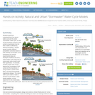
Students apply their understanding of the natural water cycle and the urban "stormwater" water cycle, as well as the processes involved in both cycles to hypothesize how the flow of water is affected by altering precipitation. Student groups consider different precipitation scenarios based on both intensity and duration. Once hypotheses and specific experimental steps are developed, students use both a natural water cycle model and an urban water cycle model to test their hypotheses. To conclude, students explain their results, tapping their knowledge of both cycles and the importance of using models to predict water flow in civil and environmental engineering designs. The natural water cycle model is made in advance by the teacher, using simple supplies; a minor adjustment to the model easily turns it into the urban water cycle model.

Subject:
Applied Science
Engineering
Hydrology
Physical Science
Material Type:
Activity/Lab
Provider:
TeachEngineering
Provider Set:
TeachEngineering
Author:
Andrew O'Brien
Austin Childress
Carleigh Samson
Maya Trotz
Ryan Locicero
Date Added:
09/18/2014
Natural and Urban "Stormwater" Water Cycles
Read the Fine Print
Educational Use
Rating
0.0 stars

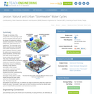
Through an overview of the components of the hydrologic cycle and the important roles they play in the design of engineered systems, students' awareness of the world's limited fresh water resources is heightened. The hydrologic cycle affects everyone and is the single most critical component to life on Earth. Students examine in detail the water cycle components and phase transitions, and then learn how water moves through the human-made urban environment. This urban "stormwater" water cycle is influenced by the pervasive existence of impervious surfaces that limit the amount of infiltration, resulting in high levels of stormwater runoff, limited groundwater replenishment and reduced groundwater flow. Students show their understanding of the process by writing a description of the path of a water droplet through the urban water cycle, from the droplet's point of view. The lesson lays the groundwork for rest of the unit, so students can begin to think about what they might do to modify the urban "stormwater" water cycle so that it functions more like the natural water cycle. A PowerPoint® presentation and handout are provided.

Subject:
Applied Science
Engineering
Hydrology
Physical Science
Material Type:
Lesson Plan
Provider:
TeachEngineering
Provider Set:
TeachEngineering
Author:
Brigith Soto
Jennifer Butler
Krysta Porteus
Maya Trotz
Ryan Locicero
William Zeman
Date Added:
09/18/2014
A New Generation of Water Planners Confronts Change Along the Colorado River
Read the Fine Print
Rating
0.0 stars

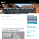
Reduced flows and increased demand for Colorado River water represent a real and present danger in the West. To address the threat, water managers and modelers initiated a study to understand the system, consider options, and take action.

Subject:
Hydrology
Physical Science
Material Type:
Case Study
Provider:
National Oceanic and Atmospheric Administration
Provider Set:
U.S. Climate Resilience Toolkit
Date Added:
08/09/2016
Non-traditional and under-represented students in hydrogeology: Learning by discovery in an urban environment
Conditional Remix & Share Permitted
CC BY-NC-SA
Rating
0.0 stars

Background:
In my experience, I have discovered many common roadblocks to non-traditional and under-represented student participation in hydrogeology:
Time constraints -- many students have complicated schedules and demands on their time that a traditional undergraduate does not have. For example, many of these students are working full time, and required experiences outside of the classroom often pose scheduling conflicts for students.

Communication skills -- many under-represented students arrive in the classroom with communication skills that are not fully developed. Students are often learning English as they are learning the complex vocabulary of hydrogeology.

Math skills -- many students are under prepared in math and/or have math phobias

Funding -- many students are unable to pay laboratory and field trip fees.

I currently teach at minority serving institution. Here, I find that hands-on practice is the most successful learning experience for students. Students grasp concepts such as discharge, flux, and residence time more effectively when they are active participants in the learning process. The most effective method I have found for addressing these issues and encouraging under represented student participation in hydrogeology is to create student-designed group research projects. I used this strategy three quarters in a row, and the same students (as well as new students they recruit) continue to sign up for these courses. This trend, in addition to students' growing confidence in engaging in the scientific method, is my primary evidence for success.

Resources are very limited at my institution, so here are a couple of suggestions that work well.
Borrow equipment -- from other universities, from consulting companies, from colleagues.

Simplify analyses -- many interesting conclusions can be drawn from simply pH, conductivity, and temperature data. But, there are also relatively inexpensive test kits on the market that are sufficient for class purposes (ex. LaMotte urban water test kit ~$30).

Description
Everyone will have different class sizes, student preparation levels, and goals when attempting an exercise like this, so I will provide general information, which others can modify to meet their needs. Below I briefly outline the steps I take the students through during the project and highlight ideas for improving success for the targeted groups.

Form groups -- depending on class size, 2-4 students per group (I try to ensure the groups are balanced based on skills and student interests)
Choose topic -- I usually provide a list of possible topics and have students adapt a topic from the list that interests them. Students require a lot of guidance at this stage to assure selection of a manageable topic for a quarter-long project. This is the most important step - guiding students into a topic they are passionate about and where they can be successful is key. Students usually have no shortage of questions they want to answer about water in an urban environment! Since most of the students have spent their whole lives in an urban situation, they are deeply passionate about these issues.
Research literature -- students perform a background search for previous work on their topic to help guide them. I provide a laboratory session on how to search the library and databases for related information, as well as provide a list of recommended journals and websites. In addition, students locate supporting data (discharge, well levels, precipitation)
Plan study -- we discuss study design, sample types, sampling location, frequency. During this phase, students use maps, study weather patterns, and determine site accessibility.
Collect data -- we set aside lab periods for collecting data together. These are the sessions where you should be prepared to answer all sort of questions. Once the students begin implementing their study, many new questions come up.
Analyze and interpret results -- multiple lab periods are used to analyze data; student data are the basis of the remainder of labs. Techniques discussed are applied to their group projects.
Present findings -- students assemble posters and present results to their classmates.

Urban topics
Below is a short list of topics to stimulate ideas. Equipment required includes pH meter, conductivity meter, flow meter, Lamotte test kits.
Sources of N and P to the Los Angeles River
Contribution of golf courses to urban runoff
Extent of tidal influence on Ballona Creek
Metal fluxes from storm drains to the ocean
Relationship of land use to water quality
Relationship of population demographics to water quality

(Note: this resource was added to OER Commons as part of a batch upload of over 2,200 records. If you notice an issue with the quality of the metadata, please let us know by using the 'report' button and we will flag it for consideration.)

Subject:
Business and Communication
Chemistry
Hydrology
Management
Physical Science
Political Science
Social Science
Material Type:
Activity/Lab
Provider:
Science Education Resource Center (SERC) at Carleton College
Provider Set:
Teach the Earth
Author:
Laura Rademacher
Date Added:
11/28/2021
Nooksack Salmon Enhancement Association - Goodness Gracious Where Have All The Glaciers Gone?
Unrestricted Use
CC BY
Rating
0.0 stars

Hands-on outdoor lesson plan for students to understand the meaning and components of climate change, and engineer and model how greenhouse gases cause heat trapping.

Subject:
Applied Science
Ecology
Education
Elementary Education
Environmental Science
Hydrology
Life Science
Physical Geography
Physical Science
Material Type:
Activity/Lab
Interactive
Lesson
Date Added:
05/23/2019