In this investigation, students discover the spatial relationship between recent earthquakes, volcanoes, …
In this investigation, students discover the spatial relationship between recent earthquakes, volcanoes, and the Earth's plates through visual inspection of tectonic activity plots on world maps, and by comparing the position of recent tectonic events with the position of the Earth's plates. Summary background information, data and images supporting the activity are available on the Earth Update data site. To complete the activity, students will need to access the Space Update multimedia collection, which is available for download and purchase for use in the classroom.
Short Description: This is an open-access lab manual for a historical geology …
Short Description: This is an open-access lab manual for a historical geology lab focused on student observations. We have uploaded this book to Lulu Press so that you may have them print a copy for you. The cost is $19.67 plus shipping. We believe in free access to educational materials, therefore we collect no revenue from Lulu. The price you pay is simply the cost Lulu charges to print the materials for you. You can also download a printable PDF version to print on your own. Do you plan on using the lab manual? Have any questions, comments, suggestions, or notice an error? Please fill out our contact form and let us know!
Word Count: 132319
(Note: This resource's metadata has been created automatically by reformatting and/or combining the information that the author initially provided as part of a bulk import process.)
Join Scripps' Institutions Neal Driscoll as he presents new high-resolution images of …
Join Scripps' Institutions Neal Driscoll as he presents new high-resolution images of landscapes and seascapes providing clearer understandings of the link between formative processes and their signatures in the geologic record. (52 minutes)
In this video segment adapted from NOVA, a scientist explains the unexpected …
In this video segment adapted from NOVA, a scientist explains the unexpected heat source fueling widespread volcanic activity on Io, a moon of Jupiter that many had previously assumed to be frozen.
In this activity, students work in groups to put a set of …
In this activity, students work in groups to put a set of cartoon cards in order, much in the way that we might assemble a geologic history. The primary goal of the activity is to explore the nature of science in general and the nature of geoscience or historical science specifically, without requiring any content knowledge.
(Note: this resource was added to OER Commons as part of a batch upload of over 2,200 records. If you notice an issue with the quality of the metadata, please let us know by using the 'report' button and we will flag it for consideration.)
Introduction to seismic theory, measurements and processing of seismic data to final …
Introduction to seismic theory, measurements and processing of seismic data to final focussed image for geological and/or physical interpretation.This course deals with the most important aspects of reflection seismics. Theory of seismic waves, aspects of data acquisition (seismic sources, receivers and recorders), and of data processing (CMP processing, velocity analysis, stacking, migration) will be dealt with. The course will be supplemented by a practical of 6 afternoons where the students will see the most important data-processing steps via exercises (in Matlab).
Spreadsheets Across the Curriculum module/Geology of National Parks course. Students use foundational …
Spreadsheets Across the Curriculum module/Geology of National Parks course. Students use foundational math to study the velocity of the North American Plate over the hot spot, the volume of eruptive materials from it, and the recurrence interval of the cataclysmic eruptions.
This activity is designed for large freshman courses (>200 students) and is …
This activity is designed for large freshman courses (>200 students) and is used in-class. The activity requires a short (15 minute) overview of Earth history before students have the opportunity to work through various questions and problems. Tasks include simple math problems, critical thinking questions, and include place-based examples of geological situations for Arizona and California.
Students completing the activity will have knowledge of Earth history, knowledge of some geological disasters, and will have learned several different perspectives of timescales that affect various events on Earth.
(Note: this resource was added to OER Commons as part of a batch upload of over 2,200 records. If you notice an issue with the quality of the metadata, please let us know by using the 'report' button and we will flag it for consideration.)
12.524 is a survey of the mechanical behavior of rocks in natural …
12.524 is a survey of the mechanical behavior of rocks in natural geologic situations. Topics will include a brief survey of field evidence of rock deformation, physics of plastic deformation in minerals, brittle fracture and sliding, and pressure-solution processes. We will compare results of field petrologic and structural studies to data from experimental structural geology.
MS-ESS2-1 Earth's SystemsDevelop a model to describe the cycling of Earth's materials …
MS-ESS2-1 Earth's SystemsDevelop a model to describe the cycling of Earth's materials and the flow of energy that drives this process.MS-ESS2-2 Earth's SystemsConstruct an explanation based on evidence for how geoscience processes have changed Earth's surface at varying time and spatial scales.MS-ESS3-1 Earth and Human ActivityConstruct a scientific explanation based on evidence for how the uneven distributions of Earth's mineral, energy, and groundwater resources are the result of past and current geoscience processes.
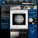
This newsletter is designed to share NASA mission discoveries about the planet …
This newsletter is designed to share NASA mission discoveries about the planet Jupiter which includes information about the 2009 Impact, birth of red spot storms, observed color changes in its atmospheric bands, calculated wind speeds, strong magnetic field-causing spectacular aurora and explanation of Jupiter's Gossamer Ring formation.
This booklet gives a brief introduction to the concept of plate tectonics …
This booklet gives a brief introduction to the concept of plate tectonics and complements the visual and written information in This Dynamic Planet, a map published in 1994 by the U.S. Geological Survey (USGS) and the Smithsonian Institution. The booklet highlights some of the people and discoveries that advanced the development of the theory and traces its progress since its proposal. Although the general idea of plate tectonics is now widely accepted, many aspects still continue to confound and challenge scientists. The earth-science revolution launched by the theory of plate tectonics is not finished.
In this inquiry based geologic field lab students will be estimating and …
In this inquiry based geologic field lab students will be estimating and measuring stream flow. Students will also map out a full scale live topography map of a dry streambed to help them estimate flow discharge. Students will use their journals to record their hypothesis, lab report questions, graphed data and evidence to backs up their observations.
This learning module demonstrates how topographic maps depict elevation differences and the …
This learning module demonstrates how topographic maps depict elevation differences and the shape of a landscape by utilizing 3-D visualizations. 2-D topographic maps are paired with 3-D visualizations of these maps, complete with interactive capabilities that allow the learner to rotate or tilt the visualization in order to gain different perspectives. Other animated features include sequential vertical slicing of a topographic cube and flooding of 3-D rendered surfaces. The goal is for the student to be able to read this type of map and easily recognize the surface features the map represents. This module is a series of visualizations set within a lesson activity that leads the student on an exploration of how 2-D topographic maps depict the 3-D character of a landscape surface. The learner embarks on a guided tour of 3-D landscapes, yet sets the pace of the adventure and is free to move backward and forward on the journey. Features explained and depicted include contour lines, cliffs, hills, valleys, and profiles. This visualization is part of a curriculum developed by Steve Reynolds, geology professor at Arizona State University. His website contains a variety of 3-D perspectives, color photographs, and information regarding the Geology of Arizona, Landscapes of the Southwest, structural geology, and science-education reform.
(Note: this resource was added to OER Commons as part of a batch upload of over 2,200 records. If you notice an issue with the quality of the metadata, please let us know by using the 'report' button and we will flag it for consideration.)
The intent is to provide a map-based framework, complete with animations showing …
The intent is to provide a map-based framework, complete with animations showing the geologic evolution of the area to be visited, so that students can then better appreciate the observations made at the various stops along the way and see how they each relate to the other and the big picture.
(Note: this resource was added to OER Commons as part of a batch upload of over 2,200 records. If you notice an issue with the quality of the metadata, please let us know by using the 'report' button and we will flag it for consideration.)
This earth systems field lab begins with an in-class guided inquiry experience …
This earth systems field lab begins with an in-class guided inquiry experience which uses Minnesota Geological Survey 3-D maps of the upper Midwest to determine where they believe glaciers may have had an influence. They will determine this by looking at landscapes and compiling their own evidence from the maps. They will also offer evidence for a hypothesis they generate which involves the direction that the glacier was traveling.
The goal of this assignment is to introduce students to the degree …
The goal of this assignment is to introduce students to the degree to which ecosystems, climate, and geography have varied through Earth history. It requires students to work in groups (which many resist) and to research each geologic period using the Paleo Portal website and external websites.
(Note: this resource was added to OER Commons as part of a batch upload of over 2,200 records. If you notice an issue with the quality of the metadata, please let us know by using the 'report' button and we will flag it for consideration.)
No restrictions on your remixing, redistributing, or making derivative works. Give credit to the author, as required.
Your remixing, redistributing, or making derivatives works comes with some restrictions, including how it is shared.
Your redistributing comes with some restrictions. Do not remix or make derivative works.
Most restrictive license type. Prohibits most uses, sharing, and any changes.
Copyrighted materials, available under Fair Use and the TEACH Act for US-based educators, or other custom arrangements. Go to the resource provider to see their individual restrictions.