This student homework and problem set has students quantitatively earthquake hazard, shaking …
This student homework and problem set has students quantitatively earthquake hazard, shaking and damage.
(Note: this resource was added to OER Commons as part of a batch upload of over 2,200 records. If you notice an issue with the quality of the metadata, please let us know by using the 'report' button and we will flag it for consideration.)
After having learned about earthquakes in class, through readings and earlier lab …
After having learned about earthquakes in class, through readings and earlier lab assignments, students (in groups of two) are asked to design and construct (using balsa wood, string, paper and glue) a three-story building designed to minimize the effects of shear-wave vibrations that occur during an earthquake. The students are required to research the design concepts on their own and most of the construction work occurs outside of the regular laboratory period. The structures are tested for strength a week before the earthquake occurs - can they support the required load for each floor? On earthquake day, the buildings a tested for a "design earthquake" and then each group is given the opportunity to see how "large" and earthquake their structure can withstand - both in terms of frequency and amplitude variations. In addition to building the structure, each team has to submit a paper reflecting on why they designed and built the structure the way they did.
(Note: this resource was added to OER Commons as part of a batch upload of over 2,200 records. If you notice an issue with the quality of the metadata, please let us know by using the 'report' button and we will flag it for consideration.)
For this exercise we meet in a computer lab and students access …
For this exercise we meet in a computer lab and students access the IRIS Earthquake Browser to download geospatial information of earthquakes. Students use the GEON Integrated Data Viewer (IDV) to explore the location of earthquake zones and their 3-dimensional characteristics. Students compare the earthquake characteristics of subduction zones, mid-oceanic ridges, and transform faults. This leads into a discussion of plate tectonics.
(Note: this resource was added to OER Commons as part of a batch upload of over 2,200 records. If you notice an issue with the quality of the metadata, please let us know by using the 'report' button and we will flag it for consideration.)
In this video segment adapted from NOVA, a geologist digs a trench …
In this video segment adapted from NOVA, a geologist digs a trench along the San Andreas Fault to reveal three thousand years of earthquake history. Information from the layers of sediment may help geologists to predict earthquakes.
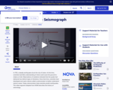
This video segment adapted from NOVA uses historical illustrations, photographs, and animations …
This video segment adapted from NOVA uses historical illustrations, photographs, and animations to explain how seismographs work, the difference between P and S waves, and the Richter scale.
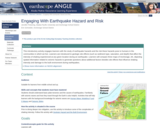
This introductory activity engages learners in the study of earthquake hazards and …
This introductory activity engages learners in the study of earthquake hazards and the risk these hazards pose to humans in the communities in which we live. Learners will compare three maps of Anchorage, AK, depicting spatial information related to seismic hazards to generate questions about the factors that influence shaking intensity and damage to the built environment during earthquakes.
(Note: this resource was added to OER Commons as part of a batch upload of over 2,200 records. If you notice an issue with the quality of the metadata, please let us know by using the 'report' button and we will flag it for consideration.)
The geologic record demonstrates that our environment has changed over a variety …
The geologic record demonstrates that our environment has changed over a variety of time scales from seconds to billions of years. This course explores the many ways in which geologic processes control and modify the Earth’s environment and serves as an introduction to Environmental Earth Science Field Course (12.120), which addresses field applications of these principles in the American Southwest.
This activity guides students to use the measured difference in P and …
This activity guides students to use the measured difference in P and S wave velocities to locate the epicenter of a minor earthquake in the Southwestern United States.
Click here to view the full activity on the KÃyah Math Project website.
(Note: this resource was added to OER Commons as part of a batch upload of over 2,200 records. If you notice an issue with the quality of the metadata, please let us know by using the 'report' button and we will flag it for consideration.)
KÃyah Math Project development team: Nancy Zumoff, Christopher Schaufele, Steven Semken, Tracy Perkins, Lynn Onken, Philippe Laval, David Gonzales, and Andrew Becenti (deceased).
KÃyah Math Project directed by Steven Semken , Arizona State University; and Christopher Schaufele and Nancy Zumoff, Professors of Mathematics, Emeritus.
Archived at Arizona State University School of Earth and Space Exploration.
Earthquakes in western Washington and Oregon are to be expected -- the …
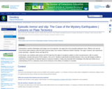
Earthquakes in western Washington and Oregon are to be expected -- the region lies in the Cascadia Subduction Zone. Offshore, the Juan de Fuca tectonic plate subducts under the North American plate, from northern California to British Columbia. The region, however, also experiences exotic seismicity -- Episodic Tremor and Slip (ETS).In this lesson, your students study seismic and GPS data from the region to recognize a pattern in which unusual tremors--with no surface earthquakes--coincide with jumps of GPS stations. This is ETS. Students model ductile and brittle behavior of the crust with lasagna noodles to understand how properties of materials depend on physical conditions. Finally, they assemble their knowledge of the data and models into an understanding of ETS in subduction zones and its relevance to the millions of residents in Cascadia.
(Note: this resource was added to OER Commons as part of a batch upload of over 2,200 records. If you notice an issue with the quality of the metadata, please let us know by using the 'report' button and we will flag it for consideration.)
Students conduct a regional seismic hazard analysis of a region of the …
Students conduct a regional seismic hazard analysis of a region of the United States of their choosing*. Using on-line data, they bring together and investigate the interaction of multiple types of data [ground motion (measured by GPS from UNAVCO), historical earthquake data and fault data] to associate rates of deformation and earthquake activity with hazard potential. Students would develop an assessment of seismic hazard potential. This project also introduces the idea of fault loading and qualitative earthquake interaction.
(Note: this resource was added to OER Commons as part of a batch upload of over 2,200 records. If you notice an issue with the quality of the metadata, please let us know by using the 'report' button and we will flag it for consideration.)
Each student will load a database file into ArcGIS software during the …
Each student will load a database file into ArcGIS software during the class period. Following the written instructions, each student will work through various steps necessary to analyze the earthquake hazards. Uses online and/or real-time data Addresses student fear of quantitative aspect and/or inadequate quantitative skills
(Note: this resource was added to OER Commons as part of a batch upload of over 2,200 records. If you notice an issue with the quality of the metadata, please let us know by using the 'report' button and we will flag it for consideration.)
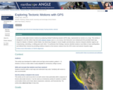
Using a map showing the horizontal velocities of GPS stations in the …
Using a map showing the horizontal velocities of GPS stations in the Plate Boundary Observatory and other GPS networks in Alaska and Western United States, students are able to describe the motions in different regions by interpreting the vectors resulting from long-term high-precision Global Positioning System (GPS) data. Show more information on NGSS alignment Hide NGSS ALIGNMENT Disciplinary Core Ideas History of Earth: HS-ESS1-5 Earth' Systems: MS-ESS2-2 Earth and Human Activity: MS-ESS3-2, HS-ESS3-1 Science and Engineering Practices 4. Analyzing and Interpreting Data 5. Using Mathematics and Computational Thinking 6. Constructing Explanations and Designing Solutions Crosscutting Concepts 4. Systems and System Models 7. Stability and Change
(Note: this resource was added to OER Commons as part of a batch upload of over 2,200 records. If you notice an issue with the quality of the metadata, please let us know by using the 'report' button and we will flag it for consideration.)
In this activity, students are introduced to faults. They will learn about …
In this activity, students are introduced to faults. They will learn about different kinds of faults and understand their relationship to earthquakes. The students will build cardboard models of the three different types of faults as they learn about how earthquakes are formed.
This article provides science content knowledge about forces that shape the Earth's …
This article provides science content knowledge about forces that shape the Earth's surface: erosion by wind, water, and ice, volcanoes, earthquakes, and plate tectonics and how these forces affect Earth's polar regions.
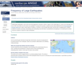
Using the IRIS Earthquake Browser tool, students gather data to support a …
Using the IRIS Earthquake Browser tool, students gather data to support a claim about how many large (Mw 8+) earthquakes will happen globally each year. This activity provides scaffolded experience downloading data and manipulating data within a spreadsheet.
(Note: this resource was added to OER Commons as part of a batch upload of over 2,200 records. If you notice an issue with the quality of the metadata, please let us know by using the 'report' button and we will flag it for consideration.)
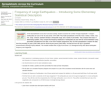
Spreadsheets Across the Curriculum module. Students examine the number of large earthquakes …
Spreadsheets Across the Curriculum module. Students examine the number of large earthquakes (magnitude 7 and above) per year for 1970-1999 and 1940-1999. QL: descriptors of a frequency distribution.
(Note: this resource was added to OER Commons as part of a batch upload of over 2,200 records. If you notice an issue with the quality of the metadata, please let us know by using the 'report' button and we will flag it for consideration.)
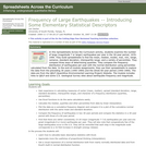
Spreadsheets Across the Curriculum module. Students examine the number of large earthquakes …
Spreadsheets Across the Curriculum module. Students examine the number of large earthquakes (magnitude 7 and above) per year for 1970-1999 and 1940-1999. QL: descriptors of a frequency distribution.
Collaborative, research-based activity of varying lengths. Main outcome is to identify potential …
Collaborative, research-based activity of varying lengths. Main outcome is to identify potential vulnerabilities in the built environment and possible solutions.
(Note: this resource was added to OER Commons as part of a batch upload of over 2,200 records. If you notice an issue with the quality of the metadata, please let us know by using the 'report' button and we will flag it for consideration.)
No restrictions on your remixing, redistributing, or making derivative works. Give credit to the author, as required.
Your remixing, redistributing, or making derivatives works comes with some restrictions, including how it is shared.
Your redistributing comes with some restrictions. Do not remix or make derivative works.
Most restrictive license type. Prohibits most uses, sharing, and any changes.
Copyrighted materials, available under Fair Use and the TEACH Act for US-based educators, or other custom arrangements. Go to the resource provider to see their individual restrictions.