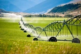
Students build a physical model to explore watershed features, then use Google …
Students build a physical model to explore watershed features, then use Google Earth software to tie the model to a real place. By exploring several layers of map-based images and data, students develop an appreciation of the complexity of a watershed and river system in the context of a both a local and national scale.
(Note: this resource was added to OER Commons as part of a batch upload of over 2,200 records. If you notice an issue with the quality of the metadata, please let us know by using the 'report' button and we will flag it for consideration.)
When populations live in areas where natural resources are scarce, conserving them …
When populations live in areas where natural resources are scarce, conserving them becomes critical for survival. The case study presented in this lesson introduces students to a real drought that has been developing in the Colorado River basin for many years. The Colorado River is the major source of water for people in the driest part of the United States. More than 30 million people in 7 states depend on this river as the primary source of their water. In this lesson, students discover how changes in climate over the Colorado watershed are reducing the amount of fresh water available in the river. They also see how the population of the region that uses this water has grown, resulting in increasing demands on a dwindling resource.
(Note: this resource was added to OER Commons as part of a batch upload of over 2,200 records. If you notice an issue with the quality of the metadata, please let us know by using the 'report' button and we will flag it for consideration.)
Stratified lakes exhibit vertical gradients in organisms, nutrients, and oxygen, which have …
Stratified lakes exhibit vertical gradients in organisms, nutrients, and oxygen, which have important implications for ecosystem structure and functioning. Mixing disrupts these gradients by redistributing these materials throughout the water column. Consequently, it is critical to understand the drivers of lake mixing and thermal stratification, especially because of the sensitivity of lake thermal conditions to altered climate. In this module, students will explore spatial and temporal patterns of lake mixing using high-frequency temperature data from lakes around the world. They will also explore how increases in air temperature affect thermal stratification by interpreting output from a lake model. Project EDDIE modules are designed with an A-B-C structure to make them flexible and adaptable to a range of student levels and course structures.
(Note: this resource was added to OER Commons as part of a batch upload of over 2,200 records. If you notice an issue with the quality of the metadata, please let us know by using the 'report' button and we will flag it for consideration.)
This module was initially developed by Carey, C.C., J.L. Klug, and R.L. Fuller. 1 August 2015. Project EDDIE: Dynamics of Lake Mixing. Project EDDIE Module 3, Version 1. cemast.illinoisstate.edu/data-for-students/modules/lake-mixing.shtml. Module development was supported by NSF DEB 1245707.
Dissolved ions are present in all freshwater systems, but humans can change …
Dissolved ions are present in all freshwater systems, but humans can change the chemical composition of freshwater in several ways. In this activity, students will examine the concentration of major ions in freshwater systems over time and reason about potential drivers of these changes.
(Note: this resource was added to OER Commons as part of a batch upload of over 2,200 records. If you notice an issue with the quality of the metadata, please let us know by using the 'report' button and we will flag it for consideration.)
Included in the activity description Metacognitive components of the activity Describing one's …
Included in the activity description Metacognitive components of the activity Describing one's thoughts to another person requires the problem-solver to listen and attend to their own thoughts as well. The questions and clarifications that the listener describes is yet another window into the problem-solver's thinking. Metacognitive goals for this activity: Promote reflective thinking, communication skills, better reasoning, listening skills, and better problem-solving and conceptual understanding. Assessing students' metacognition There have been several studies of this instructional strategy. I have used it in my own instruction of mathematics and science for more than 25 years.
(Note: this resource was added to OER Commons as part of a batch upload of over 2,200 records. If you notice an issue with the quality of the metadata, please let us know by using the 'report' button and we will flag it for consideration.)
This stream field investigation will allow students to look at stream erosional …
This stream field investigation will allow students to look at stream erosional patterns, take measurements to determine discharge, and conduct a chemical and turbidity analysis of Garvin Brook in Stockton, MN. Based on this investigation students will create a presentation that includes a new testable question that may be carried out the following year along with a stream ecology study.
This module uses existing publications from the USGS and the Army Corps …
This module uses existing publications from the USGS and the Army Corps of Engineers regarding flooding affects and classifications. The users are guided to basic overviews provided by those agencies can understand flooding and flooding concepts. The module also direct students to the 'real-time' data collected by the National Oceanic and Atmospheric Association in conjunction with the USGS so they can view graphs showing the relation between rainfall, river stage and flow for the Aberjona River. The NOAA and USGS databases can provide the user with real-time as well as historic data to track flood waves and establish base flows. This data was key to the trial in defining what amount of groundwater was derived from the Aberjona River.
(Note: this resource was added to OER Commons as part of a batch upload of over 2,200 records. If you notice an issue with the quality of the metadata, please let us know by using the 'report' button and we will flag it for consideration.)
Students analyze the natural disaster threat and potential mitigation techniques of their …
Students analyze the natural disaster threat and potential mitigation techniques of their (family) home.
(Note: this resource was added to OER Commons as part of a batch upload of over 2,200 records. If you notice an issue with the quality of the metadata, please let us know by using the 'report' button and we will flag it for consideration.)
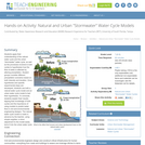
Students apply their understanding of the natural water cycle and the urban …
Students apply their understanding of the natural water cycle and the urban "stormwater" water cycle, as well as the processes involved in both cycles to hypothesize how the flow of water is affected by altering precipitation. Student groups consider different precipitation scenarios based on both intensity and duration. Once hypotheses and specific experimental steps are developed, students use both a natural water cycle model and an urban water cycle model to test their hypotheses. To conclude, students explain their results, tapping their knowledge of both cycles and the importance of using models to predict water flow in civil and environmental engineering designs. The natural water cycle model is made in advance by the teacher, using simple supplies; a minor adjustment to the model easily turns it into the urban water cycle model.
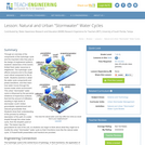
Through an overview of the components of the hydrologic cycle and the …
Through an overview of the components of the hydrologic cycle and the important roles they play in the design of engineered systems, students' awareness of the world's limited fresh water resources is heightened. The hydrologic cycle affects everyone and is the single most critical component to life on Earth. Students examine in detail the water cycle components and phase transitions, and then learn how water moves through the human-made urban environment. This urban "stormwater" water cycle is influenced by the pervasive existence of impervious surfaces that limit the amount of infiltration, resulting in high levels of stormwater runoff, limited groundwater replenishment and reduced groundwater flow. Students show their understanding of the process by writing a description of the path of a water droplet through the urban water cycle, from the droplet's point of view. The lesson lays the groundwork for rest of the unit, so students can begin to think about what they might do to modify the urban "stormwater" water cycle so that it functions more like the natural water cycle. A PowerPoint® presentation and handout are provided.
Video link and accompanying worksheet with answer key. Nebraska ranks #1 in …
Video link and accompanying worksheet with answer key. Nebraska ranks #1 in both irrigated acres and groundwater abundance in the U.S. Water is the lifeblood of the state. This program, produced in cooperation with the Nebraska State Irrigation Association, explores the relationships between groundwater and surface water, the different ways in which we use it, and how we work together to manage water for future generations.
Volcanic debris flows (lahars) flow long distances, bury and aggrade river valleys, …
Volcanic debris flows (lahars) flow long distances, bury and aggrade river valleys, and cause long-term stream disturbances and dramatic landscape changes. Students will evaluate the nature, scale, and history of past lahars from Mount Rainier in a river valley and interpret the past and potential future impact on humans of lahars.
(Note: this resource was added to OER Commons as part of a batch upload of over 2,200 records. If you notice an issue with the quality of the metadata, please let us know by using the 'report' button and we will flag it for consideration.)
Students graph existing water quality data using MS Excel, and use the …
Students graph existing water quality data using MS Excel, and use the graphs to discuss the changes in discharge, sediment load, and dissolved load along the length of the river and over time. This exercise prepares students to analyze and discuss their own data later in the semester.
(Note: this resource was added to OER Commons as part of a batch upload of over 2,200 records. If you notice an issue with the quality of the metadata, please let us know by using the 'report' button and we will flag it for consideration.)
Create hydrograph and explore changes in physical parameters on form of hydrograph. …
Create hydrograph and explore changes in physical parameters on form of hydrograph. Set up is easy: water is sprinkled into a model watershed (sand in pop bottle) and allowed to dribble onto cheap digital scale. Students record weight of water over time, convert to volume, and then create hydrograph. More complicated pop-bottle watersheds can model effect of urbanization, antecedent moisture, changes in precipitation, changes in "soil" porosity/permeability, etc. SEE TEACHING MATERIALS AND TIPS FOR DETAILS!
(Note: this resource was added to OER Commons as part of a batch upload of over 2,200 records. If you notice an issue with the quality of the metadata, please let us know by using the 'report' button and we will flag it for consideration.)
In order to give Introductory Geology (Physical Geology) undergraduate non-majors students experience …
In order to give Introductory Geology (Physical Geology) undergraduate non-majors students experience and confidence in using basic algebra to calculate very simple stream flow properties, we use a prework assignment prior to the Rivers and Streams Lab. Prework is a worksheet assigned 2 weeks in advance, which asks students to calculate velocity and discharge as well as unit conversions and calculations of stream load. The questions are put into the context of activities they completed earlier in the semester during visits to the stream (on campus) so questions are relevant to their previous experiences. The prework timeframe gives students the opportunity to seek extra help from their instructor prior to the lab period in which they will make additional measurements, similar calcualations and interpretations of their data.
(Note: this resource was added to OER Commons as part of a batch upload of over 2,200 records. If you notice an issue with the quality of the metadata, please let us know by using the 'report' button and we will flag it for consideration.)
In week one of the exercise students determine stream discharge by doing …
In week one of the exercise students determine stream discharge by doing some tedious, but simple hand calculations using data sets provided by the instructor. The following week is designed to be more hands-on. Here, they collect their own field data and create a spreadsheet to perform the calculations more efficiently and accurately. By collecting the data themselves, students gain a more thorough understanding of how stream discharge is both measured and computed; they also learn how the results can be used to determine groundwater baseflow. The fact they do hand calculations prior to creating the spreadsheet helps build their math skills and reduces the "black-box" effect that often develops when using software for data analysis. Students also gain valuable experience creating spreadsheets and learn how this tool can be used to perform repetitive computations more efficiently and with less error. Finally, this exercise asks students to consider the accuracy of their replicate field measurements through a series of questions related to their standard deviation and percent error calculations.
(Note: this resource was added to OER Commons as part of a batch upload of over 2,200 records. If you notice an issue with the quality of the metadata, please let us know by using the 'report' button and we will flag it for consideration.)
The four exercises give students an opportunity to use their knowledge of …
The four exercises give students an opportunity to use their knowledge of graphs, algebra, and maps to solve simple geological problems.
(Note: this resource was added to OER Commons as part of a batch upload of over 2,200 records. If you notice an issue with the quality of the metadata, please let us know by using the 'report' button and we will flag it for consideration.)
The wastewater treatment plant in Hamilton, Ontario is unable to keep up …
The wastewater treatment plant in Hamilton, Ontario is unable to keep up with demand during heavy rainstorms. Combined sewage and stormwater lines in the oldest parts of the city trigger outflow of screened sewage directly into the harbour several times each year, after heavy rains. The harbour itself has been the focus of a remediation effort for several decades. Addressing both industrial legacy pollution and the municipal sewage problem is considered to be key to achieving the harbour's "delisting" as an area of concern in the Great Lake watershed. This project requires students to help Hamilton residents reduce the pressure on the wastewater treatment plant by reducing the amount of water in the sewage system, the amount of water in the stormwater system or by ensuring that the water is relatively free of chemicals pollution. Some pharmaceuticals have been linked to a feminizing effect on the native fish in the harbour (Purdy, 2009). Students develop realistic strategies for residents to adopt and present their findings to a community partner, the Bay Area Restoration Council, involved with the remediation effort. Students arrange themselves into groups of three or four during a regular lecture. Any students not present at that lecture will be assigned to a group by the instructor. The groups are then charged with writing and signing a contract detailing the responsibilities and consequences of the work. For example, groups may decide how many meetings may be missed and what happens if a member misses too many meetings. Typically, the most stringent consequence is that a member is removed from the group and must complete the assignment, on time, independently. There was one case of this last year.
The groups then sign up to conduct research into one of four different theme areas: grey water, stormwater, water waste in bathrooms and domestic chemicals. They then develop a strategy for an average household to reduce pressure on the wastewater treatment plant in one of these areas. The strategy must be economically feasible for most residents in the city. The groups meet with myself or a teaching assistant at least once during the project to talk about their plan. The physical posters and electronic versions are all due on the same day and are then displayed in two separate "poster days." Students are given participation marks for giving feedback on notepads hung at each poster. Community partners form a panel of guest judges and talk to the students about their work, ask questions etc. The teaching assistants and I also visit each poster and ask questions. The guest judges award prizes to the best poster in each category (independent of any marks). Last year, the best ten posters (judged by the guests and the instructors) were also invited to present their posters at the annual general meeting of the community partner. Members of the public circulated among the posters and talked to students about their work. Members of the press were also present. This annual meeting took place after the semester had ended. The plan for the next version of this project is to send the electronic files out to community partners so they can display them on their web pages or print them out and display them in offices, schools or other public places.
(Note: this resource was added to OER Commons as part of a batch upload of over 2,200 records. If you notice an issue with the quality of the metadata, please let us know by using the 'report' button and we will flag it for consideration.)
This is a large-scale participatory activity used to prompt students to review …
This is a large-scale participatory activity used to prompt students to review what they have learned and to think actively and cooperatively about the connections between the systems we have discussed prior to the activity. It produces a large, visual product students can reflect on.
(Note: this resource was added to OER Commons as part of a batch upload of over 2,200 records. If you notice an issue with the quality of the metadata, please let us know by using the 'report' button and we will flag it for consideration.)
No restrictions on your remixing, redistributing, or making derivative works. Give credit to the author, as required.
Your remixing, redistributing, or making derivatives works comes with some restrictions, including how it is shared.
Your redistributing comes with some restrictions. Do not remix or make derivative works.
Most restrictive license type. Prohibits most uses, sharing, and any changes.
Copyrighted materials, available under Fair Use and the TEACH Act for US-based educators, or other custom arrangements. Go to the resource provider to see their individual restrictions.

![Metacognition Training through Think-Aloud Pair Problem Solving [TAPPS]: Two Lessons about Rivers](https://img.oercommons.org/160x134/oercommons/media/upload/materials/screenshots/materials-course-284818.png)