GIS techniques, data sources, and other resources are so numerous and varied …
GIS techniques, data sources, and other resources are so numerous and varied that, even if someone is doing GIS work regularly, it's common to say, "Now how did I do that last time?" or "Where did I get that data?". One of the main goals of my GIS course is to have students create a personal GIS portfolio that will be useful to them in the future, either for projects at Hamilton or in a job after graduation. Portfolios must include, at a minimum, a spreadsheet of data sources and information about downloading and prepping data from each site; an annotated Word doc of useful web sites; a DVD collection of projects and data from the course; and an organized notebook that contains the items listed above plus all class handouts, exercises, and printouts of products.
What I stress in this assignment is that portfolios need to be more than collections of GIS stuff – they must be useful for the future. To make portfolios useful for the future, students have to give significant thought not only to organization but how they will be able to find information in their portfolios in the future and how they can build indexes, annotations, flow charts, etc. to make their portfolios more than a collection of pieces of paper in a binder.
Students geocode the locations of the "big box stores" Walmart and Target …
Students geocode the locations of the "big box stores" Walmart and Target from addresses that they download. They then compare the spatial distribution of stores at the state level by performing a spatial join with a shapefile of US states, and comparing the distribution of stores with the population of each state. Finally, they write a report of their results as a recommendation for future action, either by an environmental group or a development group.
Half way through the second semester of our year-long integrated Sed/Strat and …
Half way through the second semester of our year-long integrated Sed/Strat and Structure course we travel to Sheep Mountain, Wyoming where the students spend 5 days describing and measuring section and the constructing geologic and structural maps. The field data gathered then form the basis for a paper titled: "Geologic History of the Sheep Mountain Region". In addition to simply making geologic maps, stratigraphic sections and structural cross-sections, the students have to put the local geology into the broader contexts of the Big Horn Basin and sequences of western orogenies.
(Note: this resource was added to OER Commons as part of a batch upload of over 2,200 records. If you notice an issue with the quality of the metadata, please let us know by using the 'report' button and we will flag it for consideration.)
In this lab, students work in groups with a simple sandbox (metal …
In this lab, students work in groups with a simple sandbox (metal sheets clamped to an adjustable workbench) to create thrust faults, strike-slip faults, or restraining and releasing bends on strike-slip faults. The sandboxes are designed without colored sand layers or vertical sides; they they show surface deformation rather than cross-sections, but also allow students to re-set the models and run them several times with either the same or different conditions. The models are recorded and shared with the class. Students make geometric models (sketches of the surface, using structural map symbols), guess possible cross-sections, and use the videos to develop kinematic models (sketches with arrows showing movement, and short descriptions of their kinematic observations). After making their observations, students measure properties of their materials, do scaling calculations, and compare their models with real examples of similar settings on Google Earth.
(Note: this resource was added to OER Commons as part of a batch upload of over 2,200 records. If you notice an issue with the quality of the metadata, please let us know by using the 'report' button and we will flag it for consideration.)
As a result of this lab you should be able to understand …
As a result of this lab you should be able to understand the process of georeferencing and be able to carry it out (part A). You should also be able to make a map of the results and gain a basic understanding of how land use has changed during the time period depicted by the aerial photographs (Parts B and C).
In this exercise students watch a video and then participate in a …
In this exercise students watch a video and then participate in a think-pair-share activity. The activity is designed to stimulate reflection and discussion on the nature of geospatial data. The activity emphasizes the ways in which the digital revolution has transformed the way we think and gather information about spatially located features, and how we navigate to those features.
In this problem set the students use two different equations to calculate …
In this problem set the students use two different equations to calculate a conductive geothermal gradient using a spreadsheet program like Excel. Once they have the geothermal gradient plotted, they are asked to experiment with and comment on the model by changing parameters (e.g. mantle heat flow, thermal conductivity). There is a mix of specific, fill in the blank questions and open-ended questions. This problem set helps develop quantitative problem solving skills using a spreadsheet as a tool, and forces students to think about thermal constraints during igneous and metamorphic processes.
(Note: this resource was added to OER Commons as part of a batch upload of over 2,200 records. If you notice an issue with the quality of the metadata, please let us know by using the 'report' button and we will flag it for consideration.)
Prior to this assignment, students read Chapter 2 (Earth's Climate System Today) …
Prior to this assignment, students read Chapter 2 (Earth's Climate System Today) of W. Ruddiman's Earth's Climate book and online information about the TRMM dataset. In the computer lab, students download the instructions and the pre-processed dataset from course website. The lab assignment consists of GIS raster algebra operations used to generate average precipitation rasters and to calculate anomalies. Throughout the assignment, students are asked to interpret and explain global precipitation patterns.
Students create and modify a STELLA model of the global phosphorus cycle …
Students create and modify a STELLA model of the global phosphorus cycle to test a number of scenarios.
(Note: this resource was added to OER Commons as part of a batch upload of over 2,200 records. If you notice an issue with the quality of the metadata, please let us know by using the 'report' button and we will flag it for consideration.)
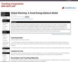
This is a teaching module, directed to undergraduate students in applied mathematics, …
This is a teaching module, directed to undergraduate students in applied mathematics, that presents a Zonal Energy Balance Model to describe the evolution of the latitudinal distribution of Earth's surface temperature subject to incremental levels of cumulative carbon emissions in the atmosphere. A strategy to avert "dangerous levels" of global warming is imbedded in the model. Students working with the module will write a computer code, using a software such as MATLAB or Mathematica, to obtain numerical solutions of the model and simulate strategies that guarantee controlled levels of global warming.
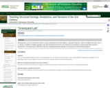
Because there is not a lot of surface structure to map in …
Because there is not a lot of surface structure to map in glacial terranes of the midwest, especially in big cities, various simulations can help. This is a "big-city" simulation of making a geologic map and interpreting the structure of a small area (a cemetery) by measuring the strike and dip of gravestones. This field activity is followed by lab work, including plotting the attitudes on stereonets and interpreting the patterns.
(Note: this resource was added to OER Commons as part of a batch upload of over 2,200 records. If you notice an issue with the quality of the metadata, please let us know by using the 'report' button and we will flag it for consideration.)
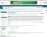
Minerals are inorganic chemical compounds with a wide range of physical and …
Minerals are inorganic chemical compounds with a wide range of physical and chemical properties. Geologists frequently measure and observe properties such as hardness, specific gravity, color, etc. Unfortunately, students usually view these properties simply as tools for identifying unknown mineral specimens. One of the objectives of this exercise is to make students aware of the fact that minerals have many additional properties that can be measured, and that all of the physical and chemical properties of minerals have important applications beyond that of simple mineral identification. Please do not let the title of this exercise scare you away. Introducing students to thermodynamics is not the primary objective. Getting students to "do" science - to observe, record, and interpret experimental data - is the primary goal. Heat capacity just happens to be a good vehicle for this purpose.
(Note: this resource was added to OER Commons as part of a batch upload of over 2,200 records. If you notice an issue with the quality of the metadata, please let us know by using the 'report' button and we will flag it for consideration.)
This homework has two parts. In the first part, the students use …
This homework has two parts. In the first part, the students use Stoke's Law to determine (a) the relative sizes of olivine and plagioclase settling at the same velocity (and relate their answer to observations made on cumulate rocks in the lab, (b) the length of time it would take a xenolith-bearing basalt on Hawaii to reach the surface, and (c) to realize that pumice landing on seawater will float, not sink! In part 2, the students fill out a worksheet to see the effects of simultaneous fractional crystallization of olivine, clinopyroxene, and plagioclase on residual melt composition, and then determine whether the melt follows a tholeiitic or calcalkaline trend. The homework involves simple algebra, but several unit conversions and normalization of the results. After the students hand in the homework, we have a class discussion on the assumptions and problems associated with using Stoke's Law to model magmatic processes. We also work with different colored marbles to see the effects of fractional removal of different "minerals" on residual magma composition. My main goal in assigning this homework is to have students see that they can use simple math to come up with results for themselves, and then to have them think about the significance of those results.
(Note: this resource was added to OER Commons as part of a batch upload of over 2,200 records. If you notice an issue with the quality of the metadata, please let us know by using the 'report' button and we will flag it for consideration.)
SSAC Physical Volcanology module. Students build a spreadsheet to examine how magma …
SSAC Physical Volcanology module. Students build a spreadsheet to examine how magma viscosity varies with temperature, fraction of crystals, and water content using the non-Arrhenian VFT model.
(Note: this resource was added to OER Commons as part of a batch upload of over 2,200 records. If you notice an issue with the quality of the metadata, please let us know by using the 'report' button and we will flag it for consideration.)
SSAC Physical Volcanology module. Students build spreadsheets to estimate melt density at …
SSAC Physical Volcanology module. Students build spreadsheets to estimate melt density at high temperatures and pressures from the thermodynamic properties of silicates.
(Note: this resource was added to OER Commons as part of a batch upload of over 2,200 records. If you notice an issue with the quality of the metadata, please let us know by using the 'report' button and we will flag it for consideration.)
SSAC Physical Volcanology module. Students build a spreadsheet to examine and apply …
SSAC Physical Volcanology module. Students build a spreadsheet to examine and apply the Mogi model for horizontal and vertical surface displacement vs. depth and pressure conditions in the magma chamber.
(Note: this resource was added to OER Commons as part of a batch upload of over 2,200 records. If you notice an issue with the quality of the metadata, please let us know by using the 'report' button and we will flag it for consideration.)
This activity is part of the community collection of teaching materials on …
This activity is part of the community collection of teaching materials on climate and energy topics. This activity was submitted by faculty as part of the CLEAN Energy Workshop, held in April, 2011.
(Note: this resource was added to OER Commons as part of a batch upload of over 2,200 records. If you notice an issue with the quality of the metadata, please let us know by using the 'report' button and we will flag it for consideration.)
SSAC Physical Volcanology module. Students build a spreadsheet to calculate velocity of …
SSAC Physical Volcanology module. Students build a spreadsheet to calculate velocity of rising magma in steady-state Plinian eruptions using conservation of mass and momentum.
(Note: this resource was added to OER Commons as part of a batch upload of over 2,200 records. If you notice an issue with the quality of the metadata, please let us know by using the 'report' button and we will flag it for consideration.)
Despite what we have learned from the theory of plate tectonics, the …
Despite what we have learned from the theory of plate tectonics, the specifics of how those plate motions contribute to movement along faults remain a matter of much debate. Since the discovery of plate tectonics, scientists have recognized that earthquake activity, both the orientation and magnitude, is related to plate motions. However, efforts to total up the motion simply associated with earthquakes often falls far short of the plate motions. This suggests that plates have a way to slide past one another along faults without generating earthquakes, and discovering what controls whether faults produce earthquakes is critical for better characterizing seismic hazards around the world. Scientists are using a combination of GPS and seismometer recordings to investigate this issue. Some portions of a fault reveal traditional earthquake stick-slip behavior where gradual GPS motions show the fault is locked for a long time while plate motions cause stress to accumulate at the fault until the rocks break and the fault moves over the span of minutes generating large seismic signals and an abrupt GPS motion. In 2003, researchers discovered that portions of a fault also release accumulated stress more gradually over the course of several weeks in the form of a slow slip event that is accompanied by weak seismic tremors observed in a narrow frequency range that requires specific filtering to observe. These new phenomena are described as episodic tremor and slip as they recur on nearly an annual basis, much more frequently than large earthquakes which can have recurrence intervals of 50-5000 years. To better understand how faults move, this activity will examine both GPS and seismic data in the Cascadia region to identify key observations and build interpretation from them.
(Note: this resource was added to OER Commons as part of a batch upload of over 2,200 records. If you notice an issue with the quality of the metadata, please let us know by using the 'report' button and we will flag it for consideration.)
This introductory exercise allows students to evaluate predictions from hydraulic geometry, area-discharge …
This introductory exercise allows students to evaluate predictions from hydraulic geometry, area-discharge scaling and downstream fining in a complex field environment. For many this is their first time collecting, entering, plotting and analyzing data. Designed for a geomorphology course Uses online and/or real-time data Addresses student fear of quantitative aspect and/or inadequate quantitative skills
(Note: this resource was added to OER Commons as part of a batch upload of over 2,200 records. If you notice an issue with the quality of the metadata, please let us know by using the 'report' button and we will flag it for consideration.)
No restrictions on your remixing, redistributing, or making derivative works. Give credit to the author, as required.
Your remixing, redistributing, or making derivatives works comes with some restrictions, including how it is shared.
Your redistributing comes with some restrictions. Do not remix or make derivative works.
Most restrictive license type. Prohibits most uses, sharing, and any changes.
Copyrighted materials, available under Fair Use and the TEACH Act for US-based educators, or other custom arrangements. Go to the resource provider to see their individual restrictions.