In this structured inquiry activity students will work in groups/ teams to …
In this structured inquiry activity students will work in groups/ teams to build a balloon rocket of their own design. The rocket will race in one dimension and require that they apply their knowledge of position, time, and velocity.
Students utilize the historical imagery function in Google Earth to determine the …
Students utilize the historical imagery function in Google Earth to determine the position of a barrier island on two different images collected in 1995 and 2013; they also compare to different topographic maps, one created in 1994 and the other in 2011. They use the measure tool in Google Earth to determine how far the island has migrated. They then calculate the migration rate, how far it would migrate in a give time period, and how long it would take to migrate a given distance. Finally, students navigate to a variety of locations to identify coastal landforms.
(Note: this resource was added to OER Commons as part of a batch upload of over 2,200 records. If you notice an issue with the quality of the metadata, please let us know by using the 'report' button and we will flag it for consideration.)
This document includes two activities related to earthquake base isolation. Learners explore …
This document includes two activities related to earthquake base isolation. Learners explore earthquake hazards and damage to buildings by constructing model buildings and subjecting the buildings to ground vibration (shaking similar to earthquake vibrations) on a small shake table. Base isolation a powerful tool for earthquake engineering. It is meant to enable a building to survive a potentially devastating seismic impact through a proper initial design or subsequent modifications. The buildings are constructed by two- or three-person learner teams.
(Note: this resource was added to OER Commons as part of a batch upload of over 2,200 records. If you notice an issue with the quality of the metadata, please let us know by using the 'report' button and we will flag it for consideration.)
This baseflow recession exercise will help students build skills in analyzing time …
This baseflow recession exercise will help students build skills in analyzing time series data in a spreadsheet. It should also open their eyes to the variation in streamflow, both at a single location over a year, and between locations across the US. Data have been gathered from 6 locations across the US. Each student is tasked with characterizing streamflow decline (baseflow recession) after precipitation events.
Index terms: hydrology, streamflow, baseflow recession
(Note: this resource was added to OER Commons as part of a batch upload of over 2,200 records. If you notice an issue with the quality of the metadata, please let us know by using the 'report' button and we will flag it for consideration.)
This assignment reviews basic of chemistry for students who should have had …
This assignment reviews basic of chemistry for students who should have had 2 introductory semesters of basic chemistry prior to enrolling in the Fundamental of Water Quality course for which the assignment is used. Assignment reviews basic equation balancing and questions about valence and concentration conversion that students will confront regularly in any geochemistry course.
(Note: this resource was added to OER Commons as part of a batch upload of over 2,200 records. If you notice an issue with the quality of the metadata, please let us know by using the 'report' button and we will flag it for consideration.)
Beginning econometrics students often have an uneven preparation in statistics. The simulation …
Beginning econometrics students often have an uneven preparation in statistics. The simulation gives students a clearer understanding of the behavior of OLS estimators.
In this project, students interpret a high-resolution image of result from an …
In this project, students interpret a high-resolution image of result from an experimental run of the Jurrasic Tank sedimentation simulator at the St. Anthony Falls Lab at the University of Minnesota. They are expected to interpret depositional environments, characterize simulated stratigraphic sections, and interpret the overall sedimentary architecture of the simulated basin. All of these observations are to put together onto a poster which is the final product of the project.
(Note: this resource was added to OER Commons as part of a batch upload of over 2,200 records. If you notice an issue with the quality of the metadata, please let us know by using the 'report' button and we will flag it for consideration.)
This is an Excel spreadsheet and graph that illustrates standard "batch" and …
This is an Excel spreadsheet and graph that illustrates standard "batch" and Rayleigh decarbonation models and how they can be used to detect fluid infiltration during metamorphism of carbonates. It makes a good lecture demonstration, but with a few modifications can be turned into a laboratory exercise. Key variables are "hotlinked" directly into the batch and Rayleigh models so students can adjust them to get a feel for the influence of different model parameters. The included carbon isotope data are from marbles in the Jervois region, central Australia (Cartwright et al., 1997). Oxygen isotope data are also included in the spreadsheet.
(Note: this resource was added to OER Commons as part of a batch upload of over 2,200 records. If you notice an issue with the quality of the metadata, please let us know by using the 'report' button and we will flag it for consideration.)
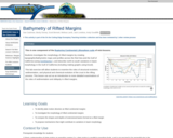
This is one component of the Rupturing Continental Lithosphere suite of mini-lessons. …
This is one component of the Rupturing Continental Lithosphere suite of mini-lessons. Students investigate the morphology of rifted margins by creating topographic/bathymetric maps and profiles across the Red Sea and the Gulf of California (using GeoMapApp ), and describe north-to-south variations in basin morphology in the Gulf of California (including making graphs using Excel). This lab exercise will allow students to examine the roles of structural evolution, sedimentation, and physical and chemical evolution of the crust in the rifting process. This lesson can act as an introduction to more detailed examinations of the roles of sedimentation and obliquity in rifted margins.
Participants learn what to do before, during, and after a potentially damaging …
Participants learn what to do before, during, and after a potentially damaging earthquake. They brainstorm valuable components for an emergency supplies backpack and then present on their ideas. The primary resource is the booklet Are you prepared for the next big EARTHQUAKE in Alaska?
(Note: this resource was added to OER Commons as part of a batch upload of over 2,200 records. If you notice an issue with the quality of the metadata, please let us know by using the 'report' button and we will flag it for consideration.)
This activity provides students with an in-class practice of landscape interpretation using …
This activity provides students with an in-class practice of landscape interpretation using slides of beaches shown by the instructor. Students view a select number of slides and are asked to classify each beach shown using the Wright and Short Beach Classification: dissipative, reflexive, and intermediate by visually identifying landforms and processes of each beach type. The outcome of this activity is that students have practice identifying landforms and processes and applying their observations and interpretations of geomorphic features and processes for an applied purpose. Designed for a geomorphology course Has minimal/no quantitative component
(Note: this resource was added to OER Commons as part of a batch upload of over 2,200 records. If you notice an issue with the quality of the metadata, please let us know by using the 'report' button and we will flag it for consideration.)
During the course of the day, students examine the high-grade metasupracrustal rocks, …
During the course of the day, students examine the high-grade metasupracrustal rocks, related gneisses, and the late Archean granitoids and mafic dikes. We have prepared a number of exercises that might be done with classes at different levels. Depending on the background and preparation of your class you might want to emphasize different learning skills specific to the class level: observation, interpretation, integration (i.e. multiple lines of evidence focused on a given problem), and synthesis (i.e. relationship to the "big picture", drawing from the corpus of geologic knowledge). We have also prepared a compilation of our key scientific results, but these are under seal and we'd like you to do the exercises first as if you were students before taking a look at the supporting evidence.
(Note: this resource was added to OER Commons as part of a batch upload of over 2,200 records. If you notice an issue with the quality of the metadata, please let us know by using the 'report' button and we will flag it for consideration.)
A Beautiful Mind won the Academy Award for best picture in 2001 …
A Beautiful Mind won the Academy Award for best picture in 2001 and it chronicles the life of John Nash who is noted for his pioneering work on general equilibrium theory. This scene is a great way to discuss self-interest and contrast it with the social optimum. Nash's work has augmented Adam Smith's "invisible hand" theory by extending how self-interest is modeled. This scene is must viewing even though the scene itself contains flawed economics (explaining why the scene is NOT a Nash equilibrium helps students learn the concept in greater depth).
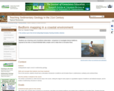
To prepare for this activity, students receive background on bedforms and flow …
To prepare for this activity, students receive background on bedforms and flow regimes in class and practice identifying and classifying bedforms from field photographs. Students are then given a map of a barrier beach/inlet/tidal delta complex in mid-coast Maine and asked to predict what bedforms they expect to find in specific sub-environments. During a subsequent field trip to the area, students observe, classify and map bedforms and relate them qualitatively to formative flows. Qualitative description and classification are supplemented by quantitative measurements of bedform morphology and orientation, and by GPS-located digital photographs. After the trip, students compare their predictions and observations of bedforms in the sub-environments, reflecting on the reasons for the differences and the evolution of their thinking. The exercise also serves to set the stage for subsequent quantitative studies of bedforms and bedload transport, as well as interpretation of sedimentary structures and clastic depositional environments in the geological record.
(Note: this resource was added to OER Commons as part of a batch upload of over 2,200 records. If you notice an issue with the quality of the metadata, please let us know by using the 'report' button and we will flag it for consideration.)
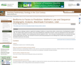
Students are given the task of predicting where parasequence boundaries would exist …
Students are given the task of predicting where parasequence boundaries would exist within a vertical section of the Blackhawk Formation, Utah. This activity challenges students to apply their knowledge of bedforms in order to interpret the facies they observe. The students work in groups of two as they make their observations. The vertical section consists of four main outcrops to be observed by the students. After making their observations and interpretations of these four outcrops, the students then make predictions of what should be found up section. Students begin down section by observing the lowest section of the four outcrops. The students make observations about lithology, grain size, sedimentary structures and trace fossils. After recording their observations in their field notebook the class gathers for a discussion. Students are called on randomly to discuss what they observed. The class creates a group stratigraphic column on a white board and includes their observations to the right of the drawn profile. They are then asked to interpret what facies these observations represent. The students defend their interpretations and, as a group, agree upon an interpretation. The facies interpretation is then added to the white board and the group moves to the next outcrop up section. After observing, describing and interpreting each of the four outcrops the students are challenged to use all of the information gathered thus far to predict what facies should be observed further up section. This exercise provides an opportunity for the students to make and defend observations and interpretations. They also get a sense for the importance of Walther's Law and how it relates to sequence stratigraphy.
(Note: this resource was added to OER Commons as part of a batch upload of over 2,200 records. If you notice an issue with the quality of the metadata, please let us know by using the 'report' button and we will flag it for consideration.)
This field mapping and map-making exercise is a capstone project for a …
This field mapping and map-making exercise is a capstone project for a course on Geological Maps. Over a weekend (~12 hours of field work), students collect lithologic and structural data from outcrops scattered over a one square mile area. Back in the classroom, students digitally compile their field data (outcrop, structure measurements, traverse locations) into ArcMAP. They infer geologic linework (faults and contacts) and units from this data in ArcMAP and then export these data layers into Illustrator. In Illustrator, they add ancillary map components (a cross section, description of map units, correlation diagram, map symbol legend,...) to create a final map at a 1:10,000 scale. Their maps are printed out on 11"x17" paper and saved as a pdf file. This exercise helps the students to appreciate how field data is collected and how these geologic facts are interpretively organized into a four-dimensional picture that is a geologic map.
(Note: this resource was added to OER Commons as part of a batch upload of over 2,200 records. If you notice an issue with the quality of the metadata, please let us know by using the 'report' button and we will flag it for consideration.)
Students collect gps locational and strike and dip data on a day-long …
Students collect gps locational and strike and dip data on a day-long fieldtrip to Cliff Island. The data is then used in ArcGIS to make a bedrock geologic map of the island. The final map is exported from Arc and prepared in Adobe InDesign as a tabloid size poster.
(Note: this resource was added to OER Commons as part of a batch upload of over 2,200 records. If you notice an issue with the quality of the metadata, please let us know by using the 'report' button and we will flag it for consideration.)
In this exercise, students will use the Neotoma database and ArcGIS Online …
In this exercise, students will use the Neotoma database and ArcGIS Online to create a distribution map of modern collection localities of beetle taxa associated with an assemblage of fossil beetles from the Conklin Quarry site in eastern Iowa.
a data rich exercise to help students discover how organisms move in response to climate change
(Note: this resource was added to OER Commons as part of a batch upload of over 2,200 records. If you notice an issue with the quality of the metadata, please let us know by using the 'report' button and we will flag it for consideration.)
This activity is a scientific investigation focusing on inquiry after using the …
This activity is a scientific investigation focusing on inquiry after using the Foss Water Kit. The students will pose a question, create a procedure and produce a poster showing their findings.
No restrictions on your remixing, redistributing, or making derivative works. Give credit to the author, as required.
Your remixing, redistributing, or making derivatives works comes with some restrictions, including how it is shared.
Your redistributing comes with some restrictions. Do not remix or make derivative works.
Most restrictive license type. Prohibits most uses, sharing, and any changes.
Copyrighted materials, available under Fair Use and the TEACH Act for US-based educators, or other custom arrangements. Go to the resource provider to see their individual restrictions.