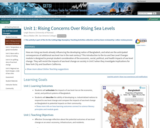
How are rising sea levels already influencing the developing nation of Bangladesh, …
How are rising sea levels already influencing the developing nation of Bangladesh, and what are the anticipated consequences of additional sea level rise in the next century? This introduction to the Ice and Sea Level Changes module is designed to prompt student consideration of the economic, social, political, and health impacts of sea level change. They will revisit the impacts of sea level change on society in Unit 5 when they investigate implications for New York City and Southern California.
Show more about Online Teaching suggestions Hide Online-ready: This opening class discussion about climate change and societal impacts could be converted to an online discussion format.
(Note: this resource was added to OER Commons as part of a batch upload of over 2,200 records. If you notice an issue with the quality of the metadata, please let us know by using the 'report' button and we will flag it for consideration.)
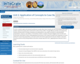
In Unit 2, students apply and evaluate foundational concepts about storm hazards …
In Unit 2, students apply and evaluate foundational concepts about storm hazards and risk in the context of two cases studies: Superstorm Sandy (2012) and the Storm of the Century (1993). Through different activities and assignments, students develop skills for finding, evaluating, and relating data to case studies and build an understanding of preparedness, response, and resilience. The activities include: an analysis of hazard mitigation plans for their local community, examination of storm-related geophysical processes in the context of societal risks, preparation of a press release for community preparedness, and a peer review and revision opportunity for the press releases. Instructors may also end this unit by having students revise their concept maps from Unit 1, applying lessons learned in Units 1 and 2.
(Note: this resource was added to OER Commons as part of a batch upload of over 2,200 records. If you notice an issue with the quality of the metadata, please let us know by using the 'report' button and we will flag it for consideration.)
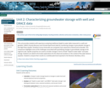
This unit provides students with experience analyzing traditional (depth to water table …
This unit provides students with experience analyzing traditional (depth to water table measured in a well) and geodetic: GRACE (Gravity Recovery and Climate Experiment) data for monitoring changes in groundwater storage in the High Plains Aquifer. Variations across timescales are compared, from seasonal to interannual to decadal. This comparison highlights some of the challenges associated with quantifying changes in groundwater storage at the regional scale. Aquifer properties are used to consider changes in terms of both "depth to water table" and water storage. Students are asked to formulate explanations for the observed variations in the context of the water balance equation. Students compare their results to a multidecadal trend reported in the literature (Konikow, 2011).
Show more about Online Teaching suggestions Hide Online-ready: The exercise is electronic and could be done individually or in small online groups. Lecture is best done synchronously due to the technical nature. Discussion would be better that way too.
(Note: this resource was added to OER Commons as part of a batch upload of over 2,200 records. If you notice an issue with the quality of the metadata, please let us know by using the 'report' button and we will flag it for consideration.)
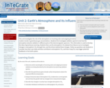
This unit investigates the role of the atmosphere on incoming solar and …
This unit investigates the role of the atmosphere on incoming solar and outgoing terrestrial radiation and analyzes modern trends in greenhouse gas concentrations. Students first investigate radiation spectra to see how the atmosphere absorbs radiation in different parts of the electromagnetic spectrum. This information is used to develop the idea of greenhouse warming. Students then use the atmospheric CO2 dataset from Mauna Loa to investigate changes in atmospheric CO2 through time, and the drivers behind these changes. Follow-up questions ask students to consider how their own daily activities contribute to atmospheric CO2, and how rising CO2 may trigger potential feedbacks in the Earth system.
(Note: this resource was added to OER Commons as part of a batch upload of over 2,200 records. If you notice an issue with the quality of the metadata, please let us know by using the 'report' button and we will flag it for consideration.)
What is the contribution of seawater thermal expansion to recent sea-level rise? …
What is the contribution of seawater thermal expansion to recent sea-level rise? In this unit, students create time-series graphs of global averaged sea surface temperature anomaly (SSTA) data spanning 1880 -- 2017 and conduct linear trend analysis to assess SST change during this period. Based on the calculated SST change, students calculate how much sea-level rise occurred during 1993 -- 2015 due to thermal expansion of the oceans. Students compare their thermal expansion calculated sea-level rise results to observed sea-level rise from radar altimetry and assess how much sea-level rise is attributable to thermal expansion.
Show more about Online Teaching suggestions Hide Online-ready: The exercise is electronic and could be done individually or in small online groups. Lecture is best done synchronously due to the technical nature. Discussion would be better that way too.
(Note: this resource was added to OER Commons as part of a batch upload of over 2,200 records. If you notice an issue with the quality of the metadata, please let us know by using the 'report' button and we will flag it for consideration.)
Students will be provided with seawater pH and carbon dioxide concentration (pCO2) …
Students will be provided with seawater pH and carbon dioxide concentration (pCO2) data spanning as far back as 1850. They will describe trends in pH, pCO2 and atmospheric CO2 concentration, outline why these parameters are related, and predict how changes in these parameters will affect marine biology. Each group of students will be given a different set of data from different regions and asked to compare with other groups to determine if seawater pH change is a global or regional phenomena. This unit will provide students with an understanding of the pH buffering system and an opportunity to interpret real climate data.
(Note: this resource was added to OER Commons as part of a batch upload of over 2,200 records. If you notice an issue with the quality of the metadata, please let us know by using the 'report' button and we will flag it for consideration.)
Armed with an overview of the complexity of issues associated with global …
Armed with an overview of the complexity of issues associated with global food security, this unit begins by contextualizing food security as an example of a wicked problem. Wicked problems are problems that are unsolvable in the traditional sense, and have complex multiscalar causal factors that contribute to the creation of new issues as old ones are addressed. Both global food security and climate change are examples of wicked problems. This unit presents systems thinking as a way to identify complex problems and explore solutions. Using a flipped classroom model, students complete a self study tutorial that presents system concepts in the context of Earth system science. The slide stack includes two guided activities related to the carbon cycle and soils. A short reading, "Why Systems Thinking?" and a video clip is included in the tutorial. Authentic assessment of the homework activity is an Earth system diagram connected to one of the issues of global food security from Unit 1 that they will bring to class. After a short class discussion that introduces concepts of sustainability and ecosystem services as related to food production, students are broken into groups and are asked to create their own systems diagram of the global food system, using the organizational systems concepts they examined as homework and the introduction activities of Unit 1. After completing the diagrams, students examine a food system diagram example, and identify the components of the system using standardized systems language. Students can photograph their diagrams or make quick sketches so they have a working copy to include with their notes.
(Note: this resource was added to OER Commons as part of a batch upload of over 2,200 records. If you notice an issue with the quality of the metadata, please let us know by using the 'report' button and we will flag it for consideration.)
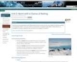
How have average global air temperature and sea level changed in the …
How have average global air temperature and sea level changed in the last three decades? Have the changes been consistent? Can future changes in air temperature and sea level be predicted? In this unit, students will become familiar with the concept of a time series by calculating recent air temperature and sea level trends and projecting these measurements for 2100. They will also begin to consider environmental factors in addition to temperature that could influence sea level and the potential implications of sea level changes during the next century.
Show more about Online Teaching suggestions Hide Online-adaptable: The lecture and main data analysis exercise can easily be moved online. Student discussions are designed to be intermixed into the flow of the lecture and exercise. Thus moving to online discussions would be might take a bit more planning.
(Note: this resource was added to OER Commons as part of a batch upload of over 2,200 records. If you notice an issue with the quality of the metadata, please let us know by using the 'report' button and we will flag it for consideration.)
Students will explore the different aspects of the carbon cycle on Earth. …
Students will explore the different aspects of the carbon cycle on Earth. This includes the original source of all the carbon on our planet, the near ubiquity of carbon, the six principle reservoirs of carbon in the Earth system, and the movement (flux) of carbon between reservoirs. Students will approach the chemical history of carbon by personifying the "journey" of specific carbon atoms throughout geologic time. The unit emphasizes the grand challenges of energy resources and climate change by grounding these issues in a solid understanding of carbon from a systems thinking perspective. The point here is for students to gain a more robust appreciation for the movement of carbon between atmosphere and geosphere, between hydrosphere and biosphere. The unit provides dynamic understanding of how perturbations to one sphere or changes in the amount of carbon in a given reservoir can have implications throughout the Earth system.
(Note: this resource was added to OER Commons as part of a batch upload of over 2,200 records. If you notice an issue with the quality of the metadata, please let us know by using the 'report' button and we will flag it for consideration.)
This unit applies a flipped classroom model. Students complete a self-study tutorial …
This unit applies a flipped classroom model. Students complete a self-study tutorial prior to attending class. Students are then asked work independently or in pairs to generate a time-aware climate change Web map application using ArcGIS Online. Returning to the theme of cocoa production introduced in Unit 1, students identify climatic conditions conducive for cacao production around the world, especially West Africa where the majority of cacao is grown. Students then use a web application in ArcGIS Online to create a time aware map showing biomes in the KÃppen Climate Classification System and determine how projected climate changes will impact the suitable production regions for cacao in West Africa. Using a jigsaw model, students collect into groups of 4, with a representative from each of the IPCC scenarios, and they compare the the impact of the 4 scenarios in specified cocoa production regions. At the end of the class they will be assigned to one of three regional areas for group work in Units 4-6.
(Note: this resource was added to OER Commons as part of a batch upload of over 2,200 records. If you notice an issue with the quality of the metadata, please let us know by using the 'report' button and we will flag it for consideration.)
After an opening discussion of systems thinking and models, student use webDICE …
After an opening discussion of systems thinking and models, student use webDICE , an online Dynamic Integrated Climate Economy model developed by Center for Robust Decision Making on Climate and Energy Policy at the University of Chicago. Students will manipulate input parameters and interpret output in small groups in-class and individually out of class to complete the major mid-module assignment. The goal is to develop their understanding of the sources of uncertainty around future predictions of climate change and its impacts. Students are also introduced to the concept of Social Cost of Carbon (SCC) which is central to subsequent units in this module.
(Note: this resource was added to OER Commons as part of a batch upload of over 2,200 records. If you notice an issue with the quality of the metadata, please let us know by using the 'report' button and we will flag it for consideration.)
In this high school unit on ecosystems, students investigate the case of …
In this high school unit on ecosystems, students investigate the case of the rapid increase and decline of the buffalo population in the Serengeti. It motivates students to ask questions and develop initial hypotheses for what could have changed in the ecosystem to create such drastic population changes. Students analyze data from many populations of organisms in the Serengeti to figure out how disease eradication in the 1960s led to the major changes we see in the Serengeti today. In Bend 2, students evaluate the claim that trees store carbon and can reduce the impact of climate change. Students figure out how photosynthesis and cellular respiration are key mechanisms to explaining the role of trees in climate mitigation. Finally, students explore and compare climate change mitigation solutions.
In this unit, we use energy flows within the climate system to …
In this unit, we use energy flows within the climate system to introduce climate feedbacks and system diagrams. The class session uses an interactive lecture approach having students work on multiple tasks throughout the class session. A system diagram highlighting the complexity of climate change mitigation policy is created to highlight the interdisciplinary nature of addressing anthropogenically forced climate change. The climatic effects of volcanic eruptions are highlighted to provide necessary scaffolding for this module's capstone assessment.
(Note: this resource was added to OER Commons as part of a batch upload of over 2,200 records. If you notice an issue with the quality of the metadata, please let us know by using the 'report' button and we will flag it for consideration.)
Students will be introduced to a few of the different methods used …
Students will be introduced to a few of the different methods used in paleoclimatology, including isotopic ratios as paleotemperature proxies. They will investigate the greenhouse gas connections of two ancient climate episodes, the cold "Snowball Earth" of the Neoproterozoic and the hot "Paleocene-Eocene Thermal Maximum" (PETM) of the Cenozoic. The unit emphasizes the grand challenges of energy resources and climate change by grounding these issues in an understanding of ancient climate from a systems thinking perspective. Students will gain a more robust appreciation for the record of the movement of carbon between atmosphere, geosphere, hydrosphere, and biosphere over geologic time, and how various components of the Earth system respond to those perturbations. The unit practices geoscientific habits of mind, such as comparing modern processes to ancient analogues recorded by geologic processes, as well as the importance of converging lines of evidence, and recognition of Earth as a long-lived, dynamic, and complex system.
(Note: this resource was added to OER Commons as part of a batch upload of over 2,200 records. If you notice an issue with the quality of the metadata, please let us know by using the 'report' button and we will flag it for consideration.)
What is the contribution of melting ice sheets compared to other sources …
What is the contribution of melting ice sheets compared to other sources of sea-level rise? How much is the sea level projected to increase during the twenty-first century? In this unit students will use Gravity Recovery and Climate Experiment (GRACE) ice-mass loss time series from Greenland and Antarctica to calculate sea-level rise due to the addition of freshwater inputs from melting ice sheets, and use Interferometric Synthetic Aperture Radar (InSAR) ice-velocity data to extrapolate which regions of the ice sheets are losing the greatest mass. Sea-level rise from melting ice sheets is then contrasted to the other dominant causes of sea-level rise, including thermal expansion, melting glaciers, and changes in land water storage. Lastly, students will extrapolate how much sea-level rise will occur by year 2100 based on recent observed rates of sea-level rise and compare these values to sea-level rise projections from the Intergovernmental Panel on Climate Change.
Show more about Online Teaching suggestions Hide Online-ready: The exercise is electronic and could be done individually or in small online groups. Lecture is best done synchronously due to the technical nature. Discussion would be better that way too.
(Note: this resource was added to OER Commons as part of a batch upload of over 2,200 records. If you notice an issue with the quality of the metadata, please let us know by using the 'report' button and we will flag it for consideration.)
This unit shows how GPS records of surface elevation can be used …
This unit shows how GPS records of surface elevation can be used to monitor groundwater changes. Students calculate secular trends in the GPS time series and then use the original and detrended records to identify sites that are dominated by the elastic response to regional groundwater changes versus those dominated by local subsidence. They then compare the magnitude and timescales of fluctuations in Earth's surface elevation that result from sediment compaction, regional groundwater extraction, and natural climatic variability. This unit provides students with hands-on experience of the challenges and advantages of using geodetic data to study the terrestrial water cycle. The case study area is in California and the GPS records include the period of the profound 2012 -- 2016 drought.
Show more information on GPS versus GNSS Hide Note: Although the term GPS (Global Positioning System) is more commonly used in everyday language, it officially refers only to the USA's constellation of satellites. GNSS (Global Navigation Satellite System) is a universal term that refers to all satellite navigation systems including those from the USA (GPS), Russia (GLONASS), European Union (Galileo), China (BeiDou), and others. In this module, we use the term GPS even though, technically, some of the data may be coming from satellites in other systems.
Show more about Online Teaching suggestions Hide Online-ready: The exercise is electronic and could be done individually or in small online groups. Lecture is best done synchronously due to the technical nature. Discussion would be better that way too.
(Note: this resource was added to OER Commons as part of a batch upload of over 2,200 records. If you notice an issue with the quality of the metadata, please let us know by using the 'report' button and we will flag it for consideration.)
Students will be able to identify the functional roles that organisms play …
Students will be able to identify the functional roles that organisms play in ocean ecosystems. How do human-induced changes in ocean conditions affect biodiversity, and thereby the health and resilience of a coral reef? Students explore and discuss the direct and indirect impacts that ocean acidification can have on species, food web dynamics, ecosystem function, and commercial resources. At the end of this unit the students should be able to articulate how changes in ocean chemistry can create negative outcomes for humans who depend on living ocean resources.
(Note: this resource was added to OER Commons as part of a batch upload of over 2,200 records. If you notice an issue with the quality of the metadata, please let us know by using the 'report' button and we will flag it for consideration.)
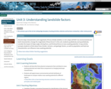
How do slope characteristics and magnitude of forces dictate whether or not …
How do slope characteristics and magnitude of forces dictate whether or not a slope will fail? Can environmental and built characteristics change the magnitude of these forces? In this unit, students qualitatively and quantitatively consider the impact of slope angle, driving force, and frictional force on mass-wasting potential. A map activity prompts students to think about how climatic, tectonic, and geologic factors, as well as population and land use characteristics can influence mass-wasting potential.
Show more about Online Teaching suggestions Hide Online-adaptable: Part 1 (lecture) and Part 3 (discussion) are particularly straight forward to adapt to online. Part 2 student exercise is typically done with printed maps but can be successfully adapted to online by having synchronous groups of students work together to annotate digital map files using: 1) PDF annotation tools in Adobe or 2) putting the map images into a Google Slides file and using the scribble tool. Google Earth files are also provided as an additional option.
(Note: this resource was added to OER Commons as part of a batch upload of over 2,200 records. If you notice an issue with the quality of the metadata, please let us know by using the 'report' button and we will flag it for consideration.)
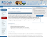
Unit 3 addresses concepts related to urban-atmosphere interactions. The content explores how …
Unit 3 addresses concepts related to urban-atmosphere interactions. The content explores how urban landscapes and atmospheric constituents modify or interact with the atmosphere to affect temperature, clouds, rainfall, and other parts of the water cycle. Fundamental concepts of weather and climate are established. The unit then transitions to focus on the "urbanized" environment and its complex interactions with the atmosphere. Students will learn about interactions such as 1) urban modification of surface temperature and energy exchanges; 2) water cycle components; 3) cloud-rainfall evolution within urban environments; and 4) applications to real societal challenges like urban flooding. The unit integrates basic meteorological/climatological analyses, geospatial thinking, and integration of scientific concepts within a real world context.
(Note: this resource was added to OER Commons as part of a batch upload of over 2,200 records. If you notice an issue with the quality of the metadata, please let us know by using the 'report' button and we will flag it for consideration.)
How are recent air temperature trends influencing Greenland's ice mass? Are ice …
How are recent air temperature trends influencing Greenland's ice mass? Are ice mass changes in Greenland spatially and temporally uniform? In this unit, students use atmospheric and geodetic data (GRACE, InSAR, altimetry) to investigate the location, magnitude, and causes of ice mass changes in Greenland.
Show more about Online Teaching suggestions Hide Online-adaptable:Main exercise is a jigsaw activity that can be successfully done in an online course; but it does take a bit of extra effort to arrange the students into two different sets of online groups with online collaboration. This will probably be more success in a synchronous format. OR the unit could be adapted away from the jigsaw format with Parts 2 and 3 below combined into a single exercise done individually or in static small groups.
(Note: this resource was added to OER Commons as part of a batch upload of over 2,200 records. If you notice an issue with the quality of the metadata, please let us know by using the 'report' button and we will flag it for consideration.)
No restrictions on your remixing, redistributing, or making derivative works. Give credit to the author, as required.
Your remixing, redistributing, or making derivatives works comes with some restrictions, including how it is shared.
Your redistributing comes with some restrictions. Do not remix or make derivative works.
Most restrictive license type. Prohibits most uses, sharing, and any changes.
Copyrighted materials, available under Fair Use and the TEACH Act for US-based educators, or other custom arrangements. Go to the resource provider to see their individual restrictions.