This is an activity about identifying images of different space bodies and …
This is an activity about identifying images of different space bodies and determining the cause of the craters pictured in each. Learners will use the Solar System Update software within Space Update to complete a worksheet. This is Solar System Activity 4 in Space Update.
A case-study approach can be used to introduce students to the work …
A case-study approach can be used to introduce students to the work that geologists do as environmental consultants. Data used by environmental consultants for a Brownfield site that is currently undergoing redevelopment in St. Paul, MN has been adapted for in-class study, either as a series of short exercises, or as part of a larger project.
(Note: this resource was added to OER Commons as part of a batch upload of over 2,200 records. If you notice an issue with the quality of the metadata, please let us know by using the 'report' button and we will flag it for consideration.)
Explore geological wonders, firsthand. Visit an EarthCache and learn from the rocks under …
Explore geological wonders, firsthand. Visit an EarthCache and learn from the rocks under your feet. An EarthCache is a special type of geocache you can visit to learn a geology lesson developed by the community. This EarthCache is located on the Columbia College campus, in Columbia, CA. After completing this EarthCache, you will learn more about the geology under your feet here.
Rating: Example of High Quality NGSS Design Awarded the NGSS Design Badge …
Rating: Example of High Quality NGSS Design
Awarded the NGSS Design Badge
Science Discipline: Life Science, Earth and Space Science, Physical Science
Length: Unit
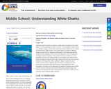
Numerous reports suggest an increase in white shark encounters in the United States in recent years and the public is worried. In this integrated middle school unit, students engage in three-dimensional learning that enables them to explain the phenomenon. White sharks in the coastal waters of Southern California serve as a case study for students to ask questions and build understanding. Students initially question if white shark encounters are in fact increasing and investigate reports of sightings. They wonder if we know whether or not the population is on the rise, leading students to next explore past evidence from fossils and data from historic fishers logs. Students then question how scientists today are monitoring white sharks, setting the stage to explore the use of modern tracking devices (digging deep into waves and signals) and what researchers know about white sharks because of the application of this technology. This opens up the opportunity for students to question and consider what the science community has learned about white shark life history, how humans have impacted the white shark population off Southern California, and to devise a way to address public concerns.
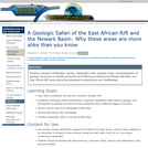
This activity explores the similarity and differences between the Newark Rift Basin …
This activity explores the similarity and differences between the Newark Rift Basin and East African Rift.
(Note: this resource was added to OER Commons as part of a batch upload of over 2,200 records. If you notice an issue with the quality of the metadata, please let us know by using the 'report' button and we will flag it for consideration.)
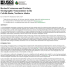
Cretaceous and Tertiary strata exposed in northern Alaska record clastic sediment deposition …
Cretaceous and Tertiary strata exposed in northern Alaska record clastic sediment deposition within a foreland basin adjacent to the ancestral Brooks Range, and form part of an important petroleum play. The goal of this U.S. Geological Survey report is to synthesize the complex stratigraphy of this area into a more simplified scheme. It discusses the regional geology of northern Alaska and the stratigraphy of the Colville Basin in detail. Maps, cross sections, correlation charts, and numerous outcrop photos with detailed captions accompany the text.
Spreadsheets Across the Curriculum/Geology of National Parks module. Students calculate the amount …
Spreadsheets Across the Curriculum/Geology of National Parks module. Students calculate the amount of rock removed and the value of copper produced at the great Keweenaw District up to 1925.
This U.S. Geological Survey clearinghouse provides a diverse array of over 40 …
This U.S. Geological Survey clearinghouse provides a diverse array of over 40 links to information on the Yellowstone volcanic system. The links are organized by category, including background and information; special items of interest; maps, graphics, and images; items of interest; useful links; educational outreach; and other menus of interest.
Students write a short essay using relative age principles to describe a …
Students write a short essay using relative age principles to describe a fictional set of geologic events and processes (specified in the exercise) that occur in a hypothetical area. The essay is used to develop a geologic profile, and then it is given to another student who is tasked with producing the correct geologic profile (as a quiz), based on the essay information. A teacher-designed rubric is used to score the quiz and to allow students to complete a self-evaluation of their learning.
In this activity, students are asked to consider three different rocks: granite, …
In this activity, students are asked to consider three different rocks: granite, shale and schist. Can these rocks become one of the others through geologic processes? Students are asked to describe the relationships between the rock types, the geologic processes involved and the geologic evidence for these relationships. Diagrams to help support their answers are suggested but not required.
(Note: this resource was added to OER Commons as part of a batch upload of over 2,200 records. If you notice an issue with the quality of the metadata, please let us know by using the 'report' button and we will flag it for consideration.)
In this video from the Science and Technology Chat series, learn about …
In this video from the Science and Technology Chat series, learn about astrobiology, an interdisciplinary field that uses biology, astronomy, and geology to study the origins of life on Earth and to search for possible life on other planets.
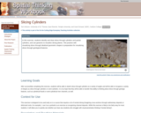
Students identify and draw slices through cylinders and partial cylinders, and use …
Students identify and draw slices through cylinders and partial cylinders, and use gestures to visualize slicing planes. This practice with visualizing slices through idealized geometric shapes is preparation for visualizing slices through geological features.
Students use aerial photography combined with field observation to interpret the geology …
Students use aerial photography combined with field observation to interpret the geology of a megascopic anticline-syncline pair exposed in the Ouachita Mountains of central Arkansas. This project focuses on the integration of remotely-sensed data with direct observation to develop and test hypotheses regarding the geology and structure of a well-defined field area. Students construct a geological map and cross-section that synthesize their observations and illustrate the geology of the field area.
(Note: this resource was added to OER Commons as part of a batch upload of over 2,200 records. If you notice an issue with the quality of the metadata, please let us know by using the 'report' button and we will flag it for consideration.)
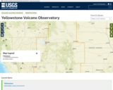
This is the homepage of the United States Geological Survey's (USGS) Yellowstone …
This is the homepage of the United States Geological Survey's (USGS) Yellowstone Volcano Observatory. It features news articles, monitoring information, status reports and information releases, and information on the volcanic history of the Yellowstone Plateau Volcanic Field. Users can access monthly updates with alert levels and aviation warning codes and real-time data on ground deformation, earthquakes, and hydrology. There is also a list of online products and publications, and an image gallery
Spreadsheets Across the Curriculum module/Geology of National Parks course. Students use foundational …
Spreadsheets Across the Curriculum module/Geology of National Parks course. Students use foundational math to calculate such earthquake-related numbers as fault displacement rate and earthquake recurrence interval associated with the San Andreas Fault at Point Reyes National Seashore.
In this activity, students play the roles of consultants in developing a …
In this activity, students play the roles of consultants in developing a geologic 'tour' south od Rochester, New York, near the Pennsylvania border. They will gather information on the local rock types and underlying geology, examine an assemblage of fossils from the bedrock and from glacial erratics, and prepare a report detailing the geology with cross-sections and a timeline based on the fossil occurrences. They will also develop a plan for a walking tour highlighting the geology of the area.
The geologic record demonstrates that our environment has changed over a variety …
The geologic record demonstrates that our environment has changed over a variety of time scales from seconds to billions of years. This course explores the many ways in which geologic processes control and modify the Earth’s environment and serves as an introduction to Environmental Earth Science Field Course (12.120), which addresses field applications of these principles in the American Southwest.
This activity is a field investigation where students reconstruct parts of Winona's …
This activity is a field investigation where students reconstruct parts of Winona's Paleozoic environment through observations of a local outcrop and the application of basic geologic principles.
Short Description: In this class, students will explore diverse topics in the …
Short Description: In this class, students will explore diverse topics in the geosciences at a high level. Students who complete this class will have had the opportunity acquire the skills needed to engage in advanced geologic study.
Word Count: 30933
(Note: This resource's metadata has been created automatically by reformatting and/or combining the information that the author initially provided as part of a bulk import process.)
No restrictions on your remixing, redistributing, or making derivative works. Give credit to the author, as required.
Your remixing, redistributing, or making derivatives works comes with some restrictions, including how it is shared.
Your redistributing comes with some restrictions. Do not remix or make derivative works.
Most restrictive license type. Prohibits most uses, sharing, and any changes.
Copyrighted materials, available under Fair Use and the TEACH Act for US-based educators, or other custom arrangements. Go to the resource provider to see their individual restrictions.