Students explore water quality and freshwater access issues around the globe. The …
Students explore water quality and freshwater access issues around the globe. The activities require students to investigate region-specific water problems in different parts of the world and analyze how those issues are sometimes remedied. The materials in this unit may be used as a stand-alone day of instruction or as part of the complete Environmental Justice and Freshwater Resources InTeGrate Module.
(Note: this resource was added to OER Commons as part of a batch upload of over 2,200 records. If you notice an issue with the quality of the metadata, please let us know by using the 'report' button and we will flag it for consideration.)
The assignment is to calculate an annual water balance for a tree …
The assignment is to calculate an annual water balance for a tree using data gathered at the Southern Sierra Critical Zone Observatory. In the framework of experimental design, students will organize around a research question "Is there enough water in the soil to account for transpiration?" After gathering and organizing data, students will calculate the annual water fluxes and reservoirs using a mass balance approach. Later these lessons can be expanded to catchment-scale calculations.
(Note: this resource was added to OER Commons as part of a batch upload of over 2,200 records. If you notice an issue with the quality of the metadata, please let us know by using the 'report' button and we will flag it for consideration.)
Units 3 and 4 of this module explored how water resources are …
Units 3 and 4 of this module explored how water resources are used for agriculture in the United States and how this can vary depending on location. In Unit 5, students explore how agricultural practices can affect the water quality in streams, rivers, lakes, and coastal areas. Important concepts in this unit include processes that transport suspended material (e.g., sediment) and dissolved material (e.g., nutrients) away from crop fields and into regional water bodies. The effects of dissolved nutrients on the health of the water ecosystems will be presented with examples of hypoxic zones in coastal areas and lake eutrophication. This last unit is well-suited to foster student advancement in systems thinking.
(Note: this resource was added to OER Commons as part of a batch upload of over 2,200 records. If you notice an issue with the quality of the metadata, please let us know by using the 'report' button and we will flag it for consideration.)
Students explore the classic case of Love Canal, New York, in which …
Students explore the classic case of Love Canal, New York, in which Lois Gibbs -- originally described as a "hysterical housewife" -- mobilized her community and called attention to the contamination of groundwater by buried hazardous waste and the resulting impact on the health of local residents. The activities require the students to investigate the history of events at Love Canal. The materials in this unit may be used as a stand-alone day of instruction or as part of the complete Environmental Justice and Freshwater Resources InTeGrate Module.
(Note: this resource was added to OER Commons as part of a batch upload of over 2,200 records. If you notice an issue with the quality of the metadata, please let us know by using the 'report' button and we will flag it for consideration.)
Screenshot of the slider tool used to relate geophysical images to vegetation …
Screenshot of the slider tool used to relate geophysical images to vegetation pattern
Provenance: Lee Slater, Rutgers University-Newark Reuse: This item is in the public domain and maybe reused freely without restriction. In this unit, students explore spatial associations between the three-dimensional electromagnetic (EM) conductivity inversions and the visible patterns of Salicornia (Pickleweed) introduced in Unit 1, Exploring Harrier Meadow. The Arcview Storymap started in Unit 1 allows students to overlay inverted electrical conductivity patterns for different depths on aerial photographs of Harrier Meadow that highlight the patches of Pickleweed. Students analyze how conductivity patterns vary with depth and explore for evidence for a relationship between electrical conductivity and Pickleweed patches based on the hypothesis introduced in Unit 1. Students then perform an integrated interpretation of both the EM and electrical imaging inversions along with the results of direct sampling (coring, pore water sampling, soil characterization) conducted at locations selected using the electrical conductivity patterns observed in the EM dataset. Students perform basic qualitative assessments of the correlation between physical and chemical properties of the sampled soils and soil electrical conductivity from the EM inversions. Students finish the module by evaluating the extent to which the geophysical dataset and supporting direct measurements support the hypothesis pertaining to the cause of the Salicornia clusters introduced in Unit 1.
(Note: this resource was added to OER Commons as part of a batch upload of over 2,200 records. If you notice an issue with the quality of the metadata, please let us know by using the 'report' button and we will flag it for consideration.)
Students will utilize the desert Southwest region of the United States and …
Students will utilize the desert Southwest region of the United States and the Ogallala Aquifer in a case study to evaluate issues regarding groundwater and its scarcity. Groundwater is often seen as a limitless resource in the Southwest since there is little regulation controlling the amount that is withdrawn (Rule of Capture). This mentality has led to overuse and to the dwindling supply of groundwater in many parts of the Ogallala Aquifer. This module will help students connect groundwater's role in the hydrological cycle to issues of inequity that can occur when groundwater is not properly regulated.
(Note: this resource was added to OER Commons as part of a batch upload of over 2,200 records. If you notice an issue with the quality of the metadata, please let us know by using the 'report' button and we will flag it for consideration.)
In this unit, students address the issue of groundwater demands and environmental …
In this unit, students address the issue of groundwater demands and environmental justice in the arid Southwest, a region with some of the largest percentages of Hispanics and Latinos in the United States. Students discuss the Rule of Capture, the overuse of water resources, and the dwindling supply of groundwater in many parts of the Ogallala Aquifer. Students connect groundwater's role to the hydrological cycle and consider how issues of inequity can occur when groundwater is not properly regulated.
(Note: this resource was added to OER Commons as part of a batch upload of over 2,200 records. If you notice an issue with the quality of the metadata, please let us know by using the 'report' button and we will flag it for consideration.)
Unit 7 continues the use of the CME Building Case Study to …
Unit 7 continues the use of the CME Building Case Study to explore water sustainability in the context of a building. The activity is extended to the catchment level, and a new tool for catchment level storm water management is introduced. Students are exposed in the pre-class assignments to low impact development (LID) and green infrastructure and the EPA National Stormwater Calculator. In class, the central activity is applying the EPA National Stormwater Calculator to evaluate an LID control plan for the CME building case study. The unit brings together concepts from previous units through the use of the calculator. The impact of landscapes, buildings, and other features on storm water runoff is illustrated. And the potential benefit of LID controls is analyzed. The homework assignment engages students in the search for a local green infrastructure site to take a picture and summarize the site in the context of a sustainable site.
(Note: this resource was added to OER Commons as part of a batch upload of over 2,200 records. If you notice an issue with the quality of the metadata, please let us know by using the 'report' button and we will flag it for consideration.)
Unit 9 is a group activity that requires students to apply the …
Unit 9 is a group activity that requires students to apply the material they have learned in Units 1 -- 8 in an urban water system design project. Students are presented with a scenario and are required to select options to design a feasible and sustainable urban water system that considers the triple bottom line in their design. The design project requires that students consider hydrologic processes (e.g., evapotranspiration, runoff) in designing outdoor landscaping and amount of pervious and impervious area. Students also consider indoor water use efficiency and other methods (e.g., rain barrels) to reduce water consumption. Students are also asked to consider the connection between urban development and atmospheric processes. Students apply systems thinking by connecting hydrologic and atmospheric processes with the human built system. Student groups present their design to the class and assess each other's designs. These activities can be used as a summative assessment for the entire module.
(Note: this resource was added to OER Commons as part of a batch upload of over 2,200 records. If you notice an issue with the quality of the metadata, please let us know by using the 'report' button and we will flag it for consideration.)
In preparation for the activity a lecture is given on the properties …
In preparation for the activity a lecture is given on the properties and history of polychlorinated biphenyls and other contaminants. Each student is assigned to one of six groups with an interest in the outcome of the debate. The teams must meet and prepare a position paper on the proposed environmental dredging in the Upper Hudson River. Each team must represent the interests of its assigned constituency. Data and background information is found on the world wide web and from the instructor's collection of related articles. On the day of the debate the student's orally present their position paper (some make posters or powerpoint presentations). After each group has made their opening statement the invited guest senators on the panel (other faculty, myself, interested students, those who were absent for the preparation) ask each group a series of questions related to their stance. After this a general debate begins with detailed and sometimes heated discussions between the groups and the panel. A few moments are saved at the end of class and everyone is allowed to drop their assumed affiliation and speak their mind on what should be done. Before leaving the class is give a series of big picture topics to think about over the weekend and these are discussed during the next class.
(Note: this resource was added to OER Commons as part of a batch upload of over 2,200 records. If you notice an issue with the quality of the metadata, please let us know by using the 'report' button and we will flag it for consideration.)
The lectures will discuss characteristics of urban water flows, hydraulics, hydrology and …
The lectures will discuss characteristics of urban water flows, hydraulics, hydrology and how to apply knowledge of these phenomena to the design and analysis of urban water systems. Integration of various scientific disciplines and technological and practical approaches is a central theme in this course.
Students will design an urban drainage system for a real case in the Netherlands or abroad using the Rational Method. They will use this design as input for a hydrodynamic computer model and perform model calculations for various conditions to check the performance of the designed system and improve where needed. They will prepare a written report of their data, design choices and results and present main results in a plenary session that concludes the lecture series.
Engineers design and implement many creative techniques for managing stormwater at its …
Engineers design and implement many creative techniques for managing stormwater at its sources in order to improve and restore the hydrology and water quality of developed sites to pre-development conditions. Through the two lessons in this unit, students are introduced to green infrastructure (GI) and low-impact development (LID) technologies, including green roofs and vegetative walls, bioretention or rain gardens, bioswales, planter boxes, permeable pavement, urban tree canopies, rainwater harvesting, downspout disconnection, green streets and alleys, and green parking. Student teams take on the role of stormwater engineers through five associated activities. They first model the water cycle, and then measure transpiration rates and compare native plant species. They investigate the differences in infiltration rates and storage capacities between several types of planting media before designing their own media mixes to meet design criteria. Then they design and test their own pervious pavement mix combinations. In the culminating activity, teams bring together all the concepts as well as many of the materials from the previous activities in order to create and install personal rain gardens. The unit prepares the students and teachers to take on the design and installation of bigger rain garden projects to manage stormwater at their school campuses, homes and communities.
In an out-of-class assignment, students receive background information for the site and …
In an out-of-class assignment, students receive background information for the site and the pump test performed, including the aquifer properties determined. Through a series of questions, students are asked to evaluate the pump test method, results, interpretations made by the consultant that performed the test, and the significance of a rain event that occurred during the test.
(Note: this resource was added to OER Commons as part of a batch upload of over 2,200 records. If you notice an issue with the quality of the metadata, please let us know by using the 'report' button and we will flag it for consideration.)
In 1978, the Egyptians constructed a canal known as the Toshka Spillway …
In 1978, the Egyptians constructed a canal known as the Toshka Spillway from Lake Nasser into a low area to the west to allow spillover of Lake Nasser water. Despite the fact that the spillway was created in 1978, it wasn't until the late 1990s that Lake Nasser actually filled up to the level of the spillway canal and the overflow lakes began to form. In November of 1998, US astronauts orbiting in the Space Shuttle noticed the lakes filling for the first time, and they have had water in them ever since.
Egypt has embarked on a long-term and far-reaching irrigation plan to create habitable land away from the Nile River Valley. The Toshka Lakes are not, however, a formal part of the project. One of the main points of the exercise is to have students use both their knowledge of Saharan hydrogeology and GIS analyses to evaluate whether the Egyptians are wise not to use the lakes as part of the proposed system of water distribution.
In this exercise, students download and prepare their own SRTM DEMs and learn how to determine areas and volumes using ArcGIS. They can then ask questions and use ArcGIS to determine the answers. How much water is in the Toshka Lakes? What happens if Lake Nasser rises and more water flows down the canal? Will more lakes form, or will the lakes that are there just get bigger? How much water might be evaporating from the lake surfaces? How much water has to flow down the canal to keep the lakes at a particular level? What might happen as the annual Nile flood fluctuates from year to year?
The document posted for downloading contains two homework assignments, two in-class activities, and a wrap-up assignment. You can also download a GIS Primer (Acrobat (PDF) PRIVATE FILE 1.2MB Mar30 10) that we have written, which is a simple GIS "how-to" manual for tasks including those used in this exercise.
(Note: this resource was added to OER Commons as part of a batch upload of over 2,200 records. If you notice an issue with the quality of the metadata, please let us know by using the 'report' button and we will flag it for consideration.)
This module looks at the feasibility of using deeper wells as a …
This module looks at the feasibility of using deeper wells as a source of low As water. The data sets are described in detail by van Geen et al. (van Geen et al., 2003; van Geen et al., 2002).
Students are being introduced to background information about the Arsenic problem in Bangladesh in lecture format. This includes health aspects and the history of the issue. They also have been using the sand tank groundwater model distributed by the University of Wisconsin Stevens Point (https://www.uwsp.edu/cnr-ap/watershed/Pages/GroundwaterModelWorkshop.aspx) to develop an intuitive understanding of groundwater flow and transport and are familiar with basic hydrogeological concepts. They inject a dye into the shallow aquifer of the model and study how pumping effects the migration of the Arsenic plume (Fig 1).
Students get an Excel spreadsheet that contains the longitude, latitude, and depth of 6000 wells and a satellite image that shows the area of investigation. They use Arc GIS software to plot data on the satellite image (Fig. 2), or alternatively plot the data as a function of longitude and latitude as a bubble plot in Excel. They find that the distribution of As in many regions is very heterogeneous. They then select sub-regions and look at the depth distribution and find that often there is a gap in the depth population of wells which turns out to be due to a clay layer varying in thickness that separates the shallow aquifer from the deep aquifer. The depth distribution (Fig. 3) of As also shows a characteristic pattern with most of the elevated As concentrated in the top 30 meters. Students then discuss remediation options, in particular the possibility of switching to neighboring wells and using deeper groundwater as an alternative source of drinking water. They find that in many regions there are safe wells within a few hundred m of the high As well. However, it is not clear how long these wells will remain low in dissolved As and there are social barriers as well to use the neighbors well. They then determine a depth below which As concentrations are low in their region and elevate the risk of using deeper groundwater for drinking water and irrigation. They find that personal use is resulting in only ~1cm year-1 of water use, while irrigation (~1 m year-1) would considerably lower the water table and potentially could contaminate the deeper aquifer as well. The conclusion is that if deeper groundwater is utilized its use should be limited to personal use.
(Note: this resource was added to OER Commons as part of a batch upload of over 2,200 records. If you notice an issue with the quality of the metadata, please let us know by using the 'report' button and we will flag it for consideration.)
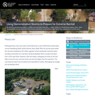
An extreme precipitation event in 2008 cost one town more than a …
An extreme precipitation event in 2008 cost one town more than a million dollars in infrastructure repairs. Now, other municipalities can simulate how their homes, businesses, and facilities might fare if they experienced a similar event.
This exercise is part of a sequence of exercises to help students …
This exercise is part of a sequence of exercises to help students understand single and multiple aquifer tests. In class, students will receive data from pumping tests at University of Minnesota's hydrogeology field site. Instead of using commercial software, students will create interactive modeling tools to facilitate curve matching and to collaborate on understanding aquifer tests at different scales using different methods. The approaches used in this exercise can be extended to develop models to compare single and multiple aquifer tests using different approaches.
(Note: this resource was added to OER Commons as part of a batch upload of over 2,200 records. If you notice an issue with the quality of the metadata, please let us know by using the 'report' button and we will flag it for consideration.)
No restrictions on your remixing, redistributing, or making derivative works. Give credit to the author, as required.
Your remixing, redistributing, or making derivatives works comes with some restrictions, including how it is shared.
Your redistributing comes with some restrictions. Do not remix or make derivative works.
Most restrictive license type. Prohibits most uses, sharing, and any changes.
Copyrighted materials, available under Fair Use and the TEACH Act for US-based educators, or other custom arrangements. Go to the resource provider to see their individual restrictions.