Student group (3-4 persons) remediation studies are an effective way to apply …
Student group (3-4 persons) remediation studies are an effective way to apply learned hydrogeology concepts to real world problems. The Crooked Creek gas station with leaking underground storage tanks is just one of 4 to 5 projects which students can work on as a final project (2 to 3 weeks) in a hydrogeology course. The student group (3 to 4 persons) is given information regarding a leaking UST at a gasoline station in western Pennsylvania; a page detailing the history of the problem and a small sketch map if the site. They must then (over a 3 week period) research the geology/hydrogeology of the site, produce maps and cross-sections, and complete a detailed report, budget and timetable which summarize their remediation plans. Group members also give a 20 to 30 minute summary presentation to the rest of the class.
(Note: this resource was added to OER Commons as part of a batch upload of over 2,200 records. If you notice an issue with the quality of the metadata, please let us know by using the 'report' button and we will flag it for consideration.)
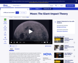
This video segment adapted from NOVA follows the Apollo 15 astronauts as …
This video segment adapted from NOVA follows the Apollo 15 astronauts as they collect samples of ancient rock from the Moon's crust, whose discovery helps lead to a radical new theory about the Moon's origin.
In this year’s seminar, we will embark on a scientific journey through …
In this year’s seminar, we will embark on a scientific journey through some of the most controversial topics about the origin and formation of our home planet. This journey will take us to other planetary bodies - even to other solar systems - as we immerse ourselves in observations and theories from the microscopic to the universe scale. The seminar will be organized around three broad questions: How was the Earth formed? What did early Earth look like? When did living organisms first appear on Earth? Experts in meteorites, geology of other planets, thermodynamics and tracers of living organisms, and theories of formation and evolution of planets, including early atmosphere and oceans, will come to WHOI and help us address these questions.
The course treats the following topics: - Relevant physical oceanography - Elements …
The course treats the following topics: - Relevant physical oceanography - Elements of marine geology (seafloor topography, acoustical properties of sediments and rocks) - Underwater sound propagation (ray acoustics, ocean noise) - Interaction of sound with the seafloor (reflection, scattering) - Principles of sonar (beamforming) - Underwater acoustic mapping systems (single beam echo sounding, multi-beam echo sounding, sidescan sonar) - Data analysis (refraction corrections, digital terrain modelling) - Applications (hydrographic survey planning and navigation, coastal engineering) - Current and future developments.
Students explore the effects of regional geology on bridge foundation, including the …
Students explore the effects of regional geology on bridge foundation, including the variety of soil conditions found beneath foundations. They learn about shallow and deep foundations, as well as the concepts of bearing pressure and settlement.
This is a series of three lab exercises integrating seismic interpretation and …
This is a series of three lab exercises integrating seismic interpretation and sedimentary geology. Each lab uses freely available software from dGB Earth Sciences, OpendTect. The seismic volume is the F3 Block in the North Sea, which is publicly available via dGB's Seismic Repository. The software is very user-friendly. The exercises are written so that no experience is needed using the software prior to the labs. Students are guided through the program as they answer questions on sedimentology, stratigraphy, geomorphology, structural geology and petroleum geology.
Spreadsheets Across the Curriculum module/Geology of National Parks course. Students work with …
Spreadsheets Across the Curriculum module/Geology of National Parks course. Students work with salmon-trace streambed data to study whether removal of a spawning run barrier was effective
Geology 101 Introductory Geology at Albion College meets the Science Mode requirement …
Geology 101 Introductory Geology at Albion College meets the Science Mode requirement through which students learn the process of science and the impact of geology on their own lives. To help students achieve these goals, we devised multiple-week projects to serve as the culmination of each half of the semester, replacing traditional lab exams. One of these is the ore exploration game, which requires students to integrate material covered in 6 weeks of lectures and labs on minerals, rocks, structures and topographic and geologic maps and to apply what they have learned to a practical problem. Students divide into teams or "mineral exploration companies" of 3 to 4 members. They are given rules for the game, an exploration budget, a geologic map, a set of rock samples keyed to the map, and worksheets to fill out as they collect information.Their assignment is to use this information to locate ore bodies both exposed and hidden and acquire the rights to these through an auction on the last day of the project. In week 1, they identify and describe samples, label structures on the map, draw cross sections, and develop a geologic history. In week 2, the groups buy geochemical and drill hole data and use these along with the geology to locate and describe ore bodies. By the end of this lab, each group will have described at least one kind of ore. Deposits are hidden with varying degrees of subtlety, allowing all students to find some ore and the best to demonstrate their abilities. In week 3, students hand in completed maps and cross sections (done as teams), and a geologic history of the area that includes descriptions of samples and structures as well as interpretations of their environments of formation, along with a two-page paper on the ore deposits (papers and histories written as individuals). Groups use the funds left in their exploration budget to bid on squares of the map they believe contain ore. To be successful, students must approach the problem as geologists, going beyond simple rock and structure identification to interpretation of rock assemblages in the context of a geologic map and synthesis of these interpretations into a coherent narrative history.
This article profiles Julie Codispoti, assistant curator at the United States Polar …
This article profiles Julie Codispoti, assistant curator at the United States Polar Rock Repository, and discusses the basics of polar geology. Modified versions are available for younger students.
Environmental geology is applied geology and being applied requires an understanding of …
Environmental geology is applied geology and being applied requires an understanding of all of the pieces of the puzzle. This activity is a culmination of many ideas learned in environmental geology: discussing the issue of population growth as well as a driving force, plate tectonics, behind a changing climate and many hazards, and then the hazards themselves, discussing anthropogenic climate change and the implications globally. An understanding of each of these and their interconnectedness provides a great context for decision-making and earth science literacy. This activity attempts to take all of the knowledge mentioned here and make judgements and decisions based on a real-world scenario
This is a lesson that applys occultations to Saturn's Moon Enceladus. Learners …
This is a lesson that applys occultations to Saturn's Moon Enceladus. Learners will establish whether Saturn’s small moon, Enceladus, has an atmosphere, whether that atmosphere is over the entire planet, and what creates Saturn’s E-ring. The activity is part of Project Spectra, a science and engineering program for middle-high school students, focusing on how light is used to explore the Solar System.
This is an activity about the way distance, reflectivity, and atmosphere affect …
This is an activity about the way distance, reflectivity, and atmosphere affect the temperature of a planet. Learners will create a planet using a computer game and change features of the planet to increase or decrease the planet's temperature. This lesson is part of Project Spectra, a science and engineering education program focusing on how light is used to explore the Solar System.
Students will identify and apply credible geologic and social science data sets …
Students will identify and apply credible geologic and social science data sets to identify local hazards and vulnerable groups and structures, and assess risk for their community.
(Note: this resource was added to OER Commons as part of a batch upload of over 2,200 records. If you notice an issue with the quality of the metadata, please let us know by using the 'report' button and we will flag it for consideration.)
The Hudson Highlands tour is part of the New York Landscape Regions …
The Hudson Highlands tour is part of the New York Landscape Regions Collection of Google Earth Tours, created by a group of New York State science educators. This tour introduces Hudson Highlands geology, including glaciology at Bear Mountain, views of the Highlands, and the Ramapo Fault to the south. It also offers other information about the area, including some animals, New York City's water supply, and the Great Swamp.
This is the homepage of the United States Geological Survey's (USGS) Yellowstone …
This is the homepage of the United States Geological Survey's (USGS) Yellowstone Volcano Observatory. It features news articles, monitoring information, status reports and information releases, and information on the volcanic history of the Yellowstone Plateau Volcanic Field. Users can access monthly updates with alert levels and aviation warning codes and real-time data on ground deformation, earthquakes, and hydrology. There is also a list of online products and publications, and an image gallery
The Allegheny Plateau tours are part of the New York Landscape Regions …
The Allegheny Plateau tours are part of the New York Landscape Regions Collection of Google Earth Tours, created by a group of New York State science educators. These tours showcase examples of Allegheny geology, including the geomorphology of glacial features near Tully, New York, southern Cayuga Lake, the geology and geomorphology of Letchworth State Park and its waterfalls, as well as waterfalls and creeks in the Ithaca Gorges. Schoharie Creek can be toured from its mouth to its source, the St. Lawrence Chesapeake and Valley Heads Moraine can be investigated to examine drainage patterns, and another tour investigates the unique geology and ecology of the Rome Sand Plains. Environmental tours also address the 2006 flooding in the Allegheny Plateau near Port Jarvis and Livingston Manor and provide an overview of the water supply system of the City of New York.
In summary, "The Varied Landscapes of the Colorado Plateau" provides an engaging …
In summary, "The Varied Landscapes of the Colorado Plateau" provides an engaging overview of the geological and geographical marvels found in this region of the United States. From ancient rock layers to stunning natural formations, the Colorado Plateau's landscapes continue to captivate and inspire those who explore its diverse terrain.
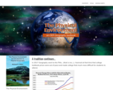
In 2017 Geography went to the Pitts… (that is me…)…I learned at …
In 2017 Geography went to the Pitts… (that is me…)…I learned at that time that college textbook prices were out of pace and made college that much more difficult for students to attend.
I wanted to do my part… I looked into a free online book and found Michael E. Ritter’s “The Physical Environment An Introduction to Physical Geography” free Online Educational Resource e-book.
In Summer 2020 in the midst of a pandemic I learned that Michael Ritter would be retiring his book. He was kind enough to share the source information and I decided to take it on… I hope to make changes as needed and add material but most importantly I want to keep this resource available for those of us who relied on the content for the instruction of our students.
The San Bernardino and San Gabriel Mountains provide an excellent setting for …
The San Bernardino and San Gabriel Mountains provide an excellent setting for exploring the evolution and diversity of crystalline rocks in California. The oldest rock-forming events which can be explored in these ranges involved episodic Paleoproterozoic magmatism and orogenesis extending from 1.81 to 1.65 Ga. Rock units of this age are widespread both east and west of the San Andreas fault. This Paleoproterozoic tectonism was followed by intrusion of younger Mesoproterozoic anorogenic igneous rocks that are areally limited, but well exposed in the San Gabriel Mountains as 1.19 Ga gabbro, anorthosite, and syenite. Proterozoic igneous activity and tectonism in southwest North America was followed by rifting during the Neoproterozoic, which led to development of the Cordilleran geosynclinal belts. Belts of rocks within the geosyncline in southern California trend northeast-southwest, with deeper water rocks to the northwest, and Neoproterozoic and Paleozoic metasedimentary rocks in the San Bernardino Mountains belong to the transition zone between the cratonal and deeper water miogeoclinal sequences. Passive margin sedimentation ended with initiation of arc magmatism oriented along a northwest to southeast trend in Late Permian time. A diverse group of Mesozoic plutons and dike swarms as young as Late Cretaceous in age characterize the crystalline terranes of both the San Bernardino and San Gabriel Mountains, culminating in emplacement of large calc-alkalic intrusive suites in both ranges about 78 Ma.
The diversity of ages and types of crystalline rocks makes a field trip through either or both of these ranges a great opportunity to engage students in active learning while linking petrology and historical geology course content in a field context. Students can utilize rock identification skills learned in the laboratory, and with knowledge of available geochronologic data, can construct a more detailed geologic time scale for the region.
Here we will provide an example of a one-day trip to examine Proterozoic metamorphic and Mesozoic intrusive igneous rocks that are easily accessible in roadcuts and on short field traverses along National Forest roads. The trip is adapted from more detailed field guides and road logs for this region (principally Barth et al., 2001), with a focus on undergraduate learning.
(Note: this resource was added to OER Commons as part of a batch upload of over 2,200 records. If you notice an issue with the quality of the metadata, please let us know by using the 'report' button and we will flag it for consideration.)
This is an activity about impact craters. Learners will experiment to create …
This is an activity about impact craters. Learners will experiment to create impact craters and examine the associated features. Then they observe images of lunar craters and explore how the mass, shape, velocity, and angle of impactors affects the size and shape of the crater. This activity is part of Explore! To the Moon and Beyond! - a resource developed specifically for use in libraries.
No restrictions on your remixing, redistributing, or making derivative works. Give credit to the author, as required.
Your remixing, redistributing, or making derivatives works comes with some restrictions, including how it is shared.
Your redistributing comes with some restrictions. Do not remix or make derivative works.
Most restrictive license type. Prohibits most uses, sharing, and any changes.
Copyrighted materials, available under Fair Use and the TEACH Act for US-based educators, or other custom arrangements. Go to the resource provider to see their individual restrictions.