Spreadsheets Across the Curriculum module/Geology of National Parks course. Students use weighted …
Spreadsheets Across the Curriculum module/Geology of National Parks course. Students use weighted averages and data from air photos from 1939 to 2005 to calculate the rate of retreat of the shoreline and the advance of the front of dunes along the shoreline.
The earthquake game teaches how scientists learn about real earthquakes. The player …
The earthquake game teaches how scientists learn about real earthquakes. The player must learn about S& P waves and triangulation to determine the epicenter of the earthquake that hit the cities.
In this year’s Geodynamics Seminar, we will explore the depth and breadth …
In this year’s Geodynamics Seminar, we will explore the depth and breadth of scientific research related to Earth’s present and past ice-sheets, glaciers and sea-ice, as well as extraterrestrial planetary ice. Invited speakers have been chosen from experts in the current frontiers in ice-related research, including planetary ice, climate records from polar and tropical ice cores, the Snowball Earth, subglacial volcanoes, ice rheology, ice sheet modeling, ice microkinetics, glacial erosion and tectonics, subglacial life and polar remote sensing. A field trip to Iceland in Summer 2006 will allow us to view some of the island’s ice caps and glacial geology, the exposed mid Atlantic Ridge and evidence of ice-volcano interactions.
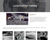
The Apollo 15 astronauts were trained in geology and sampling techniques. Complete …
The Apollo 15 astronauts were trained in geology and sampling techniques. Complete your own geology training by completing these activities to become a Lunar Explorer.
In this OLogy activity, kids learn about how rocks give us important …
In this OLogy activity, kids learn about how rocks give us important clues about Earth's history. The activity begins with an overview that explains the evidence rocks hold and how kids can begin to make observations about their different traits. Students are then given step-by-step, illustrated directions for collecting rocks, observing and sorting them, and creating a display of their collection. The activity includes a printable rock chart to help kids make their observations.
This fun Web article is part of OLogy, where kids can collect …
This fun Web article is part of OLogy, where kids can collect virtual trading cards and create projects with them. Here, they learn about volcanoes. The article begins by introducing students to Jim Webster, an Earth scientist at the Museum who studies volcanoes and has re-created the conditions for a magma chamber in his lab. In Visit Jim's Lab, students see firsthand how he studies volcanoes, both in the field and in the lab.
This lesson teaches the students about the different layers of the Earth …
This lesson teaches the students about the different layers of the Earth and how they work together. Students will be able to: Name and label the four layers of the Earth; Identify the main minerals that make up each layer; Explain how scientists formulated the idea that the Earth is comprised of four layers.
Students describe the hydrogeologic properties of different sedimentary and volcanic rocks. (Note: …
Students describe the hydrogeologic properties of different sedimentary and volcanic rocks.
(Note: this resource was added to OER Commons as part of a batch upload of over 2,200 records. If you notice an issue with the quality of the metadata, please let us know by using the 'report' button and we will flag it for consideration.)
Spreadsheets Across the Curriculum/Geology of National Parks module. Students work with a …
Spreadsheets Across the Curriculum/Geology of National Parks module. Students work with a color-coded conditional-formatted spreadsheet map to work through a USGS report applying a coastal vulnerability index, examining real data related to relative sea-level change for different areas of the Californian coas,t including Point Reyes National Seashore.
In this field investigation students document outcrop descriptions, develop investigable questions, present …
In this field investigation students document outcrop descriptions, develop investigable questions, present findings, and interpret a sedimentary rock sequence's depositional history.
This quiz for younger students asks them 10 questions about plate motions, …
This quiz for younger students asks them 10 questions about plate motions, rock types in continental and oceanic crust, crustal formation and mountain building, the supercontinent Pangea, and the theory of continental drift. A link to a page on continental drift provides information to answer the questions.
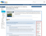
This is an interactive map that illustrates the scale of potential flooding …
This is an interactive map that illustrates the scale of potential flooding in Alabama, Mississippi, and Florida due to projected sea level rise. It is a collaborative project of NOAA Sea Grant Consortium and the US Geological Survey. It is a pilot project, so there is some possibility that the resource may not be maintained over time.
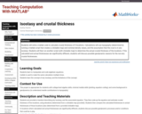
Students will write a matlab code to calculate crustal thickness of 5 …
Students will write a matlab code to calculate crustal thickness of 5 locations. Calculations will use topography (determined by running a matlab script that creates a clickable map) and nominal density values, and the assumption that the crust is in airy isostasy. Students will then run another script (with clickable map) to determine the actual crustal thickness of the locations. If the calculated and actual thicknesses are significantly different, students will discuss possible geodynamic reasons for the non-airy crustal thicknesses.
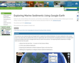
This exercise uses empirical data and Google Earth to explore the surficial …
This exercise uses empirical data and Google Earth to explore the surficial distribution of marine sediments in the modern ocean. Over 2500 sites are plotted with access to original data. We recommend first completing the Primer on Google Earth to become familiar with tools in Google Earth that are used in this exercise. The Exploring Marine Sediments in Google Earth exercise has four parts:
- Stories from the Sea Floor: A Lesson on How Science Works - A First Look at Marine Sediments - Exploring the Distribution of Marine Sediment Types on the Sea Floor - Refining Your Hypotheses on Biogenic Marine Sediment Distributions
This is an activity about transport of sediment contaminated by copper, arsenic, …
This is an activity about transport of sediment contaminated by copper, arsenic, and other heavy metals that was deposited into the Clark Fork River channel as the result of historical mining activity. The Clark Fork River between Butte and Milltown, Montana has been the focus of several large superfund projects designed to address the impacts of this legacy of mining in the watershed. This activity is used in an introductory physical geology lab (primarily non-majors) with students who may have limited experience working with quantitative analysis and analyzing graphs.
(Note: this resource was added to OER Commons as part of a batch upload of over 2,200 records. If you notice an issue with the quality of the metadata, please let us know by using the 'report' button and we will flag it for consideration.)
The activity begins by asking students to look at a drawing of …
The activity begins by asking students to look at a drawing of a crime scene. The crime scene is specifically drawn so that illustrates several key geologic principals, but to the untrained eye it appears as a murder that took place inside an office. After quietly looking at the image for a few minutes alone, they share with a partner what they think happened. As a class, we record a list of "Observations," making sure to use the opportunity to highlight the difference between observation and interpretation. After we complete the list of observations, students then offer their interpretations about the sequence of events. Without using any new vocabulary, the teacher makes sure to highlight the geologic principles of original horizontality, superposition, cross cutting relations, and uniformitarianism in the students' interpretations. After students share enough competing theories, the professor shows slides of geologic examples that have things in common with parts of the crime scene and points out the similar processes. The activity eventually ends without a clear answer about "whodunnit." This open ending leaves students frustrated, but it really gets across the point that we can never know the exact answer to some problems, we can only come up with viable theories. Students continue to ask for months about what "really" happened, but I never tell them :-) Has minimal/no quantitative componentUses geophysics to solve problems in other fields
This is a teaching module, directed to undergraduate students in applied mathematics, …
This is a teaching module, directed to undergraduate students in applied mathematics, that presents a Zonal Energy Balance Model to describe the evolution of the latitudinal distribution of Earth's surface temperature subject to incremental levels of cumulative carbon emissions in the atmosphere. A strategy to avert "dangerous levels" of global warming is imbedded in the model. Students working with the module will write a computer code, using a software such as MATLAB or Mathematica, to obtain numerical solutions of the model and simulate strategies that guarantee controlled levels of global warming.
This activity is a guided inquiry where students develop questions around a …
This activity is a guided inquiry where students develop questions around a group of rocks, use their observation skills to describe the attributes, record and analyze their findings, and use their data, in conjunction with available resources, to categorize the rocks .
This Web site, created to complement the Museum's Gottesman Hall of Planet …
This Web site, created to complement the Museum's Gottesman Hall of Planet Earth, offers a virtual visit to the Museum, complete with text, photos, and a downloadable desktop background. The site contains information on ten exhibition highlights.
The Erie Ontario Lowlands tour is part of the New York Landscape …
The Erie Ontario Lowlands tour is part of the New York Landscape Regions Collection of Google Earth tours. This tour includes glacial history, features, and views of Niagara Falls, the Niagara Escarpment, current and former spillways, and the locks at Lockport, New York. Students can also learn about the geology and glacial history of Canandaigua Lake, one of New York's Finger Lakes, which discharges into the Lowlands. There is also a lab activity in which students analyze maps, images, and information to perform an environmental assessment of the Cascade Mill development.
No restrictions on your remixing, redistributing, or making derivative works. Give credit to the author, as required.
Your remixing, redistributing, or making derivatives works comes with some restrictions, including how it is shared.
Your redistributing comes with some restrictions. Do not remix or make derivative works.
Most restrictive license type. Prohibits most uses, sharing, and any changes.
Copyrighted materials, available under Fair Use and the TEACH Act for US-based educators, or other custom arrangements. Go to the resource provider to see their individual restrictions.