This is a guided question note sheet with interactive elements linked within …
This is a guided question note sheet with interactive elements linked within for an online course in Earth History or Historical Geology. NOVA evolution lab is one component, along with other introductory videos and links to useful websites on common misconceptions about evolution and others, compiled in one place with questions for students to answer to confirm understanding of main ideas.
(Note: this resource was added to OER Commons as part of a batch upload of over 2,200 records. If you notice an issue with the quality of the metadata, please let us know by using the 'report' button and we will flag it for consideration.)
Students first navigate to the University of California Museum of Paleontology "The …
Students first navigate to the University of California Museum of Paleontology "The Geologic Timescale in Historical Perspective" website to answer a series of background questions about the geologic timescale. Students then navigate to the National Park Service Geologic Timescale website and use the Geologic Time Views Module to answer questions about major theories in geology and watch a video to answer questions about the age of the earth. Finally, students visit the National Climate Data Center "Exploring Weather & Climate Change Through the Powers of 10" website to answer questions about different scales of climate change.
(Note: this resource was added to OER Commons as part of a batch upload of over 2,200 records. If you notice an issue with the quality of the metadata, please let us know by using the 'report' button and we will flag it for consideration.)
The discipline of structural geology studies the architecture of the solid Earth …
The discipline of structural geology studies the architecture of the solid Earth and other planets. Rock deformation patterns are exciting features beacause of their aesthetic beauty and their economic interest to man. Knowledge of the subsurface structure is vital for the success of a variety of engineering and mineral exploration pograms. A thorough understanding of rock structures is essential for strategic planning in the petroleum and mining industry, in construction operations, in waste disposal surveys and for water exploration. Deformation structures in the country rock are important further for locallizing hazard zones, such as potential rockslide masses, ground subsidence, and seismic faults. Research activities concentrate on rock defomation structures in he shallow continental crust.
Students are asked to match up several unique fossils with the site …
Students are asked to match up several unique fossils with the site and location where it was found and it's geologic age.
(Note: this resource was added to OER Commons as part of a batch upload of over 2,200 records. If you notice an issue with the quality of the metadata, please let us know by using the 'report' button and we will flag it for consideration.)
Geysers and grizzlies and glaciers, oh my. The national parks may be …
Geysers and grizzlies and glaciers, oh my. The national parks may be America's best idea, saving the finest parts of the nation for everyone to enjoy forever. What better way to learn about the natural world than to tour the parks with us? We'll explore how the mountains and valleys formed and why they often come with volcanoes and earthquakes. You'll see what really killed the dinosaurs and how we can help save their modern relatives in the parks. With film clips, slide shows, and our geological interpretations of classic rock songs, isn't it time for a road trip?
Students must associate different dinosaur trackways with their locations and the rock …
Students must associate different dinosaur trackways with their locations and the rock formations containing the trackways based on clues given from various points of view.
(Note: this resource was added to OER Commons as part of a batch upload of over 2,200 records. If you notice an issue with the quality of the metadata, please let us know by using the 'report' button and we will flag it for consideration.)
Half way through the second semester of our year-long integrated Sed/Strat and …
Half way through the second semester of our year-long integrated Sed/Strat and Structure course we travel to Sheep Mountain, Wyoming where the students spend 5 days describing and measuring section and the constructing geologic and structural maps. The field data gathered then form the basis for a paper titled: "Geologic History of the Sheep Mountain Region". In addition to simply making geologic maps, stratigraphic sections and structural cross-sections, the students have to put the local geology into the broader contexts of the Big Horn Basin and sequences of western orogenies.
(Note: this resource was added to OER Commons as part of a batch upload of over 2,200 records. If you notice an issue with the quality of the metadata, please let us know by using the 'report' button and we will flag it for consideration.)
Lab instructions for Environmental Geology students Word Count: 19773 (Note: This resource's …
Lab instructions for Environmental Geology students
Word Count: 19773
(Note: This resource's metadata has been created automatically by reformatting and/or combining the information that the author initially provided as part of a bulk import process.)
Students will look up an address (either of their choosing or instructor-provided) …
Students will look up an address (either of their choosing or instructor-provided) and assess the geologic characteristics and vulnerability of that location. Students will utilize datasets about geologic issues/hazards to learn more about how different geologic processes affect the location.
One of the great challenges in teaching undergraduates is finding ways to …
One of the great challenges in teaching undergraduates is finding ways to get them to apply knowledge or skills learned in one class to problems encountered in subsequent classes. Case in point: the use of algebra, trig, and even rudimentary calculus in geology classes! This activity presents practical ways we can use to build student confidence in their ability to peer into the meaning of the equations they encounter in sedimentary geology. These techniques include: (1) Surgical Strike Reviews -- 5 to 10-minute review of relevant math principles at the beginning of the appropriate lecture, (2) Unit Analyses -- assigning fundamental units of Mass, Length, and Time to test whether an equation has been derived correctly or to explore the meaning of derivative units of measure that may be unfamiliar to students, and (3) Perturbation Interrogation -- asking students to identify whether the quantity of interest described by an equation will increase or decrease when individual components of the equation increase or decrease.
(Note: this resource was added to OER Commons as part of a batch upload of over 2,200 records. If you notice an issue with the quality of the metadata, please let us know by using the 'report' button and we will flag it for consideration.)
These six interactive modules help researchers, data stewards, managers and the public …
These six interactive modules help researchers, data stewards, managers and the public gain an understanding of the value of data management in science and provide best practices to perform good data management within their organization.
Acknowledgments The USGS Data Management Training modules were funded by the USGS Community for Data Integration and the USGS Office of Organizational and Employee Development's Technology Enabled Learning Program in collaboration with Bureau of Land Management, California Digital Library, and Oak Ridge National Laboratory. Special thanks to Jeffrey Morisette, Dept. of the Interior North Central Climate Science Center; Janice Gordon, USGS Science Analytics and Synthesis; National Indian Programs Training Center; and Keith Kirk, USGS Office of Science Quality Information.
Cite: U.S. Geological Survey, 2021, USGS Data Management Website: U.S. Geological Survey, https://doi.org/10.5066/F7MW2G15.
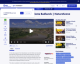
See how the geology of the North Dakota badlands has changed over …
See how the geology of the North Dakota badlands has changed over time in this video segment from NatureScene, featuring the landscape at Theodore Roosevelt National Park.
This lab serves to introduce students to geologic time and serves as …
This lab serves to introduce students to geologic time and serves as an outline for the course through the semester.
Students use a tape register and must mark out the corresponding length of each Geologic Era and Eon towards the beginning of the course. Above Western time line Navajo students construct their own time line correlating events as best as possible. As the course progresses starting from 4.6bya each week they must draw major events that occur marking correct subdivisions of time and ages ago. As fossil life gets more complex such as beginning in the Paleozoic students are must take different categories of fossils or different periods so all are doing different things but working together. (Similarly the Navajo time line builds. This time line is taped around the room---and I would have liked to paint the two time lines along the corridor of the building but Maintenance axed it.
(Note: this resource was added to OER Commons as part of a batch upload of over 2,200 records. If you notice an issue with the quality of the metadata, please let us know by using the 'report' button and we will flag it for consideration.)
In this Geologic Time Resorts activity students do in-depth research on a …
In this Geologic Time Resorts activity students do in-depth research on a given geologic time period of the Phanerozoic Eon and create brochures "selling" their time period as a resort destination.
(Note: this resource was added to OER Commons as part of a batch upload of over 2,200 records. If you notice an issue with the quality of the metadata, please let us know by using the 'report' button and we will flag it for consideration.)
This final laboratory exercise in an introductory planetary geology course requires the …
This final laboratory exercise in an introductory planetary geology course requires the students to use Google Mars to interpret a variety of geological processes.
(Note: this resource was added to OER Commons as part of a batch upload of over 2,200 records. If you notice an issue with the quality of the metadata, please let us know by using the 'report' button and we will flag it for consideration.)
This interactive resource adapted from the National Park Service describes the many …
This interactive resource adapted from the National Park Service describes the many forces that affect shorelines, including tides, weathering, erosion, and deposition.
No restrictions on your remixing, redistributing, or making derivative works. Give credit to the author, as required.
Your remixing, redistributing, or making derivatives works comes with some restrictions, including how it is shared.
Your redistributing comes with some restrictions. Do not remix or make derivative works.
Most restrictive license type. Prohibits most uses, sharing, and any changes.
Copyrighted materials, available under Fair Use and the TEACH Act for US-based educators, or other custom arrangements. Go to the resource provider to see their individual restrictions.