Geographic information systems (GIS) are important technology that allows rapid study and …
Geographic information systems (GIS) are important technology that allows rapid study and use of spatial information. GIS have become increasingly prevalent in industry and the consumer/internet world in the last 20 years. Historically, the basis of GIS was in mapping, and so it is important to understand the basis of maps and how to use them as well as why they are different from GIS. In this lesson, students learn the value of maps, how to use maps, and the basic components of a GIS. They are also introduced to numerous GIS applications.
Students complete a self-guided exercise in worksheet format combined with Google Earth …
Students complete a self-guided exercise in worksheet format combined with Google Earth that helps them explore practical and observable differences between different projection and coordinate systems. The activity improves their skills in using various Google Earth features.
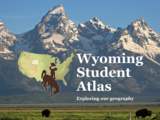
The Wyoming Student Atlas helps Wyoming's students learn about the human, physical, …
The Wyoming Student Atlas helps Wyoming's students learn about the human, physical, cultural, and historical geography of their state, while increasing critical thinking skills and spatial awareness. The Wyoming Student Atlas was produced by the Wyoming Geographic Information Science Center (WyGISC) in partnership with the Wyoming Geographic Alliance. The Wyoming Student Atlas is available as a soft cover book, as a digital flipbook, and as a series of science or social studies Web-based interactive story maps which can be used in lesson plans either as self-guided or instructor-guided activities.
Most activities are aligned with Wyoming Social Studies standards (2018) or Wyoming Science Standards (2016).
The War of 1812 ensured the United States’ independence and created opportunities …
The War of 1812 ensured the United States’ independence and created opportunities for two future U.S. presidents to demonstrate their leadership qualities.
No restrictions on your remixing, redistributing, or making derivative works. Give credit to the author, as required.
Your remixing, redistributing, or making derivatives works comes with some restrictions, including how it is shared.
Your redistributing comes with some restrictions. Do not remix or make derivative works.
Most restrictive license type. Prohibits most uses, sharing, and any changes.
Copyrighted materials, available under Fair Use and the TEACH Act for US-based educators, or other custom arrangements. Go to the resource provider to see their individual restrictions.