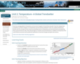
This unit is designed to engage students by introducing them to patterns …
This unit is designed to engage students by introducing them to patterns in recent climate and investigating possible reasons for recent changes. Students work in small groups to plot and analyze real-world temperature data covering a decade, and use that information to make predictions about future climatic trends. Whole-class discussions illustrate the differences between short- and long-term trends. Students also analyze graphs of solar irradiance to begin to determine reasons for the observed increase in temperature, setting the stage for Unit 2, which examines the role of the atmosphere in controlling Earth's surface temperature.
(Note: this resource was added to OER Commons as part of a batch upload of over 2,200 records. If you notice an issue with the quality of the metadata, please let us know by using the 'report' button and we will flag it for consideration.)
The constellations of satellites orbiting our planet enable high-precision positioning not just …
The constellations of satellites orbiting our planet enable high-precision positioning not just for consumer or survey applications but also for geoscience research such as detecting plate motions, landslide movement, or other changes on the Earth's surface. This unit introduces students to the fundamentals of these global navigation satellite systems (GNSS), the reference frames used for positioning, and the different acquisition techniques, including their merits and accuracy. Through classroom and field activities, students develop a familiarity with the variety of instrumentation and applications available with GNSS. This unit provides a broad conceptual understanding of GNSS applicable to all acquisition techniques. Subsequent units focus on kinematic and static methods and the different products generated using those GNSS methods.
Show more information on GPS versus GNSS Hide Note: Although the term GPS (Global Positioning System) is more commonly used in everyday language, it officially refers only to the USA's constellation of satellites. GNSS (Global Navigation Satellite System) is a universal term that refers to all satellite navigation systems including those from the USA (GPS), Russia (GLONASS), European Union (Galileo), China (BeiDou), and others. In this module, we use the term GNSS to refer generically to the use of one or more satellite constellations to determine position.
(Note: this resource was added to OER Commons as part of a batch upload of over 2,200 records. If you notice an issue with the quality of the metadata, please let us know by using the 'report' button and we will flag it for consideration.)
Students will identify how they, as individuals, think about climate science and …
Students will identify how they, as individuals, think about climate science and explore common perceptions and misconceptions that exist about climate science. The activities within this unit incorporate individual reflection by students, small group work, and larger group/class discussions, and endeavor for students to learn how to discern true and untrue statements using logic and fact. Students are presented with various statements about climate science and are tasked with determining whether these statements are factually true and whether they are logically valid. We recognize that students may have limited background factual knowledge in climate science before starting these activities, so some exercises are intended more as a way for students to evaluate how they think about climate science and how to create logically valid scientific statements (i.e., how to think and talk like a scientist). By learning how to identify logically and factually true and untrue statements, students will, by the end of this unit, be able to create and evaluate statements about climate science (even with limited factual knowledge) and critique common misconceptions about climate science.
(Note: this resource was added to OER Commons as part of a batch upload of over 2,200 records. If you notice an issue with the quality of the metadata, please let us know by using the 'report' button and we will flag it for consideration.)
In this unit, students investigate the history of the environmental justice (EJ) …
In this unit, students investigate the history of the environmental justice (EJ) movement in the United States, situating it within the context of the US civil rights and environmental movements. Students also make connections to issues of environmental equity on a global scale. The unit serves as a foundation for exploring the scientific background of environmental justice issues in subsequent units, particularly the interrelatedness of hydrology and hydrologic concepts.
(Note: this resource was added to OER Commons as part of a batch upload of over 2,200 records. If you notice an issue with the quality of the metadata, please let us know by using the 'report' button and we will flag it for consideration.)
In this unit, students will identify mass extinctions as paleontologists have done …
In this unit, students will identify mass extinctions as paleontologists have done and recognize and understand the "pull of the recent," that is, the human tendency to know more about events closer to the present. Students prepare by reading an article prior to class that describes mass extinctions. At the beginning of class, students place historical events along a physical model of the geologic timescale. Next, they examine a diagram showing changes in biodiversity across the last 542 million years and identify patterns in those data. Students and the instructor then finish class by discussing that although fossils (and rocks) are critical for explaining the present and predicting the future, their mechanisms of preservation biases our understanding of Earth's past.
(Note: this resource was added to OER Commons as part of a batch upload of over 2,200 records. If you notice an issue with the quality of the metadata, please let us know by using the 'report' button and we will flag it for consideration.)
Unit 1 serves as an introduction to Earth's climate system components. After …
Unit 1 serves as an introduction to Earth's climate system components. After exploring climate data, students are introduced to the natural processes responsible for global climate and how specific variables are interpreted by scientists.
(Note: this resource was added to OER Commons as part of a batch upload of over 2,200 records. If you notice an issue with the quality of the metadata, please let us know by using the 'report' button and we will flag it for consideration.)
How are rising sea levels already influencing the developing nation of Bangladesh, …
How are rising sea levels already influencing the developing nation of Bangladesh, and what are the anticipated consequences of additional sea level rise in the next century? This introduction to the Ice and Sea Level Changes module is designed to prompt student consideration of the economic, social, political, and health impacts of sea level change. They will revisit the impacts of sea level change on society in Unit 5 when they investigate implications for New York City and Southern California.
Show more about Online Teaching suggestions Hide Online-ready: This opening class discussion about climate change and societal impacts could be converted to an online discussion format.
(Note: this resource was added to OER Commons as part of a batch upload of over 2,200 records. If you notice an issue with the quality of the metadata, please let us know by using the 'report' button and we will flag it for consideration.)
How have mass-wasting events affected communities, and what lessons have we learned …
How have mass-wasting events affected communities, and what lessons have we learned from these natural disasters that might help us mitigate future hazards? In this unit, students answer these questions by being introduced to the landscape and societal characteristics that contributed to loss of property and life during the 1970 Nevado HuascarÃn (Peru) and 2010 San Fratello (Sicily, Italy) events.
Show more about Online Teaching suggestions Hide Online-ready: This opening class discussion about landslides and societal impacts could easily be converted to an online discussion format.
(Note: this resource was added to OER Commons as part of a batch upload of over 2,200 records. If you notice an issue with the quality of the metadata, please let us know by using the 'report' button and we will flag it for consideration.)
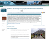
Kinematic GNSS surveys can provide a rapid means of collecting widely distributed, …
Kinematic GNSS surveys can provide a rapid means of collecting widely distributed, high-precision topographic data. The advantages of this technique over optical instruments such as a total station are that it only requires one person to operate and it does not rely on maintaining a direct line of site. Once points are collected, students will learn to interpolate them using ArcMap to create a continuous model of elevations. Students must think carefully about where they collect their points and evaluate the merits of different interpolation techniques including TIN and Kriging. Through a field-based application of kinematic GNSS, students will design and conduct a topographic survey and interpolate collected points to create a continuous elevation field. This builds upon skills learned in Unit 2 and prepares students for future techniques such as surface differencing and topographic change detection (Unit 2.2).
Show more information on GPS versus GNSS Hide Note: Although the term GPS (Global Positioning System) is more commonly used in everyday language, it officially refers only to the USA's constellation of satellites. GNSS (Global Navigation Satellite System) is a universal term that refers to all satellite navigation systems including those from the USA (GPS), Russia (GLONASS), European Union (Galileo), China (BeiDou), and others. In this module, we use the term GNSS to refer generically to the use of one or more satellite constellations to determine position.
(Note: this resource was added to OER Commons as part of a batch upload of over 2,200 records. If you notice an issue with the quality of the metadata, please let us know by using the 'report' button and we will flag it for consideration.)
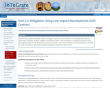
In this activity, students model the impact of changes in land cover …
In this activity, students model the impact of changes in land cover on stormwater runoff using the EPA's National Stormwater Calculator. Students mitigate increased stormwater runoff resulting from development with low impact development (LID) controls. Students assess the LID controls in terms of the ecosystem services that they are intended to replace and discuss alternative development designs to reduce the need for them.
(Note: this resource was added to OER Commons as part of a batch upload of over 2,200 records. If you notice an issue with the quality of the metadata, please let us know by using the 'report' button and we will flag it for consideration.)
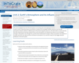
This unit investigates the role of the atmosphere on incoming solar and …
This unit investigates the role of the atmosphere on incoming solar and outgoing terrestrial radiation and analyzes modern trends in greenhouse gas concentrations. Students first investigate radiation spectra to see how the atmosphere absorbs radiation in different parts of the electromagnetic spectrum. This information is used to develop the idea of greenhouse warming. Students then use the atmospheric CO2 dataset from Mauna Loa to investigate changes in atmospheric CO2 through time, and the drivers behind these changes. Follow-up questions ask students to consider how their own daily activities contribute to atmospheric CO2, and how rising CO2 may trigger potential feedbacks in the Earth system.
(Note: this resource was added to OER Commons as part of a batch upload of over 2,200 records. If you notice an issue with the quality of the metadata, please let us know by using the 'report' button and we will flag it for consideration.)
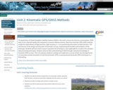
The application of Global Navigation Satellite Systems (GNSS) in the earth sciences …
The application of Global Navigation Satellite Systems (GNSS) in the earth sciences has become commonplace. GNSS data can be collected rapidly and compared in common reference frames. Real-time kinematic (RTK) GNSS methods enable the rapid delivery of high-precision, high-accuracy (+/- 2 cm) positioning information to field scientists. This unit focuses on the design and execution of kinematic surveys, emphasizing the benefits and limitations of the technique. Students will learn which research questions the technique is most applicable for, as well as the standard data processing techniques. Students advance their understanding of GNSS through a technical knowledge of kinematic GNSS surveys. This unit prepares students to design and implement a survey of their own through hands-on instruction and demonstration of real-time kinematic (RTK) or post-processed kinematic (PPK) techniques in a field setting.
Show more information on GPS versus GNSS Hide Note: Although the term GPS (Global Positioning System) is more commonly used in everyday language, it officially refers only to the USA's constellation of satellites. GNSS (Global Navigation Satellite System) is a universal term that refers to all satellite navigation systems including those from the USA (GPS), Russia (GLONASS), European Union (Galileo), China (BeiDou), and others. In this module, we use the term GNSS to refer generically to the use of one or more satellite constellations to determine position.
(Note: this resource was added to OER Commons as part of a batch upload of over 2,200 records. If you notice an issue with the quality of the metadata, please let us know by using the 'report' button and we will flag it for consideration.)
Students will be provided with seawater pH and carbon dioxide concentration (pCO2) …
Students will be provided with seawater pH and carbon dioxide concentration (pCO2) data spanning as far back as 1850. They will describe trends in pH, pCO2 and atmospheric CO2 concentration, outline why these parameters are related, and predict how changes in these parameters will affect marine biology. Each group of students will be given a different set of data from different regions and asked to compare with other groups to determine if seawater pH change is a global or regional phenomena. This unit will provide students with an understanding of the pH buffering system and an opportunity to interpret real climate data.
(Note: this resource was added to OER Commons as part of a batch upload of over 2,200 records. If you notice an issue with the quality of the metadata, please let us know by using the 'report' button and we will flag it for consideration.)
In this unit, students will keep a log of immediate, personal sensory …
In this unit, students will keep a log of immediate, personal sensory experiences by pausing once each hour over a period of ten hours and recording the sights, sounds, smells, tastes, and tactile experiences they are sensing at that moment. The log (or journaling activity) will occur outside of class and will be shared in a subsequent class meeting. In class, students will exchange their logs, respond and discuss, and then form larger groups which will discuss disparate ways of paying attention to sensory experiences. Students will develop a deeper understanding of their own perceptions and how those perceptions can be recorded and used to evaluate an environmental setting. This activity is qualitative; it requires students to create an informal, subjective journal of their sensory experiences once each hour for a ten-hour time period prior to class. When students share their individual qualitative experiences in pairs and small groups, they will begin to see patterns emerge that will enable them to develop quantitative observations for future use. They will also begin to relate their sensory experiences to the social, biological, and geophysical aspects of their personal environment; students will begin to explore how these system components are interrelated and how exposure to them may impact human experience and well-being. After the group discussion, students will reflect on the interstices between qualitative and quantitative analysis by way of their sensory logs and mutual discussion.
(Note: this resource was added to OER Commons as part of a batch upload of over 2,200 records. If you notice an issue with the quality of the metadata, please let us know by using the 'report' button and we will flag it for consideration.)
In a hands-on exploration, students will learn to describe and quantify the …
In a hands-on exploration, students will learn to describe and quantify the porosity and permeability of soil models representative of both agricultural and natural environments. Students will use this information to relate the effects of various agricultural methods on soil porosity and permeability in an exercise that requires modeling the role of a soil assessment expert. Instructors are provided with directions for collecting or assembling simple soil models.
(Note: this resource was added to OER Commons as part of a batch upload of over 2,200 records. If you notice an issue with the quality of the metadata, please let us know by using the 'report' button and we will flag it for consideration.)
How have average global air temperature and sea level changed in the …
How have average global air temperature and sea level changed in the last three decades? Have the changes been consistent? Can future changes in air temperature and sea level be predicted? In this unit, students will become familiar with the concept of a time series by calculating recent air temperature and sea level trends and projecting these measurements for 2100. They will also begin to consider environmental factors in addition to temperature that could influence sea level and the potential implications of sea level changes during the next century.
Show more about Online Teaching suggestions Hide Online-adaptable: The lecture and main data analysis exercise can easily be moved online. Student discussions are designed to be intermixed into the flow of the lecture and exercise. Thus moving to online discussions would be might take a bit more planning.
(Note: this resource was added to OER Commons as part of a batch upload of over 2,200 records. If you notice an issue with the quality of the metadata, please let us know by using the 'report' button and we will flag it for consideration.)
Students will explore the different aspects of the carbon cycle on Earth. …
Students will explore the different aspects of the carbon cycle on Earth. This includes the original source of all the carbon on our planet, the near ubiquity of carbon, the six principle reservoirs of carbon in the Earth system, and the movement (flux) of carbon between reservoirs. Students will approach the chemical history of carbon by personifying the "journey" of specific carbon atoms throughout geologic time. The unit emphasizes the grand challenges of energy resources and climate change by grounding these issues in a solid understanding of carbon from a systems thinking perspective. The point here is for students to gain a more robust appreciation for the movement of carbon between atmosphere and geosphere, between hydrosphere and biosphere. The unit provides dynamic understanding of how perturbations to one sphere or changes in the amount of carbon in a given reservoir can have implications throughout the Earth system.
(Note: this resource was added to OER Commons as part of a batch upload of over 2,200 records. If you notice an issue with the quality of the metadata, please let us know by using the 'report' button and we will flag it for consideration.)
In this unit, students are introduced to the concept of a natural …
In this unit, students are introduced to the concept of a natural cycle. They are first asked to identify the different components of the hydrologic cycle in Spanish. Students will be able to recognize the delicate balance between the individual elements of a large and complex system. Students will also be able to identify the interactions among parts of a natural system.
(Note: this resource was added to OER Commons as part of a batch upload of over 2,200 records. If you notice an issue with the quality of the metadata, please let us know by using the 'report' button and we will flag it for consideration.)
Translated and adapted by Ruth Hoff, Wittenberg University, from Unit 2 material of Environmental Justice and Freshwater Resources module by Adriana Perez, Jill S. Schneiderman, Meg Stewart, and Joshua Villalobos
This unit is designed to allow students to quantitatively assess how much …
This unit is designed to allow students to quantitatively assess how much water is used for irrigating crops and how this varies across the United States. This unit also has students link water use to the economic value of the crops that are produced--spanning the scientific and economic disciplines. The concepts that students learn here will connect back to the Water Footprint concept that was introduced in Unit 2, as students consider the accuracy of water calculators.
(Note: this resource was added to OER Commons as part of a batch upload of over 2,200 records. If you notice an issue with the quality of the metadata, please let us know by using the 'report' button and we will flag it for consideration.)
After an opening discussion of systems thinking and models, student use webDICE …
After an opening discussion of systems thinking and models, student use webDICE , an online Dynamic Integrated Climate Economy model developed by Center for Robust Decision Making on Climate and Energy Policy at the University of Chicago. Students will manipulate input parameters and interpret output in small groups in-class and individually out of class to complete the major mid-module assignment. The goal is to develop their understanding of the sources of uncertainty around future predictions of climate change and its impacts. Students are also introduced to the concept of Social Cost of Carbon (SCC) which is central to subsequent units in this module.
(Note: this resource was added to OER Commons as part of a batch upload of over 2,200 records. If you notice an issue with the quality of the metadata, please let us know by using the 'report' button and we will flag it for consideration.)
No restrictions on your remixing, redistributing, or making derivative works. Give credit to the author, as required.
Your remixing, redistributing, or making derivatives works comes with some restrictions, including how it is shared.
Your redistributing comes with some restrictions. Do not remix or make derivative works.
Most restrictive license type. Prohibits most uses, sharing, and any changes.
Copyrighted materials, available under Fair Use and the TEACH Act for US-based educators, or other custom arrangements. Go to the resource provider to see their individual restrictions.