Updating search results...

Search Resources

361 Results

View
Selected filters:
  • geography
Biometry Protocol
Read the Fine Print
Educational Use
Rating
0.0 stars

The purpose of this resource is to measure and classify the plant life at a Land Cover Site to help determine the MUC classification.

Subject:
Applied Science
Ecology
Environmental Science
Life Science
Material Type:
Activity/Lab
Interactive
Provider:
UCAR Staff
Provider Set:
GLOBE Teacher's Guide NGSS Aligned Records
Author:
The GLOBE Program, University Corporation for Atmospheric Research (UCAR)
Date Added:
08/01/2003
Blue Coral Atlas of US Expansion
Only Sharing Permitted
CC BY-NC-ND
Rating
0.0 stars

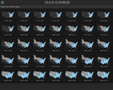
Blue Coral Atlas of US Expansion tells the geographic story of the United States from the original thirteen colonies to today. View all the maps together in a single scroll or choose maps either individually or in series together for a closer look.

Blue Coral Atlas of US Expansion is fully responsive in the web browser for large and small devices in both horizontal and vertical orientations.

Subject:
History
Physical Geography
Physical Science
U.S. History
Material Type:
Interactive
Provider:
Blue Coral Learning
Date Added:
01/05/2018
British Columbia in a Global Context
Unrestricted Use
CC BY
Rating
0.0 stars

Short Description:
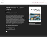
This first-year geography textbook takes a holistic approach to geography by incorporating elements of physical, human, and regional geography, as well as bringing in methods and perspectives from spatial information science. This textbook applies a fundamental geographical approach to understanding our globally changing world by looking at local processes, which are linked to larger global processes and events. The textbook includes numerous case studies specific to British Columbia as well as a number of suggested service learning activities.

Long Description:
Over the course of four days in June, 2014, five faculty members from across British Columbia supported by a facilitator, librarian, researcher, illustrator, programmer, and instructional designer created this book. This involved drawing on our own research, teaching, and experience and working with the team to put it all together into an online format; one which would be accessible to students and educators alike.

Beyond the unique way in which this book was created in a book-sprint process, there are other elements of this book that make it unique. First, it takes a holistic approach to first-year geography, incorporating elements of physical, human, and regional geography, as well as bringing in methods and perspectives from spatial information science.

Pedagogically, this book incorporates elements of service learning and suggested service learning activities, recognizing that the study of geography is deeply connected to the communities we live in. Many of the suggestions for service learning are illustrated through the use of case studies from across BC.

The book is aimed at a first-year or introductory geography student and would be suitable for a first-year geography course on BC.

Word Count: 48187

ISBN: 978-1-77420-018-6

(Note: This resource's metadata has been created automatically by reformatting and/or combining the information that the author initially provided as part of a bulk import process.)

Subject:
Cultural Geography
Social Science
Material Type:
Textbook
Provider:
BCcampus
Author:
Geography Open Textbook Collective
Date Added:
06/12/2014
British Columbia in a Global Context
Unrestricted Use
CC BY
Rating
0.0 stars

This first year Geography textbook takes a holistic approach to Geography by incorporating elements of physical, human and regional geography, as well as bringing in methods and perspectives from spatial information science.. This textbook applies a fundamental geographical approach to understanding our globally changing world by looking at local processes which are linked to larger global processes and events. For example mining and its effects are a global issue and we can see how these unfold in BC. A further example is the recent apology to First Nation peoples on the residential school treatment, as similar events occur in the US, Ireland and Australia. Processes of urbanization, a phenomenon which people all over the globe are experiencing, can be seen in Vancouver with our discussion of the city’s development. Geography students, indeed all first year students, need to be able to critically assess their own contexts and environments in order to properly engage with our continually globalizing world.

Subject:
Physical Geography
Physical Science
Material Type:
Textbook
Provider:
BCcampus
Provider Set:
BCcampus Faculty Reviewed Open Textbooks
Author:
Arthur Green
Aviv Ettya
Britta Ricker
Cristina Tenemos
Simon Fraser
Siobhan McPhee
Date Added:
10/31/2014
Building Suburbia: Highways and Housing in Postwar America
Unrestricted Use
CC BY
Rating
0.0 stars

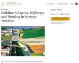
This lesson highlights the changing relationship between the city center and the suburb in the postwar decades, especially in the 1950s. Students will look at the legislation leading up to and including the Federal Highway Act of 1956. They will also examine documents about the history of Levittown, the most famous and most important of the postwar suburban planned developments.

Subject:
History
Material Type:
Lesson Plan
Provider:
National Endowment for the Humanities
Provider Set:
EDSITEment!
Date Added:
09/06/2019
Case Study: Zhouqu, China Landslide
Conditional Remix & Share Permitted
CC BY-NC-SA
Rating
0.0 stars

This is a 'citizen science' research project where students to apply their knowledge of landslide processes in an investigation of the natural and anthropogenic causes of a real-world landslide catastrophe. Students produce a 'magazine' article discussing the Zhouqu, China, August 8, 2010 landslide catastrophe.

(Note: this resource was added to OER Commons as part of a batch upload of over 2,200 records. If you notice an issue with the quality of the metadata, please let us know by using the 'report' button and we will flag it for consideration.)

Subject:
Biology
Business and Communication
Career and Technical Education
Communication
Composition and Rhetoric
English Language Arts
Environmental Studies
Life Science
Material Type:
Case Study
Lesson Plan
Provider:
Science Education Resource Center (SERC) at Carleton College
Provider Set:
Teach the Earth
Author:
Robin Humphreys
Date Added:
09/01/2020
Challenging reality
Conditional Remix & Share Permitted
CC BY-SA
Rating
0.0 stars

A behind the scenes interview with Professor Christopher Barnatt, Director and Producer of a new TV documentary on what we perceive to be real, and what, if any, future lies ahead for us.

The TV documentary was televised in April 2009 and was based on a book written by Professor Christopher Barnatt in 1997, also entitled Challenging Reality, which focused on momentus change across history. The new television series developed this theme further, with input from numerous other experts at the University of Nottingham, across three episodes looking at human achievement, geography and communications and the individual and their role in society.

April 2009

Suitable for Undergraduate study and community education

Professor Christopher Barnatt, Associate Professor Business School and Director Producer of "Challenging Reality"

Professor Christopher Barnatt has worked in the Business School at the University of Nottingham for around 19 years, where he is now Director of Teaching. Outside of that role he teaches computing and technology modules, mainly on undergraduate programmes. He is currently researching in the areas of Future Studies, Web 2.0, and green computing, and is actively involved in research, online teaching support and development in a variety of media termed as "Higher Education 2.0".

Outside of the University he is the author of ExplainingComputers.com and ExplainingTheFuture.com, as well as a regular contributor to the Morning Show on BBC Radio Nottingham and "The Night Before" on Kerrang! Radio.

Subject:
Arts and Humanities
Material Type:
Lecture
Provider:
University of Nottingham
Author:
Associate Professor Christopher Barnatt
Date Added:
03/21/2017
Characteristics of a State
Conditional Remix & Share Permitted
CC BY-NC-SA
Rating
0.0 stars

This inquiry leads students through a geographic investigation of the characteristics of a state. During this inquiry, students will utilize an online geographic information system to examine and classify different types of borders. Resource created by Elliot Ruleaux, Yutan Public Schools, as part of the Nebraska ESUCC Social Studies Special Projects 2023 - Inquiry Design Model (IDM).

Subject:
Cultural Geography
History
Material Type:
Unit of Study
Author:
Nebraska OER
ESU Coordinating Council
Date Added:
07/31/2023
Climate Kids: Lemur Moms
Read the Fine Print
Rating
0.0 stars

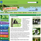
This article discusses the challenges facing a species of lemur in Madagascar. Due to atypical rain patterns resulting from climate change, the survival rate of the offspring of these lemurs is decreasing. The Climate Kids website is a NASA education resource featuring articles, videos, images and games focused on the science of climate change.

Subject:
Geoscience
Oceanography
Physical Science
Material Type:
Lecture
Provider:
NASA
Provider Set:
NASA Wavelength
Date Added:
11/05/2014
Climate Kids: Make a Terrarium Mini-garden
Read the Fine Print
Rating
0.0 stars

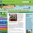
Instructions are provided for constructing a terrarium. The analogy between the terrarium and Earth is also provided. This activity is part of the Climate Kids website, a NASA education resource featuring articles, videos, images and games focused on the science of climate change.

Subject:
Geoscience
Physical Science
Space Science
Material Type:
Activity/Lab
Provider:
NASA
Provider Set:
NASA Wavelength
Date Added:
11/05/2014
Climate Kids: Water-wise Landscaper
Read the Fine Print
Rating
0.0 stars

A landscaper explains, through an interview format, how it is possible to design and maintain yards and gardens that require very little water. The Climate Kids website is a NASA education resource featuring articles, videos, images and games focused on the science of climate change.

Subject:
Ecology
Education
Forestry and Agriculture
Geoscience
History
History, Law, Politics
Life Science
Physical Science
Material Type:
Lecture
Provider:
NASA
Provider Set:
NASA Wavelength
Date Added:
11/05/2014
Common Misconceptions About the Polar Regions: Geography and Mapping
Conditional Remix & Share Permitted
CC BY-SA
Rating
0.0 stars

This article describes common misconceptions about the Arctic and Antarctica and how to test and teach for student understanding.

Subject:
Applied Science
Environmental Science
Geoscience
Physical Science
Space Science
Material Type:
Lesson Plan
Provider:
Ohio State University College of Education and Human Ecology
Provider Set:
Beyond Penguins and Polar Bears: An Online Magazine for K-5 Teachers
Author:
Jessica Fries-Gaither
Date Added:
10/17/2014
Computer Cartography course plan
Conditional Remix & Share Permitted
CC BY-NC
Rating
0.0 stars

To address the cost of resources for exercise manuals in GIS, I have developed a series of class exercises that can be used with QGIS, a free and open source software.
In addition, some class activities address more general ideas associated with cartography, such as color theory. To make these resources fully accessible to students, I have recorded publicly available videos documenting how these class activities can be completed. There is one video for each classroom lesson in this course offering, and links to all of the videos on the website Vimeo are linked to.

DESCRIPTION
Develops skills needed to produce maps using ArcGIS Desktop software. Outlines cartographic principles and map use. Emphasis on mapping techniques within a GIS. Intended for students enrolled in GIS or UAS programs.

LEARNING OUTCOMES
1. Demonstrate knowledge and apply skills essential to the discipline.
2. Coordinate and manage the delivery of reliable, valid, GIS data including analysis and specialized user needs products.
3. Communicate effectively and appropriately within a professional setting in both written and oral form.
4. Utilize professional communication skills to achieve project outcomes in collaboration with GIS users across disciplines.
5. Research, interpret and apply data/information in the professional setting.
6. Develop and implement GIS services for users who may or may not be GIS knowledgeable.

Subject:
Physical Geography
Physical Science
Material Type:
Lesson Plan
Author:
Patrick Kennelly
Date Added:
03/09/2020
Computer-aided Land Cover Mapping Protocol
Read the Fine Print
Educational Use
Rating
0.0 stars

The purpose of the resource is to produce a land cover type map from the digital file of a Landsat satellite image using MultiSpec software.

Subject:
Physical Geography
Physical Science
Material Type:
Activity/Lab
Interactive
Provider:
UCAR Staff
Provider Set:
GLOBE Teacher's Guide
Author:
The GLOBE Program, University Corporation for Atmospheric Research (UCAR)
Date Added:
08/01/2003
Constructing a Model of ppbv of Surface Ozone
Read the Fine Print
Educational Use
Rating
0.0 stars

The purpose of this activity is to construct a model that will provide students with a visual representation of parts per billion. Students work in teams to construct cubes of different volumes and to compare them to get a feel for parts per million by volume and parts per billion by volume. The intended outcome is that students gain a feeling for the small quantities of gases, such as ozone, present in the Earth's atmosphere.

Subject:
Atmospheric Science
Physical Science
Material Type:
Activity/Lab
Interactive
Lesson Plan
Provider:
UCAR Staff
Provider Set:
GLOBE Teacher's Guide
Author:
The GLOBE Program, UCAR (University Corporation for Atmospheric Research)
Date Added:
08/01/2003
Contour Plates
Read the Fine Print
Rating
0.0 stars

In this activity, students construct three-dimensional models from terrain information provided by two-dimensional topographic maps. This will allow them to visualize how changes in elevation over a certain distance can be represented on a flat piece of paper that can be folded up and tucked away. Each group is responsible for constructing a model of Mount St. Helens 'before' and 'after', a depression, a stream, and a hill. Discussion questions related to the different representations are also included.

Subject:
Astronomy
Chemistry
Geoscience
Physical Geography
Physical Science
Physics
Space Science
Material Type:
Activity/Lab
Interactive
Provider:
UCAR Staff
Provider Set:
New York State Earth Science Instructional Collection
Author:
Drew Patrick
Date Added:
11/06/2014