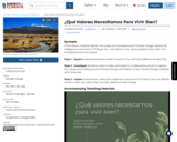
SYNOPSIS: In this lesson, students identify the causes and consequences of climate …
SYNOPSIS: In this lesson, students identify the causes and consequences of climate change, explore the Indigenous cosmovision of El Buen Vivir, and reflect on the values needed to live within the ecological limits of the planet.
SCIENTIST NOTES: The lesson highlights the importance of protecting nature and recognizes the role played by Indigenous Peoples in protecting biodiversity and living well with nature. Students will find this lesson promising and insightful as it prepares them to be environmental stewards. All the materials are credible, and this lesson is recommended for teaching.
La lección destaca la importancia de proteger la naturaleza y reconoce el papel que juegan los pueblos indígenas en la protección de la biodiversidad y vivir bien con la naturaleza. Los estudiantes encontrarán esta lección prometedora y perspicaz, ya que los prepara para ser administradores ambientales. Todos los materiales tienen buenas fuentes y esta lección se recomienda para la enseñanza.
POSITIVES: -This lesson integrates interpersonal and presentational speaking skills with listening and reading activities from authentic Spanish-language sources. -Students make interdisciplinary connections to science and global challenges. -Students explore the diversity of Indigenous cultures in Latin America and are exposed to women who are Indigenous leaders. -Many activities are student-led and reinforce new vocabulary in multi-modal ways. -Answer keys are provided for the listening activities. -The teacher can leave the posters or artwork visible in the classroom to refer back to when discussing values related to other topics or units later in the year.
ADDITIONAL PREREQUISITES: -Students should have a minimum of novice-high proficiency to complete the activities in this lesson. -Students should have a basic understanding of some natural cycles of the Earth in order to complete the activity in the Investigate section without teacher support.
DIFFERENTIATION: -Teachers can divide this lesson into two or more class periods as needed. For example, students can complete the Inquire and Investigate sections in one class period, complete the reading and video comprehension activities for homework, then complete the Inspire section in a second class period. -Teachers can extend the Inspire section to two class periods to accommodate in-class presentations or ask students to record their presentations for homework.
In this lesson, students identify the causes and consequences of climate change, …
In this lesson, students identify the causes and consequences of climate change, explore the Indigenous cosmovision of El Buen Vivir, and reflect on the values needed to live within the ecological limits of the planet.
Step 1 - Inquire: Students brainstorm what it means to “live well” from different perspectives.
Step 2 - Investigate: Students watch a video, participate in a collaborative activity to explore the causes and consequences of climate change, and reflect on how climate change interferes with living well.
Step 3 - Inspire: Students learn about the Indigenous cosmovision of El Buen Vivir and identify values in their own culture that can help address climate change.
Students build a watershed model to define what a watershed is, identify …
Students build a watershed model to define what a watershed is, identify the different parts within a watershed, and discover how water moves within a watershed. After learning Best Management Practices and mitigation techniques, students rebuild their models.
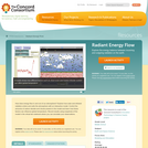
How does energy flow in and out of our atmosphere? Explore how …
How does energy flow in and out of our atmosphere? Explore how solar and infrared radiation enters and exits the atmosphere with an interactive model. Control the amounts of carbon dioxide and clouds present in the model and learn how these factors can influence global temperature. Record results using snapshots of the model in the virtual lab notebook where you can annotate your observations.
Groups of 3-4 students work in parallel on different radiocarbon data sets …
Groups of 3-4 students work in parallel on different radiocarbon data sets in this project assignment; the content described here would comprise one group data set including a brief descriptive statement and bibliographic reference, raw data including errors, background lecture notes, and an example final poster presentation.
(Note: this resource was added to OER Commons as part of a batch upload of over 2,200 records. If you notice an issue with the quality of the metadata, please let us know by using the 'report' button and we will flag it for consideration.)
In this lesson, students will examine the amount of annual and seasonal …
In this lesson, students will examine the amount of annual and seasonal rainfall in four cities to compare decimals to the hundredths place. Students will add and round digits to the thousandths place. Students will utilize technology by navigating to a specific United States climate website to get relatively current and accurate data. This unit was created as part of the ALEX Interdisciplinary Resource Development Summit.
In this hands-on inquiry-based activity, students face an engineering challenge based on …
In this hands-on inquiry-based activity, students face an engineering challenge based on real-world applications. They are tasked with developing a tool they can use to measure the amount of rain that falls each day. This is more of a mini unit than a stand alone activity.
The students are asked to identify the drainage area at which channels …
The students are asked to identify the drainage area at which channels begin on the island of Hawaii. Using ARC GIS, they are asked to create a slope, contour, and hillshade map. They use these maps as a guide to create river shape files with different drainage area thresholds in order to identify the proper threshold or thresholds. They are then given a map of the actual river locations and a precipitation map. The students must hand in their maps along with a write-up that describes how they used the slope, contour and hillshade maps to determine the location of rivers. They must also report on what drainage area threshold(s) they chose and why. They are also asked to explain why the map of the actual river locations looks different from any of river maps that they created. This activity gives students practice at interpreting and synthesizing multiple data sets. Designed for a geomorphology course Uses online and/or real-time data
(Note: this resource was added to OER Commons as part of a batch upload of over 2,200 records. If you notice an issue with the quality of the metadata, please let us know by using the 'report' button and we will flag it for consideration.)
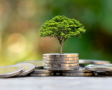
Ranchers are participating in a pilot project to improve carbon storage and …
Ranchers are participating in a pilot project to improve carbon storage and reduce net greenhouse gas emissions. After quantifying their baseline emissions and carbon storage, they implement conservation practices that may let them tap into revenue from voluntary carbon markets.
This unit applies a spreadsheet, based on the storm water hydrograph modeling …
This unit applies a spreadsheet, based on the storm water hydrograph modeling module, that applies the widely utilized Rational Method to estimate hydrographs and flooding for urban watersheds. The specific structure of the model is based on assumptions encoded for Maricopa County, Arizona, which is an urbanized area in the Desert Southwest of the USA, so the model is directly applicable to any similar climate. The model is broadly applicable to urban watersheds anywhere in the world, if appropriate adjustments are made to model parameters and if the necessary input data can be obtained. This model is designed to be utilized in parallel with a modeling guide by the same authors and alongside conceptual instruction in the hydrological concepts of rainfall and runoff processes in undergraduate classrooms. Hydrology and/or computational learning outcomes are assessed using a validated pre/post assessment instrument included with the unit.
(Note: this resource was added to OER Commons as part of a batch upload of over 2,200 records. If you notice an issue with the quality of the metadata, please let us know by using the 'report' button and we will flag it for consideration.)
Students answer several questions about Rayleigh fractionation and the oxygen isotope composition …
Students answer several questions about Rayleigh fractionation and the oxygen isotope composition of ice cores which require them to manipulate the values and equations in a MS Excel spreadsheet. This helps them to see how the oxygen isotope composition of ice cores changes with temperature in the high latitudes. Future iterations of the exercise should include a visualization of the Clausius-Clapeyron equation.
(Note: this resource was added to OER Commons as part of a batch upload of over 2,200 records. If you notice an issue with the quality of the metadata, please let us know by using the 'report' button and we will flag it for consideration.)
In this activity, students learn about the tools and methods paleoclimatologists use …
In this activity, students learn about the tools and methods paleoclimatologists use to reconstruct past climates. In constructing sediment cores themselves, students will achieve a very good understanding of the sedimentological interpretation of past climates that scientists can draw from cores.
This lesson plan pretends to connect Economics basic concepts such as Scarcity, …
This lesson plan pretends to connect Economics basic concepts such as Scarcity, Trade offs and opportunity cost and Climate Change awareness. It has been designed for Economics Course for High School students.
This visualization offers a variety of realistic actions anyone can take to …
This visualization offers a variety of realistic actions anyone can take to live a more sustainable lifestyle. Topics include how to create an energy efficient home, how to practice sustainable shopping, how to adopt sustainable eating habits, and how to prioritize eco-friendly transportation and travel.
This activity engages learners to investigate the impact of Earth's tilt and …
This activity engages learners to investigate the impact of Earth's tilt and the angle of solar insolation as the reason for seasons by doing a series of hands-on activities that include scale models. Students plot the path of the Sun's apparent movement across the sky on two days separated by three months of time.
The inquiry method and meteorological and astronomical online data can be used …
The inquiry method and meteorological and astronomical online data can be used to elicit the inconsistencies of students' naÃve ideas about the "real" reasons for the seasons. The first phase of this two-part investigation uses online meteorological data to identify factors that might explain differences of seasonal temperatures among cities These factors are used to hypothesize why differences of seasonal temperatures occur among cities. During the second phase, the variables and hypotheses that were previously identified in part one are used to design and conduct an inquiry-oriented investigation. Astronomical data is used as part of the investigation to "test" students' hypotheses -- conclusions are drawn then communicated.
(Note: this resource was added to OER Commons as part of a batch upload of over 2,200 records. If you notice an issue with the quality of the metadata, please let us know by using the 'report' button and we will flag it for consideration.)
No restrictions on your remixing, redistributing, or making derivative works. Give credit to the author, as required.
Your remixing, redistributing, or making derivatives works comes with some restrictions, including how it is shared.
Your redistributing comes with some restrictions. Do not remix or make derivative works.
Most restrictive license type. Prohibits most uses, sharing, and any changes.
Copyrighted materials, available under Fair Use and the TEACH Act for US-based educators, or other custom arrangements. Go to the resource provider to see their individual restrictions.