Updating search results...

Search Resources

969 Results

View
Selected filters:
  • Measurement and Data
Measuring Ground Motion with GPS: How GPS Works (Demonstration)
Conditional Remix & Share Permitted
CC BY-NC-SA
Rating
0.0 stars

With printouts of typical GPS velocity vectors found near different tectonic boundaries and models of a GPS station, demonstrate how GPS work to measure ground motion.GPS velocity vectors point in the direction that a GPS station moves as the ground it is anchored to moves. The length of a velocity vector corresponds to the rate of motion. GPS velocity vectors thus provide useful information for how Earth's crust deforms in different tectonic settings.

(Note: this resource was added to OER Commons as part of a batch upload of over 2,200 records. If you notice an issue with the quality of the metadata, please let us know by using the 'report' button and we will flag it for consideration.)

Subject:
Biology
Life Science
Mathematics
Measurement and Data
Statistics and Probability
Material Type:
Activity/Lab
Homework/Assignment
Provider:
Science Education Resource Center (SERC) at Carleton College
Provider Set:
Teach the Earth
Author:
Shelley Olds
Date Added:
08/27/2022
Measuring Plate Motion with GPS: Iceland
Conditional Remix & Share Permitted
CC BY-NC-SA
Rating
0.0 stars

This lesson teaches middle and high school students to understand the architecture of GPS -- from satellites to research quality stations on the ground. This is done with physical models and a presentation. Then students learn to interpret data for the station's position through time ("time series plots"). Students represent time series data as velocity vectors and add the vectors to create a total horizontal velocity vector. They apply their skills to discover that the Mid-Atlantic Ridge is rifting Iceland. They cement and expand their understanding of GPS data with an abstraction using cars and maps. Finally, they explore GPS vectors in the context of global plate tectonics.

(Note: this resource was added to OER Commons as part of a batch upload of over 2,200 records. If you notice an issue with the quality of the metadata, please let us know by using the 'report' button and we will flag it for consideration.)

Subject:
Biology
Life Science
Mathematics
Measurement and Data
Statistics and Probability
Material Type:
Activity/Lab
Provider:
Science Education Resource Center (SERC) at Carleton College
Provider Set:
Teach the Earth
Author:
Shelley Olds
Date Added:
08/27/2022
Measuring the Earth
Conditional Remix & Share Permitted
CC BY-NC-SA
Rating
0.0 stars

Because the campuses of the University of Kansas and the University of Houston are almost directly on a N-S line we can duplicate many aspects of the classic measurement of Eratosthenese in determining the circumference of the Earth. We use a web cast (backed up by cell phones) to communicate between the two campuses in real time. We measure the shadow of a 2 m stick in both locations at the same time and then go through the math required to calculate the size of the planet.

(Note: this resource was added to OER Commons as part of a batch upload of over 2,200 records. If you notice an issue with the quality of the metadata, please let us know by using the 'report' button and we will flag it for consideration.)

Subject:
Biology
Life Science
Mathematics
Measurement and Data
Statistics and Probability
Material Type:
Activity/Lab
Provider:
Science Education Resource Center (SERC) at Carleton College
Provider Set:
Teach the Earth
Author:
Peter Copeland
Date Added:
08/06/2019
Metric Conversion of Liters and Milliliters to Find Equivalent Units
Conditional Remix & Share Permitted
CC BY-NC-SA
Rating
0.0 stars

This short video and interactive assessment activity is designed to give fifth graders an overview of conversion of capacity units (metric units).

Subject:
Mathematics
Measurement and Data
Material Type:
Assessment
Interactive
Lecture
Provider:
CK-12 Foundation
Provider Set:
CK-12 Elementary Math
Date Added:
03/06/2015
Metric Length Comparison in Meters Centimeters and Millimeters
Conditional Remix & Share Permitted
CC BY-NC-SA
Rating
0.0 stars

This short video and interactive assessment activity is designed to teach fifth graders about comparing meters, centimeters, and millimeters.

Subject:
Mathematics
Measurement and Data
Material Type:
Assessment
Interactive
Lecture
Provider:
CK-12 Foundation
Provider Set:
CK-12 Elementary Math
Date Added:
03/06/2015
The Metrical Mastrix in Teaching Mineralogy
Conditional Remix & Share Permitted
CC BY-NC-SA
Rating
0.0 stars

The calculation of the d-spacings, the angles between planes and zones, the bond lengths and angles and other important geometric relationships for a mineral can be a tedious task for the student and the instructor, particularly when completed with the large assortment of trigonometric identities and algebraic formulae that are available. However, such calculations are straightforward and relatively easy to do when completed with the metrical matrix and the interactive software MATOP. Several applications of the matrix are presented here, each of which is worked out in detail and which is designed to teach its use in the study of crystal geometry.

(Note: this resource was added to OER Commons as part of a batch upload of over 2,200 records. If you notice an issue with the quality of the metadata, please let us know by using the 'report' button and we will flag it for consideration.)

Subject:
Biology
Life Science
Mathematics
Measurement and Data
Statistics and Probability
Material Type:
Activity/Lab
Provider:
Science Education Resource Center (SERC) at Carleton College
Provider Set:
Teach the Earth
Date Added:
09/04/2019
Microplastic Extraction of Exfoliating Beads from Cleansers
Read the Fine Print
Educational Use
Rating
0.0 stars

After watching a short online video that recaps the enormous scale of accumulating plastic waste in our oceans, student teams are challenged to devise a method to remove the most plastic microbeads from a provided commercial personal care product—such as a facial cleanser or body wash. They brainstorm filtering methods ideas and design their own specific procedures that use teacher-provided supplies (coffee filters, funnels, plastic syringes, vinyl tubing, water, plastic bags) to extract the microplastics as efficiently as possible. The research and development student teams compare the final masses of their extracted microbeads to see which filter solutions worked best. Students suggest possible future improvements to their filter designs. A student worksheet is provided.

Subject:
Applied Science
Engineering
Life Science
Mathematics
Measurement and Data
Material Type:
Activity/Lab
Provider:
TeachEngineering
Provider Set:
Activities
Author:
David Bennett
Sara Hettenbach
William Welch
Date Added:
06/01/2018
Middle School Water Quality Curriculum Synopsis
Only Sharing Permitted
CC BY-NC-ND
Rating
0.0 stars

Middle School Water Quality Curriculum SynopsisDesign your own wetland science field trip or have WREN staff visit your classroom.Programs address Oregon State Science Standards and Common Core State Learning Standards. Purpose of the Water Quality Curriculum: •    For students to model the scientific method, engineering, math, and social studies practices. •    To explore and solve problems along the Long Tom River Watershed. •    To use tools and technology to collect data and use that data to answer questions.•    To engineer solutions to real-life problems and learn how to resolve water quality disputes in real-life scenarios.  Each lesson can be integrated into our 2-hour tour of the West Eugene Wetlands (WEW). How much time is required for the lesson, the best season, and where the lesson is best experienced is indicated next to the lesson tile._______________________________________________________________________________________________What is a Watershed? Activity/ 50 minutes (Class or WEW):It’s recommended that all classes begin their wetland field study with this fun and interactive, whole-body activity that investigates how vegetation affects the movement of water over land surfaces and identifies best management practices to reduce erosion. Science Standards: MS-ESS2; MS-ESS2-4.    Earth’s Systems: Develop a model to describe cycling of water through earth’s systems driven by energy from the sun and force of gravity._______________________________________________________________________________________________Wetland Soil Study/ 90 minutes (WEW- Fall or Spring):Students will learn the history behind the unique composition of soil in the southern Willamette Valley, discover how wetland soils have an important role in filtering and cleaning the water that runs through them, explore and record the physical characteristics of wetland soil using a Munsell Chart, measure the hydric capacity of different types of soil, and make the connection between soils and water in a wet prairie. Science Standards: MS-ESS2-2.    Earth’s Systems: Construct an explanation based on evidence for how geoscience processes have changed Earth's surface at varying time and spatial scales.Common Core Standards:Mathematics7.EE.B.4.     Use variables to represent quantities in a real-world of mathematical problem, and construct simple equations and inequalities to solve problems by reasoning about quantities.______________________________________________________________________________________________           Water Quality of Amazon Creek/ 90 minutes (WEW- Fall and Spring):Through experimentation and a simulation, students will learn how increases in water acidity have endangered the quality of life for water-based organisms in parts of Eugene. Students will model water molecules under different circumstances, test water samples from Amazon creek for dissolved oxygen, PH, and temperature and learn how these variables impact the quality of life in our waterways.  Science Standards: MS-PS1-1.          Matter and Its Interactions: Develop models to describe the atomic composition of simple molecules  and extended structures.Common Core Standards:Mathematics 6.SP.B.4.            Display numerical data in plots on a number line, including dot plots, histograms, and box plots.7.EE.3.               Solve multiple real-life & mathematical problems posed with positive and negative rational numbers in any form using tools strategically. Apply properties of operations to calculate with numbers in any form. _______________________________________________________________________________________________Flood-Plan Engineering Design/ 90 minutes (WEW or Class- Fall, Winter, Spring):Students will learn about historic floods in the Willamette Valley, and explore flood dynamics by building models of riverbeds and testing their holding capacity. Students will use engineering to design systems that will help prevent flood damage and learn about how human modifications to a river or wetland can alter the floodplain.Science Standards:MS-ESS3-3.     Earth’s & Human Activity: Apply Scientific principles to design a method for monitoring and minimizing a human impact on the environment.MS-ESS3-2.    Earth’s & Human Activity: Analyze and interpret data on natural hazards to forecast future catastrophic events and inform the development of technologies to mitigate their efforts.MS-ETS1-1; 1-4. Engineering Design: Develop a model to generate data for iterative testing and modification of a  proposed object, tool, or process such that an optimal design can be achieved.  Common Core Standards:MathematicsMP.2.        Reason abstractly and quantitatively._______________________________________________________________________________________________Water Quality Debate/ 60 minutes (Class- Fall, Winter, Spring):Students will demonstrate how disputes regarding water quality and quantity can be settled through mediation by playing character roles in a mock Town Hall Meeting. They will develop and engage in an evidence supporting argument surrounding a local water-related issue, evaluate arguments presented by others of different viewpoints, and decide on a resolution.Science Standards:MS-LS2-5.    Ecosystems: Interactions, Energy and Dynamics: Evaluate competing design solutions for maintaining biodiversity and ecosystem servicesCommon Core Standards:ELA/LiteracyMS-LS-2-2.    Engage effectively in a range of collaborative discussions (one on one, in groups, and teacher led) with diverse partners on grade 8 topics, texts, and issues, building on other’s ideas and expressing their own clearly. MS-LS2-2.    Present claims or findings, emphasizing salient points in a focused coherent manner with relevant evidence, sound valid reasoning and adequate well-chosen details, use appropriate eye contact, adequate volume, and other pronunciation. 
Subject:
Computer Science
Ecology
Engineering
Environmental Science
Environmental Studies
Measurement and Data
Ratios and Proportions
Sociology
Speaking and Listening
Material Type:
Lesson Plan
Author:
Laura Maloney
Date Added:
08/03/2018
Mixed Adding and Subtracting of Capacities English Units
Conditional Remix & Share Permitted
CC BY-NC-SA
Rating
0.0 stars

This short video and interactive assessment activity is designed to teach fifth graders about mixed adding and subtracting of capacities (english units).

Subject:
Mathematics
Measurement and Data
Material Type:
Assessment
Interactive
Lecture
Provider:
CK-12 Foundation
Provider Set:
CK-12 Elementary Math
Date Added:
03/06/2015
Mixed Operations Addition and Subtraction Metric Capacities
Conditional Remix & Share Permitted
CC BY-NC-SA
Rating
0.0 stars

This short video and interactive assessment activity is designed to give fifth graders an overview of metric capacity operations.

Subject:
Mathematics
Measurement and Data
Material Type:
Assessment
Interactive
Lecture
Provider:
CK-12 Foundation
Provider Set:
CK-12 Elementary Math
Date Added:
03/06/2015
Modeling Earth's Temperature
Conditional Remix & Share Permitted
CC BY-NC-SA
Rating
0.0 stars

Students use the STELLA program to create hierarchies of models of increasing complexity to understand the absorption of solar energy by the Earth and its radiation of that energy back to space.

(Note: this resource was added to OER Commons as part of a batch upload of over 2,200 records. If you notice an issue with the quality of the metadata, please let us know by using the 'report' button and we will flag it for consideration.)

Subject:
Biology
Chemistry
Geoscience
Life Science
Mathematics
Measurement and Data
Physical Science
Space Science
Statistics and Probability
Material Type:
Activity/Lab
Interactive
Provider:
Science Education Resource Center (SERC) at Carleton College
Provider Set:
Teach the Earth
Author:
Kirsten Menking
Date Added:
09/03/2019
Modeling: Rolling Cups
Only Sharing Permitted
CC BY-NC-ND
Rating
0.0 stars

This lesson unit is intended to help teachers assess how well students are able to: choose appropriate mathematics to solve a non-routine problem; generate useful data by systematically controlling variables; and develop experimental and analytical models of a physical situation.

Subject:
Functions
Geometry
Mathematics
Measurement and Data
Material Type:
Assessment
Lesson Plan
Provider:
Shell Center for Mathematical Education
Provider Set:
Mathematics Assessment Project (MAP)
Date Added:
04/26/2013
Modeling the interior of the Earth using Seismic Waves
Conditional Remix & Share Permitted
CC BY-NC-SA
Rating
0.0 stars

Students use a variety of tools to explore the interior of the Earth in this inquiry activity.

(Note: this resource was added to OER Commons as part of a batch upload of over 2,200 records. If you notice an issue with the quality of the metadata, please let us know by using the 'report' button and we will flag it for consideration.)

Subject:
Biology
Geology
Geoscience
Life Science
Mathematics
Measurement and Data
Physical Science
Statistics and Probability
Material Type:
Activity/Lab
Interactive
Provider:
Science Education Resource Center (SERC) at Carleton College
Provider Set:
Teach the Earth
Author:
Eric Baer
Date Added:
08/28/2020
Modi-FLIED
Conditional Remix & Share Permitted
CC BY-NC
Rating
0.0 stars

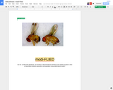
Students will breed fruit flies through several generations and record their data using mathematical models in order to demonstrate the inheritance of trait variations.

Subject:
Algebra
Genetics
Life Science
Mathematics
Measurement and Data
Numbers and Operations
Ratios and Proportions
Material Type:
Unit of Study
Provider:
Lane County STEM Hub
Provider Set:
Content in Context SuperLessons
Author:
Courtney Stitt
Jessica Johnson
Date Added:
06/27/2017
Module 1: An Ecology/Climate Scenario
Conditional Remix & Share Permitted
CC BY-NC-SA
Rating
0.0 stars

In this module, participants read a short scenario and answer a series of questions to emulate the scientific process of making observations and hypotheses. Entitled "Gotta find a better place to fish...", the scenario details observations of biological, environmental, and ecological changes to a mountain stream over time. Participants answer questions that ask them to hypothesize why some of these changes might be occurring and how they are related. Part of the Neotoma Education Modules for Biotic Response to Climate Change.

(Note: this resource was added to OER Commons as part of a batch upload of over 2,200 records. If you notice an issue with the quality of the metadata, please let us know by using the 'report' button and we will flag it for consideration.)

Subject:
Applied Science
Biology
Environmental Science
History
Information Science
Life Science
Mathematics
Measurement and Data
Material Type:
Activity/Lab
Provider:
Science Education Resource Center (SERC) at Carleton College
Provider Set:
Teach the Earth
Author:
James S. Oliver III and Russell W. Graham
Pennsylvania State University
Date Added:
08/05/2022