The free-air effect tells us that as elevation above sea level increases, …
The free-air effect tells us that as elevation above sea level increases, gravitational acceleration g decreases at the rate of about 0.3086 mgal/meter. This effect is routinely corrected for when making gravity surveys. We will use the LaCoste & Romberg gravimeter to measure the free-air effect in a tall building on campus, and compare with the theoretical value.
keywords: gravity; vertical gradient; gravimeter
(Note: this resource was added to OER Commons as part of a batch upload of over 2,200 records. If you notice an issue with the quality of the metadata, please let us know by using the 'report' button and we will flag it for consideration.)
Students use a variety of tools to explore the interior of the …
Students use a variety of tools to explore the interior of the Earth in this inquiry activity.
(Note: this resource was added to OER Commons as part of a batch upload of over 2,200 records. If you notice an issue with the quality of the metadata, please let us know by using the 'report' button and we will flag it for consideration.)
In this lab activity students are given five different map views of …
In this lab activity students are given five different map views of the continent of Australia: Geology, Gravity Anomaly, Magnetic Anomaly, Digital Elevation, and Satellite Image, and asked to investigate and interpret these different data sets. The primary goal is to introduce students to the potential of geophysical data for regional geologic and tectonic investigations.
(Note: this resource was added to OER Commons as part of a batch upload of over 2,200 records. If you notice an issue with the quality of the metadata, please let us know by using the 'report' button and we will flag it for consideration.)
This course provides an introduction to nonlinear dynamics and chaos in dissipative …
This course provides an introduction to nonlinear dynamics and chaos in dissipative systems. The content is structured to be of general interest to undergraduates in science and engineering. The course concentrates on simple models of dynamical systems, mathematical theory underlying their behavior, their relevance to natural phenomena, and methods of data analysis and interpretation. The emphasis is on nonlinear phenomena that may be described by a few variables that evolve with time.
A 15-20 minute think-pair-share activity interpreting a deep-sea sediment core combining concepts …
A 15-20 minute think-pair-share activity interpreting a deep-sea sediment core combining concepts from oceanography, sedimentology, and plate tectonics.
(Note: this resource was added to OER Commons as part of a batch upload of over 2,200 records. If you notice an issue with the quality of the metadata, please let us know by using the 'report' button and we will flag it for consideration.)
Oceans Socratic questions and answers. (Note: this resource was added to OER …
Oceans Socratic questions and answers.
(Note: this resource was added to OER Commons as part of a batch upload of over 2,200 records. If you notice an issue with the quality of the metadata, please let us know by using the 'report' button and we will flag it for consideration.)
The Chukchi Sea, a broad and shallow sea between Siberia and Alaska, …
The Chukchi Sea, a broad and shallow sea between Siberia and Alaska, has a profound influence on Arctic climate and on the supply of fresh water and nutrients to the Arctic Ocean. Join Scripps Oceanography geophysicist Neal Driscoll as he presents research findings from two Arctic cruises onboard the U.S. Coast Guard icebreaker Healy that provide intriguing new insightsinto the complex climatic and sea level history of the Arctic. (55 minutes)
This undergraduate petrology course surveys the distribution, chemical composition, and mineral associations …
This undergraduate petrology course surveys the distribution, chemical composition, and mineral associations in rocks of the earth's crust and upper mantle, and establishes its relation to tectonic environment. The emphasis of the course is on the use of chemistry and physics to interpret rock forming processes.
This course discusses phase transitions in Earth's interior. Phase transitions in Earth …
This course discusses phase transitions in Earth's interior. Phase transitions in Earth materials at high pressures and temperatures cause the seismic discontinuities and affect the convections in the Earth's interior. On the other hand, they enable us to constrain temperature and chemical compositions in the Earth's interior. However, among many known phase transitions in mineral physics, only a few have been investigated in seismology and geodynamics. This course reviews important papers about phase transitions in mantle and core materials.
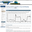
In this exercise, students relate large-scale features on Earth's surface to lithospheric …
In this exercise, students relate large-scale features on Earth's surface to lithospheric plates, the underlying asthenosphere, earthquakes, and volcanoes. After creating a cross section showing elevation using GeoMapApp, students add additional features by hand.
(Note: this resource was added to OER Commons as part of a batch upload of over 2,200 records. If you notice an issue with the quality of the metadata, please let us know by using the 'report' button and we will flag it for consideration.)
This a semester long activity for students in a plate tectonics course …
This a semester long activity for students in a plate tectonics course will be read one (or two) geological journal articles every other week on the major topics covered in the course. Students will submit reading responses and there will be class discussions of each paper.
(Note: this resource was added to OER Commons as part of a batch upload of over 2,200 records. If you notice an issue with the quality of the metadata, please let us know by using the 'report' button and we will flag it for consideration.)
This resource is a video abstract of a research paper created by …
This resource is a video abstract of a research paper created by Research Square on behalf of its authors. It provides a synopsis that's easy to understand, and can be used to introduce the topics it covers to students, researchers, and the general public. The video's transcript is also provided in full, with a portion provided below for preview:
"The Amazon River drainage basin is the largest river system in the world New research suggests that the Amazon is rerouting water from a neighboring river in a phenomenon called "river capture" River capture can cause rivers to change course or reverse flow direction and forge new waterways for fish and other organisms to travel through But the process of river capture is rarely observed and poorly understood Now, researchers think they’ve identified a river capture in action The Rio Casiquiare is rerouting water from the Rio Orinoco into an Amazon tributary All the water in the upper Rio Orinoco is expected to change course If this happens, the Amazon will acquire an additional ~40,000 km² of drainage area creating a river network of astonishing proportions Stokes, et al. Ongoing River Capture in the Amazon..."
The rest of the transcript, along with a link to the research itself, is available on the resource itself.
In this exercise, students use U.S. Geological Survey and other websites to …
In this exercise, students use U.S. Geological Survey and other websites to learn about the history of earthquakes in New York. Through their web research, they will learn what earthquakes are, how and where they occur, and the types of hazards associated with large quakes. They are encouraged to write a report summarizing their results.
Maps displaying global environmental data (specifically Solar Energy and Average Temperature) through …
Maps displaying global environmental data (specifically Solar Energy and Average Temperature) through the course of a year are compared in order to understand how the Earth works as a system focusing on Polar Regions. Students then explore data from schools located in Alaska and Antarctica to understand processes that drive the temperature patterns; students then visit the National Snow and Ice Data Center Web site to learn more about the Cryosphere (focusing on Albedo and Sea Ice); finally students visit NOAA's web site looking at data of Sea Ice data anomalies. (Link to the relevant pages in these web sites are listed below.)
(Note: this resource was added to OER Commons as part of a batch upload of over 2,200 records. If you notice an issue with the quality of the metadata, please let us know by using the 'report' button and we will flag it for consideration.)
This laboratory activity demonstrates how seismic waves are generated and helps students …
This laboratory activity demonstrates how seismic waves are generated and helps students understand how they can reveal the composition of Earth's inner layers. Students will construct models by filling shoe boxes with various materials, drop rocks on them to generate 'seismic waves', record the waves, and make observations about their differences.
The following lab will introduce students to the basic concepts of seismic …
The following lab will introduce students to the basic concepts of seismic refraction as well as some actual data collected during seismic refraction surveys. You will use your knowledge of seismic refraction to calculate various parameters of interest. The two travel time data sets come from an existing SERC activity by Robert Cicerone at Bridgewater State College.
(Note: this resource was added to OER Commons as part of a batch upload of over 2,200 records. If you notice an issue with the quality of the metadata, please let us know by using the 'report' button and we will flag it for consideration.)
This cross-disciplinary course aims to understand the historical development and the current …
This cross-disciplinary course aims to understand the historical development and the current status of ideas and models, to present and question the constraints from the different research fields, and to investigate if and how the different views on mantle flow can be reconciled with the currently available data.
The main objective of this cross-disciplinary course is to understand the historical …
The main objective of this cross-disciplinary course is to understand the historical development and the current status of ideas and models, to present and question the constraints from the different research fields, and to investigate if and how the different views on mantle flow can be reconciled with the currently available data.
Seismograms of the 2004 M9.0 Sumatra earthquake, as recorded on station WANC …
Seismograms of the 2004 M9.0 Sumatra earthquake, as recorded on station WANC on Wrnagell volcano, Alaska. The red signal shows the raw data and the blue represented data that have been lowpass filtered. The red spikes near 2800 s are local microearthquakes triggered by the passing of the surface waves.
Provenance: Jackie Caplan-Auerbach, Western Washington University Reuse: This item is offered under a Creative Commons Attribution-NonCommercial-ShareAlike license http://creativecommons.org/licenses/by-nc-sa/3.0/ You may reuse this item for non-commercial purposes as long as you provide attribution and offer any derivative works under a similar license.
In this exercise, written for an undergraduate seismology class, students use MATLAB to analyze waveforms from the 2004 Sumatra M9.0 earthquake, as they were recorded on three seismic stations in Alaska. Two of the stations are broadbands and one is a short period station. Students use MATLAB scripts (provided) to plot and filter the time series data and to calculate power spectra at the different stations. They also see that surface waves from the Sumatra earthquake triggered microseismicity at Wrangell volcano as they passed through the hydrothermal system, an observation first made by West et al. (2005).
To view this video please enable JavaScript, and consider upgrading to a web browser that supports HTML5 video
Click to watch Jackie Caplan-Auerbach discuss her activity or watch the full webinar.
In doing this exercise students learn how the type of instrument and the instrument response affect the appearance of a seismogram. They identify body and surface waves in broadband seismograms. After examining the data on their own, students read a scientific paper that describes how microearthquakes were triggered by the passing surface waves. Not only does this provide them with experience reading and interpreting a scientific paper, but it shows them the types of observations made by the authors when they first analyzed the same data presented in this study.
(Note: this resource was added to OER Commons as part of a batch upload of over 2,200 records. If you notice an issue with the quality of the metadata, please let us know by using the 'report' button and we will flag it for consideration.)
These are short exercises that allow students practice with concepts in Structural …
These are short exercises that allow students practice with concepts in Structural Geology, Tectonics, or Geophysics. (Many of them were designed with Eric Horsman.) The basic idea is to give students opportunities for frequent practice with difficult concepts, many of which require spatial visualization skills. These activities nearly always fit on a half-sheet of paper, and include a visual and verbal component. Instructors may use them for formative assessment or as group activities in class.
(Note: this resource was added to OER Commons as part of a batch upload of over 2,200 records. If you notice an issue with the quality of the metadata, please let us know by using the 'report' button and we will flag it for consideration.)
No restrictions on your remixing, redistributing, or making derivative works. Give credit to the author, as required.
Your remixing, redistributing, or making derivatives works comes with some restrictions, including how it is shared.
Your redistributing comes with some restrictions. Do not remix or make derivative works.
Most restrictive license type. Prohibits most uses, sharing, and any changes.
Copyrighted materials, available under Fair Use and the TEACH Act for US-based educators, or other custom arrangements. Go to the resource provider to see their individual restrictions.