In this lab, students measure a topographic and geologic cross-section across a …
In this lab, students measure a topographic and geologic cross-section across a floodplain by simple surveying and auguring techniques.
(Note: this resource was added to OER Commons as part of a batch upload of over 2,200 records. If you notice an issue with the quality of the metadata, please let us know by using the 'report' button and we will flag it for consideration.)
Students explore the USGS water website to identify the location of stream …
Students explore the USGS water website to identify the location of stream gauges on the Minnesota River and the types of data that can be retrieved from the website. They determine which data to download based on the area of interest in the exercise (St. Peter, MN) and import historical flood data into MS Excel. The students use a spreadsheet to rank each flood and calculate a recurrence interval for a given flood, then estimate the discharge and stage of the 100-year flood in St. Peter, MN. The final task is to establish a flood hazard zone on a topographic map of the city of St. Peter. Note: this exercise can be applied to almost any non-dammed river with two or more USGS gaging stations on it. Go to http://water.usgs.gov and select your state from the pull-down menu to view an interactive map of your state's rivers and gaging station locations.
(Note: this resource was added to OER Commons as part of a batch upload of over 2,200 records. If you notice an issue with the quality of the metadata, please let us know by using the 'report' button and we will flag it for consideration.)
This exercise looks at the dollar losses and deaths caused by flooding …
This exercise looks at the dollar losses and deaths caused by flooding in the US, and at the causes of, and relationships between the two trends.
(Note: this resource was added to OER Commons as part of a batch upload of over 2,200 records. If you notice an issue with the quality of the metadata, please let us know by using the 'report' button and we will flag it for consideration.)
This is the data collection portion of a semester-long project. Before this …
This is the data collection portion of a semester-long project. Before this lab, students will have graphed discharge data for one previous water year, graphed similar data collected by classes during a previous year, written one-page explanations of the techniques that they will be using, and speculated about the results they expect to get. After this lab, their data will be shared with other lab sections, which will have collected similar data at other sites along the same river. Each research group will present their preliminary data to the class during a later lab meeting, and the class will discuss how the different types of data relate to one another. The project culminates in a final paper (one per research group).
(Note: this resource was added to OER Commons as part of a batch upload of over 2,200 records. If you notice an issue with the quality of the metadata, please let us know by using the 'report' button and we will flag it for consideration.)
This is a homework assignment used as preparation for a group research …
This is a homework assignment used as preparation for a group research project. Students graph annual discharge data from a local river by hand, and compare the discharge patterns from the stream above a reservoir with those below the dam. This exercise gives students practice graphing a small amount of data by hand, and gets them thinking about ways graphs can be used to help interpret data.
(Note: this resource was added to OER Commons as part of a batch upload of over 2,200 records. If you notice an issue with the quality of the metadata, please let us know by using the 'report' button and we will flag it for consideration.)
Most of this lab is a fairly traditional rocks-in-boxes lab on identification …
Most of this lab is a fairly traditional rocks-in-boxes lab on identification of sedimentary and metamorphic rocks. At the end of the lab, students practice identifying real rocks in the campus rock garden, which includes boulders of most of the bedrock units within our county. Students use GPS units to find the samples to identify (so that they can explore while the instructor answers other student questions). At each boulder, students identify the rock type, the minerals present, and the rock textures. The lab handout includes a simplified geologic map of an area that they previously visited on a field trip, and which they will use later in the semester in discussions of water samples that they collect.
(Note: this resource was added to OER Commons as part of a batch upload of over 2,200 records. If you notice an issue with the quality of the metadata, please let us know by using the 'report' button and we will flag it for consideration.)
This group research project serves as the focus for our introductory Earth …
This group research project serves as the focus for our introductory Earth Systems Science classes. Each of four to six lab sections of 15-25 students collect discharge, sediment load, and water chemistry data from a different site along a local river, and compare their data to that collected in previous years and at other sites along the river. The project incorporates topographic map reading and graphing as well as collecting and analyzing data, and presenting the results in oral and written form. Labs on rocks and minerals use samples from the project area to encourage students to make connections between the solid Earth and surface processes.
Each component of the Florida River Project is described below, with a link to the activity sheet and related files.
Topographic Maps: Integrated Florida River project Florida River Project: Minerals in the field Florida River Project: Sedimentary and metamorphic rocks lab Florida River Project: Plotting discharge data Plotting Florida River Data Using Excel Florida River Project: Measuring discharge, sediment, and water chemistry
(Note: this resource was added to OER Commons as part of a batch upload of over 2,200 records. If you notice an issue with the quality of the metadata, please let us know by using the 'report' button and we will flag it for consideration.)
The Florida River Project is a semester-long project involving (1) an individual …
The Florida River Project is a semester-long project involving (1) an individual project in which students pose a scientific question and use existing data to test their hypothesis, and (2) a group project in which students collect and present data associated with stream monitoring.
Outcomes of the individual project include: - Practice applying the process of science - Graphing and interpreting data - Making an argument supported by quantitative evidence. - Communicating a scientific argument in writing. - Supporting a scientific argument using appropriate formats (especially graphs and tables)
Outcomes of the group project include: - Collecting field data (discharge, sediment load, water chemistry) - Presenting data orally. - Discussing preliminary interpretations of data.
(Note: this resource was added to OER Commons as part of a batch upload of over 2,200 records. If you notice an issue with the quality of the metadata, please let us know by using the 'report' button and we will flag it for consideration.)
This is a travel itinerary featuring 13 historic shipwrecks in waters near …
This is a travel itinerary featuring 13 historic shipwrecks in waters near Florida, a convergence point for maritime trade routes. Learn about the historical significance of these 13 shipwrecks. See photos and an essay on Florida maritime history.
In this lesson designed to enhance literacy skills, students learn about the …
In this lesson designed to enhance literacy skills, students learn about the unique environment of southern Florida's Everglades and gain insights into the interrelatedness of living things, nonliving things, and climate.
This activity is a field investigation where students make observations, formulate a …
This activity is a field investigation where students make observations, formulate a question, construct and collect data on that question on stream flow on the Crow River in Central Minnesota
This video introduces viewers to oceanic thermohaline circulation - the system of …
This video introduces viewers to oceanic thermohaline circulation - the system of global ocean currents that cycle warm and cold water across the planet.
Explore pressure in the atmosphere and underwater. Reshape a pipe to see …
Explore pressure in the atmosphere and underwater. Reshape a pipe to see how it changes fluid flow speed. Experiment with a leaky water tower to see how the height and water level determine the water trajectory.
This exercise is intended to help link the observations of water and …
This exercise is intended to help link the observations of water and sediment motion that student made in the laboratory flume with the theory discussed in lecture. Students use the measurements made to ask some basic questions about what happened in the flume as the discharge was varied by a factor of two. Designed for a geomorphology course
(Note: this resource was added to OER Commons as part of a batch upload of over 2,200 records. If you notice an issue with the quality of the metadata, please let us know by using the 'report' button and we will flag it for consideration.)
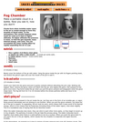
In this weather-related activity, learners make a portable cloud in a bottle. …
In this weather-related activity, learners make a portable cloud in a bottle. Learners discover that clouds form when invisible water vapor in the air is cooled enough to form tiny droplets of liquid water. You an accomplish the same cooling effect by rapidly expanding air in a jar using a wide-mouth jar, rubber glove, matches, and tap water. This activity can be conducted as a demonstration or by learners with adult supervision.
This six-week curriculum unit is designed for students in the second grade …
This six-week curriculum unit is designed for students in the second grade as they follow a water molecule through a watershed. The unit begins with Follow the Water from Brook to Ocean , a picture book by Arthur Dorros that introduces to primary-level students how water moves and how it has shaped our earth over time. The young scientists will use their skills of inquiry to understand the structure of a watershed, investigate human impact, and participate in activities and experiments throughout. Students will use journals to document their learning as they build vocabulary, identify stream order, discover how materials dissolve or not in our waters, create an aquifer, and design a game that simulates the pollution entering our watershed.
This online lesson provides perspectives from Native American community members, images, objects, …
This online lesson provides perspectives from Native American community members, images, objects, and other sources to help students and teachers understand the efforts of Native Nations of the Pacific Northwest to protect and sustain salmon, water, and homelands. Scroll to begin an exploration of the Pacific Northwest history and cultures.
Short Description: Drawing upon the food security literature and current events in …
Short Description: Drawing upon the food security literature and current events in the media, this survey course will encourage learners to build a new understanding of food security, water shortages in agricultural production, and climate change challenges in agriculture. We will introduce policy tools and case studies illustrating the effects that climate change has on agriculture which will be useful and applicable to individual cross-disciplinary learning.
Long Description: Food security is one of the most pressing dilemmas of our time. Around the globe, approximately 2 billion people experience some form of food deprivation each day. One in ten people suffer from some form of food insecurity in Canada. This has led scholars to question why food insecurity exists in an ostensibly food secure country. The literature on food security and climate change has also grown exponentially over the past several decades in large part as a response to world events such as the Green Revolution and other forms of industrial agricultural development since the 1970s. Despite the advances in research and technology, we still possess inadequate knowledge of the dynamics causing the onset of food insecurity, and significant disagreement persists among scholars concerning the best way to ameliorate food insecurity.
Drawing upon the food security literature and current events in the media, this survey course will encourage learners to build a new understanding of food security, water shortages in agricultural production, and climate change challenges in agriculture. We will introduce policy tools and case studies illustrating the effects that climate change has on agriculture which will be useful and applicable to individual cross-disciplinary learning.
This course is part of the Adaptation Learning Network led by the Resilience by Design Lab at Royal Roads University. The project is supported by the Climate Action Secretariat of the BC Ministry of Environment & Climate Change Strategy and Natural Resources Canada through its Building Regional Adaptation Capacity and Expertise (BRACE) program. The BRACE program works with Canadian provinces to support training activities that help build skills and expertise on climate adaptation and resilience.
Word Count: 19025
(Note: This resource's metadata has been created automatically by reformatting and/or combining the information that the author initially provided as part of a bulk import process.)
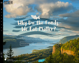
The Future of Food is an introductory-level science course that emphasizes the …
The Future of Food is an introductory-level science course that emphasizes the challenges facing food systems in the 21st century, and issues of sustainability for agriculture and other food production activities, as well as the challenges posed by food insecurity and modern diets to human health and well-being. Topics covered include introduction to the coupled-system perspective, historical development of food systems, socioeconomic aspects of the food system, interaction of the food system with the Earth's environment including soil, water, biota and climate, and the future of the food system considering potential changes such as in climate, urbanization, and demography.
No restrictions on your remixing, redistributing, or making derivative works. Give credit to the author, as required.
Your remixing, redistributing, or making derivatives works comes with some restrictions, including how it is shared.
Your redistributing comes with some restrictions. Do not remix or make derivative works.
Most restrictive license type. Prohibits most uses, sharing, and any changes.
Copyrighted materials, available under Fair Use and the TEACH Act for US-based educators, or other custom arrangements. Go to the resource provider to see their individual restrictions.