Arcade Expression Crash Course with COVID-19 data by Wing Cheung.
- Subject:
- Physical Geography
- Physical Science
- Material Type:
- Textbook
- Author:
- Wing Cheung
- Date Added:
- 06/15/2022

Astronomy, Atmospheric Science, Chemistry, Geology, Hydrology, Oceanography, Physical Geography and Physics.

Arcade Expression Crash Course with COVID-19 data by Wing Cheung.
This first year Geography textbook takes a holistic approach to Geography by incorporating elements of physical, human and regional geography, as well as bringing in methods and perspectives from spatial information science.. This textbook applies a fundamental geographical approach to understanding our globally changing world by looking at local processes which are linked to larger global processes and events. For example mining and its effects are a global issue and we can see how these unfold in BC. A further example is the recent apology to First Nation peoples on the residential school treatment, as similar events occur in the US, Ireland and Australia. Processes of urbanization, a phenomenon which people all over the globe are experiencing, can be seen in Vancouver with our discussion of the citys development. Geography students, indeed all first year students, need to be able to critically assess their own contexts and environments in order to properly engage with our continually globalizing world.

L’énergie solaire au Sénégal : un droit, des droits, une histoire
Long Description:
L’énergie solaire est une promesse de développement et de prospérité pour l’Afrique. Elle a été annoncée et expérimentée sur le continent dans un esprit de science ouverte et de « communs » technologiques et énergétiques il y a déjà près de soixante ans. Séchoirs et chauffe-eaux, pompes solaires et centrales électriques thermodynamiques : des pionniers ont développé et installé, dès la fin des années 1950, des techniques et des matériels en Afrique de l’Ouest et en particulier au Sénégal.
Le présent ouvrage, issu de deux journées d’études organisées à Dakar en mai 2016, rend compte pour la première fois, de manière particulièrement symbolique, de cette histoire et du futur de l’énergie solaire en Afrique. Il rassemble, dans une première partie, des témoignages d’acteurs et une mise en perspective sociohistorique large des politiques de l’énergie solaire en Afrique de l’Ouest sur un demi-siècle. Ce regard est complété par la réédition d’un texte de référence du professeur Abdou Moumouni Dioffo, pionnier nigérien de l’énergie solaire dès 1964.
Dans une seconde partie, cet ouvrage interroge également les prolongements actuels de l’énergie solaire en France et au Sénégal, en particulier son encadrement juridique et réglementaire. L’énergie solaire peut-elle ou doit-elle être considérée comme un « commun » ou un droit humain fondamental? Quels sont aujourd’hui les droits associés à l’énergie solaire au Sénégal? Quels enseignements tirer d’une comparaison avec le corpus juridique en la matière tel qu’il existe en France?
Associant juristes français et sénégalais, et spécialistes de la sociologie et des politiques de l’énergie, cet ouvrage se veut au final une invitation et un outil pour poursuivre les recherches sur l’histoire et le droit de l’énergie solaire en Afrique.
(Compléments vidéos, entretiens et témoignages sur le blog de recherche : https://afrisol.hypotheses.org)
Word Count: 96883
ISBN: 978-2-924661-34-5
(Note: This resource's metadata has been created automatically by reformatting and/or combining the information that the author initially provided as part of a bulk import process.)
Études culturelles africaines
Short Description:
Comment lire et comprendre les pratiques culturelles africaines? Comment mobiliser les savoirs sur l’Afrique, ses arts et ses cultures sans verser dans la réification ou le folklorisme? Profondément novateur, cet ouvrage collectif mobilise les outils théoriques des cultural studies pour proposer un généreux panorama de l’étude de la culture en Afrique. Il rassemble des textes d’auteurs et d’autrices d’Afrique de l'Ouest, théoriques ou descriptifs, qui mettent en lumière la réévaluation passionnante des modes d’appréhension des pratiques et objets en contexte africain que proposent les études culturelles africaines. L’épilogue qui clôt le livre n’est donc point fermeture, mais plutôt ouverture sur les enjeux relatifs à ce nouveau champ d’études, plein de promesses pour rendre compte de l’extraordinaire créativité des cultures africaines.
Long Description:
Comment lire et comprendre les pratiques culturelles africaines? Comment mobiliser les savoirs sur l’Afrique, ses arts et ses cultures sans verser dans la réification ou le folklorisme? Profondément novateur, cet ouvrage collectif mobilise les outils théoriques des cultural studies pour proposer un généreux panorama de l’étude de la culture en Afrique. Il rassemble des textes d’auteurs et d’autrices d’Afrique de l’ouest, théoriques ou descriptifs, qui mettent en lumière la réévaluation passionnante des modes d’appréhension des pratiques et objets en contexte africain que proposent les études culturelles africaines. L’épilogue qui clôt le livre n’est donc point fermeture, mais plutôt ouverture sur les enjeux relatifs à ce nouveau champ d’études, plein de promesses pour rendre compte de l’extraordinaire créativité des cultures africaines.
Word Count: 78460
ISBN: 978-2-924661-82-6
(Note: This resource's metadata has been created automatically by reformatting and/or combining the information that the author initially provided as part of a bulk import process.)
Essentials of Geographic Information Systems integrates key concepts behind the technology with practical concerns and real-world applications. Recognizing that many potential GIS users are nonspecialists or may only need a few maps, this book is designed to be accessible, pragmatic, and concise. Essentials of Geographic Information Systems also illustrates how GIS is used to ask questions, inform choices, and guide policy. From the melting of the polar ice caps to privacy issues associated with mapping, this book provides a gentle, yet substantive, introduction to the use and application of digital maps, mapping, and GIS.
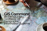
This is not a typical e-book; it is a free, web-based, open-source “textbook” available to anyone interested in using mapping tools to create maps. This e-text focuses primarily on Geographic Information Systems (GIS)—a geospatial technology that enables you to create spatial databases, analyze spatial patterns, and produce maps that communicate more effectively. While this GIS textbook is principally an introduction to GIS, most of the chapter’s concepts are applicable to other geotechnologies including remote sensing, global positioning systems (GPS), Internet mapping, and virtual globes.
Creating good maps and analyzing spatial data is a time consuming and challenging practice, but recently, a new set of powerful mapping tools has enabled almost anyone with a computer to make maps easily and to perform at least some low-level analyses. The results, however, are not encouraging. Most of the new mapmakers do not have adequate training in mapping concepts and spatial analysis principles, and their maps are often improperly designed and do not communicate easily nor effectively. This e-text—GIS Commons—seeks to help you analyze spatial data and communicate more effectively. In short, GIS education is our goal.
Essentials of Geographic Information Systems integrates key concepts behind the technology with practical concerns and real-world applications. Recognizing that many potential GIS users are nonspecialists or may only need a few maps, this book is designed to be accessible, pragmatic, and concise. Essentials of Geographic Information Systems also illustrates how GIS is used to ask questions, inform choices, and guide policy. From the melting of the polar ice caps to privacy issues associated with mapping, this book provides a gentle, yet substantive, introduction to the use and application of digital maps, mapping, and GIS.
The purpose of this text is to promote understanding of the Geographic Information Science and Technology enterprise (GIS&T, also known as “geospatial”).
The purpose of this text is to promote understanding of the Geographic Information Science and Technology enterprise (GIS&T, also known as “geospatial”).

Welcome to Physical Geography at College of the Canyons.
This textbook was designed especially for College of the Canyons students, as a resource to instill the knowledge and adventure that the discipline of geography holds for so many of us. The following units will cover a wide array of topics such as: Earth’s grid system, rivers, oceans, deserts, basic geology, and cartography.
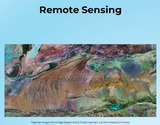
This introductory book on Remote Sensing is intended to be the equivalent of a textbook for an undergraduate-level university course. There is also a French version titled "Télédétection".
The goals of this textbook are to help students acquire the technical skills of using software and managing a database, and develop research skills of collecting data, analyzing information and presenting results. We emphasize that the need to investigate the potential and practicality of GIS technologies in a typical planning setting and evaluate its possible applications. GIS may not be necessary (or useful) for every planning application, and we anticipate these readings to provide the necessary foundation for discerning its appropriate use. Therefore, this textbook attempts to facilitate spatial thinking focusing more on open-ended planning questions, which require judgment and exploration, while developing the analytical capacity for understanding a variety of local and regional planning challenges.
While this textbook provides the background for understanding the concepts in GIS as applicable to urban and regional planning, it is best when accompanied by a hands-on tutorial, which will enable readers to develop an in-depth understanding of the specific planning applications of GIS. Chapters in this text book are either composed by the editors using Creative Common materials, or linked to a book chapter scanned copy in the library reserve. In the end of each chapter, we also provided several discussion questions, together with contextual applications through some web links.
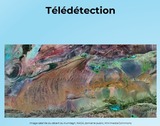
Ce livre d’introduction à la télédétection se veut l’équivalent d’un manuel pour un cours universitaire de premier cycle. Il existe aussi une version en anglais intitulée “Remote Sensing”.
The discipline of geography bridges the social sciences with the physical sciences and can provide a
framework for understanding our world. By studying geography, we can begin to understand the
relationships and common factors that tie our human community together. The world is undergoing
globalization on a massive scale as a result of the rapid transfer of information and technology and
the growth of modes of transportation and communication. The more we understand our world, the
better prepared we will be to address the issues that confront our future. There are many approaches
to studying world geography. This textbook takes a regional approach and focuses on themes that
illustrate the globalization process, which in turn assists us in better understanding our global
community and its current affairs.
Méthodes avancées
Short Description:
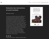
Une couverture universelle des soins de santé en 2030 pour tous les êtres humains, du Nord au Sud? Réaliser cet objectif de développement durable aussi ambitieux que nécessaire exigera une exceptionnelle volonté politique, mais aussi de solides données probantes sur les moyens d’y arriver, notamment sur les interventions de santé mondiale les plus efficaces. Savoir les évaluer est donc un enjeu majeur. On ne peut plus se contenter de mesurer leur efficacité : il nous faut comprendre pourquoi elles l’ont été (ou pas), comment et dans quelles conditions. Cet ouvrage collectif réunissant 27 auteurs et 12 autrices de différents pays et de disciplines variées a pour but de présenter de manière claire et accessible, en français, un florilège d’approches et de méthodes avancées en évaluation d’interventions : quantitatives, qualitatives, mixtes, permettant d’étudier l’évaluabilité, la pérennité, les processus, la fidélité, l’efficience, l’équité et l’efficacité d’interventions complexes. Chaque méthode est présentée dans un chapitre à travers un cas réel pour faciliter la transmission de ces savoirs précieux.
Long Description:
Une couverture universelle des soins de santé en 2030 pour tous les êtres humains, du Nord au Sud? Réaliser cet objectif de développement durable aussi ambitieux que nécessaire exigera une exceptionnelle volonté politique, mais aussi de solides données probantes sur les moyens d’y arriver, notamment sur les interventions de santé mondiale les plus efficaces. Savoir les évaluer est donc un enjeu majeur. On ne peut plus se contenter de mesurer leur efficacité : il nous faut comprendre pourquoi elles l’ont été (ou pas), comment et dans quelles conditions.
Cet ouvrage collectif réunissant 27 auteurs et 12 autrices de différents pays et de disciplines variées a pour but de présenter de manière claire et accessible, en français, un florilège d’approches et de méthodes avancées en évaluation d’interventions : quantitatives, qualitatives, mixtes, permettant d’étudier l’évaluabilité, la pérennité, les processus, la fidélité, l’efficience, l’équité et l’efficacité d’interventions complexes. Chaque méthode est présentée dans un chapitre à travers un cas réel pour faciliter la transmission de ces savoirs précieux.
Word Count: 144929
ISBN: 978-2-924661-60-4
(Note: This resource's metadata has been created automatically by reformatting and/or combining the information that the author initially provided as part of a bulk import process.)