This course is a series of presentations on an advanced topic in …
This course is a series of presentations on an advanced topic in the field of geology by the visiting William Otis Crosby lecturer. The Crosby lectureship is awarded to a distinguished international scientist each year to introduce new scientific perspectives to the MIT community. This year’s Crosby lecturer is Prof. Kevin Burke. His lecture is about African history. The basic theme is the distinctiveness of the African continent in both the way that it originated 600 million years ago and in the way that it has developed ever since.
This activity involves explicitly sharing with students all the thoughts that occur …
This activity involves explicitly sharing with students all the thoughts that occur to the instructor, as they occur, at a geologic field site. Assessment can be conducted with concept sketches.
Students describe and interpret glacial features exposed in gravel pits and outcrops. …
Students describe and interpret glacial features exposed in gravel pits and outcrops.
(Note: this resource was added to OER Commons as part of a batch upload of over 2,200 records. If you notice an issue with the quality of the metadata, please let us know by using the 'report' button and we will flag it for consideration.)
Students in an area remote from igneous and metamorphic rocks wrote papers …
Students in an area remote from igneous and metamorphic rocks wrote papers on the properties of locally used building stones and gave a walking tour in which they presented their results.
(Note: this resource was added to OER Commons as part of a batch upload of over 2,200 records. If you notice an issue with the quality of the metadata, please let us know by using the 'report' button and we will flag it for consideration.)
Students examine the effects of geology on earthquake magnitudes and how engineers …
Students examine the effects of geology on earthquake magnitudes and how engineers anticipate and prepare for these effects. Using information provided through the Earthquakes Living Lab interface, students investigate how geology, specifically soil type, can amplify the magnitude of earthquakes and their consequences. Students look in-depth at the historical 1906 San Francisco earthquake and its destruction thorough photographs and data. They compare the 1906 California earthquake to another historical earthquake in Kobe, Japan, looking at the geological differences and impacts in the two regions, and learning how engineers, geologists and seismologists work to predict earthquakes and minimize calamity. A worksheet serves as a student guide for the activity.
Students are asked to match up the five largest mass extinction events …
Students are asked to match up the five largest mass extinction events with their relative dates, approximate duration, and severity (percentage of species that became extinct) based on clues given from various perspectives.
(Note: this resource was added to OER Commons as part of a batch upload of over 2,200 records. If you notice an issue with the quality of the metadata, please let us know by using the 'report' button and we will flag it for consideration.)
Brief analysis of the geologic setting of the Grand Strand (Myrtle Beach, …
Brief analysis of the geologic setting of the Grand Strand (Myrtle Beach, South Carolina, and vicinity) coast and the limited occurrence of sand suitable for beach re-nourishment. Students use a USGS Fact Sheet to examine the beach, near offshore, and edge of Coastal Plain geology.
PowerPoint module leading students through creation and manipulation of spreadsheet to forward …
PowerPoint module leading students through creation and manipulation of spreadsheet to forward model an example of exponential decay -- the number of remaining unpopped kernels of popcorn in a bag of popping popcorn.
(Note: this resource was added to OER Commons as part of a batch upload of over 2,200 records. If you notice an issue with the quality of the metadata, please let us know by using the 'report' button and we will flag it for consideration.)
Christina StringerâUniversity of South Florida, Tampa FL 33620
This activity was developed for Spreadsheets Across the Curriculum. National Science Foundation, DUE 0442629.
Given a schematic cross-section and some background information about numerical ages, Part …
Given a schematic cross-section and some background information about numerical ages, Part 1 of this activity asks students to give the relative time sequence of 14 geological events. In Part 2, students must provide numerical age brackets for a number of geologic events and/or rock units. In Part 3, students are asked to explain their reasoning for their age bracket assignments in part 2, including the principles of relative age they employed. Students are provided with a copy of the geologic time scale (2009, Geological Society of America) to assist them in completing this activity.
(Note: this resource was added to OER Commons as part of a batch upload of over 2,200 records. If you notice an issue with the quality of the metadata, please let us know by using the 'report' button and we will flag it for consideration.)
This a semester long activity for students in a plate tectonics course …
This a semester long activity for students in a plate tectonics course will be read one (or two) geological journal articles every other week on the major topics covered in the course. Students will submit reading responses and there will be class discussions of each paper.
(Note: this resource was added to OER Commons as part of a batch upload of over 2,200 records. If you notice an issue with the quality of the metadata, please let us know by using the 'report' button and we will flag it for consideration.)
12.491 is a seminar focusing on problems of current interest in geology …
12.491 is a seminar focusing on problems of current interest in geology and geochemistry. For Fall 2005, the topic is organic geochemistry. Lectures and readings cover recent research in the development and properties of organic matter.
Students will make observations at two different locations and will infer the …
Students will make observations at two different locations and will infer the geological events that happened at each location to explain what they see and create questions for further study.
In this lesson, students will learn what erosion is and how human …
In this lesson, students will learn what erosion is and how human actions influence erosion. Includes introduction, demonstration instructions, and questions for wrap-up discussion.
NGSS: K-ESS3-3
Time: 50 minutes
Materials: plastic containers with sand and gravel, sponges, and plastic cups.
This lab is used as an introductory lab for undergraduate and graduate …
This lab is used as an introductory lab for undergraduate and graduate geology majors in a Geologic Remote Imaging course
(Note: this resource was added to OER Commons as part of a batch upload of over 2,200 records. If you notice an issue with the quality of the metadata, please let us know by using the 'report' button and we will flag it for consideration.)
Students download and merge the multiple sheets of the New York State …
Students download and merge the multiple sheets of the New York State Geologic Map together and reclassify units to create an attractive and legible version of the state geologic map at postcard scale. The class votes on the winning layout, and we have postcards printed at OvernightPrints.com *Special thanks to Brian Hynek, University of Colorado, for the basic idea for this exercise.* You might also be interested in our Full GIS course with links to all assignments.
Students will begin this lesson by ordering the events of their morning …
Students will begin this lesson by ordering the events of their morning using relative and absolute dating techniques. Students will also write a personal definition of the terms absolute age and relative age. Next, students will work with collaborative groups to order events in Earth's geologic history by relative age, then order those same events by absolute age in a scaled model timeline. Lastly, students will use the time-scale model created with their group members to analyze events in Earth's geologic history. This lesson results from a collaboration between the Alabama State Department of Education and ASTA.
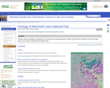
Students analyze topographic and geologic maps, through a set of guiding questions, …
Students analyze topographic and geologic maps, through a set of guiding questions, to figure out why western Kentucky is home to a world-famous cave system. They consider the effect of glaciation on the water table as well as the effects of stratigraphy.
(Note: this resource was added to OER Commons as part of a batch upload of over 2,200 records. If you notice an issue with the quality of the metadata, please let us know by using the 'report' button and we will flag it for consideration.)
No restrictions on your remixing, redistributing, or making derivative works. Give credit to the author, as required.
Your remixing, redistributing, or making derivatives works comes with some restrictions, including how it is shared.
Your redistributing comes with some restrictions. Do not remix or make derivative works.
Most restrictive license type. Prohibits most uses, sharing, and any changes.
Copyrighted materials, available under Fair Use and the TEACH Act for US-based educators, or other custom arrangements. Go to the resource provider to see their individual restrictions.