Breve introducción de herramientas de programación
- Subject:
- Applied Science
- Computer Science
- Information Science
- Material Type:
- Module
- Author:
- David Crespo
- Date Added:
- 10/02/2024

Breve introducción de herramientas de programación
An overview of querying IN subqueries
How to retrieve data from a database using SQL.
An overview of restricting grouped results with HAVING
SQL tutorial for corporate developers and students
Welcome to “SQL and Database Management Using Pop Culture,” a GitHub repository that leads a double life as an interactive Database and SQL textbook. Through this innovative approach, we blend the technical world of SQL and database management with the relatable and often thrilling realm of pop culture. This book is designed to make the complex concepts of databases not just understandable but genuinely enjoyable to learn.
Why This Book? Databases are the backbone of the modern data-driven world, yet their intricacies can often seem labyrinthine to learners. This book demystifies these complexities by drawing parallels with popular culture, weaving a narrative that is both informative and relatable. Whether you are a student stepping into the world of databases or a professional seeking to deepen your understanding, this book provides a fresh perspective that is both comprehensive and accessible. The book starts with basic queries in SQLite, and move on to introduce both PostgreSQL and MySQL in later chapters. The content is aligned with the content of the CompTia Data Sys+ and Oracle Database Foundations exams.
The Structure of the Book. Each chapter of this book is crafted like an episode of a TV series, where learning SQL and database management becomes an adventure rather than a routine academic endeavor. Here’s what awaits you in this journey:
Chapter 0: Get started with an interactive introduction to SQL and Python in Colab notebooks.
Chapters 1 to 12: From the deck of the Star Trek Enterprise to the magical corridors of Hogwarts, dive into every aspect of SQL and database management. Each chapter unfolds a new scenario, tying complex database concepts to familiar stories and characters from pop culture.
This repository houses twelve Jupyter notebooks, making the learning experience highly interactive and hands-on. You’ll not just read about SQL queries and database theories but also get to experiment and see the results in real-time.
Workshop overview for the Data Carpentry Social Sciences curriculum. Data Carpentry’s aim is to teach researchers basic concepts, skills, and tools for working with data so that they can get more done in less time, and with less pain. This workshop teaches data management and analysis for social science research including best practices for data organization in spreadsheets, reproducible data cleaning with OpenRefine, and data analysis and visualization in R. This curriculum is designed to be taught over two full days of instruction. Materials for teaching data analysis and visualization in Python and extraction of information from relational databases using SQL are in development. Interested in teaching these materials? We have an onboarding video and accompanying slides available to prepare Instructors to teach these lessons. After watching this video, please contact team@carpentries.org so that we can record your status as an onboarded Instructor. Instructors who have completed onboarding will be given priority status for teaching at centrally-organized Data Carpentry Social Sciences workshops.
A spatial database is the backbone of a successful organization or website that depends upon maintaining and using data pertinent to locations on Earth. In GEOG 868, Spatial Database Management, capabilities specific to Relational Database Management Systems (RDBMS) and Geographic Information Systems (GIS) are combined to teach students to create, maintain, and query spatial databases in both desktop and enterprise environments. Learn the basics of Standard Query Language (SQL) and database design/normalization, the specifics of managing spatial data in an open-source technologies context (Postgres/PostGIS) and in the context of the Esri geodatabase. Along the way, you will become familiar with spatial functions and versioning, the latter in a server environment hosted by Amazon Web Services.

This semester long subject (11.521) is divided into two halves. The first half focuses on learning spatial database management techniques and methods and the second half focuses on using these skills to address a ‘real world,’ client-oriented planning problem. The first half of the semester may be taken separately using the class number 11.523 and the second half may be taken separately as 11.524.
In order to help shape and utilize the information infrastructure that will support the management and development of our metropolitan areas, planners need a basic understanding of the tools and technology for querying, analyzing, and sharing complex databases and maps. Managing online access to large and constantly-changing spatial datasets can be a powerful aid to planning and can facilitate inter-agency cooperation and collaboration in an increasingly decentralized world. But it requires the use of knowledge representation methods, client-server technologies and access control issues that are quite different from what are needed to model and visualize standalone datasets on a personal computer. Hence, planners should acquire basic skills in database management, digital spatial data analysis, and networking.
The 11.523 portion of the semester addresses these issues while retaining a focus on planning (rather than on computer science). This is an intensive, hands-on class that stresses learning by doing. Exercises and examples involving real-world data, maps, and images are used to develop skills with database query languages and the design development and use of structured databases. Class work utilizes web tools, GIS, and database software with lab exercises primarily on the new high-performance PC computing cluster. Specifically, we will access an Oracle 8i database using SQL (structured query language) and use ArcView for GIS. Each week there are two sixty to ninety-minute classes plus another 90+ minute hands-on lab in electronic classrooms. Class lectures will focus on concepts and case discussion, the scheduled lab time focuses on computer mechanics and skill building. Specific topics during 11.523 include:
finding, understanding and structuring digital spatial data that are available on the Internet using various browsing, visualization, and data management tools;
considerable work with relational database technologies and the Structured Query Language (SQL) to design, construct, query, and update urban planning databases;
some experience with so-called ‘client/server’ and ’enterprise GIS’ technologies for facilitating distributed access to complex spatial data and urban planning applications;
advanced GIS topics such as 3D visualizations and geospatial web services.
The 11.524 portion of the semester will treat the classroom like a professional planning office, working as a team to produce a two deliverables for their client, Lawrence Community Works, Inc. (LCW), a community development corporation located in the City of Lawrence, Massachusetts. LCW and DUSP recently agreed to work together for the next five years to design and implement a multi-tier web-based planning system that promotes democratic involvement and informs community development projects. Your involvement this semester is critical, because the implementation plan that you craft this semester will serve as the road map for both organizations for years to come and the simple web-based planning tool that you design will engage stakeholders by giving them a better sense of how technologies can aid decision-making processes. To assist you with the more technical aspects of the project, we hired Robert Cheetham, President of Azavea, Inc. (http://www.azavea.com/ ), to provide exactly 100 hours of consultancy services. Through their project work, students will enhance important professional skills by:
formulating an implementation plan for a real client;
designing a simple web-based tool for understanding problems;
engaging constituents and stakeholders in a real setting;
integrating theory and practice by evaluating the role of technology in community development;
learning to communicate effectively within a group and with a professional consultant;
working with such tools as the WWW, Access, ArcView, ArcIMS, SDE, etc.
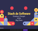
Una recopilacación de varias herramientas utilizadas en Big Data.

This class uses lab exercises and a workshop setting to help students develop a solid understanding of the planning and public management uses of geographic information systems (GIS). The goals are to help students: acquire technical skills in the use of GIS software; acquire qualitative methods skills in data and document gathering, analyzing information, and presenting results; and investigate the potential and practicality of GIS technologies in a typical planning setting and evaluate possible applications.
The workshop teaches GIS techniques and basic database management at a level that extends somewhat beyond the basic thematic mapping and data manipulation skills included in the MCP core classes (viz. 11.204 and 11.220). Instead of focusing on one thematic map of a single variable, students will concentrate on more open-ended planning questions that invite spatial analysis but will require judgment and exploration to select relevant data and mapping techniques; involve mixing and matching new, local data with extracts from official records (such as census data, parcel data and regional employment and population forecasts); utilize spatial analysis techniques such as buffering, address matching, overlays; use other modeling and visualization techniques beyond thematic mapping; and raise questions about the skills, strategy, and organizational support needed to sustain such analytic capability within a variety of local and regional planning settings.
Students seeking graduate credit should enroll in the subject 11.520; undergraduates should enroll in the subject 11.188. The subjects meet together and have nearly identical content.
ArcGIS/ArcMap/ArcInfo Graphical User Interface is the intellectual property of ESRI and is used herein with permission. Copyright © ESRI. All rights reserved.

The ZooCoder virtual field trip is an exciting app that combines C#, SQLite databases, and Visual Studio Code within GitHub Codespaces. Its goal? To create a full-stack web application that displays feeding schedules for animals at the Como Zoo in Saint Paul, Minnesota. The app is available in two file formats: SCORM 1.2 and H5P.Import the SCORM or H5P file into your Learning Management System (LMS) to share the virtual field trip app with your students.