This activity is a guided inquiry where students develop questions around a …
This activity is a guided inquiry where students develop questions around a group of rocks, use their observation skills to describe the attributes, record and analyze their findings, and use their data, in conjunction with available resources, to categorize the rocks .
This visualization focuses on public acceptance of climate science. The set of …
This visualization focuses on public acceptance of climate science. The set of interactive maps illustrates public opinion on a variety of climate beliefs, risk perceptions, and policy support. The data is from the Yale Project on Climate Communication.
This lesson explores factors that control the character and fate of carbon …
This lesson explores factors that control the character and fate of carbon delivered by rivers from the continents to the oceans, using mapped characteristics and data from 12 different rivers, including the MARGINS Waipaoa and Fly systems.
In this class we will critically review both classical works and recent …
In this class we will critically review both classical works and recent literature on complexity in ecology. The emphasis will be on developing quantitative theories in the context of experimental and observational data. We will meet twice weekly for roundtable discussions.
This unit was developed for a junior level pre-Calculus class to be …
This unit was developed for a junior level pre-Calculus class to be taught during the first quarter of the 2016-17 school year. The lessons of the unit will culminate in each group of students creating and analyzing a mathematical model to predict the future impacts of climate change in New Hampshire and make a presentation as a group. The texts and historic data source, while specific to New Hampshire, may be of interest to other regions of the country. However, state climate change reports and climate data specific to your location may be available through state universities and meteorological stations.
Included in the course are introductions to each lesson, lecture slides, videos, and problem questions. Topics include:
Types of Data Sampling Techniques Qualitative Data Frequency Distributions Descriptive Statistics Variation and Position Confidence Intervals Hypothesis Testing Chi-Square Goodness of Fit Linear Regression Variance ANOVA
A key first step toward developing students' understanding Woburn's water problems is …
A key first step toward developing students' understanding Woburn's water problems is having a students understand the geologic model of the Aberjona River Valley. Geologist use a series of tools to be able to construct models of the subsurface features of a given location. The first step in this tool is to look at these are official features of an area to gain a perspective of the subsurface composition. Geologist typically then will drill borings into the subsurface to obtain samples of rocks. During the drilling process geologist will measure the depth at which changes in rock type occur, they also will try to identify similar rock types and different borings to come up with a spatial arrangement of rock layers. This data is then used to construct the geologic cross-section. So the objective of this module is to get students familiar with its surface and subsurface geologic features so that they may begin to interpret the interrelation between geology and hydrogeology. Geologic logs are provided for students to create their own subsurface geologic cross-sections, which can be applied to later modules when they begin to evaluate groundwater flow towards Wells G & H.
(Note: this resource was added to OER Commons as part of a batch upload of over 2,200 records. If you notice an issue with the quality of the metadata, please let us know by using the 'report' button and we will flag it for consideration.)
This module uses existing publications from the USGS and the Army Corps …
This module uses existing publications from the USGS and the Army Corps of Engineers regarding flooding affects and classifications. The users are guided to basic overviews provided by those agencies can understand flooding and flooding concepts. The module also direct students to the 'real-time' data collected by the National Oceanic and Atmospheric Association in conjunction with the USGS so they can view graphs showing the relation between rainfall, river stage and flow for the Aberjona River. The NOAA and USGS databases can provide the user with real-time as well as historic data to track flood waves and establish base flows. This data was key to the trial in defining what amount of groundwater was derived from the Aberjona River.
(Note: this resource was added to OER Commons as part of a batch upload of over 2,200 records. If you notice an issue with the quality of the metadata, please let us know by using the 'report' button and we will flag it for consideration.)
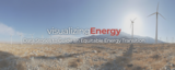
Visualizing Energy is an open access, interdisciplinary science communication project that aims …
Visualizing Energy is an open access, interdisciplinary science communication project that aims to increase actionable knowledge about a sustainable and just energy transition. It uses engaging visualizations coupled with accessible data stories to communicate in clear, concise, jargon-free language. It is highly interdisciplinary and uses energy as an organizing principle to reveal logical connections across disciplines. Visualizing Energy knits data analysis, visualizations, and the written word into stories that promote critical thinking and communication. Its initial focus is on three interconnected areas: the connection between energy and human well-being; the history of energy transitions; and equity issues surrounding energy transitions (energy justice, energy burden, energy poverty, energy insecurity).
The project co-leaders are Cutler J. Cleveland, Professor of Earth and Environment, and Heather Clifford, data scientist in the Boston University Institute for Global Sustainability.
Short Description: This is an inquiry based field investigation where students gather …
Short Description: This is an inquiry based field investigation where students gather data on the Credit River from the rocks in the river bed, water speed, and maps. Students interpret their findings and develop new questions.
The Metropolitan Policy Program offers a number of features that allow users …
The Metropolitan Policy Program offers a number of features that allow users to interactively display and map data related to the program's signature research projects on the nation's largest metropolitan areas
***This resource is published by Cassie Kozyrhov.Cassie is Head of Decision Intelligence at …
***This resource is published by Cassie Kozyrhov.Cassie is Head of Decision Intelligence at Google and this is her video channel. It provides short video clips on stats, AI, data, and decision science. May serve as a supplemental resource.
This resource is a video abstract of a research paper created by …
This resource is a video abstract of a research paper created by Research Square on behalf of its authors. It provides a synopsis that's easy to understand, and can be used to introduce the topics it covers to students, researchers, and the general public. The video's transcript is also provided in full, with a portion provided below for preview:
"A new method for identifying post-translational modifications in proteins promises to cut biomedical researchers’ workload in half. Enabling multiple affinity enrichment procedures to be run in parallel, the one-pot method yields the same search results as traditional methods in less time and from less tissue. As proteomics researchers know well, identifying post-translational modifications in biological samples can be tedious. Enriching samples with target modifications, such as the attachment of acetyl , succinyl or methyl groups to amino acid residues, and matching experimental data with catalogued results involves numerous steps. And the work load is only getting bigger. With exploding interest in how multiple modifications are linked across the vast proteome , the amount of time and the amount of sample required for exploration are skyrocketing in proportion. But with the new one-pot enrichment method, that could soon change..."
The rest of the transcript, along with a link to the research itself, is available on the resource itself.
Students load a topographic overlay into Google Earth. Rather than working with …
Students load a topographic overlay into Google Earth. Rather than working with paper maps they will learn to make observations and collect data directly from digital maps, in this case while learning about fluvial systems. The lab is designed to introduce student to the power and usefulness of freely available software and data found on the internet. Designed for a geomorphology course
(Note: this resource was added to OER Commons as part of a batch upload of over 2,200 records. If you notice an issue with the quality of the metadata, please let us know by using the 'report' button and we will flag it for consideration.)
This unit was developed for a junior level pre-Calculus class to be …
This unit was developed for a junior level pre-Calculus class to be taught during the first quarter of the 2016-17 school year. The lessons of the unit will culminate in each group of students creating and analyzing a mathematical model to predict the future impacts of climate change in New Hampshire and make a presentation as a group. The texts and historic data source, while specific to New Hampshire, may be of interest to other regions of the country. However, state climate change reports and climate data specific to your location may be available through state universities and meteorological stations.
Move the sun, earth, moon and space station to see how it …
Move the sun, earth, moon and space station to see how it affects their gravitational forces and orbital paths. Visualize the sizes and distances between different heavenly bodies, and turn off gravity to see what would happen without it!
This course introduces fundamentals of radon physics, geology, radiation biology; provides hands …
This course introduces fundamentals of radon physics, geology, radiation biology; provides hands on experience of measurement of radon in MIT environments, and discusses current radon research in the fields of geology, environment, building and construction, medicine and health physics. The course is offered during the Independent Activities Period (IAP), which is a special 4-week term at MIT that runs from the first week of January until the end of the month.
This undergraduate level course presents a basic study in geology. It introduces …
This undergraduate level course presents a basic study in geology. It introduces major minerals and rock types, rock-forming processes, and time scales; temperatures, pressures, compositions, structure of the Earth, and measurement techniques; geologic structures and relationships observable in the field; sediment movement and landform development by moving water, wind, and ice; crustal processes and planetary evolution in terms of global plate tectonics with an emphasis on ductile and brittle processes.
In this course, we will present the theory of Probabilistically Checkable Proofs …
In this course, we will present the theory of Probabilistically Checkable Proofs (PCPs), and prove some fundamental consequences of it as well as more recent advances. More specifically, the first half of the course will be devoted to the (algebraic) proof of the basic PCP Theorem and basic relation to approximation problems. We will then move on to more advanced topics, such as hardness amplification, the long-code framework, the Unique-Games Conjecture and its implications, and the 2-to-2 Games Theorem.
No restrictions on your remixing, redistributing, or making derivative works. Give credit to the author, as required.
Your remixing, redistributing, or making derivatives works comes with some restrictions, including how it is shared.
Your redistributing comes with some restrictions. Do not remix or make derivative works.
Most restrictive license type. Prohibits most uses, sharing, and any changes.
Copyrighted materials, available under Fair Use and the TEACH Act for US-based educators, or other custom arrangements. Go to the resource provider to see their individual restrictions.