This activity is a classroom based inquiry activity where students will observe …
This activity is a classroom based inquiry activity where students will observe how water changes when it is moved through a variety of different mediums. Eventually, the students will take this model to the larger ideas of watershed in the community.
A selection of children's books is provided to help students learn about …
A selection of children's books is provided to help students learn about the greenhouse effect and ways humans impact the environment. The book list complements lessons and activities focused on the theme of the free, online magazine Beyond Weather and the Water Cycle. The magazine integrates science and literacy learning for students in grades K-5.
The 11 books selected for inclusion in the issue of Beyond Weather …
The 11 books selected for inclusion in the issue of Beyond Weather and the Water Cycle devoted to climate studies range from easy readers to biographies. Each book is briefly described; all were reviewed for accuracy and appropriate reading levels for students in grades K-5. Several books deal with careers in meteorology.
This issue of the free online magazine, Beyond Penguins and Polar Bears, …
This issue of the free online magazine, Beyond Penguins and Polar Bears, explores how elementary teachers can move from a study of the weather at home to the weather of the polar regions through hands-on activity, reading, and discussion.
Students discuss several human reproductive technologies available today pregnancy ultrasound, amniocentesis, in-vitro …
Students discuss several human reproductive technologies available today pregnancy ultrasound, amniocentesis, in-vitro fertilization and labor anesthetics. They learn how each technology works, and that these are ways engineers have worked to improve the health of expecting mothers and babies.
In this video, Jonathan travels to Holbox, Mexico in search of the …
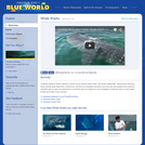
In this video, Jonathan travels to Holbox, Mexico in search of the massive whale sharkŰÓthe worldŰŞs largest fish. Reaching 50 feet long, these animals grow larger than a school bus, but they are completely harmless since they eat only plankton and small fish. Jonathan gets up close and personal to a mouth the size of a small car in his investigation to discover why so many whale sharks visit Holbox every summer. Please see the accompanying study guide for educational objectives and discussion points.
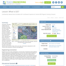
Geographic information systems (GIS) are important technology that allows rapid study and …
Geographic information systems (GIS) are important technology that allows rapid study and use of spatial information. GIS have become increasingly prevalent in industry and the consumer/internet world in the last 20 years. Historically, the basis of GIS was in mapping, and so it is important to understand the basis of maps and how to use them as well as why they are different from GIS. In this lesson, students learn the value of maps, how to use maps, and the basic components of a GIS. They are also introduced to numerous GIS applications.
This activity is a field/classroom activity where students collect soil samples, form …
This activity is a field/classroom activity where students collect soil samples, form inquiry questions, devise a sorting method, make observations of the contents, record information, share information, and draw conclusions about their findings. Students will generate other inquiry questions related to soil for future learning opportunities.
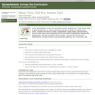
Spreadsheets Across the Curriculum module. Simulating a forensic calculation, students build spreadsheets …
Spreadsheets Across the Curriculum module. Simulating a forensic calculation, students build spreadsheets and create graphs to find the time of death of a potato victim from temperature vs. time data.
This article provides an overview of research-based resources for engaging girls in …
This article provides an overview of research-based resources for engaging girls in math and science available from the Doing What Works web site, a site sponsored by the U.S. Department of Education.
This is an activity about image analysis. Learners will create a map …
This is an activity about image analysis. Learners will create a map of the room and discuss the perspectives shown in their drawings and how this relates to satelite images. Participants brainstorm a list of features that might be recognizable in satellite photos, search the Earth Images for these features, and place the images in categories depicting these features. This is activity 2 of 9 in Mars and Earth: Science Learning Activities for After School.
Spreadsheets Across the Curriculum/Geology of National Parks module. Students estimate the net …
Spreadsheets Across the Curriculum/Geology of National Parks module. Students estimate the net volume of pollutants flowing into the Houchin's Narrows entrance of Mammoth Cave using actual air-flow and air-quality data from the park.
Learners will compare satellite images of Mars and Earth to look for …
Learners will compare satellite images of Mars and Earth to look for similar features. Then they brainstorm a list of forces or events that could have caused some of these features to form on Mars. This is activity 3 of 9 in Mars and Earth: Science Learning Activities for After School.
The activity describes Eratosthenes' experiments which determined that the Earth is spherical, …
The activity describes Eratosthenes' experiments which determined that the Earth is spherical, rather than flat. Students reproduce Eratosthenes' methods using a slice of pizza to calculate the circumference of the entire pie.
The purpose of this resource is to introduce students to the concept …
The purpose of this resource is to introduce students to the concept that sometimes there is no one "right" answer to a question or measurement. Students learn to be careful when searching for a right answer to questions such as 'What time is it?' by comparing multiple measurements of the time of day. Students gain an intuitive understanding of the characteristics of imperfect measurements. Using different clocks, students simultaneously record the displayed times. The resulting time measurements are converted from minutes and seconds to seconds. These measurements are plotted to illustrate the mathematical techniques of averages and deviations from an average.
SSAC Physical Volcanology module. Students build a spreadsheet to estimate the volume …
SSAC Physical Volcanology module. Students build a spreadsheet to estimate the volume of volcanic deposits using map, thickness and high-water mark data from the 2005 Panabaj debris flow (Guatemala).
Students complete a self-guided exercise in worksheet format combined with Google Earth …
Students complete a self-guided exercise in worksheet format combined with Google Earth that helps them explore practical and observable differences between different projection and coordinate systems. The activity improves their skills in using various Google Earth features.
This fun Web article is part of OLogy, where kids can collect …
This fun Web article is part of OLogy, where kids can collect virtual trading cards and create projects with them. Here they learn about the various steps in an archaeological investigation including fieldwork, lab work and the role of museum collections.
No restrictions on your remixing, redistributing, or making derivative works. Give credit to the author, as required.
Your remixing, redistributing, or making derivatives works comes with some restrictions, including how it is shared.
Your redistributing comes with some restrictions. Do not remix or make derivative works.
Most restrictive license type. Prohibits most uses, sharing, and any changes.
Copyrighted materials, available under Fair Use and the TEACH Act for US-based educators, or other custom arrangements. Go to the resource provider to see their individual restrictions.