Updating search results...

Search Resources

8827 Results

View
Selected filters:
Introduction to Terrestrial Laser Scanning
Conditional Remix & Share Permitted
CC BY-NC-SA
Rating
0.0 stars

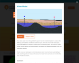
In spring 2020, the world was hit by a pandemic that spread globally by March, causing universities and most of the world to move to remote means. Summer field camps, long hailed as a rite of passage in the geosciences, were cancelled throughout the US. The community moved quickly, with NAGT developing remote learning tools and arranging for sharing and collaboration between instructors and institutions. As such, UNAVCO (GETSI) and University of Northern Colorado embarked on a data collection campaign for a summer field course entitled "Geoscience Field Issues Using High-Resolution Topography to Understand Earth Surface Processes" -- originally slated for in-person teaching. The team collected GNSS data, drone imagery for use in structure from motion (SfM), and terrestrial laser scanning (TLS) from a site near Greeley, Colorado on the Poudre River. In this assignment, students analyze TLS data in a similar manner as previously done for the SfM unit conducted previously in the course. Students compare and contrast the SfM and TLS datasets.
Day 7 - This activity is part of the 2-week remote field course Geoscience Field Issues Using High-Resolution Topography to Understand Earth Surface Processes

(Note: this resource was added to OER Commons as part of a batch upload of over 2,200 records. If you notice an issue with the quality of the metadata, please let us know by using the 'report' button and we will flag it for consideration.)

Subject:
Biology
Life Science
Material Type:
Activity/Lab
Simulation
Provider:
Science Education Resource Center (SERC) at Carleton College
Provider Set:
Teach the Earth
Author:
Beth Pratt-Sitaula
Sharon Bywater-Reyes
Date Added:
08/11/2022
A grammar of Palula
Unrestricted Use
CC BY
Rating
0.0 stars

This grammar provides a grammatical description of Palula, an Indo-Aryan language of the Shina group. The language is spoken by about 10,000 people in the Chitral district in Pakistan’s Khyber Pakhtunkhwa Province. This is the first extensive description of the formerly little-documented Palula language, and is one of only a few in-depth studies available for languages in the extremely multilingual Hindukush-Karakoram region. The grammar is based on original fieldwork data, collected over the course of about ten years, commencing in 1998. It is primarily in the form of recorded, mainly narrative, texts, but supplemented by targeted elicitation as well as notes of observed language use. All fieldwork was conducted in close collaboration with the Palula-speaking community, and a number of native speakers took active part in the process of data gathering, annotation and data management. The main areas covered are phonology, morphology and syntax, illustrated with a large number of example items and utterances, but also a few selected lexical topics of some prominence have received a more detailed treatment as part of the morphosyntactic structure. Suggestions for further research that should be undertaken are given throughout the grammar. The approach is theory-informed rather than theory-driven, but an underlying functional-typological framework is assumed. Diachronic development is taken into account, particularly in the area of morphology, and comparisons with other languages and references to areal phenomena are included insofar as they are motivated and available. The description also provides a brief introduction to the speaker community and their immediate environment.

Subject:
Linguistics
Social Science
Material Type:
Textbook
Provider:
Language Science Press
Author:
Henrik Liljegren
Date Added:
07/03/2019
Erosion Experiment -- Out Teach
Conditional Remix & Share Permitted
CC BY-NC-SA
Rating
0.0 stars

In this lesson, students will conduct experiments simulating erosion by pouring water on various surfaces in the outdoor classroom.

Subject:
Physical Science
Material Type:
Lesson Plan
Author:
Out Teach
Date Added:
07/22/2021
Smithsonian Science Starter: Dive into Science with Cartesian Divers
Conditional Remix & Share Permitted
CC BY-NC
Rating
0.0 stars

Students will focus on neutral buoyancy and how it plays a role on a ketchup packet in a bottle of water an apply knowledge obtained to astronauts in space.

Subject:
Applied Science
Engineering
Physical Science
Material Type:
Lesson Plan
Provider:
National Air and Space Museum
Author:
National Air and Space Museum
Date Added:
09/02/2022
Physical Sciences
Unrestricted Use
Public Domain
Rating
0.0 stars

The content on this pages is intented for grade 12 learners from South Africa. The curriculum standards used are those of the Curriculum Assessments Policy Standards which is a the Curriculum document used in South Africa.

Subject:
Physical Science
Material Type:
Activity/Lab
Homework/Assignment
Lecture Notes
Author:
Sethabile Dladla
Date Added:
05/16/2021
Computer Simulation of the Sonoran Desert Community
Read the Fine Print
Educational Use
Rating
0.0 stars

The computer program's simulation of a Sonoran desert community should ultimately strengthen the student's comprehension of what is required for a natural ecosystem to sustain itself (remain in balance). This computer simulation program has great flexibility. It allows the student to manipulate the population numbers of five Sonoran Desert species. A species natural history attachment provides vital information for the students to familiarize themselves with each species' behaviors, its niche and food resource needs. The program includes two producers, the Saguaro cactus and the Ironwood Tree. It also includes 3 consumers, but their interactions both toward the producers and each other differ. The community's ability to remain in balance and sustain all five species so that none die out rests on the student's assessment skills enabling him to correctly identify these dependencies. The student learns by trial and error as he continues to fine tune the ecosystem that he maintains stewardship of.

Subject:
Applied Science
Ecology
Engineering
Life Science
Material Type:
Activity/Lab
Provider:
TeachEngineering
Provider Set:
TeachEngineering
Author:
Amber Spolarich
Wendy J. Holmgren
Date Added:
09/18/2014
Estimating the Storage Capacity of a CD/DVD
Read the Fine Print
Educational Use
Rating
0.0 stars

Students estimate the storage capacity of CDs and DVDs by assessing diffraction patterns of green and red laser beams.

Subject:
Applied Science
Career and Technical Education
Electronic Technology
Engineering
Material Type:
Activity/Lab
Provider:
TeachEngineering
Provider Set:
TeachEngineering
Author:
Lars Seemann
Mila Bersabal
Date Added:
09/18/2014
The Egg-cellent Egg Launch
Conditional Remix & Share Permitted
CC BY-NC
Rating
0.0 stars

In this activity, students will learn about and apply the Laws of Physics to successfully launch and land a raw egg. The activity frames the problem around designing and building a bottle rocket that will protect a raw egg being launched into the air at least seven meters. Resources included in this lesson are found at the bottom of this document and include:

-Teacher guide
-Physics note sheets on motion, speed, velocity, acceleration, momentum, force, friction, Newton’s Laws of Motion, potential and kinetic energy and gravity.
-Egg Launch Instructions
-Link to Bottle Rocket Launching Instructions
-Links to videos
-Post Assessment

Subject:
Applied Science
Engineering
Physical Science
Material Type:
Activity/Lab
Assessment
Unit of Study
Date Added:
12/05/2018
Changes Ahoof: Could Climate Change Affect Arctic Caribou?
Read the Fine Print
Rating
0.0 stars

Students run a simplified computer model to explore how climate conditions can affect caribou, the most abundant grazing animal in the Arctic.

Subject:
Applied Science
Biology
Career and Technical Education
Ecology
Environmental Science
Environmental Studies
Life Science
Physical Science
Material Type:
Activity/Lab
Provider:
CLEAN: Climate Literacy and Energy Awareness Network
Provider Set:
CLEAN: Climate Literacy and Energy Awareness Network
Author:
Smithsonian National Museum of Natural History
Date Added:
06/19/2012
Structural Control of Giant Rock Avalanches in Argentina
Conditional Remix & Share Permitted
CC BY-NC-SA
Rating
0.0 stars

Jigsaw version: To prepare, students do background reading on landslides and rock avalanches and read the introductory portion of Hermanns and Strecker's 1999 article on rock avalanches in Argentina. In class, students receive data (assembled from figures in the article) on bedrock geology and physiography, as well as stereonets showing orientations of prominent joint sets, bedding, and foliations in the bedrock. Their task is to answer the question of why gigantic rock avalanches occur is some places but not others in this part of Argentina. Each student receives one of four possible data sets and works with a team to analyze the data and solve the problem for the team's area. Each team member must then individually explain his/her analysis to a group of three other students, one from each of the other teams, and the group then compares the four locations for similarities and differences. The activity gives students practice in interpreting geologic maps, using stereonets, and peer teaching. The activity also connects structural geology to another geoscience discipline.Short case example version: This is an abbreviated version of the jigsaw activity described above and focuses on only one of the rock avalanche areas.

(Note: this resource was added to OER Commons as part of a batch upload of over 2,200 records. If you notice an issue with the quality of the metadata, please let us know by using the 'report' button and we will flag it for consideration.)

Subject:
Biology
Life Science
Material Type:
Activity/Lab
Provider:
Science Education Resource Center (SERC) at Carleton College
Provider Set:
Teach the Earth
Author:
Barb Tewksbury
Date Added:
09/06/2020
Integrating knowledge of proteins and small molecules with UniProtKB
Unrestricted Use
CC BY
Rating
0.0 stars

A complete understanding of biological systems requires integration of knowledge of the regulation and function of small molecule metabolites – the metabolome – with that of genes, transcripts, and proteins (the genome, transcriptome, and metabolome).

The UniProt knowledgebase UniProtKB supports biomedical research by providing a comprehensive, high quality and freely accessible resource of protein sequences and functional information. UniProtKB integrates, interprets and standardizes data from a range of sources including the scientific literature, tools for protein sequence analysis, other knowledge resources and databases, and automatic annotation systems, to provide a detailed overview of the available protein knowledge.

This webinar will provide an introduction into how UniProtKB captures and represents knowledge of small molecule metabolites using the Rhea knowledgebase of biochemical reactions, based on the chemical ontology ChEBI, and how UniProt users can access and exploit that knowledge.

Who is this course for?
This webinar targets life scientists and bioinformaticians who study enzymes and small molecules, particularly those interested in linking or bridging the two domains. No prior knowledge of bioinformatics or cheminformatics is required, but an undergraduate level knowledge of biology/ biochemistry would be useful.

Outcomes
By the end of the webinar you will be able to:

Describe how UniProt annotates enzyme and transporter function, and where the data comes from
Find and retrieve information about specific enzymes, transporters and the metabolites on which they act, by searching UniProtKB using text, chemical structures, and chemical classifications
Help us develop the representation of small molecule data in UniProtKB by providing valuable feedback

Subject:
Applied Science
Life Science
Material Type:
Lecture
Provider:
EMBL-EBI
Date Added:
03/25/2021
The OER Starter Kit for Program Managers
Unrestricted Use
CC BY
Rating
0.0 stars

Short Description:
The OER Starter Kit for Program Managers was created to bring attention to the work that is involved in building and managing an OER program, from learning about open educational practices and soliciting team members to collecting and reporting data on your program’s outcomes. Regardless of your program's scope and your own experience with OER, we hope that the Starter Kit for Program Managers will have some tips to help you along your way. Join the community of practice!

Long Description:
The OER Starter Kit for Program Managers was created to bring attention to the work that is involved in building and managing an OER program, from learning about open educational practices and soliciting team members to collecting and reporting data on your program’s outcomes. Regardless of your program’s scope and your own experience with OER, we hope that the Starter Kit for Program Managers will have some tips to help you along your way.

The OER Starter Kit for Program Managers contains seven parts: A Quick Guide to Open Education Building an OER Program Program Management Training and Professional Development Supporting OER Adoption Supporting Open Textbook Creation Collecting and Reporting Data

Visit the project homepage to join the community of practice!

Word Count: 107835

(Note: This resource's metadata has been created automatically by reformatting and/or combining the information that the author initially provided as part of a bulk import process.)

Subject:
Business and Communication
Management
Material Type:
Textbook
Provider:
Rebus Community
Author:
Abbey K Elder
Amy Hofer
Apurva Ashok
Billy Meinke-Lau
Cheryl Cullier
Dawn Lowe-wincentsen
James Glapa-Grossklag
Jeff Gallant
Jojo Karlin
Krystyna Michael
Marco Seiferle-valencia
Quill West
Regina Gong
Robin Miller
Stefanie Buck
Date Added:
04/30/2022
Water Model
Read the Fine Print
Educational Use
Rating
0.0 stars

How does water move through Earth's layers? Use the model templates to explore the differing permeabilities of different sediment types, drill wells into model landscapes, explore the difference between confined and unconfined aquifers, discover how water moves around gaining and losing streams, and explore the difference between rural and urban area aquifers. Create your own landscapes to test ideas about water movement and sustainability of wells. Use the graphs to measure the amount of water from each well and monitor the level of water in streams.

Subject:
Geology
Physical Science
Material Type:
Simulation
Provider:
Concord Consortium
Provider Set:
Concord Consortium
Author:
Concord Consortium
Date Added:
05/14/2021
Acoustical Oceanography
Conditional Remix & Share Permitted
CC BY-NC-SA
Rating
0.0 stars

This course will begin with brief overview of what important current research topics are in oceanography (physical, geological, and biological) and how acoustics can be used as a tool to address them. Three typical examples are climate, bottom geology, and marine mammal behavior. Will then address the acoustic inverse problem, reviewing inverse methods (linear and nonlinear) and the combination of acoustical methods with other measurements as an integrated system. Last part of course will concentrate on specific case studies, taken from current research journals. This course is taught on campus at MIT and with simultaneous video at Woods Hole Oceanographic Institution.

Subject:
Applied Science
Atmospheric Science
Engineering
Oceanography
Physical Science
Physics
Material Type:
Full Course
Provider:
MIT
Provider Set:
MIT OpenCourseWare
Author:
Lynch, James
Date Added:
02/01/2012
Coastal Margins Lab
Conditional Remix & Share Permitted
CC BY-NC-SA
Rating
0.0 stars

Most students understand that water quality is an important issue, however many do not understand the complexity associated with the processes involved, the complex nature of estuarine systems, or the fact that management decisions are made based on available data sets that can be difficult at best to interpret. Students will be provided nutrient data in Excel for two Texas estuaries which they will supplement with additional information that they have compiled on these two estuaries during the duration of the course through a GIS database available to the entire class. Furthermore, students will retrieve information from the WWW to learn more about the specific estuaries and the nutrients of interest and their impacts on the environment.

(Note: this resource was added to OER Commons as part of a batch upload of over 2,200 records. If you notice an issue with the quality of the metadata, please let us know by using the 'report' button and we will flag it for consideration.)

Subject:
Biology
Hydrology
Life Science
Oceanography
Physical Science
Material Type:
Activity/Lab
Provider:
Science Education Resource Center (SERC) at Carleton College
Provider Set:
Teach the Earth
Author:
karen mcneal
Date Added:
10/21/2021
Soil Properties and Geomorphology
Conditional Remix & Share Permitted
CC BY-NC-SA
Rating
0.0 stars

To prepare for this exercise, the students have been lectured on soil formation and on a field trip, described a simple soil within loess. Here, the students use data collected from a chronosequence to compare the relative age and amount of soil formation on a series of fluvial terraces. The students are to insert the data into a graphic program and generate specific graphs of soil properties. The students then interpret the amount of soil formation compared to the relative age of the fluvial terraces. Finally, the students assess how the 5 soil forming factors (climate, organisms, relief, parent material, and time) influenced soil formation in this setting.
Designed for a geomorphology course

(Note: this resource was added to OER Commons as part of a batch upload of over 2,200 records. If you notice an issue with the quality of the metadata, please let us know by using the 'report' button and we will flag it for consideration.)

Subject:
Biology
Life Science
Material Type:
Activity/Lab
Provider:
Science Education Resource Center (SERC) at Carleton College
Provider Set:
Teach the Earth
Author:
Mark Sweeney
Date Added:
09/21/2022
Hydrogeology Laboratory Semester Project: Hydrogeologic Assessment for CenTex Water Supply, Inc.
Conditional Remix & Share Permitted
CC BY-NC-SA
Rating
0.0 stars

This activity is a single, semester-long project that involves a hydrogeologic assessment of a property in Central Texas. The project is presented in the lab portion of a hydrogeology class, and it is broken into several separate steps. Each step is treated as a separate assignment, however, the data and results associated with each assignment are applied towards the overall goal of the project. Students are required to maintain a file and a master Excel workbook containing all information, data, and results from each of the steps. All this information is then used to develop an analytical model that simulated drawdowns in the aquifer. This model is used to answer the primary question associated with the project. The results are then documented in a technical report.

(Note: this resource was added to OER Commons as part of a batch upload of over 2,200 records. If you notice an issue with the quality of the metadata, please let us know by using the 'report' button and we will flag it for consideration.)

Subject:
Biology
Hydrology
Life Science
Physical Science
Material Type:
Activity/Lab
Homework/Assignment
Provider:
Science Education Resource Center (SERC) at Carleton College
Provider Set:
Teach the Earth
Author:
Matthew Uliana
Date Added:
08/28/2019
TECH-COM ALBANY, A SYMPOSIUM
Only Sharing Permitted
CC BY-NC-ND
Rating
0.0 stars

Prepare for a POSTDIGITAL world of OPPORTUNITY at this free community technology event.Interactive learning about our use of mobile devices and broadband technologies guides the design of a human-centered, digital technology infrastructure for Albany, NY during this community technology event. The Howe Branch Library kicks off the Tech-Com Albany Symposium as the host of the opening plenary session on design-thinking about data diets, WiFi hotspots, and user experience concerns on Friday, April 28, 2017 at 10AM.  Trinity Alliance CSCC, co-hosts the second day of the symposium with a half day of interactive workshops on inclusive thinking in STEM and career choice on Saturday, April 29th at 8:30AM. Pre-register today! Tech-Com Albany Plenary Session Data - Friday, April 28, 2017 

Subject:
Applied Science
Arts and Humanities
Business and Communication
Career and Technical Education
Computer Science
Educational Technology
Electronic Technology
Information Science
Social Science
Material Type:
Module
Author:
Sage Shoppe
Date Added:
03/30/2017