Geography 468 provides the geospatial information system professional an overview of systems …
Geography 468 provides the geospatial information system professional an overview of systems analysis and design with emphasis on the concepts behind the process, including: business use case modeling, business object modeling, requirements definition, analysis and preliminary design, and, finally, detailed design. The concepts of the geospatial software and database development process are introduced and the current modeling techniques are addressed within the geospatial systems development paradigm. In a series of related activities, students learn about the methods, tools and the concepts of the systems development process to document a portion of a geospatial system with Unified Modeling Language (UML), the standard graphical notation for modeling application needs.
In GEOG 489, you will learn advanced applications of Python for developing …
In GEOG 489, you will learn advanced applications of Python for developing and customizing GIS software, designing user interfaces, solving complex geoprocessing tasks, and leveraging open source. The course consists of readings, walkthroughs, projects, quizzes, and discussions about advanced GIS programming concepts and techniques, and a final term project. It complements the material covered in GEOG 485: GIS Programming and Customization. Software covered in the course includes: Esri ArcGIS Pro/arcpy, Jupyter Notebook, Esri ArcGIS API for Python, QGIS, GDAL/OGR. Students will also use of the Git version control software for code management, and learn techniques for distributing Python applications to end users.
Bill Gates is credited with saying he would \hire a lazy person …
Bill Gates is credited with saying he would \hire a lazy person to do a difficult job\" with the justification that \"a lazy person will find an easy way to do it.\" GEOG 485 doesn't teach the lazy way to get the job done, but it does teach the scripting way _ which is arguably even better. You've probably heard the \"give a fish\"/\"teach to fish\" saying? That's the gist of GEOG 485: to equip you, in an ArcGIS context, with the ModelBuilder and Python scripting skills to make your boring, repetitive geoprocessing tasks easier, quicker and automatic _ so you can focus on the more interesting (potentially more valuable) work that you (and your employers) really want you to be doing."
Today GPS is critical to positioning, navigation, and timing. The smooth functioning …
Today GPS is critical to positioning, navigation, and timing. The smooth functioning of financial transactions, air traffic, ATMs, cell phones and modern life in general around the world depend on GPS. This very criticality requires continuous modernization. The oldest satellites in the current constellation were launched in the 1990s. If you imagine using a computer of that vintage today, it is not surprising that the system is being substantially updated. Global Positioning System (GPS) is now a part of a growing international con?text-the Global Navigation Satellite System, GNSS. This course dives into how GPS and other GNSS systems are designed, how they operate, and the impacts they have on spatial analysis and spatially-enabled systems.
An integrated course stressing the principles of biology. Life processes are examined …
An integrated course stressing the principles of biology. Life processes are examined primarily at the molecular and cellular levels. Intended for students majoring in biology or for non-majors who wish to take advanced biology courses.
An integrated course stressing the principles of biology. Life processes are examined …
An integrated course stressing the principles of biology. Life processes are examined primarily at the organismal and population levels. Intended for students majoring in biology or for non-majors who wish to take advanced biology courses.
This science resource covers a variety of topics; however, the specific URL …
This science resource covers a variety of topics; however, the specific URL is on Genetics. It has significant explanations on the basic Principles of Genetics, Co-dominance, Incomplete dominance, and Sex-Linked traits. The units have precise and manageable explanations, and there are numerous links and additional resources to support instructors and students to advance learning. The access to videos and online simulations enhances particular areas, and the diverse assessments support mastery of skills. This is a very purposeful resource on genetics; it is useful to make learning more effective either as an overall instructional method or as an individualized learning supplement.
Download GeoGebra Illustrative Mathematics LMS course files. All of GeoGebra's Illustrative Mathematics …
Download GeoGebra Illustrative Mathematics LMS course files. All of GeoGebra's Illustrative Mathematics apps have been placed via links into Moodle courses - each unit is one course. There are twenty save middles school courses and more for high school (the list is growing.) These course files can then be uploaded into Moodle, Schoology, Canvas or D2L.
A good detective or researcher like Sherlock Holmes knows the fundamental questions …
A good detective or researcher like Sherlock Holmes knows the fundamental questions that need to be answered to gather facts to solve a problem. So how does geospatial intelligence contribute to answering these questions? While geospatial technology is useful in revealing who, what, when, and where events take place, it is less useful in explaining why events occur. However, geospatial intelligence analysis leverages geographic information science and technology with the intelligence tradecraft to develop products that support decision-making in national and homeland security, law enforcement, emergency management, and international relief efforts. GEOG 882 will challenge you to think critically, consider alternative viewpoints, and question your own assumptions when analyzing why human events occur over place and time.
In this data rich world, we need to understand how things are …
In this data rich world, we need to understand how things are organized on the Earth's surface. Those things are represented by spatial data and necessarily depend upon what surrounds them. Spatial statistics provide insights into explaining processes that create patterns in spatial data. In geographical information analysis, spatial statistics such as point pattern analysis, spatial autocorrelation, and spatial interpolation will analyze the spatial patterns, spatial processes, and spatial association that characterize spatial data. Understanding spatial analysis will help you realize what makes spatial data special and why spatial analysis reveals a truth about spatial data.
What factors lead to a natural disaster? What causes a famine? Why …
What factors lead to a natural disaster? What causes a famine? Why do cities flood? According to a recent article in The Atlantic, Houston's flooding during the 2017 Hurricane Harvey was primarily caused by impervious pavement which prevents the absorption of water into the land. This example illustrates how nature and society are interlinked, which is the main focus of Geography 30, Penn State's introductory course to nature-society geography. In addition to examining the linkages between human development and natural hazards, this course will also explore human society's connection to food systems, climate change, urbanization and biodiversity. The course will also cover topics of ethics and decision making in order to help students evaluate the tradeoffs of these interconnections. \The Atlantic\" needs to be made into a link pointing to this: https://www.theatlantic.com/technology/archive/2017/08/why-cities-flood/538251/"
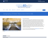
Geography 431 is designed to further understanding of the natural processes of …
Geography 431 is designed to further understanding of the natural processes of aquatic ecosystems, management of water resources, and threats to sustaining water quantity. Develop awareness and appreciation of the perspectives about water as a precious resource, commodity, and sometimes hazard. Learn how and why water is distributed unevenly around the Earth. Examine how resource management decisions are strongly related to water availability, quantity, and quality. The course examines water resources management; dams and dam removal; provision of safe potable water; threats to water quantity and quality; land use changes; the water economy; water laws and policy; institutions for water management at the global, national, regional, and local scale; and issues of water security and climate change.
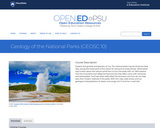
Geysers and grizzlies and glaciers, oh my. The national parks may be …
Geysers and grizzlies and glaciers, oh my. The national parks may be America's best idea, saving the finest parts of the nation for everyone to enjoy forever. What better way to learn about the natural world than to tour the parks with us? We'll explore how the mountains and valleys formed and why they often come with volcanoes and earthquakes. You'll see what really killed the dinosaurs and how we can help save their modern relatives in the parks. With film clips, slide shows, and our geological interpretations of classic rock songs, isn't it time for a road trip?
In this course, you will study the relationships between lines and angles. …
In this course, you will study the relationships between lines and angles. You will learn to calculate how much space an object covers, determine how much space is inside of a three-dimensional object, and other relationships between shapes, objects, and the mathematics that govern them.
In this course students gain proficiency in basic geometric concepts, including properties …
In this course students gain proficiency in basic geometric concepts, including properties of triangles, circles, and polygons; transformations including translations, rotations, reflections, and dilations; and working with surface area and volume of solids.
CK-12's Basic Geometry FlexBook is designed to present students with geometric principles …
CK-12's Basic Geometry FlexBook is designed to present students with geometric principles in a simpler, more graphics-oriented course. Students will explore geometry at a slower pace with an emphasis placed on visual aids and approachability.
The Teacher's Edition covers tips, common errors, enrichment, differentiated instruction and problem …
The Teacher's Edition covers tips, common errors, enrichment, differentiated instruction and problem solving for teaching CK-12's Basic Geometry Student Edition. The solution and assessment guides are available upon request.
CK-12 Foundation's Geometry FlexBook is a clear presentation of the essentials of …
CK-12 Foundation's Geometry FlexBook is a clear presentation of the essentials of geometry for the high school student. Topics include: Proof, Congruent Triangles, Quadrilaterals, Similarity, Perimeter & Area, Volume, and Transformations.
This stand-alone module examines the history, applications, and various proofs of the …
This stand-alone module examines the history, applications, and various proofs of the Pythagorean Theorem. The module also includes student activities and exercise problems. The module assumes the reader has a basic geometry background.
CK-12's Geometry - Second Edition is a clear presentation of the essentials …
CK-12's Geometry - Second Edition is a clear presentation of the essentials of geometry for the high school student. Topics include: Proofs, Triangles, Quadrilaterals, Similarity, Perimeter & Area, Volume, and Transformations.
No restrictions on your remixing, redistributing, or making derivative works. Give credit to the author, as required.
Your remixing, redistributing, or making derivatives works comes with some restrictions, including how it is shared.
Your redistributing comes with some restrictions. Do not remix or make derivative works.
Most restrictive license type. Prohibits most uses, sharing, and any changes.
Copyrighted materials, available under Fair Use and the TEACH Act for US-based educators, or other custom arrangements. Go to the resource provider to see their individual restrictions.