For this assignment, students will use a graphic organizer to think about …
For this assignment, students will use a graphic organizer to think about how the geography and environment of a place have shaped the economy, culture, society, and politics of Mesopotamia, Mesoamerican, Andean societies as well as a society of their choice.
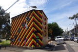
Latin America covers part of North America, South America, and the West …
Latin America covers part of North America, South America, and the West Indies. It stretches from lifeless Atacama desert to rugged highlands and Alpine glaciers of the Andes mountains. The fertile plains of the Pampas are one of the world's richest agricultural regions. The Amazon Basin is the largest and wettest lowland in the world. Culturally, Latin America is a great mixture of European, indigenous and African cultures.
In this course, we will examine the peoples and places of Latin America from a geographical perspective. We will explore the geographical dimensions of economic, cultural, political, and physical forces influencing Latin America as a region. We will have a mixture of thematic and regional approaches to study the concepts and look into various physical and historical processes that have shaped dynamic and diverse cultural landscapes. We will study contemporary environmental and developmental issues, trends in migration, agricultural change, and globalization to understand Latin America's position in the global economy.
COURSE LEVEL LEARNING OUTCOMES
Define Latin America as a world region. Identify the main physical and cultural features and characteristics of Latin America. Interpret maps, graphs, and visuals as tools for analyzing the distribution patterns of phenomena and understanding their importance in the context of Latin America. Explain the impacts of European colonialism in Latin America. Evaluate how changing cultural, social, political, and economic characteristics of Latin American countries influence internal strife and external intervention. Explain the complexities that contributed to the social inequality, political conflict, and environmental concerns prevalent in some Latin American countries. Discuss the changing political and economic relationships between the United States and countries in Latin America.
This exercise is designed to simulate how a basic geological investigation of …
This exercise is designed to simulate how a basic geological investigation of a site takes place. A basic geological investigation includes familiarizing yourself with the unconsolidated sediments, rocks, structural geology, and groundwater present at your site. As part of this exercise you will have to properly identify a variety of rock types and sediments, create maps that represent data you collected at each location, and complete a basic report of your findings (optional). Once completed, this exercise should give students a basic understanding of how the various concepts used throughout the semester are applied in the real world in the form of a geological investigation.
(Note: this resource was added to OER Commons as part of a batch upload of over 2,200 records. If you notice an issue with the quality of the metadata, please let us know by using the 'report' button and we will flag it for consideration.)
Half way through the second semester of our year-long integrated Sed/Strat and …
Half way through the second semester of our year-long integrated Sed/Strat and Structure course we travel to Sheep Mountain, Wyoming where the students spend 5 days describing and measuring section and the constructing geologic and structural maps. The field data gathered then form the basis for a paper titled: "Geologic History of the Sheep Mountain Region". In addition to simply making geologic maps, stratigraphic sections and structural cross-sections, the students have to put the local geology into the broader contexts of the Big Horn Basin and sequences of western orogenies.
(Note: this resource was added to OER Commons as part of a batch upload of over 2,200 records. If you notice an issue with the quality of the metadata, please let us know by using the 'report' button and we will flag it for consideration.)
Each student in the Geological Oceanography class writes a series of one-page …
Each student in the Geological Oceanography class writes a series of one-page papers for topics throughout the semester, presents one topic as a 3 to 5 minute oral presentation, and revises all papers as a portfolio for submission at the end of the semester. The eight topics are objects in the solar system, minerals, rocks, hydrothermal vents, volcanoes & earthquakes, marine sediments, hurricanes & typhoons, and tides.
This is a short writing assignment given in the second semester of …
This is a short writing assignment given in the second semester of an introductory geology course. Students are encouraged to come up with ideas for places around the world that they wish to investigate with respect to geology. The instructor cross-compares lists and assigns locations maximizing global spread of the places covered. Students must review not only the geological history of the location but how society in that place is influenced by the underlying landscape (e.g., mining for resources, natural hazards, etc). Goals include a) encouraging their curiosity about geology with respect to places that may have meaning to them, b) strengthening research and writing skills, and c) using this assignment as a way to synthesize concepts learned in class as related to a particular location around the world.
This Google Slides presentation is a great resource on a review day …
This Google Slides presentation is a great resource on a review day for various geometric constructions. Links embedded in the presentation allow students to work through constructions at their own pace and in their own order.
In this course, you will study the relationships between lines and angles. …
In this course, you will study the relationships between lines and angles. You will learn to calculate how much space an object covers, determine how much space is inside of a three-dimensional object, and other relationships between shapes, objects, and the mathematics that govern them.
This was an assignment for students in two parts: (1) for a …
This was an assignment for students in two parts:
(1) for a given week, students sign up for a landform that pertains to the processes we’ll be studying (e.g. landslides, streams, volcanoes, etc…). The student will use wikipedia, govt. agency websites, or primary sources to present a “show and tell” of the landform including 4 things: a) describe the process by which that feature is formed, b) give an example of where it can be found, c) find 3 pictures of the landform, & d) sketch (or find a depiction) of what the feature would look like on a topographic contour map.
(2) Students will take their presentations and use them to create pages on a Google Sites webpage that will become an online textbook. Students will be able to use the book to study for quizzes on the landforms.
(3) Students will read and leave comments on 2 other students’ pages to provide constructive feedback to help improve the textbook’s content and readability.
Learning Objectives: Students gain oral and written communication skills by presenting and documenting/sharing their research. Students will describe the shape of landforms and connect landforms with the processes responsible for their formation by learning from each other and from doing their own research.
The goal of this research project is to allow students to integrate …
The goal of this research project is to allow students to integrate and apply their geomorphic knowledge in a comprehensive study of a local landscape system. In this project, students investigate the origin and significance of a series of flat-topped mesas and isolated hills that rise above the gently sloping surface of alluvial fans along the San Gabriel Mountain foothills. Students work as part of a research team of 3 or 4 members. Each team is assigned a different field area and conduct a comprehensive geomorphic investigation of landforms within that area. Team members are expected to work collaboratively to formulate a research plan, complete a background literature search, and conduct independent fieldwork outside of class time. Each team divides up responsibilities as they see fit. At the end of the quarter, each team presents the results of their research in an oral presentation in front of the class, and in a professional written report submitted to the professor. Designed for a geomorphology course
(Note: this resource was added to OER Commons as part of a batch upload of over 2,200 records. If you notice an issue with the quality of the metadata, please let us know by using the 'report' button and we will flag it for consideration.)
Please see the related test//problem set. Integrates geomorphology into a core course …
Please see the related test//problem set. Integrates geomorphology into a core course in geology Designed for an introductory geology course Has minimal/no quantitative component Uses geomorphology to solve problems in other fields
(Note: this resource was added to OER Commons as part of a batch upload of over 2,200 records. If you notice an issue with the quality of the metadata, please let us know by using the 'report' button and we will flag it for consideration.)
Walks the student through the creation of a prediction map using a …
Walks the student through the creation of a prediction map using a very simple (fictitious) spatial planning and analysis scenario. Although the actual prediction "rules" for this scenario are not from a geoscience background, the GIS techniques practiced here can apply to geoscience prediction/analysis scenarios with more complex rules. The exercise mainly deals with vector geoprocessing ("map overlay") operations, such as buffering, union, dissolve, clip, but combines them with spatial joins and spatial queries. The results are presented as a map.
As a result of this lab you should be able to understand …
As a result of this lab you should be able to understand the process of georeferencing and be able to carry it out (part A). You should also be able to make a map of the results and gain a basic understanding of how land use has changed during the time period depicted by the aerial photographs (Parts B and C).
Georgia Southern Team for IHE Accessibility in OER Implementation Guide. This is …
Georgia Southern Team for IHE Accessibility in OER Implementation Guide. This is a brief Landscape Analysis to uncover key structures and supports to help guide our work to support Accessibility in OER.
This project involved students in in-depth research, thus understanding, of the geological …
This project involved students in in-depth research, thus understanding, of the geological setting of Bozeman. Teams defined the scope of their investigations (with faculty oversight) and delegated tasks to build a knowledge base. This understanding lead to the outreach component -- a poster session to present this knowledge to the campus and broader community. The poster contents were submitted in a digital form as well, with the long-term goal the compilation of a printed poster (suitable for the Chamber of Commerce, for example, to distribute) analogous to those produced for the Geoscape Canada project. As a hook, I would plan to do a brief pretest on the region involving WHAT students know about the region beforehand and WHY they might need to know. Sample questions: Content: How deep would one have to dig or drill to find groundwater under downtown Bozeman Under the airport?? Significance: Which of the following processes/hazards are made worse by groundwater close to the surface? Earthquakes, Landslides... An advantage to such a pretest would be an end-of-semester reflection exercise including the same test as a post-test.
(Note: this resource was added to OER Commons as part of a batch upload of over 2,200 records. If you notice an issue with the quality of the metadata, please let us know by using the 'report' button and we will flag it for consideration.)
In this exercise students watch a video and then participate in a …
In this exercise students watch a video and then participate in a think-pair-share activity. The activity is designed to stimulate reflection and discussion on the nature of geospatial data. The activity emphasizes the ways in which the digital revolution has transformed the way we think and gather information about spatially located features, and how we navigate to those features.
This is a set of three tasks for students to do to …
This is a set of three tasks for students to do to elaborate on understanding of Bertolt Brecht's Die Unwürdige GreisinThis would be over a few days- working on the interpersonal questions and intial reading in the first two days to activiate their prior knowledge about common family dynamics, and how they could be different now as opposed to 100+ years ago, then give students time to work on reading the entire text, finally having students create a conversation between the two brothers. This does not have comprehension questions for the entire text.
This is a short writing and grading rubric, taking 20-30 minutes for …
This is a short writing and grading rubric, taking 20-30 minutes for students to work on giving appropriate advice for a person they know who is sick using simple and complex sentences.
This is a brief explanation of how to access and use the …
This is a brief explanation of how to access and use the MyOpenMath assignments for many math courses. It also includes some links to useful resources.
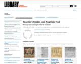
Teacher's Guides and Analysis Tool Primary Source Analysis Tool for Students Students …
Teacher's Guides and Analysis Tool Primary Source Analysis Tool for Students Students can use this simple tool to examine and analyze any kind of primary source and record their responses.
No restrictions on your remixing, redistributing, or making derivative works. Give credit to the author, as required.
Your remixing, redistributing, or making derivatives works comes with some restrictions, including how it is shared.
Your redistributing comes with some restrictions. Do not remix or make derivative works.
Most restrictive license type. Prohibits most uses, sharing, and any changes.
Copyrighted materials, available under Fair Use and the TEACH Act for US-based educators, or other custom arrangements. Go to the resource provider to see their individual restrictions.