Updating search results...

Search Resources

653 Results

View
Selected filters:
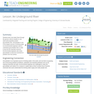
An Underground River
Read the Fine Print
Educational Use
Rating
0.0 stars

Groundwater is one of the largest sources of drinking water, so environmental engineers need to understand groundwater flow in order to tap into this important resource. Environmental engineers also study groundwater to predict where pollution from the surface may end up. In this lesson, students will learn how water flows through the ground, what an aquifer is and what soil properties are used to predict groundwater flow.

Subject:
Applied Science
Engineering
Hydrology
Physical Science
Material Type:
Activity/Lab
Lesson Plan
Provider:
TeachEngineering
Provider Set:
TeachEngineering
Author:
Janet Yowell
Malinda Schaefer Zarske
Melissa Straten
Date Added:
09/18/2014
Flood Analysis
Read the Fine Print
Educational Use
Rating
0.0 stars

Students learn how to use and graph real-world stream gage data to create event and annual hydrographs and calculate flood frequency statistics. Using an Excel spreadsheet of real-world event, annual and peak streamflow data, they manipulate the data (converting units, sorting, ranking, plotting), solve problems using equations, and calculate return periods and probabilities. Prompted by worksheet questions, they analyze the runoff data as engineers would. Students learn how hydrographs help engineers make decisions and recommendations to community stakeholders concerning water resources and flooding.

Subject:
Applied Science
Engineering
Hydrology
Physical Science
Material Type:
Activity/Lab
Provider:
TeachEngineering
Provider Set:
TeachEngineering
Author:
Emily Gill
Malinda Schaefer Zarske
Date Added:
09/18/2014
How Does Melting Ice Affect Sea Level?
Unrestricted Use
CC BY
Rating
0.0 stars

Students investigate how sea levels might rise when ice sheets and ice caps melt. By constructing a pair of models, students can observe the effects of ice melt in two different situations.

Subject:
Oceanography
Physical Science
Material Type:
Activity/Lab
Provider:
CLEAN: Climate Literacy and Energy Awareness Network
Provider Set:
CLEAN: Climate Literacy and Energy Awareness Network
Author:
ANDRILL
LuAnn Dahlman
Date Added:
06/19/2012
Investigating groundwater-surface water interactions using a multidisciplinary approach involving hydrogeology, geology, and geophysics
Conditional Remix & Share Permitted
CC BY-NC-SA
Rating
0.0 stars

Students and faculty participate in an integrated effort to characterize hydrologic relationships using hydrologic, geologic & geophysical data

(Note: this resource was added to OER Commons as part of a batch upload of over 2,200 records. If you notice an issue with the quality of the metadata, please let us know by using the 'report' button and we will flag it for consideration.)

Subject:
Biology
Hydrology
Life Science
Physical Science
Material Type:
Activity/Lab
Data Set
Lesson Plan
Provider:
Science Education Resource Center (SERC) at Carleton College
Provider Set:
Teach the Earth
Author:
Robert Bauer
Date Added:
09/22/2022
Putting It All Together (Water Cycle, Deforestation, and Climate Change #4)
Conditional Remix & Share Permitted
CC BY-NC
Rating
0.0 stars

In this lesson, students learn about extreme weather, create an infographic, and educate others on the knowledge gained from this unit.

Step 1 - Inquire: Students watch videos to understand why weather is becoming more extreme.

Step 2 - Investigate: Students create an infographic about extreme weather impacts in their area.

Step 3 - Inspire: Students educate others on the knowledge gained from this unit.

Subject:
Applied Science
Environmental Science
Material Type:
Lesson
Lesson Plan
Provider:
SubjectToClimate
Author:
Mallory Swafford
Date Added:
03/15/2023
Where Does All the Water Go?
Read the Fine Print
Educational Use
Rating
0.0 stars

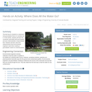
The best way for students to understand how groundwater flows is to actually see it. In this activity, students will learn the vocabulary associated with groundwater and see a demonstration of groundwater flow. Students will learn about the measurements that environmental engineers need when creating a groundwater model of a chemical plume.

Subject:
Applied Science
Engineering
Hydrology
Physical Science
Material Type:
Activity/Lab
Provider:
TeachEngineering
Provider Set:
TeachEngineering
Date Added:
10/14/2015
Gaoming Studio - China
Conditional Remix & Share Permitted
CC BY-NC-SA
Rating
0.0 stars

The studio will focus on the district of Gaoming, located in the northwest of the Pearl River Delta (PRD) - the fastest growing and most productive region of China. The District has recently completed a planning effort in which several design institutes and a Hong Kong planning firm prepared ideas for a new central area near the river. The class will complement these efforts by focusing on planning and design options on the waterfront of the proposed new district and ways of integrating water/hydrological factors into all aspects and land uses of a modern city (residential, commercial, industrial) - including watershed and natural ecosystem protection, economic and recreational activities, transportation, and tourism.

Subject:
Applied Science
Architecture and Design
Arts and Humanities
Economics
Engineering
Environmental Science
Hydrology
Physical Science
Social Science
Material Type:
Full Course
Provider:
MIT
Provider Set:
MIT OpenCourseWare
Author:
Ben-Joseph, Eran
Lee, Tunney
Date Added:
02/01/2005
What Happens to Water When it Hits the Ground?
Conditional Remix & Share Permitted
CC BY-NC-SA
Rating
0.0 stars

Students will test the percolation rates of 6 different soil samples. Three of the samples are measured sand and clay and three are collected from the schoolyard and wetland.

Subject:
Geoscience
Hydrology
Physical Science
Material Type:
Activity/Lab
Simulation
Provider:
Science Education Resource Center (SERC) at Carleton College
Provider Set:
Pedagogy in Action
Author:
Debra Hornfeldt
Date Added:
08/16/2012
The Physics of Fluid Mechanics
Read the Fine Print
Educational Use
Rating
0.0 stars

From drinking fountains at playgrounds, water systems in homes, and working bathrooms at schools to hydraulic bridges and levee systems, fluid mechanics are an essential part of daily life. Fluid mechanics, the study of how forces are applied to fluids, is outlined in this unit as a sequence of two lessons and three corresponding activities. The first lesson provides a basic introduction to Pascal's law, Archimedes' principle and Bernoulli's principle and presents fundamental definitions, equations and problems to solve with students, as well as engineering applications. The second lesson provides a basic introduction to above-ground storage tanks, their pervasive use in the Houston Ship Channel, and different types of storage tank failure in major storms and hurricanes. The unit concludes with students applying what they have learned to determine the stability of individual above-ground storage tanks given specific storm conditions so they can analyze their stability in changing storm conditions, followed by a project to design their own storage tanks to address the issues of uplift, displacement and buckling in storm conditions.

Subject:
Applied Science
Engineering
Hydrology
Physical Science
Material Type:
Full Course
Unit of Study
Provider:
TeachEngineering
Provider Set:
TeachEngineering
Author:
Emily Sappington
Mila Taylor
Date Added:
09/18/2014
Water: Modeling a Watershed by T. Kabealo & B. Cullinan (42.WCS)
Conditional Remix & Share Permitted
CC BY-NC
Rating
0.0 stars

Students will be working with the problem “How do we know water is safe to drink?” under the theme of “How does access to clean water and sanitation affect a culture?” Students participate in labs related to the hydrologic cycle and water quality. Students design and build a local watershed to model the movement of water across land. Students also research and explore print, video, and audio resources for news and information about local / global water pollution / impact by and on humans.Students share what they have researched with each other, then create an artifact (infographic, video, slideshow, animation, comic strip, etc) intended to educate peers and younger students about water quality and its importance. Ideally, finished products would be shared with others in an authentic setting.Standards:Ohio Science Standards (Grade 7)CCSS English Language Arts (Grade 7)

Subject:
Educational Technology
English Language Arts
Environmental Science
World Cultures
Material Type:
Lesson Plan
Author:
Cathryn Chellis
Blended Learning Teacher Practice Network
Date Added:
08/30/2018
Glaciers Then and Now
Unrestricted Use
CC BY
Rating
0.0 stars

In this activity, students compare two photographs (with time spans of 30-100 years between photos) of specific Alaskan glaciers to observe how glaciers have changed over the time interval. Activity is a good kickoff for learning about glaciology - how and why glaciers form, grow and shrink, and their relation to climate change.

Subject:
Applied Science
Career and Technical Education
Environmental Science
Environmental Studies
Physical Science
Material Type:
Activity/Lab
Provider:
CLEAN: Climate Literacy and Energy Awareness Network
Provider Set:
CLEAN: Climate Literacy and Energy Awareness Network
Author:
Lisa Gardiner
Teri Eastburn
Windows to the Universe
Date Added:
06/19/2012
Modeling Tool Helps Optimize Use of Groundwater Supplies
Read the Fine Print
Rating
0.0 stars

As Public Works Director of Nogales, Arizona, Alejandro Barcenas works to ensure a safe and secure water supply for the city’s 20,500 residents. His task isn’t easy: the city is located in an arid region just north of the United States–Mexico border, and its entire supply comes from groundwater.

Half of Nogales’ water comes from alluvial aquifers that are highly responsive to rainfall events. Though this convenient source of water recharges easily, it is also vulnerable to climate-related changes such as reduced precipitation and increased evaporation. The other half of the city’s groundwater comes from a lower-quality source—this water is more expensive to produce. To optimize the use of the two sources of groundwater into the future, Barcenas is contributing to the development of a modeling tool that simulates how the aquifers may change in response to climate.

Subject:
Hydrology
Physical Science
Material Type:
Case Study
Provider:
National Oceanic and Atmospheric Administration
Provider Set:
U.S. Climate Resilience Toolkit
Date Added:
08/09/2016
Rangelands in Nebraska
Conditional Remix & Share Permitted
CC BY-NC-SA
Rating
0.0 stars

Rangelands are one of Nebraska’s most important and valuable natural resources: forage for livestock, habitat for wildlife, protection to soil from erosion, filters runoff water, and recharges groundwater. This unit will prepare students with a better understanding of rangeland ecosystems to prepare them for better management decision making. Unit by Kortni Burnett, Nebraska Agriculture, Food, and Natural Resources Educator

Subject:
Agriculture
Material Type:
Activity/Lab
Assessment
Diagram/Illustration
Homework/Assignment
Lecture
Lecture Notes
Lesson Plan
Student Guide
Author:
Owl Nest Manager
Date Added:
02/29/2024
Fresh or Salty?
Read the Fine Print
Educational Use
Rating
0.0 stars

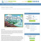
Between 70 and 75% of the Earth's surface is covered with water and there exists still more water in the atmosphere and underground in aquifers. In this lesson, students learn about water bodies on the planet Earth and their various uses and qualities. They will learn about several ways that engineers are working to maintain and conserve water sources. They will also think about their role in water conservation.

Subject:
Applied Science
Engineering
Hydrology
Physical Science
Material Type:
Activity/Lab
Lesson Plan
Provider:
TeachEngineering
Provider Set:
TeachEngineering
Author:
Janet Yowell
Malinda Schaefer Zarske
Sara Born
Date Added:
09/18/2014
GLOBE Videos: Overview (10:59 min)
Read the Fine Print
Rating
0.0 stars

This video highlights students taking scientific measurements to support investigations in atmospheric science, hydrology, soils, and land cover. It shows students reporting data through the Web, creating scientific visualizations for analysis, and collaborating with students and scientists around the world. This is one two introductory videos in the 24-part GLOBE video series. GLOBE (Global Learning and Observation to Benefit the Environment) is a worldwide, hands-on, K-12 school-based science education program.

Subject:
Atmospheric Science
Ecology
Education
Forestry and Agriculture
Geoscience
Hydrology
Life Science
Oceanography
Physical Science
Material Type:
Lecture
Provider:
NASA
Provider Set:
NASA Wavelength
Date Added:
11/05/2014
Using Wetlands to Teach Hydrogeology
Conditional Remix & Share Permitted
CC BY-NC-SA
Rating
0.0 stars

Wetlands provide an ideal field hydrology laboratory because the water table is so close to the land surface. Eight field exercises, in which students generate their own data, are presented that demonstrate surface-water, vadose-zone, and groundwater hydrology concepts. Standard field equipment and methods are used to conduct investigations including measuring stream discharge, estimating groundwater seepage to a stream and/or pond, preparing a topographic profile showing the water-table configuration, measuring infiltration rates and estimating constant infiltration capacity, measuring field-saturated hydraulic conductivity, estimating hydraulic conductivity from slug tests, and determining the direction, hydraulic gradient, and specific discharge of groundwater. These labs compliment lecture material commonly covered in a first semester hydrology course.

(Note: this resource was added to OER Commons as part of a batch upload of over 2,200 records. If you notice an issue with the quality of the metadata, please let us know by using the 'report' button and we will flag it for consideration.)

Subject:
Biology
Hydrology
Life Science
Physical Science
Material Type:
Activity/Lab
Provider:
Science Education Resource Center (SERC) at Carleton College
Provider Set:
Teach the Earth
Author:
Catherine Carlson
Date Added:
08/27/2020
Middle School Water Quality Curriculum Synopsis
Only Sharing Permitted
CC BY-NC-ND
Rating
0.0 stars

Middle School Water Quality Curriculum SynopsisDesign your own wetland science field trip or have WREN staff visit your classroom.Programs address Oregon State Science Standards and Common Core State Learning Standards. Purpose of the Water Quality Curriculum: •    For students to model the scientific method, engineering, math, and social studies practices. •    To explore and solve problems along the Long Tom River Watershed. •    To use tools and technology to collect data and use that data to answer questions.•    To engineer solutions to real-life problems and learn how to resolve water quality disputes in real-life scenarios.  Each lesson can be integrated into our 2-hour tour of the West Eugene Wetlands (WEW). How much time is required for the lesson, the best season, and where the lesson is best experienced is indicated next to the lesson tile._______________________________________________________________________________________________What is a Watershed? Activity/ 50 minutes (Class or WEW):It’s recommended that all classes begin their wetland field study with this fun and interactive, whole-body activity that investigates how vegetation affects the movement of water over land surfaces and identifies best management practices to reduce erosion. Science Standards: MS-ESS2; MS-ESS2-4.    Earth’s Systems: Develop a model to describe cycling of water through earth’s systems driven by energy from the sun and force of gravity._______________________________________________________________________________________________Wetland Soil Study/ 90 minutes (WEW- Fall or Spring):Students will learn the history behind the unique composition of soil in the southern Willamette Valley, discover how wetland soils have an important role in filtering and cleaning the water that runs through them, explore and record the physical characteristics of wetland soil using a Munsell Chart, measure the hydric capacity of different types of soil, and make the connection between soils and water in a wet prairie. Science Standards: MS-ESS2-2.    Earth’s Systems: Construct an explanation based on evidence for how geoscience processes have changed Earth's surface at varying time and spatial scales.Common Core Standards:Mathematics7.EE.B.4.     Use variables to represent quantities in a real-world of mathematical problem, and construct simple equations and inequalities to solve problems by reasoning about quantities.______________________________________________________________________________________________           Water Quality of Amazon Creek/ 90 minutes (WEW- Fall and Spring):Through experimentation and a simulation, students will learn how increases in water acidity have endangered the quality of life for water-based organisms in parts of Eugene. Students will model water molecules under different circumstances, test water samples from Amazon creek for dissolved oxygen, PH, and temperature and learn how these variables impact the quality of life in our waterways.  Science Standards: MS-PS1-1.          Matter and Its Interactions: Develop models to describe the atomic composition of simple molecules  and extended structures.Common Core Standards:Mathematics 6.SP.B.4.            Display numerical data in plots on a number line, including dot plots, histograms, and box plots.7.EE.3.               Solve multiple real-life & mathematical problems posed with positive and negative rational numbers in any form using tools strategically. Apply properties of operations to calculate with numbers in any form. _______________________________________________________________________________________________Flood-Plan Engineering Design/ 90 minutes (WEW or Class- Fall, Winter, Spring):Students will learn about historic floods in the Willamette Valley, and explore flood dynamics by building models of riverbeds and testing their holding capacity. Students will use engineering to design systems that will help prevent flood damage and learn about how human modifications to a river or wetland can alter the floodplain.Science Standards:MS-ESS3-3.     Earth’s & Human Activity: Apply Scientific principles to design a method for monitoring and minimizing a human impact on the environment.MS-ESS3-2.    Earth’s & Human Activity: Analyze and interpret data on natural hazards to forecast future catastrophic events and inform the development of technologies to mitigate their efforts.MS-ETS1-1; 1-4. Engineering Design: Develop a model to generate data for iterative testing and modification of a  proposed object, tool, or process such that an optimal design can be achieved.  Common Core Standards:MathematicsMP.2.        Reason abstractly and quantitatively._______________________________________________________________________________________________Water Quality Debate/ 60 minutes (Class- Fall, Winter, Spring):Students will demonstrate how disputes regarding water quality and quantity can be settled through mediation by playing character roles in a mock Town Hall Meeting. They will develop and engage in an evidence supporting argument surrounding a local water-related issue, evaluate arguments presented by others of different viewpoints, and decide on a resolution.Science Standards:MS-LS2-5.    Ecosystems: Interactions, Energy and Dynamics: Evaluate competing design solutions for maintaining biodiversity and ecosystem servicesCommon Core Standards:ELA/LiteracyMS-LS-2-2.    Engage effectively in a range of collaborative discussions (one on one, in groups, and teacher led) with diverse partners on grade 8 topics, texts, and issues, building on other’s ideas and expressing their own clearly. MS-LS2-2.    Present claims or findings, emphasizing salient points in a focused coherent manner with relevant evidence, sound valid reasoning and adequate well-chosen details, use appropriate eye contact, adequate volume, and other pronunciation. 
Subject:
Computer Science
Ecology
Engineering
Environmental Science
Environmental Studies
Measurement and Data
Ratios and Proportions
Sociology
Speaking and Listening
Material Type:
Lesson Plan
Author:
Laura Maloney
Date Added:
08/03/2018
Karst Landscapes of the Interior Low Plateaus
Conditional Remix & Share Permitted
CC BY-NC-SA
Rating
0.0 stars

This laboratory exercise examines the linkages between ground and surface water hydrology and landscape evolution in the Interior Low Plateaus Region of Kentucky. The exercise focuses upon the origin of Mammoth Cave.

Subject:
Applied Science
Environmental Science
Hydrology
Physical Geography
Physical Science
Material Type:
Activity/Lab
Provider:
Science Education Resource Center (SERC) at Carleton College
Provider Set:
Teach the Earth
Author:
David Franzi
Date Added:
01/20/2023
Minnesota Watersheds
Conditional Remix & Share Permitted
CC BY-NC-SA
Rating
0.0 stars

This unit is to be taught as an extension to the FOSS WATER INVESTIGATION 1, Part 3, WATER ON A SLOPE. After learning that water flows down a slope, students will understand that this concept determines how our watersheds flow. It will also explain why some rivers (such as the Red River) appear to be flowing "up" on a map. They will then create a landform map of Minnesota accurately representing the higher elevations (our RIDGELINES) and the location of our major rivers and bodies of water. This unit can also be extended by many of the activities in the Project Wild and the MinnAqua Lesson Books.

Subject:
Geoscience
Hydrology
Physical Science
Material Type:
Activity/Lab
Provider:
Science Education Resource Center (SERC) at Carleton College
Provider Set:
Pedagogy in Action
Author:
Stafford Gutknecht
Date Added:
08/16/2012
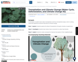
Transpiration and Climate Change (Water Cycle, Deforestation, and Climate Change #2)
Conditional Remix & Share Permitted
CC BY-NC
Rating
0.0 stars

In this lesson, students learn about transpiration and how transpiration plays a role in cooling cities that experience extreme heat due to climate change.

Step 1 - Inquire: Students explore the idea of transpiration through a hands-on experiment.

Step 2 - Investigate: Students learn about trees' connection to urban heat island.

Step 3 - Inspire: Students create a proposal to improve tree equity in their neighborhoods.

Subject:
Applied Science
Environmental Science
Material Type:
Lesson
Lesson Plan
Provider:
SubjectToClimate
Author:
Mallory Swafford
Date Added:
03/15/2023