Updating search results...

Search Resources

86 Results

View
Selected filters:
  • gis
Programming for the Web: From Soup to Nuts: Implementing a complete GIS web page using HTML5, CSS, JavaScript, Node.js, MongoDB, and Open Layers
Unrestricted Use
CC BY
Rating
0.0 stars

This book is designed to be used as a class text but should be easily accessible to programmers interested in Web Programming. It should even be accessible to an advanced hobbyist.

The original goal behind this text was to help students doing research with me in Web based mapping applications, generally using Open Layers. The idea was to provide persistent storage using REST and simple http request from JavaScript to store the data on a server.

Subject:
Applied Science
Computer Science
Material Type:
Textbook
Provider:
Gettysburg College
Author:
Charles W. Kann III
Date Added:
09/11/2018
Reimagining History with Heritage Maps
Conditional Remix & Share Permitted
CC BY-NC-SA
Rating
0.0 stars

Cover image features National Geographic Explorer Alicia Odewale, courtesy of Alicia Odewale.The National Geographic Society is making this content available under a Creative Commons CC-BY-NC-SA license. The License excludes the National Geographic Logo (meaning the words National Geographic + the Yellow Border Logo) and any images that are included as part of each content piece. For clarity the Logo and images may not be removed, altered, or changed in any way. How can we use maps to reimagine our history? See how Explorer Alicia Odewale uses maps to help students visualize and understand life in Oklahoma’s historic all-Black towns one hundred years ago.

Subject:
Cultural Geography
History
Physical Geography
U.S. History
Material Type:
Activity/Lab
Lesson
Author:
Margot Willis
National Geographic Society
Date Added:
09/06/2024
Renewable Energy Living Lab: Exploring Regional and Local Resources
Read the Fine Print
Educational Use
Rating
0.0 stars

Students become familiar with the online Renewable Energy Living Lab interface and access its real-world solar energy data to evaluate the potential for solar generation in various U.S. locations. They become familiar with where the most common sources of renewable energy are distributed across the U.S. Through this activity, students and teachers gain familiarity with the living lab's GIS graphic interface and query functions, and are exposed to the available data in renewable energy databases, learning how to query to find specific information for specific purposes. The activity is intended as a "training" activity prior to conducting activities such as The Bright Idea activity, which includes a definitive and extensive end product (a feasibility plan) for students to create.

Subject:
Applied Science
Ecology
Engineering
Life Science
Material Type:
Activity/Lab
Provider:
TeachEngineering
Provider Set:
TeachEngineering
Author:
Jessica Noffsinger
Jonathan Knudtsen
Karen Johnson
Mike Mooney
Minal Parekh
Scott Schankweiler
Date Added:
09/18/2014
Satellite Navigation
Conditional Remix & Share Permitted
CC BY-NC-SA
Rating
0.0 stars

Global Satellite Navigation Systems (GNSS), such as GPS, have revolutionized positioning and navigation. Currently, four such systems are operational or under development. They are the American GPS, the Russian Glonass, the European Galileo, and the Chinese Beidou-Compass. This course will address: (1) the technical principles of Global Navigation Satellite Systems (GNSS), (2) the methods to improve the accuracy of standard positioning services down to the millimeter accuracy level and the integrity of the systems, and (3) the various applications for positioning, navigation, geomatics, earth sciences, atmospheric research and space missions. The course will first address the space segment, user and control segment, signal structure, satellite and receiver clocks, timing, computation of satellite positions, broadcast and precise ephemeris. It will also cover propagation error sources such as atmospheric effects and multipath. The second part of the course covers autonomous positioning for car navigation, aviation, and location based services (LBS). This part includes the integrity of GNSS systems provided for instance by Space Based Augmentation Systems (e.g. WAAS, EGNOS) and Receiver Autonomous Integrity Monitoring (RAIM). It will also cover parameter estimation in dynamic systems: recursive least-squares estimation, Kalman filter (time update, measurement update), innovation, linearization and Extended Kalman filter. The third part of the course covers precise relative GPS positioning with two or more receivers, static and kinematic, for high-precision applications. Permanent GPS networks and the International GNSS Service (IGS) will be discussed as well. In the last part of the course there will be two tracks (students only need to do one): (1) geomatics track: RTK services, LBS, surveying and mapping, civil engineering applications (2) space track: space based GNSS for navigation, control and guidance of space missions, formation flying, attitude determination The final lecture will be on (scientific) applications of GNSS.

Subject:
Astronomy
Physical Science
Material Type:
Assessment
Homework/Assignment
Lecture Notes
Reading
Provider:
Delft University of Technology
Provider Set:
TU Delft OpenCourseWare
Author:
A.A. Verhagen
Date Added:
02/10/2016
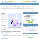
Searching for Bigfoot and Others Like Him
Read the Fine Print
Educational Use
Rating
0.0 stars

Cryptids, creatures of questionable existence, are used as a source of data to guide students into the creation of their own GIS data layer in Google Earth. The activity serves the purpose of a tutorial to teach students how to make data layers with a simple subject. Then they use that skill on other topics such as plastics in their neighborhood.

Subject:
Applied Science
Computing and Information
Engineering
Geoscience
Physical Science
Technology
Material Type:
Activity/Lab
Provider:
TeachEngineering
Provider Set:
TeachEngineering
Author:
Andrey Koptelov
Nathan Howell
Date Added:
09/18/2014
Spatial Database Management
Conditional Remix & Share Permitted
CC BY-NC-SA
Rating
0.0 stars

A spatial database is the backbone of a successful organization or website that depends upon maintaining and using data pertinent to locations on Earth. In GEOG 868, Spatial Database Management, capabilities specific to Relational Database Management Systems (RDBMS) and Geographic Information Systems (GIS) are combined to teach students to create, maintain, and query spatial databases in both desktop and enterprise environments. Learn the basics of Standard Query Language (SQL) and database design/normalization, the specifics of managing spatial data in an open-source technologies context (Postgres/PostGIS) and in the context of the Esri geodatabase. Along the way, you will become familiar with spatial functions and versioning, the latter in a server environment hosted by Amazon Web Services.

Subject:
Applied Science
Atmospheric Science
Business and Communication
Career and Technical Education
Engineering
Environmental Science
Environmental Studies
Finance
Physical Science
Material Type:
Full Course
Provider:
Penn State College of Earth and Mineral Sciences
Author:
Jim Detwiler
Jim Sloan
Date Added:
10/07/2019
Spatial Database Management and Advanced Geographic Information Systems
Conditional Remix & Share Permitted
CC BY-NC-SA
Rating
0.0 stars

This semester long subject (11.521) is divided into two halves. The first half focuses on learning spatial database management techniques and methods and the second half focuses on using these skills to address a ‘real world,’ client-oriented planning problem. The first half of the semester may be taken separately using the class number 11.523 and the second half may be taken separately as 11.524.
In order to help shape and utilize the information infrastructure that will support the management and development of our metropolitan areas, planners need a basic understanding of the tools and technology for querying, analyzing, and sharing complex databases and maps. Managing online access to large and constantly-changing spatial datasets can be a powerful aid to planning and can facilitate inter-agency cooperation and collaboration in an increasingly decentralized world. But it requires the use of knowledge representation methods, client-server technologies and access control issues that are quite different from what are needed to model and visualize standalone datasets on a personal computer. Hence, planners should acquire basic skills in database management, digital spatial data analysis, and networking.
The 11.523 portion of the semester addresses these issues while retaining a focus on planning (rather than on computer science). This is an intensive, hands-on class that stresses learning by doing. Exercises and examples involving real-world data, maps, and images are used to develop skills with database query languages and the design development and use of structured databases. Class work utilizes web tools, GIS, and database software with lab exercises primarily on the new high-performance PC computing cluster. Specifically, we will access an Oracle 8i database using SQL (structured query language) and use ArcView for GIS. Each week there are two sixty to ninety-minute classes plus another 90+ minute hands-on lab in electronic classrooms. Class lectures will focus on concepts and case discussion, the scheduled lab time focuses on computer mechanics and skill building. Specific topics during 11.523 include:

finding, understanding and structuring digital spatial data that are available on the Internet using various browsing, visualization, and data management tools;
considerable work with relational database technologies and the Structured Query Language (SQL) to design, construct, query, and update urban planning databases;
some experience with so-called ‘client/server’ and ’enterprise GIS’ technologies for facilitating distributed access to complex spatial data and urban planning applications;
advanced GIS topics such as 3D visualizations and geospatial web services.

The 11.524 portion of the semester will treat the classroom like a professional planning office, working as a team to produce a two deliverables for their client, Lawrence Community Works, Inc. (LCW), a community development corporation located in the City of Lawrence, Massachusetts. LCW and DUSP recently agreed to work together for the next five years to design and implement a multi-tier web-based planning system that promotes democratic involvement and informs community development projects. Your involvement this semester is critical, because the implementation plan that you craft this semester will serve as the road map for both organizations for years to come and the simple web-based planning tool that you design will engage stakeholders by giving them a better sense of how technologies can aid decision-making processes. To assist you with the more technical aspects of the project, we hired Robert Cheetham, President of Azavea, Inc. (http://www.azavea.com/ ), to provide exactly 100 hours of consultancy services. Through their project work, students will enhance important professional skills by:

formulating an implementation plan for a real client;
designing a simple web-based tool for understanding problems;
engaging constituents and stakeholders in a real setting;
integrating theory and practice by evaluating the role of technology in community development;
learning to communicate effectively within a group and with a professional consultant;
working with such tools as the WWW, Access, ArcView, ArcIMS, SDE, etc.

Subject:
Applied Science
Computer Science
Engineering
Social Science
Sociology
Material Type:
Full Course
Provider Set:
MIT OpenCourseWare
Author:
Ferreira, Joseph
Hoyt, Lorlene
Date Added:
02/01/2003
Spatial Thinking in Planning Practice: An Introduction to GIS
Conditional Remix & Share Permitted
CC BY-NC
Rating
0.0 stars

The goals of this textbook are to help students acquire the technical skills of using software and managing a database, and develop research skills of collecting data, analyzing information and presenting results. We emphasize that the need to investigate the potential and practicality of GIS technologies in a typical planning setting and evaluate its possible applications. GIS may not be necessary (or useful) for every planning application, and we anticipate these readings to provide the necessary foundation for discerning its appropriate use. Therefore, this textbook attempts to facilitate spatial thinking focusing more on open-ended planning questions, which require judgment and exploration, while developing the analytical capacity for understanding a variety of local and regional planning challenges.
While this textbook provides the background for understanding the concepts in GIS as applicable to urban and regional planning, it is best when accompanied by a hands-on tutorial, which will enable readers to develop an in-depth understanding of the specific planning applications of GIS. Chapters in this text book are either composed by the editors using Creative Common materials, or linked to a book chapter scanned copy in the library reserve. In the end of each chapter, we also provided several discussion questions, together with contextual applications through some web links.

Subject:
Physical Geography
Physical Science
Material Type:
Textbook
Provider:
Portland State University
Provider Set:
PDXOpen
Author:
Eugenio Arriaga Cordero
Vivek Shandas
Date Added:
12/23/2014
Spatial Tools in Water Resources Management
Conditional Remix & Share Permitted
CC BY-NC-SA
Rating
0.0 stars

The course discusses several Geopgraphical Information System (GIS) and Remote Sensing (RS) tools relevant for analysis of (problems in and aspects of) water systems. Within the course, several applications are introduced. These applications include GIS tools to determine mapping of surface water systems (catchment delineation, reservoirs and canal systems). The RS tools include determination of evaporation and soil moisture patterns, and measurement of water levels in surface water systems. In exercises and lectures, different tools and applications are offered. For each application, assignments are given to allow students to acquire relevant skills. The course structure combines assignments and introductory lectures. Each week participants work on one assignment. These assignments are discussed in the next lecture and graded. Each week a new assignment is introduced, together with supporting materials (an article discussing the relevant application) and lectures (introducing theoretical issues). The study material of the course consists of a study guide, assignments, lecture material and articles. The final mark is the average of the grades of the individual assignments.

Subject:
Hydrology
Physical Science
Material Type:
Full Course
Provider:
Delft University of Technology
Provider Set:
TU Delft OpenCourseWare
Author:
S.C. Steele-Dunne
Date Added:
02/15/2016
Spatial data analyzing (Final project)
Conditional Remix & Share Permitted
CC BY-NC-SA
Rating
0.0 stars

The goal of this lecture plan "Spatial data analyzing" is to adapt the final project of Edit-027, at this time, this document helps students acquire technical skills in using GIS opensource software (QGIS) for producing, managing databases, and to develop research skills in spatial analysis.This module is for 0.5 credit hoursThis OER document was adapted from OER "Introduction to GIS for urban studies" 

Subject:
Engineering
Information Science
Material Type:
Lecture
Lesson Plan
Module
Author:
The Nguyen
Date Added:
05/24/2022
Technology in Transportation
Conditional Remix & Share Permitted
CC BY-NC-SA
Rating
0.0 stars

This course provides an introduction to the transportation industry’s major technical challenges and considerations. For upper level undergraduates interested in learning about the transportation field in a broad but quantitative manner. Topics include road vehicle engineering, internal combustion engines, batteries and motors, electric and hybrid powertrains, urban and high speed rail transportation, water vessels, aircraft types and aerodynamics, radar, navigation, GPS, GIS. Students will complete a project on a subject of their choosing.

Subject:
Applied Science
Career and Technical Education
Engineering
Logistics and Transportation
Material Type:
Full Course
Provider Set:
MIT OpenCourseWare
Author:
Sarma, Sanjay
Date Added:
02/01/2011
Topographic Maps and Ratios: A Study of Denali
Read the Fine Print
Educational Use
Rating
0.0 stars

Students overlay USGS topographic maps into Google Earth’s satellite imagery. By analyzing Denali, a mountain in Alaska, they discover how to use map scales as ratios to navigate maps, and use rates to make sense of contour lines and elevation changes in an integrated GIS software program. Students also problem solve to find potential pathways up a mountain by calculating gradients.

Subject:
Applied Science
Engineering
Geometry
Mathematics
Measurement and Data
Numbers and Operations
Physical Science
Material Type:
Activity/Lab
Provider:
TeachEngineering
Provider Set:
Activities
Author:
Andrea Burrows
Jake Schell
Date Added:
10/06/2018
Topography and our national heritage - Earth Science GeoInquiry
Conditional Remix & Share Permitted
CC BY-NC-SA
Rating
0.0 stars

Interpret properties of the landscape using topographic maps of well-known national parks. Direct link on ArcGIs. THE EARTH SCIENCE GEOINQUIRY COLLECTIONhttp://www.esri.com/geoinquiriesThe Earth Science GeoInquiry collection contains 15 free, web-mapping activities that correspond and extend map-based concepts in leading middle school Earth science textbooks. The activities use a standard inquiry-based instructional model, require only 15 minutes for a teacher to deliver, and are device agnostic.  The activities harmonize with the Next Generation Science Standards. Activity topics include:•                 Topographic maps•                 Remote sensing•                 Minerals / Mining•                 Rock Types•                 Landforms•                 Plate tectonics•                 Earthquakes•                 Volcanoes•                 Mountain building•                 Fresh water•                 Ocean features•                 Ground wind and temperature patterns•                 Weather•                 Storms•                 Climate change

Subject:
Geoscience
Physical Geography
Material Type:
Lesson Plan
Author:
Tom Baker
Date Added:
01/24/2017
Unmanned Aerial Systems
Conditional Remix & Share Permitted
CC BY-NC-SA
Rating
0.0 stars

Unmanned Aerial Systems, or drones, are developing aggressively, and many government and non-government agencies are considering acquiring such systems. This course will focus on the geo-spatial utilization of a UAS. It will cultivate students' knowledge of the capabilities and limitations of the UAS and data post-processing systems. It introduces fundamental concepts surrounding operating a UAS such as strategies for selecting the right UAS, assessing its performance, managing resulting products (i.e. imagery), selecting the appropriate commercially available processing software, assessing product accuracy, figuring ways and means of producing metric products from UAS, and understanding rules and regulations governing operating a UAS in the United States.

Subject:
Physical Geography
Physical Science
Material Type:
Full Course
Provider:
Penn State College of Earth and Mineral Sciences
Author:
Qassim Abdullah
Date Added:
10/07/2019
Using GIS and Maps to Teach Mathematics:  Measurement, Numbers, and Shapes
Conditional Remix & Share Permitted
CC BY-NC-SA
Rating
0.0 stars

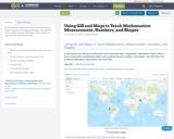
In this activity, students work with measurement and shapes using live web maps and images of the Earth at various scales using ArcGIS Online. Time required: 2 class periods (100 minutes total).

Subject:
Career and Technical Education
Mathematics
Social Science
Material Type:
Lesson
Date Added:
01/24/2017
Volume Open Access "I Bacini Culturali e la progettazione sociale orientata all’Heritage-Making, tra Politiche giovanili, Innovazione sociale, Diversità culturale"
Conditional Remix & Share Permitted
CC BY-NC-SA
Rating
0.0 stars

Il volume rappresenta la tappa finale della prima stagione di implementazione del Progetto ABACUS (giugno 2019 - settembre 2020), sostenuta dal finanziamento pubblico garantito dalla Regione Siciliana e dalla Presidenza del Consiglio dei Ministri. In tal senso, la pubblicazione raccoglie sia una sezione di materiali di discussione critica sul percorso progettuale e sui primi esiti maturati, sia una ricca parte di contributi tematici offerti da referenti istituzionali, studiosi ed esperti, docenti accademici e ricercatori, professionisti e rappresentanti di organismi del Terzo settore Sono state così affrontate ed esaminate differenti tematiche e problematiche socio-culturali e socio-economiche, e prospettive e approcci metodologico-operativi tra loro affini e convergenti, che si sviluppano a cavallo delle politiche sociali, giovanili e culturali, della progettazione sociale e culturale, dell'innovazione sociale e della diversità culturale, in differenti contesti socio-territoriali siciliani e italiani, con una particolare attenzione per quelle iniziative che rappresentano casi paradigmatici in cui le istanze istituzionali, della ricerca, dell'educazione e della formazione si incontrano con le aspettative dei pubblici differenziati e, specialmente, delle giovani generazioni, anche sull'orizzonte della innovazione dell'occupazione giovanile.

Subject:
Arts and Humanities
World Cultures
Material Type:
Textbook
Author:
Alessandra Caravale
Alessia Bono
Andrea De Tommasi
Andrea Messina
Angela Vitale
Antonija Netolicki
Antonio Grasso
Antonio Sutera
Carlo Volpe
Caterina Mulè
Claudio La Rocca
Daniele Tulone
Davide Silvestri
Eleonora Giovene di Girasole
Elisabetta Di Stefano
Erika Coco
Fabio Pagano
Federica Lamonaca
Filippo Gravagno
Francesca Piazza
Francesca Rita Cerami
Francesco Iacono Quarantino
Gabriela Del Rosario Abate
Gabriella Paolini
Giorgia Leoni
Giovanna Sedita
Giuseppe Bivona
Giusi Carioto
Giusy Pappalardo
Ilaria Vitellio
Lucia Piastra
Luisella Pavan-Woolfe
Maria Chiara Falcone
Maria Laura Scaduto
Massimo Clemente
Matteo Tedo Fici
Mirella Serlorenzi
Riccardo Pozzo
Rossella Mancini
Sabrina Tomassini
Salvatore Aurelio Bruno
Stefan Luca Mangione
Stefania Picciola
Susanna Gristina
Tiziana Bonsignore
Ugo Arioti
Vanessa Mantia
Vania Virgili
Vilislava Metodieva
Yoanna Yordanova
Date Added:
03/01/2021
Water Science Curriculum
Read the Fine Print
Rating
0.0 stars

Water Science offers a two-semester water resource management curriculum for second year technical students or undergraduates in water resource management, water science, or environmental resource management programs. Water Science is divided into 6 major units. Each unit is divided into modules encompassing approximately a week's worth of lectures and labs.

Subject:
Ecology
Life Science
Material Type:
Activity/Lab
Full Course
Lecture Notes
Provider:
University of Minnesota
Date Added:
10/31/2006
Water on the Web Basic Science
Read the Fine Print
Rating
0.0 stars

WOW lessons are designed for infusion into the existing science curriculums for college freshmen and advanced high school students. The lessons use the aquatic environment and real lake data to explore basic science concepts through two different approaches: a directed study “Studying” and an inquiry “Investigating” approach. The directed studies allow students to apply and learn concepts through direct, guided experience. The inquiry lessons provide a more open-ended opportunity for students to discover the same concepts.
Each teacher's lesson plan provides general direction for guiding students to understand the topic through the directed study and the inquiry approach. Student lessons are organized into a thinking framework of six sequential components that are critical for improving scientific and technological literacy: knowledge base, experimental design, data collection, data management and analysis, interpretation of results, and reporting results. The teacher lesson plans follow the same format.
Lesson titles are simple and descriptive so that you may easily find useful materials. We recommend you begin by reviewing the student lessons that may be appropriate for your class. When you've found a student lesson to use, return to the menu below to review the associated teacher's lesson plan. There are tutorials to help you and your students get familiar with the site, they may be accessed from the menu below, or at the top of any 'teacher' page.

Subject:
Ecology
Life Science
Material Type:
Lesson Plan
Provider:
University of Minnesota
Date Added:
02/16/2011