Updating search results...

Search Resources

500 Results

View
Selected filters:
  • Physical Geography
Disaster Simulation Infographic
Conditional Remix & Share Permitted
CC BY-NC
Rating
0.0 stars

The goal for this lesson is to increase student comprehension and problem-solving skills by emphasizing real-world problems and encouraging students to be proactive in solving those problems. Description of classroom, grade level, and students: This assignment is for a 10th grade English II classroom, ranging from AP to standard student populations.Prior Knowledge of Subject: Students possess a prior knowledge about tornado activity, severe thunderstorms, and earthquakes due to living in Oklahoma.Length of Lesson: Students will be allotted 10 class periods of 45 minutes in class. They are also allowed to work on this assignment outside of class, if needed.

Subject:
Educational Technology
English Language Arts
Geology
Physical Geography
Public Relations
Material Type:
Lesson Plan
Author:
Lori Hartin
Date Added:
06/06/2016
Distorted Disturbances
Read the Fine Print
Educational Use
Rating
0.0 stars

Students pass around and distort messages written on index cards to learn how we use signals from GPS occultations to study the atmosphere. The cards represent information sent from GPS satellites being distorted as they pass through different locations in the Earth's atmosphere and reach other satellites. Analyzing GPS occultations enables better global weather forecasting, storm tracking and climate change monitoring.

Subject:
Applied Science
Engineering
Physical Geography
Physical Science
Material Type:
Activity/Lab
Provider:
TeachEngineering
Provider Set:
TeachEngineering
Author:
Jonah Kisesi
Marissa H. Forbes
Penina Axelrad
Date Added:
09/18/2014
Drawing Structural and Isopachous Maps
Conditional Remix & Share Permitted
CC BY-NC-SA
Rating
0.0 stars

This activity has 3 maps with real stratigraphic data recorded adjacent to drill holes in the Illinois Basin. Students contour the structural data. They may also contour the associated thickness data or they can just look at the trends of the thickness data relative to the structures on their completed structure map.

Subject:
Geology
Physical Geography
Physical Science
Material Type:
Activity/Lab
Homework/Assignment
Provider:
Science Education Resource Center (SERC) at Carleton College
Provider Set:
Teach the Earth
Author:
Janis Treworgy
Date Added:
01/20/2023
Drilling Back to the Future: Climate Clues from Ancient Ice on Greenland
Read the Fine Print
Educational Use
Rating
0.0 stars

This video, from ClimateCentral, features a team of scientists from the Northern Greenland Eemian Ice Drilling Project who study atmospheric air bubbles trapped in an ice core. This work highlights a period in Greenland's ice sheet which began about 130,000 years ago and lasted about 10,000 years; a period known as the Eemian. The air bubbles from the ancient atmosphere reveal what happened with climate change over that period of time.

Subject:
Archaeology
Career and Technical Education
Environmental Studies
Physical Geography
Physical Science
Social Science
Material Type:
Diagram/Illustration
Reading
Provider:
CLEAN: Climate Literacy and Energy Awareness Network
Provider Set:
CLEAN: Climate Literacy and Energy Awareness Network
Author:
Climate Central
Date Added:
08/29/2012
Drumbeats in Time: Where are the significant places, regions, and people in the Pacific Northwest?
Conditional Remix & Share Permitted
CC BY-NC
Rating
0.0 stars

Where are the significant places, regions, and people in the Pacific Northwest?This fourth grade unit for Drumbeats in Time was produced by a team of teachers from Thorp School District, Washington in consultation with members of the Kittitas Band of the Confederated Tribes and Bands of the Yakama Nation

Subject:
Cultural Geography
Physical Geography
U.S. History
Material Type:
Lesson
Lesson Plan
Unit of Study
Author:
Carlee Stueckle
Casceila Miller
Washington OSPI OER Project
Date Added:
06/30/2021
Du soleil pour tous
Unrestricted Use
CC BY
Rating
0.0 stars

L’énergie solaire au Sénégal : un droit, des droits, une histoire

Long Description:
L’énergie solaire est une promesse de développement et de prospérité pour l’Afrique. Elle a été annoncée et expérimentée sur le continent dans un esprit de science ouverte et de « communs » technologiques et énergétiques il y a déjà près de soixante ans. Séchoirs et chauffe-eaux, pompes solaires et centrales électriques thermodynamiques : des pionniers ont développé et installé, dès la fin des années 1950, des techniques et des matériels en Afrique de l’Ouest et en particulier au Sénégal.

Le présent ouvrage, issu de deux journées d’études organisées à Dakar en mai 2016, rend compte pour la première fois, de manière particulièrement symbolique, de cette histoire et du futur de l’énergie solaire en Afrique. Il rassemble, dans une première partie, des témoignages d’acteurs et une mise en perspective sociohistorique large des politiques de l’énergie solaire en Afrique de l’Ouest sur un demi-siècle. Ce regard est complété par la réédition d’un texte de référence du professeur Abdou Moumouni Dioffo, pionnier nigérien de l’énergie solaire dès 1964.

Dans une seconde partie, cet ouvrage interroge également les prolongements actuels de l’énergie solaire en France et au Sénégal, en particulier son encadrement juridique et réglementaire. L’énergie solaire peut-elle ou doit-elle être considérée comme un « commun » ou un droit humain fondamental? Quels sont aujourd’hui les droits associés à l’énergie solaire au Sénégal? Quels enseignements tirer d’une comparaison avec le corpus juridique en la matière tel qu’il existe en France?

Associant juristes français et sénégalais, et spécialistes de la sociologie et des politiques de l’énergie, cet ouvrage se veut au final une invitation et un outil pour poursuivre les recherches sur l’histoire et le droit de l’énergie solaire en Afrique.

(Compléments vidéos, entretiens et témoignages sur le blog de recherche : https://afrisol.hypotheses.org)

Word Count: 96883

ISBN: 978-2-924661-34-5

(Note: This resource's metadata has been created automatically by reformatting and/or combining the information that the author initially provided as part of a bulk import process.)

Subject:
Applied Science
Engineering
Physical Geography
Physical Science
Material Type:
Textbook
Provider:
Éditions science et bien commun
Author:
Mamadou Badji
Sous la direction de Frédéric Caille
Date Added:
10/25/2021
Dɔnko
Conditional Remix & Share Permitted
CC BY-SA
Rating
0.0 stars

Études culturelles africaines

Short Description:
Comment lire et comprendre les pratiques culturelles africaines? Comment mobiliser les savoirs sur l’Afrique, ses arts et ses cultures sans verser dans la réification ou le folklorisme? Profondément novateur, cet ouvrage collectif mobilise les outils théoriques des cultural studies pour proposer un généreux panorama de l’étude de la culture en Afrique. Il rassemble des textes d’auteurs et d’autrices d’Afrique de l'Ouest, théoriques ou descriptifs, qui mettent en lumière la réévaluation passionnante des modes d’appréhension des pratiques et objets en contexte africain que proposent les études culturelles africaines. L’épilogue qui clôt le livre n’est donc point fermeture, mais plutôt ouverture sur les enjeux relatifs à ce nouveau champ d’études, plein de promesses pour rendre compte de l’extraordinaire créativité des cultures africaines.

Long Description:
Comment lire et comprendre les pratiques culturelles africaines? Comment mobiliser les savoirs sur l’Afrique, ses arts et ses cultures sans verser dans la réification ou le folklorisme? Profondément novateur, cet ouvrage collectif mobilise les outils théoriques des cultural studies pour proposer un généreux panorama de l’étude de la culture en Afrique. Il rassemble des textes d’auteurs et d’autrices d’Afrique de l’ouest, théoriques ou descriptifs, qui mettent en lumière la réévaluation passionnante des modes d’appréhension des pratiques et objets en contexte africain que proposent les études culturelles africaines. L’épilogue qui clôt le livre n’est donc point fermeture, mais plutôt ouverture sur les enjeux relatifs à ce nouveau champ d’études, plein de promesses pour rendre compte de l’extraordinaire créativité des cultures africaines.

Word Count: 78460

ISBN: 978-2-924661-82-6

(Note: This resource's metadata has been created automatically by reformatting and/or combining the information that the author initially provided as part of a bulk import process.)

Subject:
Anthropology
Arts and Humanities
Performing Arts
Physical Geography
Physical Science
Social Science
Material Type:
Textbook
Provider:
Éditions science et bien commun
Author:
Salaka Sanou
Sous la direction d'Isaac Bazié
Date Added:
06/08/2019
EARTH
Only Sharing Permitted
CC BY-NC-ND
Rating
0.0 stars

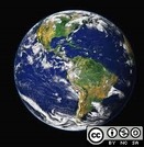
Earth is the third planet from the Sun and the only astronomical object known to harbor life. According to radiometric dating estimation and other evidence, Earth formed over 4.5 billion years ago. Earth's gravity interacts with other objects in space, especially the Sun and the Moon, which is Earth's only natural satellite. Earth orbits around the Sun in 365.256 solar days, a period known as an Earth sidereal year. During this time, Earth rotates about its axis 366.256 times, that is, a sidereal year has 366.256 sidereal days. Earth's axis of rotation is tilted with respect to its orbital plane, producing seasons on Earth. The gravitational interaction between Earth and the Moon causes tides, stabilizes Earth's orientation on its axis, and gradually slows its rotation. Earth is the densest planet in the Solar System and the largest and most massive of the four rocky planets.

Subject:
Physical Geography
Material Type:
Assessment
Author:
Santosh Upreliya
Date Added:
05/29/2020
Earth Science in the News Investigation
Conditional Remix & Share Permitted
CC BY-NC-SA
Rating
0.0 stars

This is a writing assignment intended to get to students to think about the relevance of Earth Science to their everyday lives. Students are asked to read a short news article, selecting 1 of 3 articles provided as choices, that discusses a specific earth science topic. Students write a 1-page report summarizing the article and use the write-up to summarize their familiarity with the topics presented. Students will re-evaluate their understanding of the article and associated earth science topic at the end of the course.

Subject:
Geology
Physical Geography
Physical Science
Material Type:
Homework/Assignment
Provider:
Science Education Resource Center (SERC) at Carleton College
Provider Set:
Teach the Earth
Author:
Alex Lechler
Date Added:
01/20/2023
Earth Structure: Modeling and Three-Dimensional Thinking
Conditional Remix & Share Permitted
CC BY-NC-SA
Rating
0.0 stars

This is a series of three lessons that focus on two and three dimensional thinking, modeling, and earth structure. The main goal of the lessons is to develop a sense of two- and three-dimensional models of earth's surface, pros/cons and accuracy of those models, and a sense for why accuracy (and understanding inaccuracies) is important. The lessons were developed for upper-level elementary students, and include suggestions and/or links to other related resources for scaling up to middle or high school levels.

Lesson 1: Earth Surface Models in 2- and 3-Dimensions (globes vs maps)
Lesson 2: Visualizing and Modeling Earth Structure in 2- and 3-Dimensions
Lesson 3: Understanding Wave Motion in 2- and 3-Dimensions

Rationale: Three-dimensional thinking is difficult for students from the elementary through the college level. Introducing activities that incorporate spatial models in the elementary levels helps to create a foundation for lessons in spatial awareness and modeling.

These lessons were developed as part of NSF CSEDI grant #1458184, awarded to the University of Wisconsin-Whitewater, 2014-2017, in collaboration with Abigail Christensen and Alexis Miller (UWW education students, 2016-17).

Subject:
Geology
Physical Geography
Physical Science
Material Type:
Activity/Lab
Provider:
Science Education Resource Center (SERC) at Carleton College
Provider Set:
Teach the Earth
Author:
Anna Courtier
Date Added:
01/20/2023
Earthquake 8.2
Conditional Remix & Share Permitted
CC BY-NC
Rating
0.0 stars

An engineering and design lesson for middle school (our 7th grade standards).

In the aftermath of a natural disaster, can you engineer a device that will keep medicine within a 40-60°F range using natural resources from the biome you live in, and/or debris created by the disaster for three days, until the Red Cross can arrive?

You are a team of relief workers in __________________after a major earthquake/tsunami has occurred. Your team lead as just told you about a young women with diabetes has been injured and needs insulin to be delivered __________ miles away (no open roads). Your team will need to research, design, and build a portable device to keep the insulin between _____ and ______ °(F/C) for _____ days. Once you return you will present the effectiveness of your device to your lead and a team other relief workers showing your both your design/device and explaining the process.

Subject:
Applied Science
Chemistry
Engineering
Geology
Life Science
Physical Geography
Physical Science
Material Type:
Activity/Lab
Provider:
Lane County STEM Hub
Provider Set:
Content in Context SuperLessons
Author:
Bobbi Dano
Jen Bultler
Date Added:
06/27/2017
Earthquake Case Studies: Scientific Details and Societal Impacts
Conditional Remix & Share Permitted
CC BY-NC-SA
Rating
0.0 stars

Learning outcomes for this activity include learning earthquake basics. The larger context of the inequity of earthquake impacts provides a social/environmental justice lens that encourages students to examine earthquake hazards with a broader perspective.

Subject:
Geology
Physical Geography
Physical Science
Social Science
Material Type:
Activity/Lab
Provider:
Science Education Resource Center (SERC) at Carleton College
Provider Set:
Teach the Earth
Author:
Matthew Nyman
Date Added:
01/20/2023
Earth's Changing Climates
Read the Fine Print
Rating
0.0 stars

In this activity, students are guided through graphs of surface air temperature anomaly data and Vostok ice core data to illustrate how scientists use these data to develop the basis for modeling how climate is likely to change in the future.

Subject:
Applied Science
Archaeology
Career and Technical Education
Environmental Science
Environmental Studies
Physical Geography
Physical Science
Social Science
Material Type:
Activity/Lab
Provider:
CLEAN: Climate Literacy and Energy Awareness Network
Provider Set:
CLEAN: Climate Literacy and Energy Awareness Network
Author:
Concord Consortium
Date Added:
09/24/2018
The Eastern World: Daily Readings on Geography
Conditional Remix & Share Permitted
CC BY-NC-SA
Rating
0.0 stars

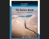
In essay format, this textbook considers examples of various sub-categories of Geography in combination with five regions of the Eastern World.

Created for GEOGR 1105 - Eastern World Geography at the College of DuPage. This resource will be updated as needed. For the most recent version, visit: https://cod.pressbooks.pub/easternworlddailyreadingsgeography/

Subject:
Cultural Geography
Physical Geography
Physical Science
Social Science
Material Type:
Textbook
Provider:
College of DuPage
Author:
Joel Quam
Scott Campbell
Date Added:
08/03/2022
Ecology/Geography Classification
Conditional Remix & Share Permitted
CC BY-NC-SA
Rating
0.0 stars

This short lesson was designed in collaboration with a 7th grade Life Science teacher (Paul Jeffery). The idea behind the lesson is to help students better understand ecological and geographical classifications by teaching them at the same time in their Life Science class and their Geography class. Teaching the two classifications together will help reinforce the idea of classification. While this lesson would best be taught outdoors it can also be adapted to the indoors.

Subject:
Ecology
Life Science
Physical Geography
Physical Science
Material Type:
Activity/Lab
Provider:
Science Education Resource Center (SERC) at Carleton College
Provider Set:
Pedagogy in Action
Author:
Brianne Meick
Date Added:
08/10/2012
Efeito Estufa vs. Meio Ambiente (Jogo de Tabuleiro)
Conditional Remix & Share Permitted
CC BY-NC
Rating
0.0 stars

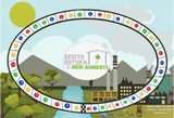
O jogo Efeito Estufa vs. Meio Ambiente é um jogo de tabuleiro interdisciplinar no arquivo em anexo é possivel baixar e reproduzir esse jogo para utilização como material de apoio pedagógico interdisciplinar de forma a contribuir nas atividades de educação ambiental tendo o efeito estufa como tema transversal no ensino dos gases. 

Subject:
Biology
Chemistry
Environmental Science
Physical Geography
Physics
Material Type:
Game
Interactive
Teaching/Learning Strategy
Author:
Paulo Cabral Filho
Andréa Silva
Date Added:
10/17/2020
Eléments du milieu physique africain et leur caractéristiques
Conditional Remix & Share Permitted
CC BY-NC-SA
Rating
0.0 stars

Description des différents éléments du milieu physique africain
Préciser les Principales caractéristiques des éléments du milieu physique.

Subject:
Physical Geography
Physical Science
Material Type:
Lecture Notes
Author:
COMPAORE Nadège
Date Added:
12/06/2019
Energy Industry Applications of GIS
Conditional Remix & Share Permitted
CC BY-NC-SA
Rating
0.0 stars

Is Energy and GIS your passion? If so, Energy Industry Applications of GIS provides students with an in-depth exploration of the complexities of siting decisions in the electricity market. The course introduces a variety of siting challenges that confront the energy industry and its customers and neighbors but focuses on the siting of electrical transmission lines. The course also provides hands-on experience with a common decision support technology, ArcGIS, and considers how the technology may be used to facilitate public participation in siting decisions.

Subject:
Physical Geography
Physical Science
Material Type:
Full Course
Provider:
Penn State College of Earth and Mineral Sciences
Author:
Ron Santini
Date Added:
10/07/2019