Citizen participation is everywhere. Invoking it has become de rigueur when discussing …
Citizen participation is everywhere. Invoking it has become de rigueur when discussing cities and regions in the developing world. From the World Bank to the World Social Forum, the virtues of participation are extolled: From its capacity to “deepen democracy” to its ability to improve governance, there is no shortage to the benefits it can bring. While it is clear that participation cannot possibly “do” all that is claimed, it is also clear that citizen participation cannot be dismissed, and that there must be something to it. Figuring out what that something is — whether it is identifying the types of participation or the contexts in which it happens that bring about desirable outcomes — is the goal of the class.
This resource is a video abstract of a research paper created by …
This resource is a video abstract of a research paper created by Research Square on behalf of its authors. It provides a synopsis that's easy to understand, and can be used to introduce the topics it covers to students, researchers, and the general public. The video's transcript is also provided in full, with a portion provided below for preview:
"The Earth is undeniably getting hotter. For the third time in a row, the past year has gone down as the hottest on record. While researchers don’t expect every year to be record-shattering, the trend is disconcerting—perhaps nowhere more so than in South Asia. A new study shows that here, unique climate effects converge with poor living conditions and high population density to create the most at-risk hot spot on our planet. Climate data shows that some of the world’s hottest zones lie across Asia. In these areas, the wet-bulb temperature, a measure of temperature that accounts for humidity, reaches life-threatening highs, commonly above 28°C. For perspective, consider that spending just a few hours at a wet-bulb temperature of 35°C is enough to cause death. And according to an international team of researchers, this heating trend might only get worse..."
The rest of the transcript, along with a link to the research itself, is available on the resource itself.
In 1999, the University of Chicago began the Digital Dictionaries of South …
In 1999, the University of Chicago began the Digital Dictionaries of South Asia (DDSA) to make electronic dictionaries of South Asian languages available to the public for free. It includes languages from Afghanistan, Bangladesh, Bhutan, India, the Maldives, Nepal, Pakistan, and Sri Lanka. Gary Tubb, Professor and Chair of the Department of South Asian Languages and Civilizations (SALC), and James Nye, former University of Chicago Library Southern Asia bibliographer and COSAS Emeritus, were awarded a grant from the U.S. Department of Education that allows them to expand these digital dictionaries to include Kashmiri, Panjabi, Persian, Sindhi, Sinhala, Telugu, and Urdu languages. James Nye is a CAORC Multi-Country Research Fellowship alum, who traveled to Sri Lanka, Maldives, Nepal, and India on the fellowship.
The Digital South Asia Library provides digital materials for reference and research …
The Digital South Asia Library provides digital materials for reference and research on South Asia to scholars, public officials, business leaders, and others. Participants in the Digital South Asia Library include leading U.S. universities, the Center for Research Libraries, the South Asia Microform Project, the Committee on South Asian Libraries and Documentation, the Association for Asian Studies, the Library of Congress, the Asia Society, the British Library, the University of Oxford, the University of Cambridge, MOZHI in India, the Sundarayya Vignana Kendram in India, Madan Puraskar Pustakalaya in Nepal, and other institutions in South Asia. James Nye is a CAORC Multi-Country Research Fellowship alum, who traveled to Sri Lanka, Maldives, Nepal, and India on the fellowship.
In essay format, this textbook considers examples of various sub-categories of Geography …
In essay format, this textbook considers examples of various sub-categories of Geography in combination with five regions of the Eastern World.
Created for GEOGR 1105 - Eastern World Geography at the College of DuPage. This resource will be updated as needed. For the most recent version, visit: https://cod.pressbooks.pub/easternworlddailyreadingsgeography/
This class explores the interrelationship between humans and natural environments. It does …
This class explores the interrelationship between humans and natural environments. It does so by focusing on conflict over access to and use of the environment as well as ideas about “nature” in various parts of the world.
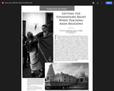
An article written by Todd Lewis that was published in Education About …
An article written by Todd Lewis that was published in Education About Asia in 2010 that discuses what educators need to know when they prepare to teach asian religions. Introduction: For teachers seeking resources to instill greater global literacy on world religions, it is the best of times and the worst of times. Cultural diversity in American schools is increasing, and the number of Hindu temples, mosques, and Buddhist meditation centers is rising. Because of popular media, references to Hindu gods, Daoist geomancy, or Buddhist karma teachings no longer seem exotic...
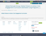
Global Citizens in Action is a civic engagement curriculum that focuses on …
Global Citizens in Action is a civic engagement curriculum that focuses on cultural exchange, media literacy, and global citizenship. Through exploring the driving question, “How do we, as youth, engage our communities to create positive social change?”
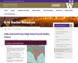
India and South Asia: From Area Studies to Ethnic Studies Course design …
India and South Asia: From Area Studies to Ethnic Studies Course design by Rachel Heilman, Issaquah High School. Developed with the support of Sunila Kale (Associate Professor of International Studies) and the South Asia Center (Henry M. Jackson School of International Studies, University of Washington), with funding from the U.S. Department of Education National Resource Centers Program.
Dear Colleague,
I hope you are able to implement some version of this course at your institution! I have it aligned to Washington State Social Studies Standards, but it is right in line with Common Core-driven expectations and should fit well with any state’s standards. This course also very much supports the new Washington Ethnic Studies Framework.
––Rachel Heilman, March 2022
Course Description
How can understanding a particular region both shape and enhance our understanding of ourselves and the world around us? As we gain knowledge, how do we both recognize and cross the political boundaries we see on maps? In this one-semester course we will use an interdisciplinary approach to examine India and wider South Asia as we work to conceptualize the ways people, power, geography, and the past shape the region. For the purposes of this course South Asia will include Bangladesh, Bhutan, India, Maldives, Nepal, Pakistan, and Sri Lanka. In our role as global citizens we will also expand our inquiries to the web of connections between South Asia and our own individual and social identities.
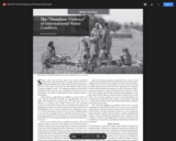
The Education About Asia (2017) piece orients students to current debates about …
The Education About Asia (2017) piece orients students to current debates about the specter of water wars. The essay presents cases in South and Southeast Asia to illustrate how international water conflicts are more likely to engender ordinary, everyday forms of violence than the spectacular conflicts envisioned in water wars.
This course, organized as a series of lectures, aims to provide an …
This course, organized as a series of lectures, aims to provide an interdisciplinary view of the history and current climate of nuclear weapons and non-proliferation policy. The first lecture begins the series by discusses nuclear developments in one of the world’s most likely nuclear flash points, and the second lecture presents a broad discussion of the dangers of current nuclear weapons policies as well as evaluations of current situations and an outlook for future nuclear weapons reductions.
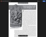
An article written by Todd Lewis and Jinah Kim that was published …
An article written by Todd Lewis and Jinah Kim that was published in Education About Asia in 2020 that discuses what educators need to know when they prepare to teach about South Asian Religious Art Introduction: There are many ways to talk about the art of India (here, India is a shorthand for the South Asian subcontinent). From a serene stone sculpture of a meditating Buddha to the dynamic image of Dancing Shiva in bronze, to cosmic symbolism of soaring temples covered in sensuous celestial bodies built in stone to the perfect architecture of Taj Mahal, to colorful paintings of heroes and heroines of love stories and myths to intricate carvings on ivory...
This semester, we will read writing about travel and place from Columbus’s …
This semester, we will read writing about travel and place from Columbus’s Diario through the present. Travel writing has some special features that will shape both the content and the work for this subject: reflecting the point of view, narrative choices, and style of individuals, it also responds to the pressures of a real world only marginally under their control. Whether the traveler is a curious tourist, the leader of a national expedition, or a starving, half-naked survivor, the encounter with place shapes what travel writing can be. Accordingly, we will pay attention not only to narrative texts but to maps, objects, archives, and facts of various kinds. Our materials are organized around three regions: North America, Africa and the Atlantic world, the Arctic and Antarctic. The historical scope of these readings will allow us to know something not only about the experiences and writing strategies of individual travelers, but about the progressive integration of these regions into global economic, political, and knowledge systems. Whether we are looking at the production of an Inuit film for global audiences, or the mapping of a route across the North American continent by water, these materials do more than simply record or narrate experiences and territories: they also participate in shaping the world and what it means to us. Authors will include Olaudah Equiano, Caryl Philips, Claude Lévi-Strauss, Joseph Conrad, Jamaica Kincaid, William Least Heat Moon, Louise Erdrich, Álvar Núñez Cabeza de Vaca. Expeditions will include those of Lewis and Clark (North America), Henry Morton Stanley (Africa), Ernest Shackleton and Robert F. Scott (Antarctica).
This resource is a video abstract of a research paper created by …
This resource is a video abstract of a research paper created by Research Square on behalf of its authors. It provides a synopsis that's easy to understand, and can be used to introduce the topics it covers to students, researchers, and the general public. The video's transcript is also provided in full, with a portion provided below for preview:
"Flooding affects nearly 21 million people and costs over 96 billion dollars worldwide every year. And South Asia is one of the hardest hit areas. If flood conditions were better forecasted, then at-risk communities might have a chance at avoiding flood disasters. But adequate preparation requires at least 5 to 10 days advance notice of a flood, and in South Asia, a lack of information on rainfall and river conditions is an ongoing forecasting challenge. Now, researchers have created a model that can provide earlier warning of flood conditions using easy-to-access data. The model, named ReqSim , tracks key features of basin hydrology using the principle of requisite simplicity to balance modeling complexity and utility. Using rainfall data, basin topography, and day-to-day persistence of river conditions, the model offers greater insight into the likelihood of flooding than other commonly used approaches..."
The rest of the transcript, along with a link to the research itself, is available on the resource itself.
No restrictions on your remixing, redistributing, or making derivative works. Give credit to the author, as required.
Your remixing, redistributing, or making derivatives works comes with some restrictions, including how it is shared.
Your redistributing comes with some restrictions. Do not remix or make derivative works.
Most restrictive license type. Prohibits most uses, sharing, and any changes.
Copyrighted materials, available under Fair Use and the TEACH Act for US-based educators, or other custom arrangements. Go to the resource provider to see their individual restrictions.